Greetings from London where I am busy preparing some amazing things for UC (this isn’t a humblebrag, it’s not me doing the amazing things, but ArcGIS CityEngine customers are just the best!). I’m so looking forward to seeing many of you at the Esri User Conference in San Diego in July.
Do you know what else I’m looking forward to? This release! That’s right, it’s that time of year again, we’ve officially released ArcGIS CityEngine 2023.0 and it’s jam-packed with amazing features and updates. My favourite one, you ask? …Get Map Data. Yes yes, Get Map Data isn’t new…but go and check out Get Map Data and you’ll see what I mean. See it in action in a recent tutorial we put together in collaboration with our pal Devin Lavigne of Houseal Lavigne Associates, Build cities with Get Map Data.
As usual, let us know what you like and what you don’t like and if you come to Esri UC, please grab me, sit me down and make me listen to all your wishes for ArcGIS CityEngine. See you in San Diego!
More basemaps and vector tiles in Get Map Data

You now have a much larger selection of basemaps to choose from in Get Map Data. Imagery and vector tile basemaps in ArcGIS Online or the active portal’s basemap gallery are available for import (previously, these were limited to Imagery, Streets, Topographic, Light Gray Canvas, or Dark Gray Canvas).
You can customize your import by excluding individual layers of the chosen basemap.
More performance in the Viewport: Adaptive terrain rendering
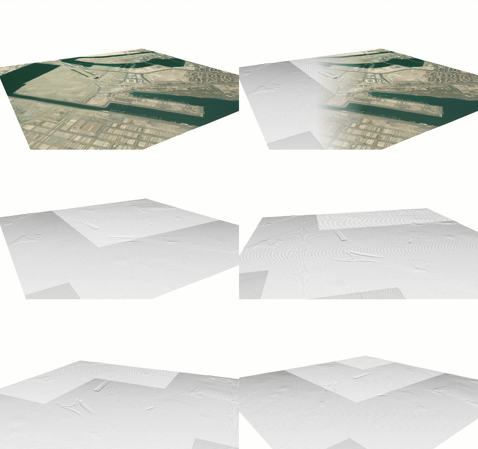
Terrain rendering performance is dramatically increased through adaptive rendering. Terrains are now always rendered at maximum resolution. There is no need anymore to manually set the resolution of elevation maps in order to have rendering at interactive rates.
The resolution field in the Terrain Inspector is removed and high-res elevation maps are not limited to 1K anymore by default.
New brush for terrain editing

In addition to the Terrain Edit Brush and Terrain Reset Brush, there is now a Terrain Smooth Brush that allows the smoothing of hard edges and artifacts in the original elevation data or after manual edits.
Dynamic imports in CGA
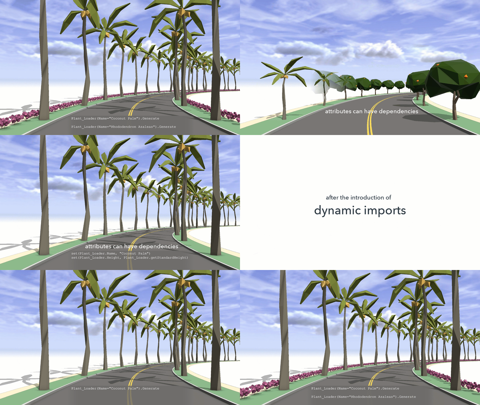
With ArcGIS CityEngine 2023.0, we introduce a new way to use instances of imported rulesets.
On import, rulesets are “instantiated” once, meaning their attributes are initialized, depending on override parameters in the import statement. The new dynamic imports feature allows you to temporarily instantiate (and therefore parameterize) a ruleset at any place in the code. The temporary ruleset instance can be parameterized with values only available at runtime and allows for using a rule in the ruleset once.
This gives you better flexibility for reusing and customizing rule files and modularizing your CGA code.
Check the new dynamic imports tutorial for an example; the import statement in the CGA reference for more details; and the CGA changelog for more information on improvements in CGA.
ArcGIS Urban Integration: Import scenarios into ArcGIS CityEngine
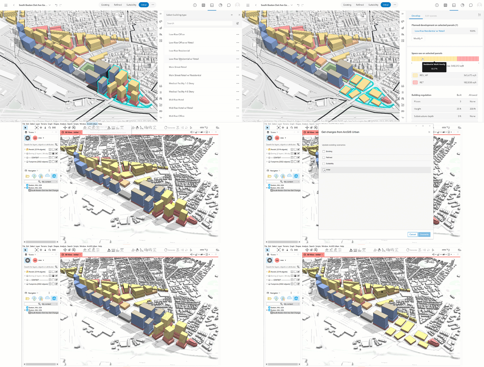
In ArcGIS CityEngine 2022.1, we introduced a new UI to save changes back to ArcGIS Urban . Now, it’s possible to go the other way around: ArcGIS Urban scenes can now be updated per scenario in ArcGIS CityEngine using the changes made in ArcGIS Urban.
We also made improvements to the search in the Urban tab of the Navigator: You can search for ArcGIS Urban models and plans by their IDs and help you find specific items. Filter options are aligned with those from the start page in ArcGIS Urban allowing you to filter between My Content, My Groups, and My Organization. The filter settings are applied directly to the current search result.
Clipping planes for bookmarks

We added clipping planes to the bookmarks. This feature can be activated in the Bookmark Inspector. It allows you to create street section views for example, in which the rendering in the Viewport is limited to a specific range.
New low-poly trees in Esri.lib
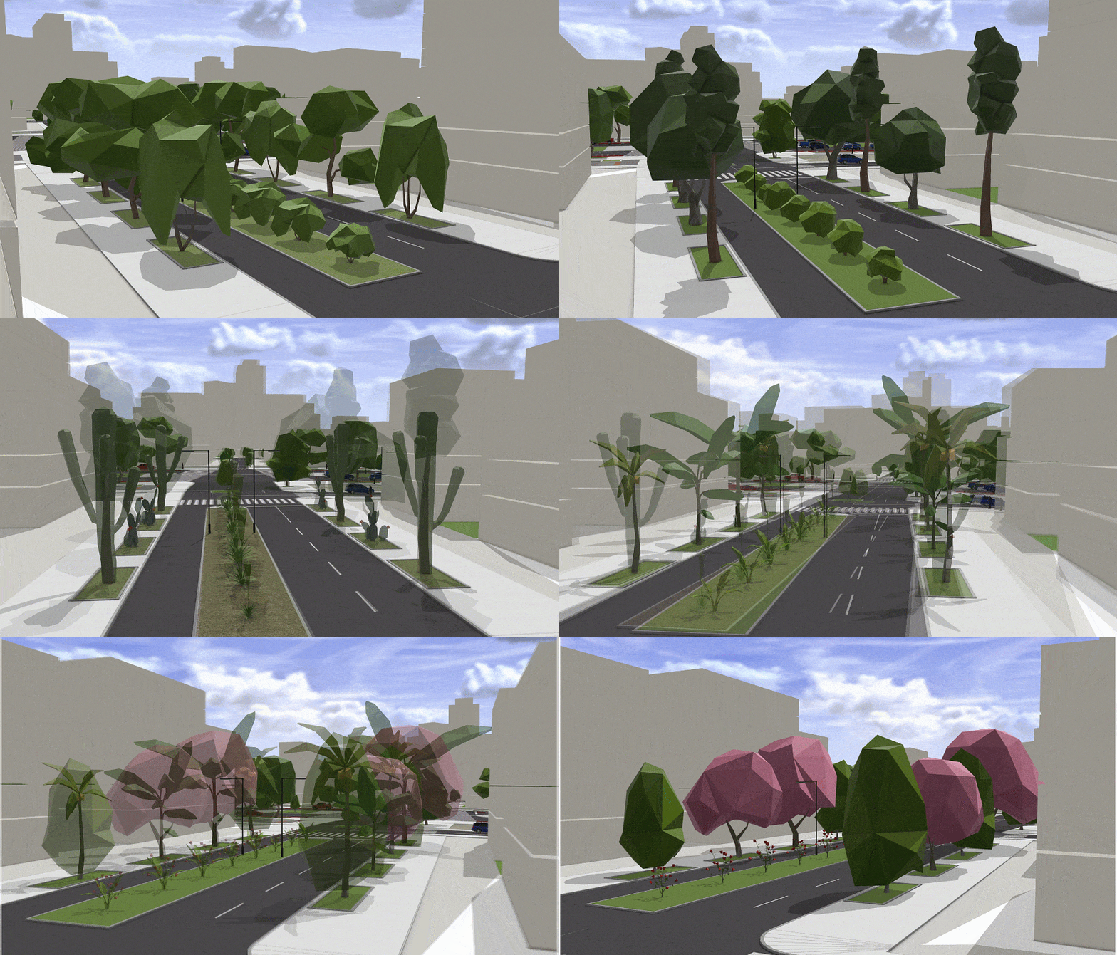
ArcGIS CityEngine comes with an extensive set of rules and assets free of use in your projects. We added a new set of low-poly trees to Esri.lib. The low-poly trees are stylized versions of the realistic vegetation models and, as the name says, have a reduced polygon count.
New and refurbished tutorials

We added two new tutorials: Essentials: Build cities with Get Map Data covers topics such as Get Map Data, street networks, and terrain editing; and Tutorial 22: Dynamic imports shows a new way to use instances of imported rulesets. We also updated the tutorials Tutorial 6: Basic shape grammar and Tutorial 15: Publish web scenes.
To see a complete list of updates, check out the ArcGIS CityEngine 2023.0 release notes for all the details on new features, enhancements, and bug fixes, and visit My Esri to upgrade to ArcGIS CityEngine 2023.0.
To learn more about ArcGIS CityEngine, visit our website, and if you’re new to ArcGIS CityEngine, try a 21-day free trial and explore learning resources to get started!
We also have tons of exciting sessions and demos in store for you at the Esri User Conference, happening July 10-14 in San Diego. Check out a preliminary agenda of events featuring ArcGIS CityEngine, and check back here for more soon!




Article Discussion: