ArcGIS Field Maps

Map your community cleanup

Community cleanups are a popular activity to teach children about the environment and foster engagement in the community. The new Learn ArcGIS lesson, Map your community cleanup, guides a community group or class through the process of collecting and visualizing data from a community cleanup.

In this lesson, you will use ArcGIS Field Maps to gather data on the litter collected during your community cleanup. You will then use ArcGIS Insights to create a report showing your cleanup progress.
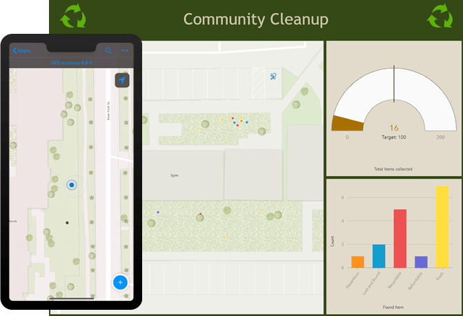
Collecting and visualizing your community cleanup

Platforms: ArcGIS Online, ArcGIS Field Maps, and ArcGIS Insights

Time: 1 hour 15 minutes

Level: Beginner*

*This lesson is appropriate for elementary school students in grades 4-6

About the authors

Vicki Lynn Cove is a documentation writer for Map Viewer analysis and ArcGIS Insights at Esri's Research and Development Centre in Ottawa, Canada. She has a background in biology, English literature, and GIS. In her spare time, Vicki Lynn enjoys fibre arts, playing her guitar, and the outdoors.

Connect:

D'Maia is a product writer with a background in Geology who is passionate about communicating technical information.

Josh is a Product Writer with a background in geography and comparative literature. When he isn't writing for the field apps team, he enjoys reading short stories and playing his bass clarinet.

Connect:
0 Comments
Inline Feedbacks
View all comments

Next Article

Basemap Releases Include Over 300 New and Updated Communities

Read this article