As we’re getting ready for our first release of 2023, I thought this might be a great time to highlight the latest and greatest features that were introduced in Field Maps in 2022 and give you a sneak peek at what’s to come in 2023.
What we build comes from the valuable insights and suggestions throughout the year from you, our users, from our Esri Field Maps Community forums, discussions at conferences, and one-on-one meetings. Your feedback shapes how we plan and prioritize development efforts.
Interested how you can shape the future of Field Maps? We’ll show you how you can share your thoughts in this blog.
Layer Filtering
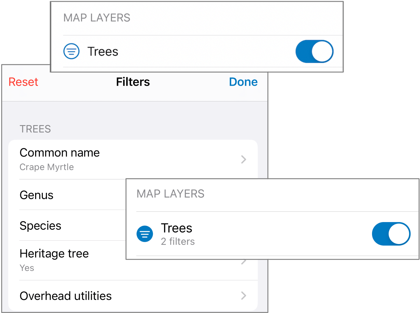
This #1 Field Maps idea voted on by customers in the Esri Community, was built and released in our 2022 November release! Now mobile users can filter layers in the mobile app to control which features they see on the map. Map authors set up which layers and fields can be filtered in the web component, Field Maps Designer.
Form
In 2022, we introduced lots of new capabilities to make the form experience more robust and efficient.
Calculated Expressions
One of the most impactful new form features, introduced in our 2022 March release, is calculated expressions. This means that form authors can now leverage Arcade to automatically calculate values.
Examples include:
Calculating a value based on other values
$feature["foundation_condition"] + $feature["roof_condition"] + $feature["habitability"]
Finding a value from another layer that intersects with a feature
// Create a feature set using the 'Regions' layer in the map
var regions = FeatureSetByName($map, 'Regions', ['name'])

// Intersect the current location with the regions and
// get the first region
var region = First(Intersects($feature, regions))

// If the current location does intersect a feature,
// return the name of the region. Otherwise, return null
if (!IsEmpty(region)) {
    return region['name']
} else {
    return null
}
Pre-filling the mobile users’ information such as their user name
GetUser($layer).fullName]
See the most common calculated expressions used in Field Maps
Choice Form Elements
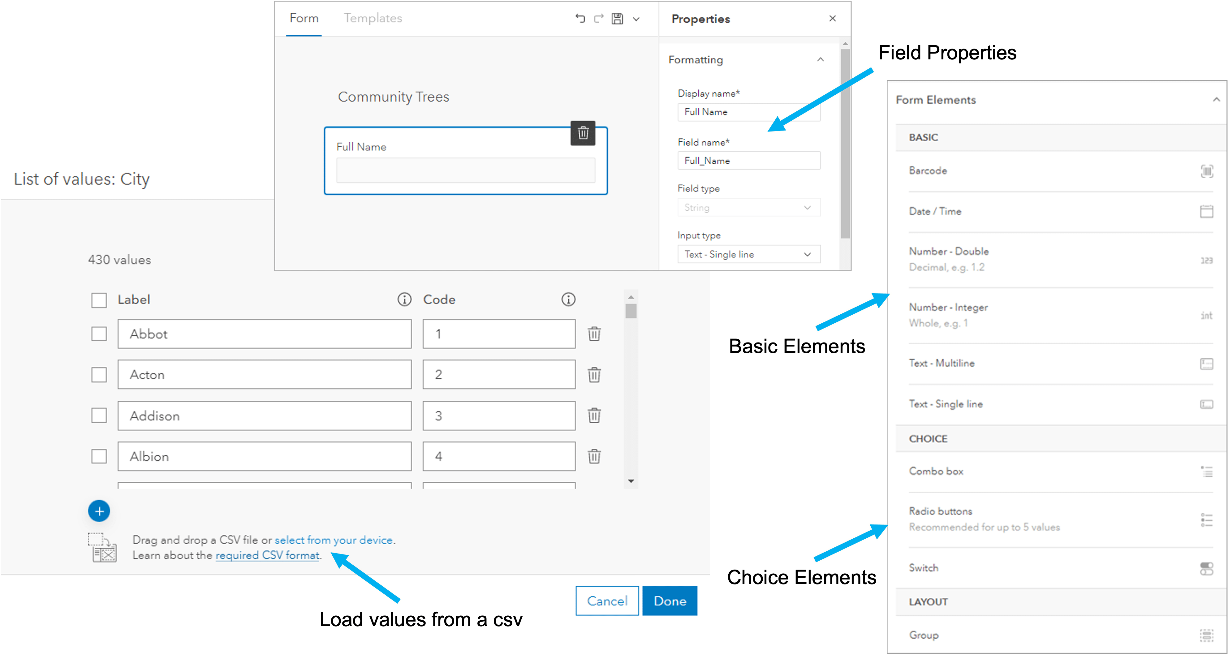
The new Switch, Combo and Radio buttons help make forms more intuitive to complete.
Contingent Attribute Values
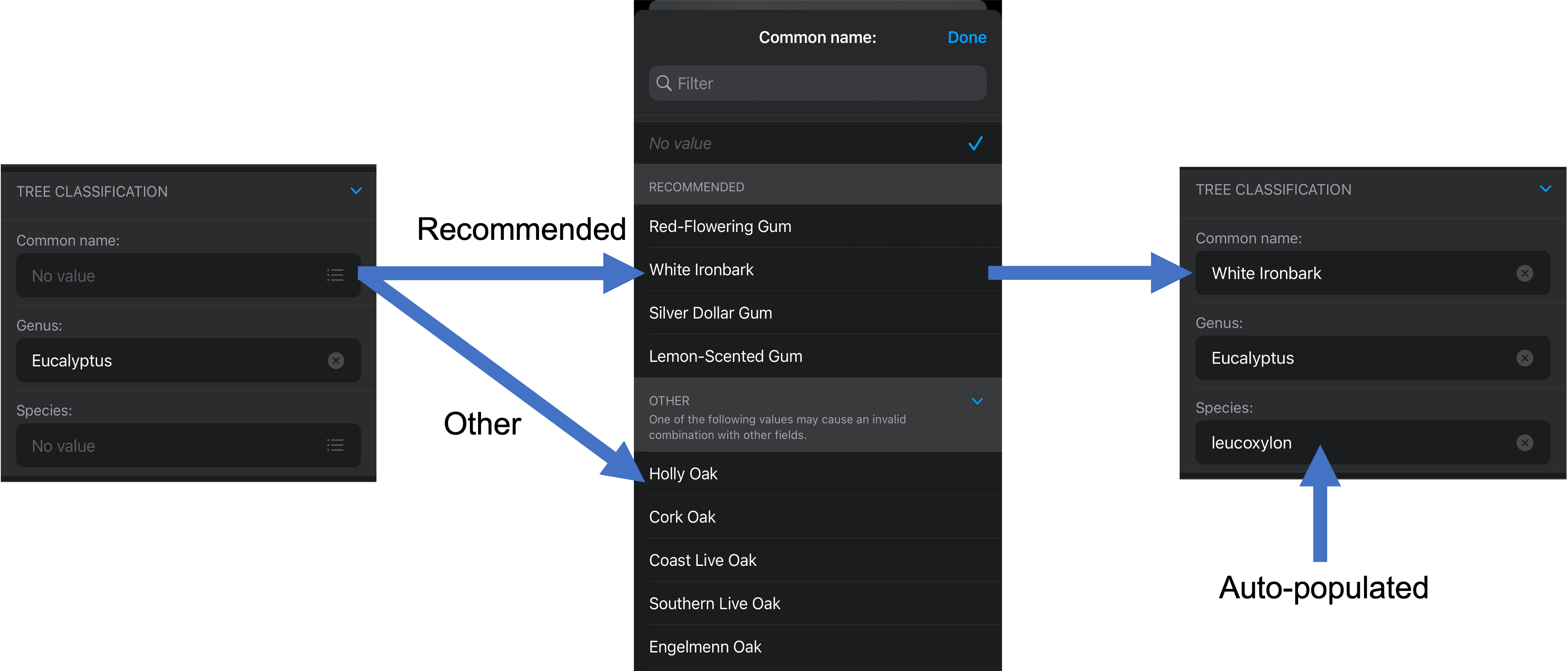
We also introduced support for contingent attribute values authored in ArcGIS Pro. Contingent attribute values can dramatically improve the efficiency and accuracy of form data capture in ArcGIS Field Maps. They are typically used when modelling natural classifications (trees, plants, wildlife) or material classifications for assets (poles, pipes).
Geofences
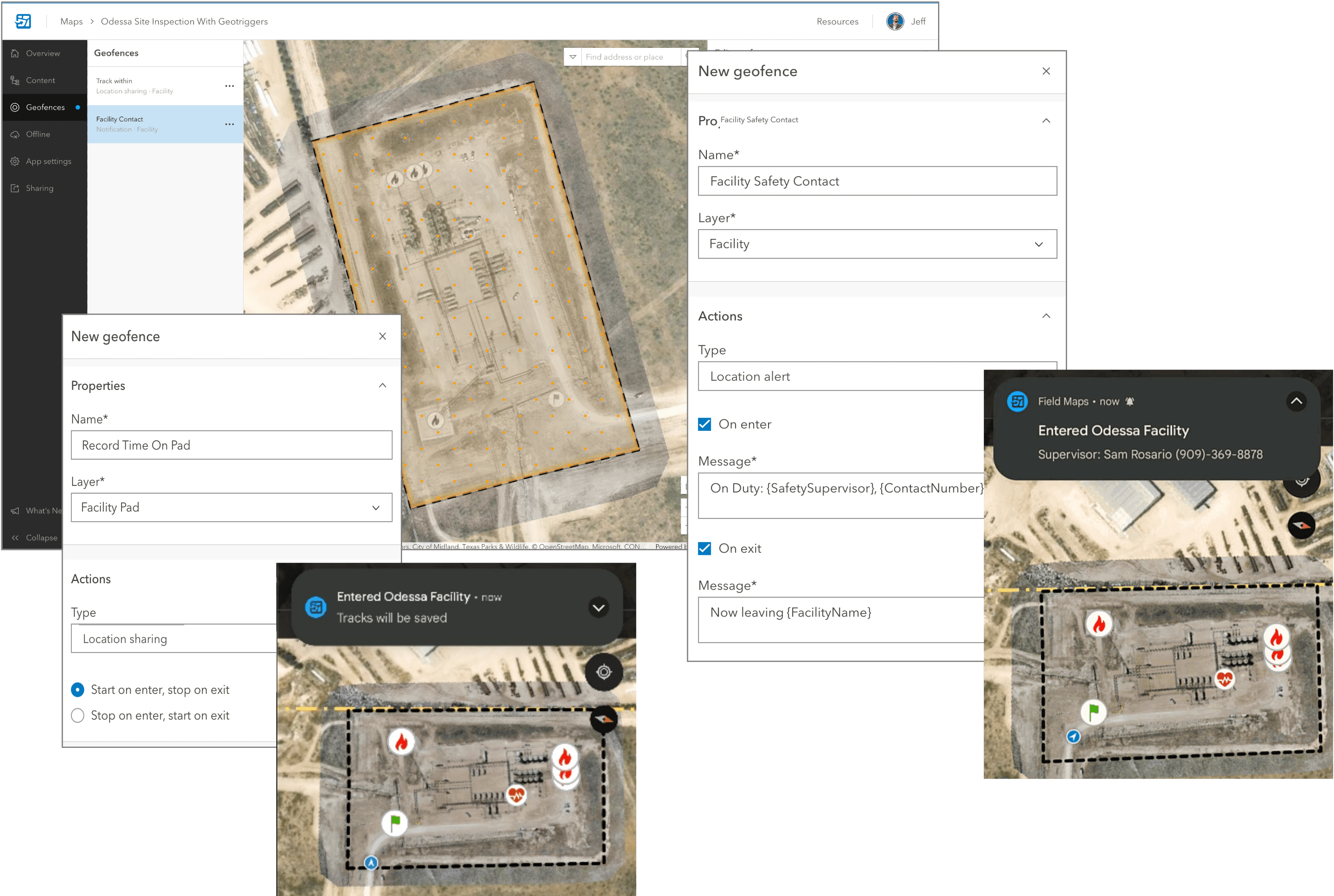
Want to provide alerts to users when they enter an area? Do you need audit trail records within survey areas? Geofences allow you to define messages sent to users when they enter or exit a geofenced location. This could be to warn your mobile workers of certain conditions or provide critical information before entering a site. Geofences can also be used to define where your associates need to share their location and where it’s not required.
Pop Up Elements
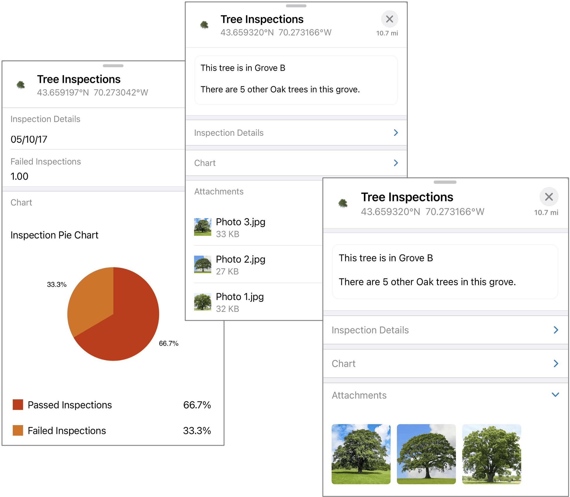
We updated support for pop up elements in the new Map Viewer. You can build pop ups that ensure mobile workers have access to key information quickly and clearly in Field Maps. These pop ups provide a rich, user-friendly way to display information with many options to display fields, charts, dynamic text, and attachments.
Creating Maps
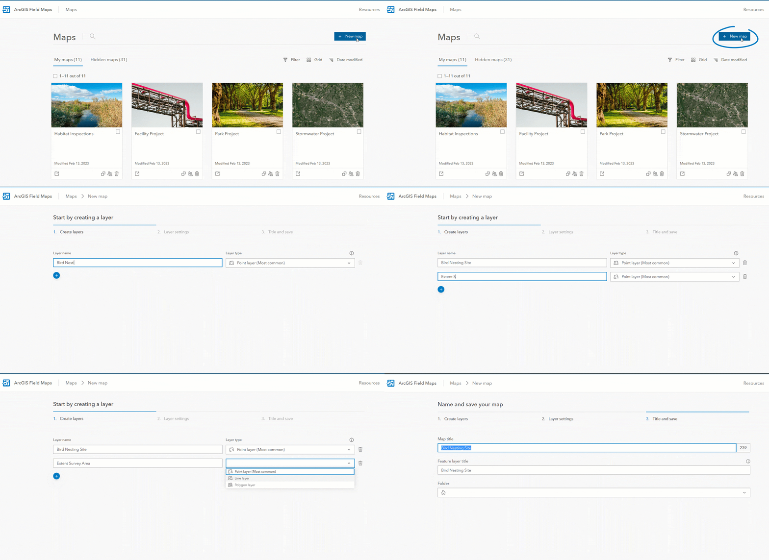
In 2022, we also introduced the ability to create maps directly in Field Maps Designer, which makes getting maps ready for the field quicker and simpler.
Field Maps Designer guides you through the map creation process step by step. The map that’s created in this process is already enabled for offline data collection. Right within the same app, you can configure the experience for your mobile teams such as configuring the form and its behaviors.
Offline – One Map
Gone are the days of needing to create both an online and an offline version of the same map! You’ve been asking for this and we listened. Now your mobile workers can access a single map in its full state with connectivity and its offline areas when they don’t have connectivity. One map for offline and connected workflows!
New Patterns
Indoor GIS
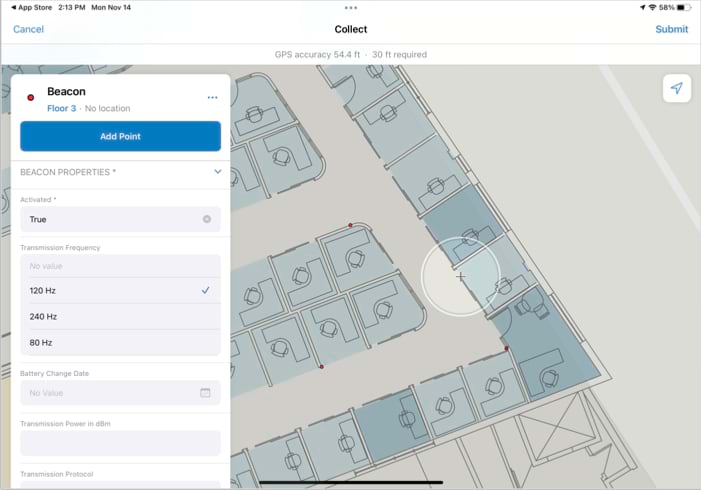
Field Maps now works just as well indoors as it does outside with support for Indoor Positioning Systems (IPS) and Indoor models. Mobile users can filter the map based on the floor and capture the floor details when adding or editing features.
Utility Network
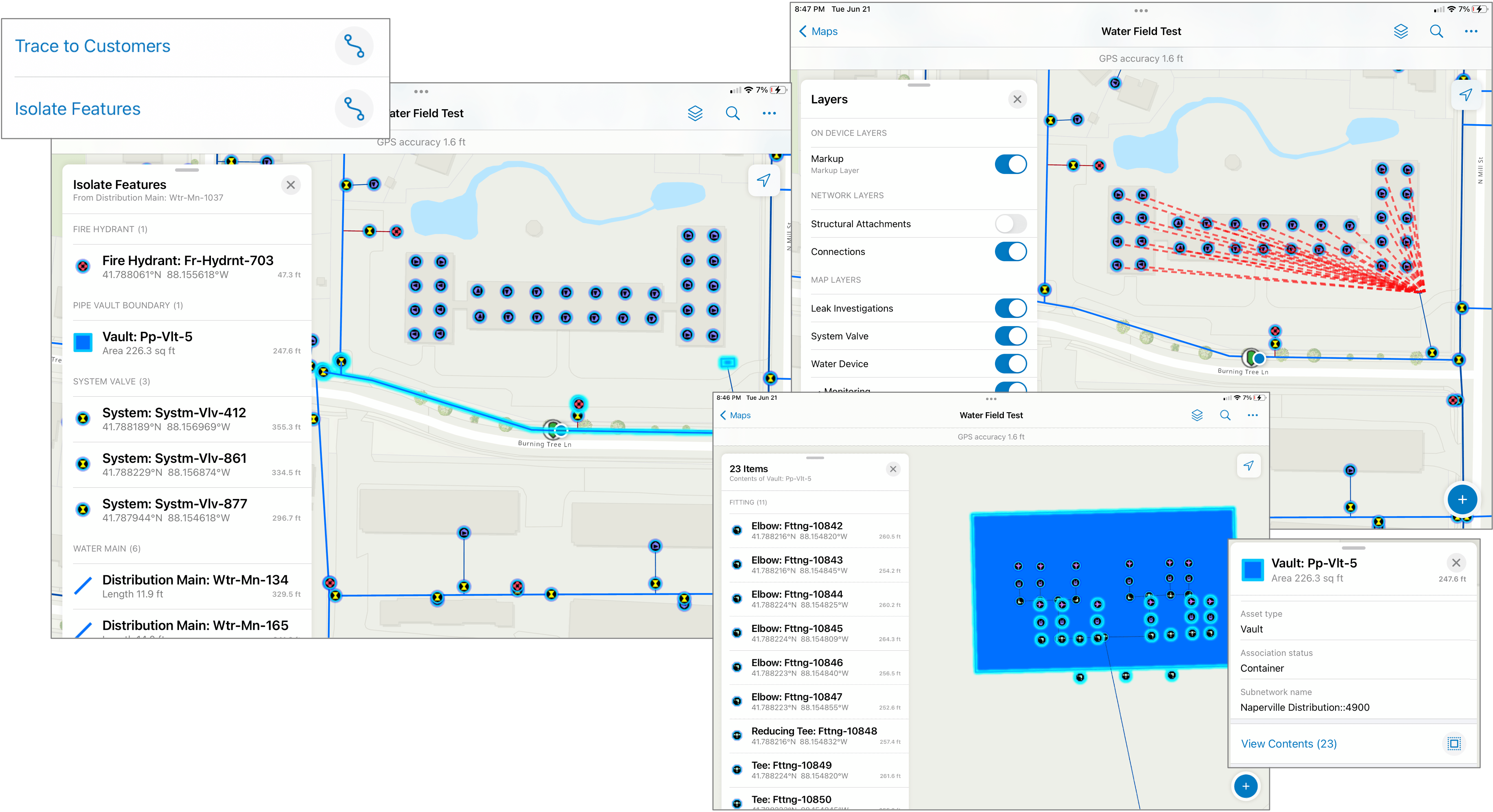
The Utility Network allows organizations to model real life assets and connectivity. We’ve brought this powerful data model to the field. From our 2022 June release, you can now view and trace your Utility Network in Field Maps.
Linear Referencing
Used by transportation authorities, utilities, pipelines, and railroads, linear referencing helps to manage linear assets along a corridor. This data model is used by inspectors, engineers, and contractors to validate their location relative to a linear measurement and locate measurements along a linear feature.
With our 2022 March release, mobile workers can now tap on the Find Measure action to see the closest M value to their location. They can drop a pin at that value or type in an alternate measurement. The pin’s location can be used as a navigational aid or to collect a new feature. New features captured from the pinned location will store the measurement value if they are m-aware.
Licensing and Deployment
Last year we had a few changes to licensing:
- The Field Worker user type was renamed to Mobile Worker user type to better reflect how this user type is used, especially with the advent of Indoor GIS support in our mobile applications.
- The Location Sharing User Type Extension is now available to light up the location sharing capability in Field Maps. With the retirement of ArcGIS Tracker, we have retired the ArcGIS Tracker App premium license.
In terms of deployment, we removed our retired apps from Google Play and Apple App Store: ArcGIS Collector, Collector Classic, ArcGIS Tracker, and ArcGIS Explorer.
Coming soon
Windows 11
Windows support for Field Maps has been one of our most requested capabilities on Esri Community. With the new Windows Subsystem for Android (or WSA), it’s now possible to run Field Maps (Android version) on Windows 11! Field Maps on Windows 11 is currently available for customers to test in our Early Adopter Program.
Field Maps Designer
This article has referenced the term Field Maps Designer several times. If you thought, “I’ve not heard this term before”, you’re right, it’s new! In our next release, we are naming the web component of Field Maps to Field Maps Designer to more easily reference its capabilities. Field Maps Designer streamlines the preparation and configuration for maps deployed to the Field Maps mobile app. There you can create new maps, create and edit forms, configure offline use, manage geofences, and much more!
CAC iOS 16
iOS 16 introduced support for CCID-compliant smart card readers and PIV smart cards. In our first release of 2023, Field Maps will support CAC cards when using Apple Devices at iOS version 16 and above.
Share your ideas
The best place to provide feedback and ideas is through our Esri Field Maps Community forums. Our team continually monitors the ideas submitted, discussed, and voted on by the user community. We have implemented many of the ideas that have come in through the forms.
Another great way to provide feedback is while we are actively developing new capabilities, through our Early Adopter Community. Watch the Esri Field Maps Community blog where we announce when there are opportunities to beta test new functionality.
We also speak to our customers on a regular basis to understand workflows, learn how Field Maps is being used, and to gather feedback on the experience. If you would like to participate in a user research interview please get in touch with your Esri contact or email us at ArcGISFieldMaps@esri.com.
Where to find out more
This article has been the highlight reel of the new functionality we released in Field Maps last year but is by no means everything. If you’d like to learn more, the following resources provide a thorough list of what was in each release. You can also check out the archived What’s New list in our Field Maps FAQ for a historical view of all the new functionality we’ve release in the past.
| 2022 Field Maps Releases | Resources |
| March
|
Overview Video |
| May
|
What’s New Blog |
| June
|
What’s New Video |
| Nov
|
What’s New Video |

Commenting is not enabled for this article.