The latest release of ArcGIS Field Maps includes several exciting new features targeted at utility customers who have implemented the ArcGIS Utility Network. These new features provide a robust user experience for mobile workers who need to view and trace their utility networks in the field.
View Experience
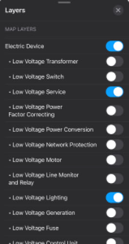
One of the first things your mobile team will notice when they open ArcGIS Field Maps and view the utility network is the user experience when viewing their organization’s assets has been improved. Web maps that contain subtype group layers are now supported in ArcGIS Field Maps. This means data technicians now have more control labelling and symbology – enabling purpose-built maps for the field, quick draw times, and reduced map clutter due to scale suppression.
Structural Attachments, Connectivity, and Containment
Using Field Maps, mobile workers will be able to view and explore assets details and assess how these assets are connected to one another in the field.
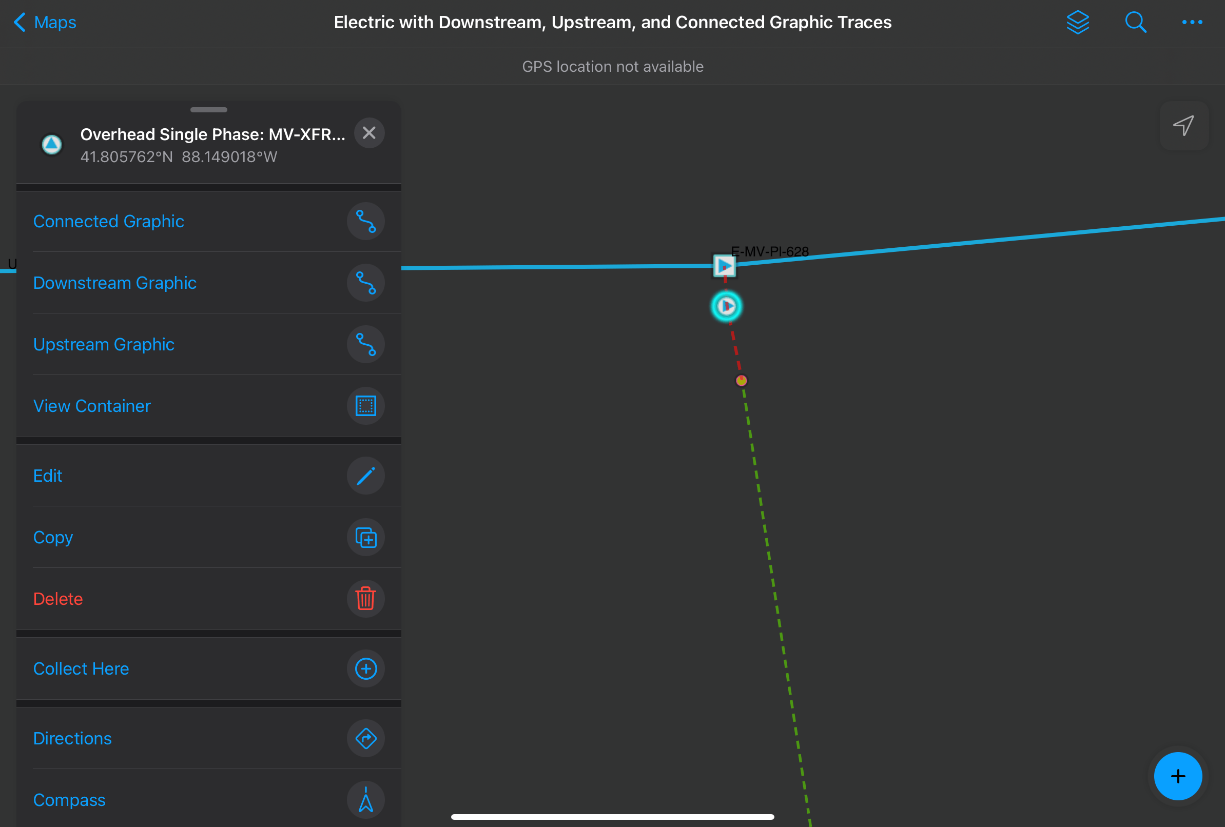
Mobile workers can turn on layers and query assets to view the following associations:
- Structural attachments (such as equipment attached to poles).
- Connectivity (for example, between junction and device objects such as taps and transformers).
- Containment (for example, stations or ducts within a conduit).
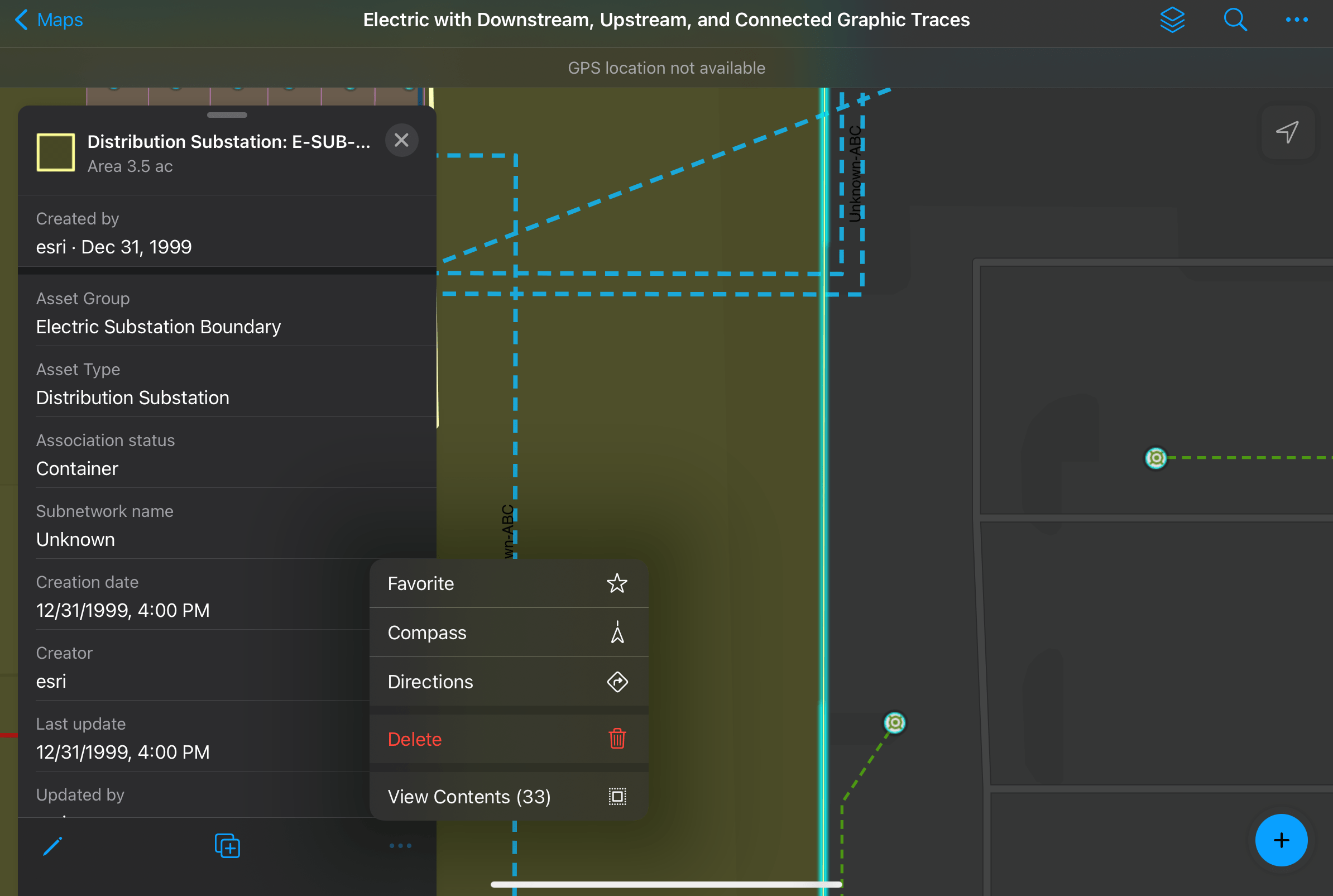
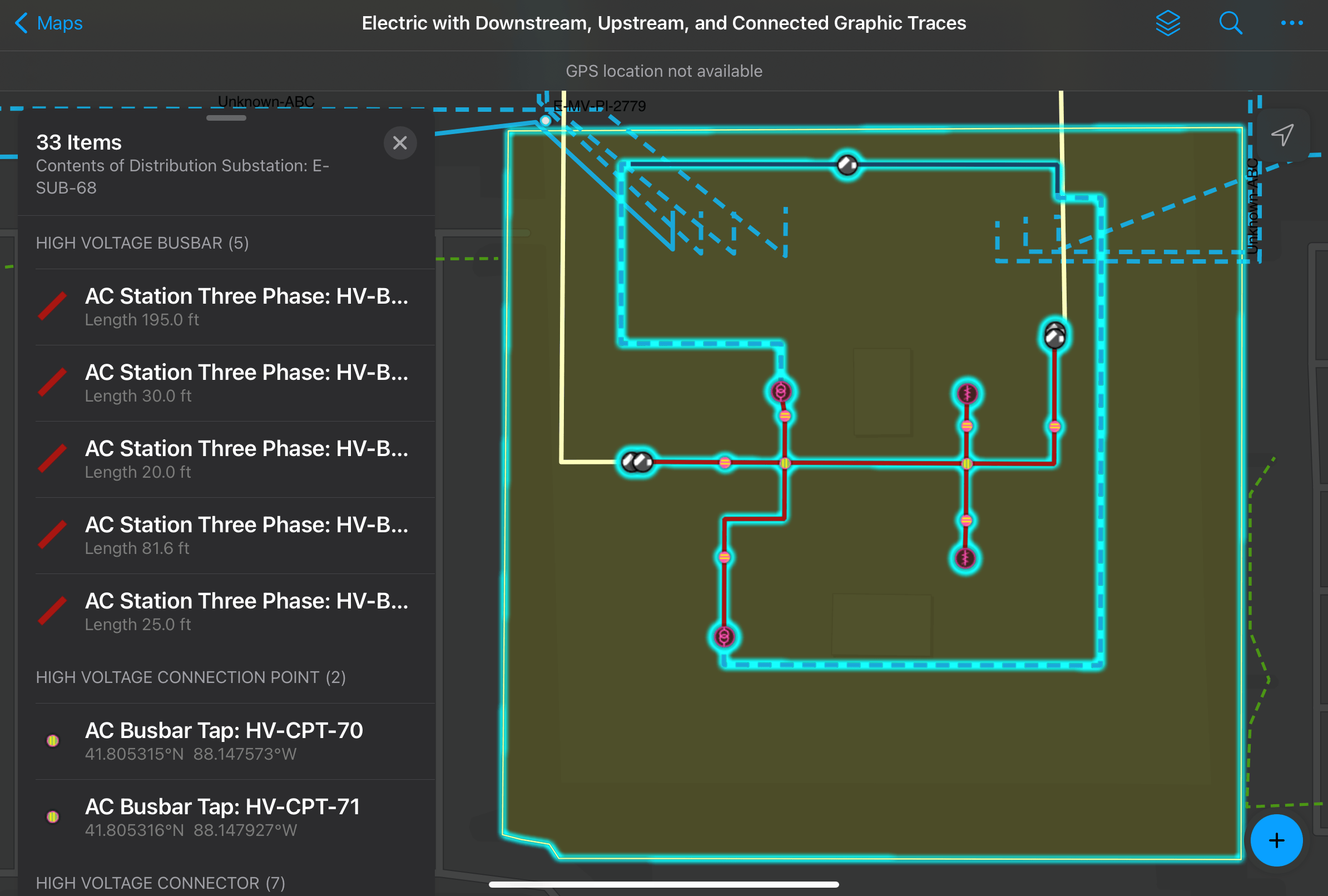
Users who are familiar with the utility network model will notice that Field Maps honors any display filters that are configured in the map, ensuring mobile workers have access to the data they need, including the ability to view content inside containers.
Trace
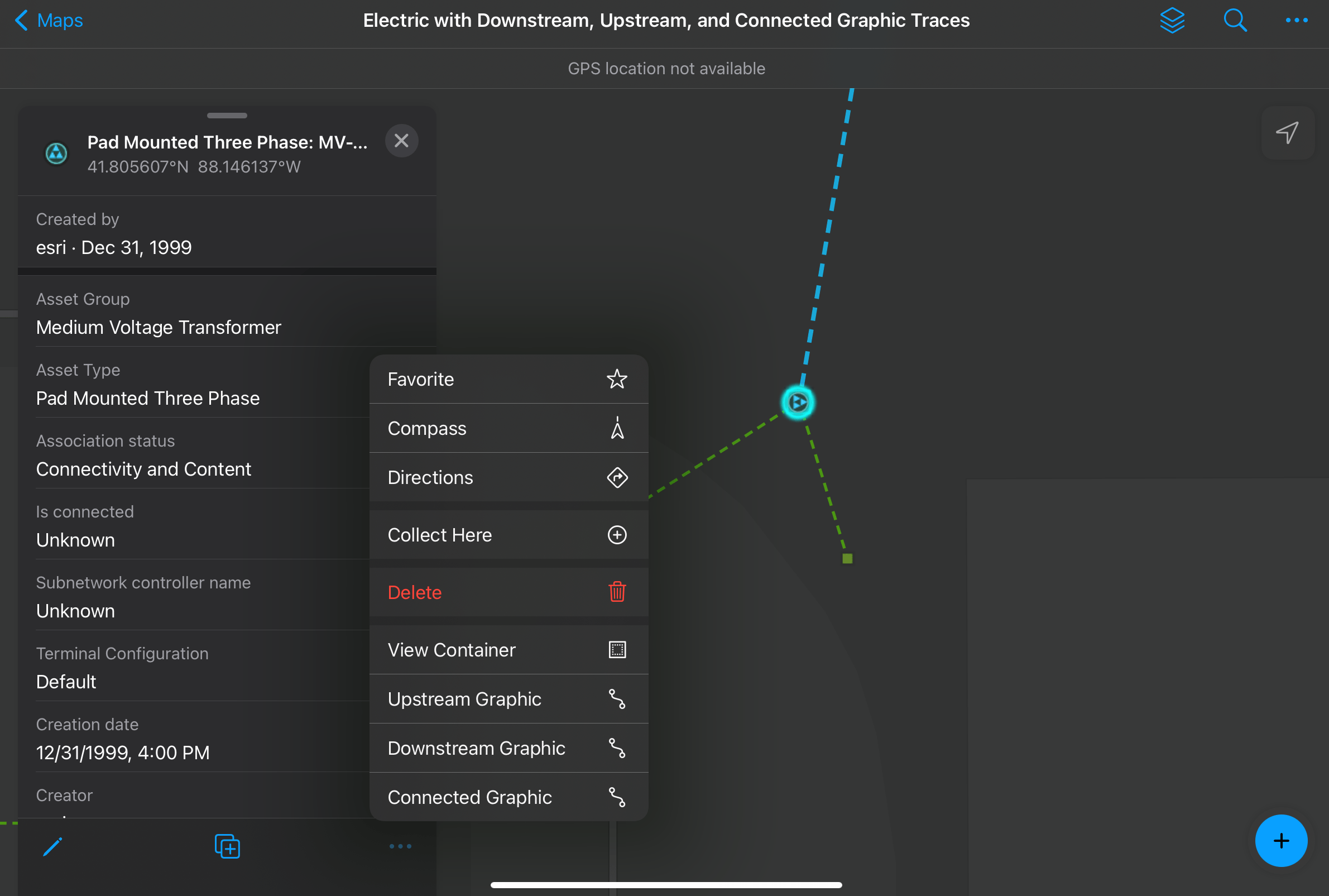
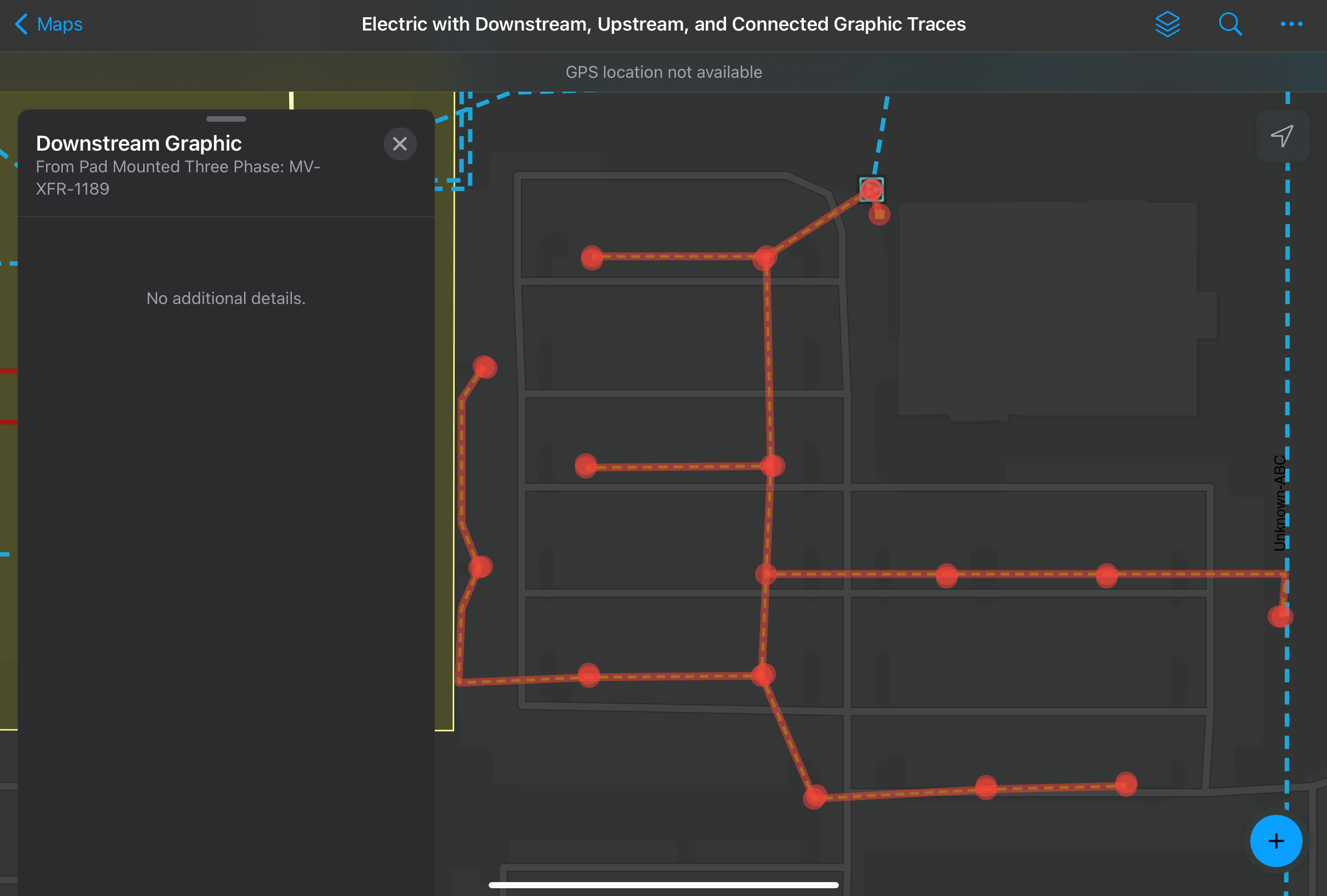
ArcGIS Field Maps enables mobile workers to access the capabilities they need in the field by allowing them to trace the utility network. Whether this is performing an upstream trace to identify a switch/valve, or a downstream trace to identify the customers affected by an outage, mobile workers can perform traces to select affected assets, show aggregated geometries on the map, and even perform calculations with the trace results! Supported trace types include:
- Upstream
- Downstream
- Connected
- Isolation
- Subnetwork
- Loops
Conclusion
To learn more about how to share named trace configurations in a web map, see Named Trace Configurations.
This is the first release of ArcGIS Field Maps that adds support for the Utility Network and we’re eager to hear your thoughts about these new features. Check out the ArcGIS Field Maps and ArcGIS Utility Network Esri Community pages to access resources, ask questions, leave feedback, and tell us about your ideas.


Commenting is not enabled for this article.