Introduction
For water utilities, accurate asset location is foundational. When the mapped location of critical infrastructure is off, even by a small margin, the effects can be felt across the organization, from field operations to emergency response. Crews spend more time locating assets, workflows slow down, and confidence in the system of record begins to erode.
Austin Water recognized this challenge and decided to address it within its own system. Rather than relying on manual correction alone, the team explored how high-resolution lidar, combined with geographic information system (GIS) technology and custom automation, could be used to systematically improve the spatial accuracy of its assets, starting with fire hydrants. What began as an internal effort to address known data issues has evolved into a scalable approach that is helping strengthen asset management across the organization.
About Austin Water
Austin Water serves a large and growing customer base in Austin, Texas, with more than 260,000 meters across its system. The organization operates in a federated model, with strong coordination across departments supported by a centralized IT function.
GIS plays a central role in that environment. It serves as the system of record for asset management and supports core workflows across capital planning, field operations, and customer billing. Dedicated GIS teams manage enterprise data and develop applications that allow staff across the organization, as well as other city departments such as the Austin Fire Department, to access and use that information in their daily work.
In 2021, the utility began a focused effort to validate GPS data against what existed in GIS. That work surfaced a clear pattern: While the system was widely used and trusted, there were known gaps in spatial accuracy across several asset classes.
The Challenge
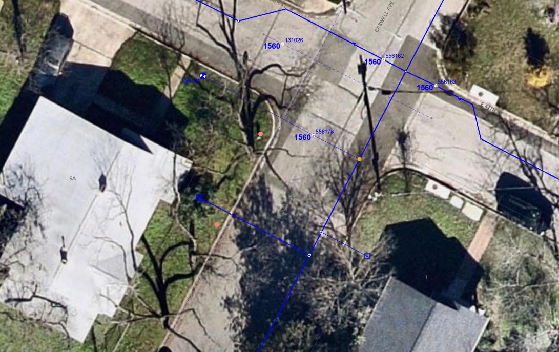
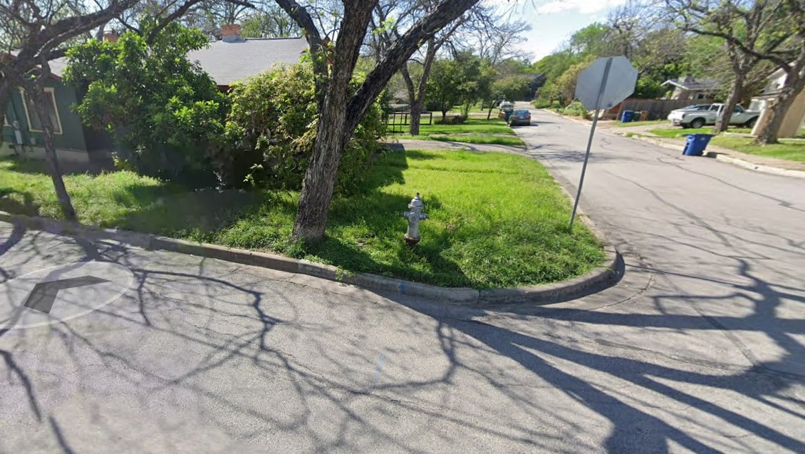
The issue was straightforward but significant. Fire hydrants within the system were not located where they were represented in GIS. When record drawings were compared to GIS, some assets were shown as much as 50 feet from their expected location.
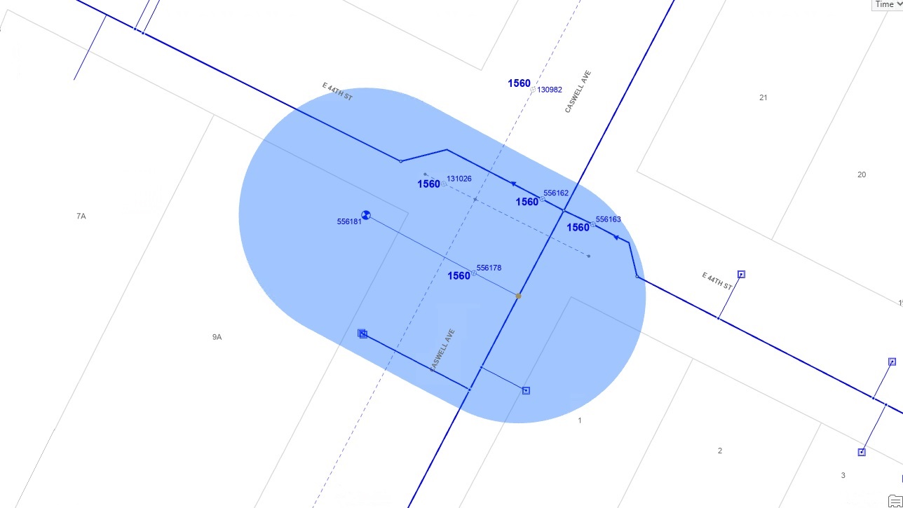
For field staff, this created real operational friction. Crews would navigate to a mapped location and still need to search for the asset. Over time, that disconnect reduced efficiency and weakened confidence in the data.
The problem was not caused by a single data update error. Instead, it reflected the cumulative effect of historical inaccuracies and inconsistent updates over time. Many of the issues were tied to older records and assets added before GPS capture became more consistent, while the volume of assets and backlog of corrections made the problem difficult to address through manual GPS validation alone.
Austin Water needed a more scalable way to validate and correct asset locations so field crews could rely on the data in front of them.
Building a New Approach
Austin Water already had access to high-quality lidar at the city level. The team began to look at that dataset differently, not just as surface information, but as a potential source for identifying and validating aboveground assets such as fire hydrants.
With additional training and internal collaboration, the team began mapping out how lidar could support this effort. From the start, the work was iterative, with a focus on building a practical workflow that could be refined over time.
Implementing the Solution
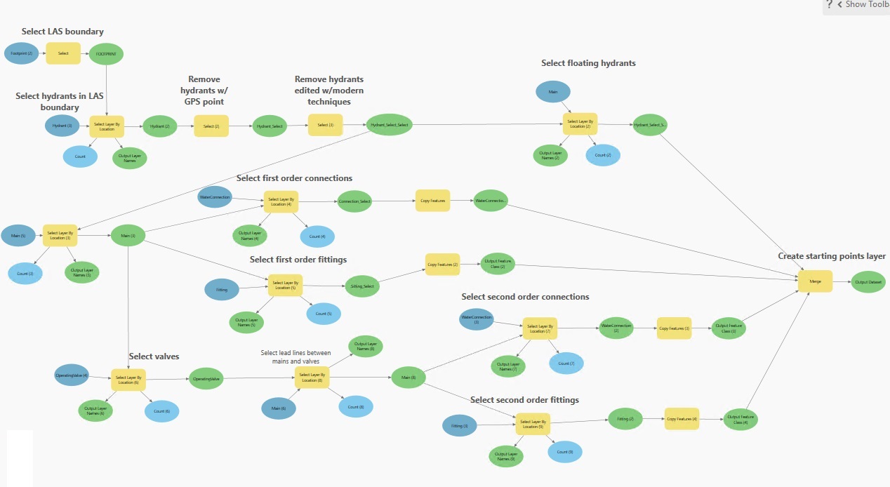
The workflow that emerged combines ArcGIS Pro, ModelBuilder, and Python to process lidar data and compare it against existing hydrant locations.
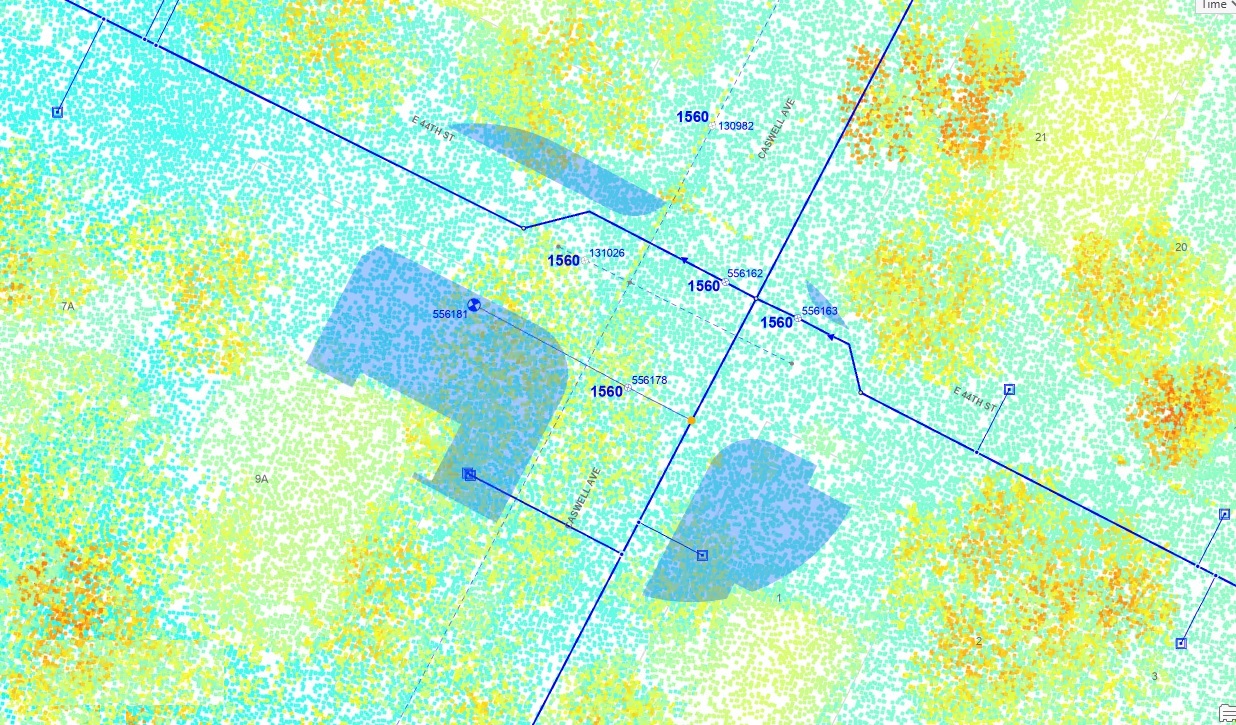
The process begins by narrowing the analysis to areas where hydrants are most likely to exist. From there, lidar LAS files are converted into usable multipoint formats and filtered to remove irrelevant features such as vegetation, ground, and buildings.
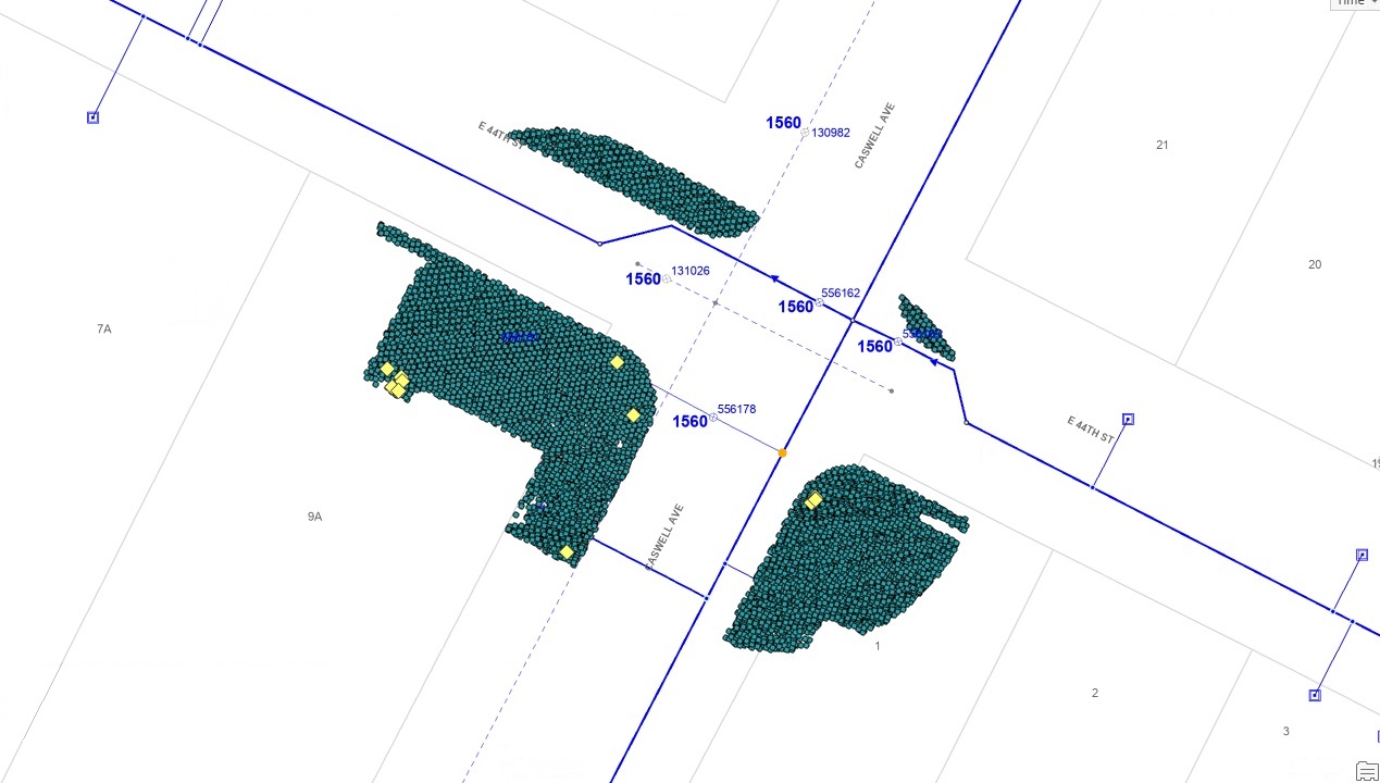
The core of the analysis focuses on elevation. Hydrants appear as vertical features, so the team developed a method to identify localized elevation differences within the lidar data. Using Python, they built a script to compare elevation values across nearby points and identify likely hydrant candidates.
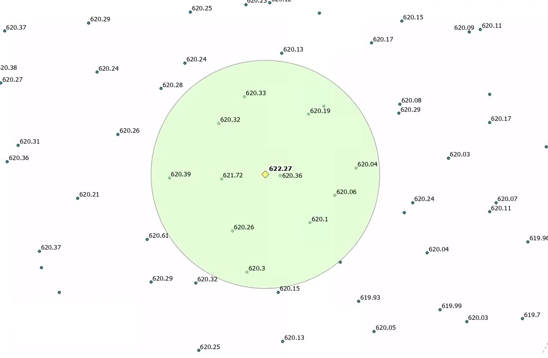
This was not a one-step process. It required repeated testing and adjustment, including tuning slope tolerances, refining buffers, and improving how candidate features were identified. Over time, what started as multiple scripts and models was consolidated into a single Python workflow capable of processing lidar grids in minutes.
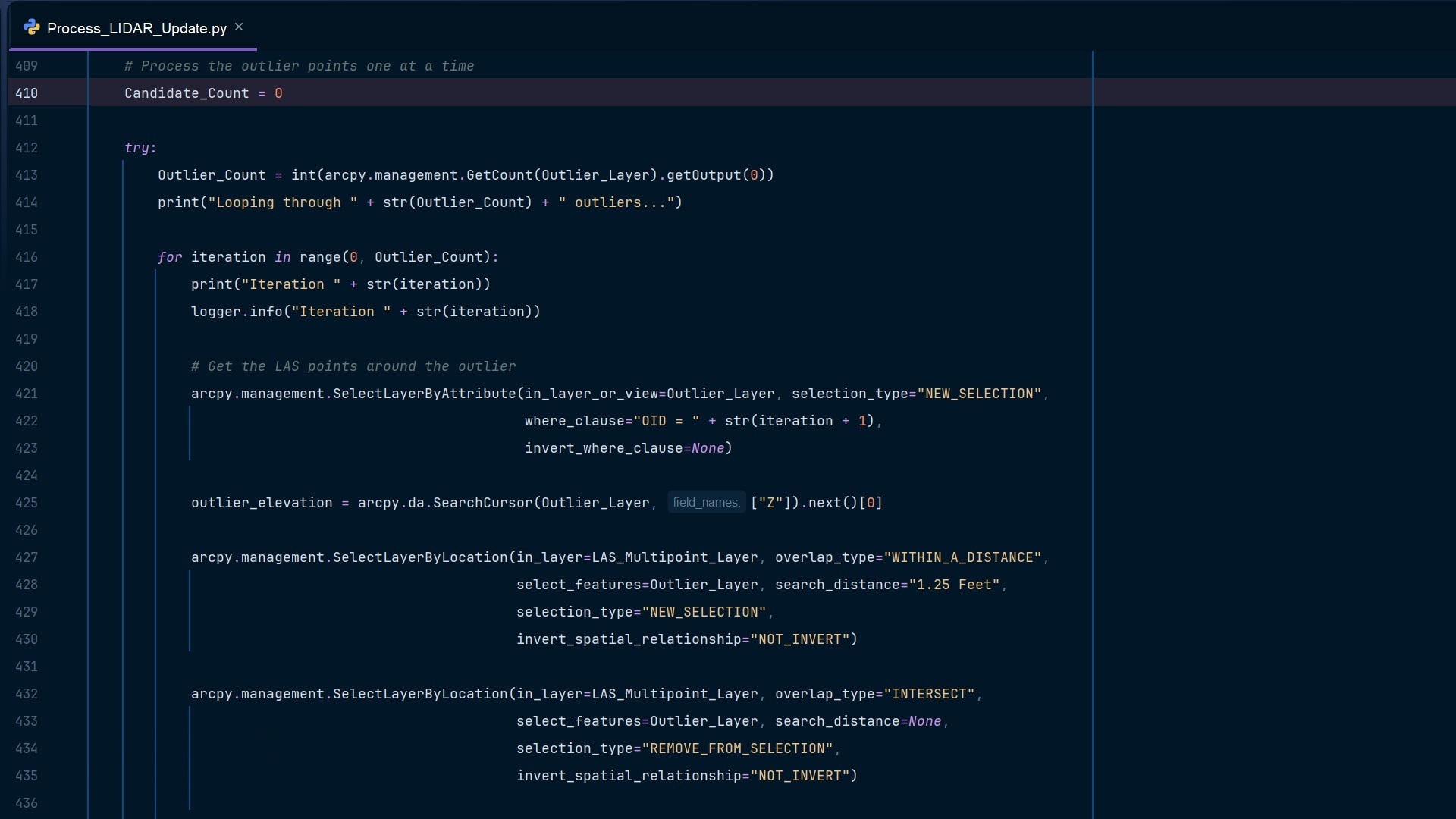
The script is not intended to find every hydrant. Instead, it focuses on a subset of assets known to be inaccurate, particularly hydrants added to the system prior to 2019 or those without GPS coordinates. Outputs are then reviewed and validated before updates are made in GIS.
How GIS Enabled the Workflow
GIS made the entire approach workable.
ArcGIS Pro provided the environment to bring lidar data and asset records together. ModelBuilder helped structure repeatable parts of the workflow, while Python extended the analysis beyond standard tools.
Just as important, GIS is where the results live. Austin Water’s GIS remains the system of record, so once corrections are made, they are immediately available to the rest of the organization and integrated into existing workflows and systems, including Austin Water’s asset management platform, Infor.
Operational Impact
The most immediate change has been in-field confidence.
Crews are spending less time searching for assets and more time completing work. When they open a map, they expect the asset to be where it is shown, and increasingly, that is the case. There are also downstream benefits. Hydrant data supports more than water operations. The Austin Fire Department relies on accurate hydrant locations for fire flow testing and verifying code requirements. Improvements to this dataset support those processes directly.
Results
The workflow improved the spatial accuracy of fire hydrants and contributed to stronger confidence in related asset data. For hydrants, the average distance between GPS and GIS locations was reduced from nearly 39 feet in 2021 to just under 13 feet in 2026, a 67 percent improvement.
Austin Water has also tracked significant improvements in spatial accuracy across other asset types. Valves improved by 55 percent, and wastewater maintenance holes improved by 67 percent. In total, more than 900 hydrants have been corrected using this workflow, with ongoing updates continuing to improve overall data quality.
Advancing Asset Management
The most important outcome is not just improved accuracy, but greater confidence in the system of record.
By systematically validating and correcting asset locations, Austin Water has strengthened the foundation of its asset management program. The organization has a clearer understanding of what assets exist and where they are located, which directly supports better decision-making and more efficient operations.
This is what advancing asset management maturity looks like in practice.
Looking Ahead and Key Takeaways
This work is ongoing. The team continues to refine the workflow, improve automation, and scale processing to larger grid areas. The goal at Austin Water is not just to fix data once, but to establish a repeatable process that keeps it accurate over time and can be applied to additional asset features. A few takeaways from the team that can help other water utilities who are looking outside of the box for asset management practices include:
- High-resolution lidar can be used to validate and improve asset location at scale.
- Combining GIS with Python enables workflows that go beyond manual correction.
- Iteration is critical when working with complex spatial data.
- Accurate asset location is foundational to operational efficiency and asset management maturity.
Stay Connected with Esri’s Water Team
ArcGIS is an enterprise geospatial platform that enables modernization of workflows with easy-to-use applications for the field and office. Strengthen your organization with geospatial solutions that will increase efficiency and provide insight for decision-makers.
Visit the Esri Water Utilities web site for more information.
Join the Water Utilities Community
Follow #EsriWater on social media: X | LinkedIn
Subscribe to the Water Industry newsletter “Esri News for Water Utilities and Water Resources“