Esri Young Professionals Network (YPN) is proud to feature Faces of YPN, an article series highlighting professionals entering geospatial technology careers. In this series, we interview young pros from various sectors and work environments to learn the following:
- How they use geographic information system (GIS) technology in their career
- What they love about GIS
- How they got their start in GIS
- What advice they’d like to give to other young professionals
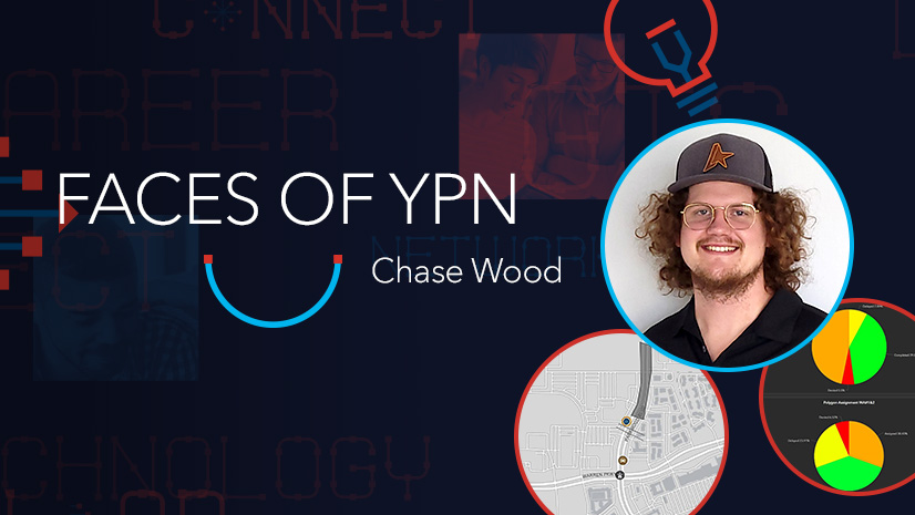
This Faces of YPN interview is with Chase Wood, a GIS specialist for Lamb-Star Engineering. During our conversation, we asked about his journey with GIS and to provide some practical tips and tricks he has used to progress in his career.
Don’t be afraid to reach out to people, even if it’s a guest presenter from a college course. That is how I got into my current role at Lamb-Star.
Below is our Q&A with Wood.
How did you get your start in GIS?
A: My grandfather was a surveyor, so I had some background in surveying growing up. But I studied spatial science at Stephen F. Austin State University in Nacogdoches, Texas, which was my first exposure to GIS technology. During my time at college, I participated in an internship with Nacogdoches County, where I was a part of their 911 Addressing department, where I verified rural addresses in the field to ensure fast and efficient response times. Shortly after starting the internship, I moved on to another project that was solely GIS oriented.
Tell us about your GIS internships in college.
A: I participated in a seven-month internship in the Nacogdoches County’s GIS department, where I was the analyst working under the head of the department. However, during my time in that role, the city engineering department staff noticed that I had some availability, and I transitioned to a new project that they wanted me to create. At the time, we primarily worked with ArcMap where we updated addresses in the police dispatch database, which meant a lot of digitizing. For example, I digitized driveways and had to relate them to their respective roadways so dispatch could see all available options on how to get to an address point. It was really meaningful work that I am proud of.
Shortly after I started the internship at Nacogdoches County, the only GIS person at the City of Nacogdoches went on leave, so the county loaned me to the City of Nacogdoches to work on updating addresses in [its] database. Here, I was in charge of stacking address points for apartment buildings. Rather than having a single point for an entire apartment building, I created multiple points, one on top of another, for all units in the apartment building. Stacking address points like this is important so police know exactly which unit to go to, rather than having to waste time finding the correct unit on-site. While I was at it, I also added other information to the data, like floor levels, so the data could eventually be incorporated into 3D models.
How do you use GIS in your current role?
A: I started at Lamb-Star in 2020 as a field crew member in the survey department. After my field experience, I moved to a role in-office as a survey technician where I was also the first GIS employee at Lamb-Star. I was really pleased with this new position because I had the opportunity and liberty to take my idea of a GIS department and make it happen. Recently, we’ve expanded my role into a bigger position within Lamb-Star. Overall, it has been a nice, organic growth here.
An example of how I use GIS in my position is how frequently we work with the Texas DOT [Department of Transportation]. Specifically, we do right-of-way mapping, where we survey roadways, drainage structures, and anything that falls within the Texas DOT right-of-way. Or if Texas DOT is purchasing new right-of-way, we will map it out so the state has the information [its staff] needed to purchase new right-of-way.
How do you stay updated on new technology and trends?
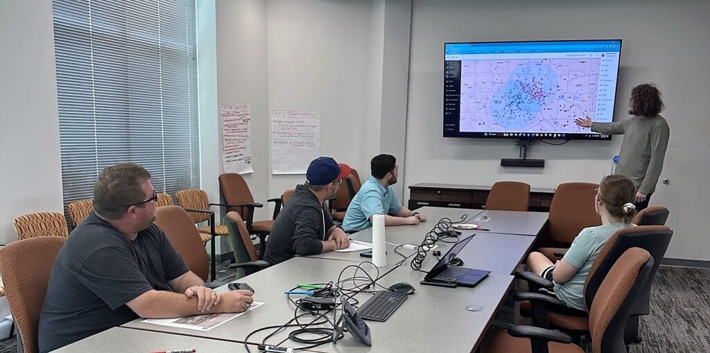
A: Primarily, I stay updated by researching topics online and getting my hands dirty with new products and technology. I find it easier to learn new and different products by installing, configuring, and messing around with them to understand their capacities. For example, Lamb-Star started out with a simple reporting system that field [staff] used to view all forms that they needed to fill out to carry out their specific tasks for the day. I then asked myself, “Can we assign these forms, and can we assign certain tasks to field staff?” Through my curiosity, I stumbled upon ArcGIS Workforce, which allowed me to do exactly what I was looking for.
Additionally, I like to build ArcGIS Workforce projects and applications for my own knowledge to see if I can implement the product in other ways. I’ll create a small ArcGIS Workforce project and play with it on my phone in order to further understand it and see all of the capabilities, and to see exactly what our field staff will see on their devices to make sure it’s user-friendly. This workflow opened our eyes to templating specific metrics that are useful to us and clients to somewhat recreate the ArcGIS Workforce flow through ArcGIS Field Maps, and ArcGIS Experience Builder.
Esri Community is also a great resource for ironing out some finer-scale and specific issues and questions that I might run into. My curiosity sometimes extends outside of work hours too. I’ll catch myself searching the internet for solutions to try to further advance my work after business hours.
What Esri technology do you use in your current role?
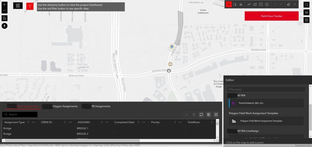
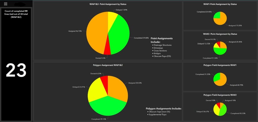
A: One of the workflows that we have pieced together is developing a geodatabase template that we use to track field assignments for individual projects. This process includes appending our estimation KMZs using a customized templated ArcGIS Pro project, which pushes the data online where a map is created for use in ArcGIS Field Maps by our field personnel with all relevant fields.
By taking advantage of the Esri technology available to us, I can use the map I mentioned above in ArcGIS Experience Builder to allow non-GIS professionals to analyze, edit, and export the data while also embedding ArcGIS Dashboards and other online aspects to centralize all relevant data. This allows for seamless field-to-office communication on the project, and it can even be client facing. This workflow allows an analytical and visual aspect to what may have been just an email stating completed tasks.
We utilize ArcGIS Workforce for some of our smaller projects and build simple applications using ArcGIS Web AppBuilder. We frequently use ArcGIS Survey123 to build surveys for an easy way to collect data; and it comes with a unique way to display survey results with custom reports. ArcGIS Survey123 is a versatile tool and allows us to collect information on everything from important construction services inspection data to gathering numbers on who will attend company events.
Outside of collecting and editing data, I utilize ArcGIS StoryMaps for technical training and marketing material. Putting together a brief company brochure to showcase in ArcGIS StoryMaps makes for an intuitive, interactive, and impressive display. This also allows us to use a single URL instead of having to print, resend, or reupload any changes [via] a more traditional method. Exploring all Esri technology has streamlined processes and made a very professional feel for several workflows.
What value have you received from being a member of Esri YPN?
A: I officially joined Esri YPN three or four months ago, but I’ve utilized the blogs and other related content for much longer. Reading through blogs and the success stories has given me hope, and it gives me good insight into advice that you probably wouldn’t catch elsewhere—especially if you’re like me and don’t have a large network.
As a younger professional and in an environment where I don’t have many GIS resources, I don’t have much of a GIS network at all. This year is the first year that I’ll be attending Esri User Conference, and I’m really excited to get there and start networking with other GIS professionals. Access to Esri YPN and reading other members’ journeys through GIS and all the different thought processes has helped me tremendously.
What is your best advice would you give to young pros?
A: Some initial advice I’d give to others is to not be afraid to reach out to people, even if it’s just a guest presenter from college. It’s actually how I got my current role at Lamb-Star.
Another word of advice would be to try to have a basic understanding of the software and have a grasp on what it’s capable of. Coupling this with a strong understanding of the existing process at hand allows you to connect the two together. It’s important as it will set you apart from others and allow you to be more efficient with your work. For example, if you have a basic understanding of GIS software and someone hands you a list of addresses inside a CSV file, you can look at that data and immediately understand that it’s probably not the most useful format of the data. Why not import this data into a geodatabase so it can be displayed on a map more efficiently, or imported into an address locator?
Esri has tons of free training resources on its website to help get new users acquainted with all of Esri’s technology, so I highly recommend checking it out if you’re curious about learning more about certain products.
How would you like to use GIS in the future?
A: The Survey Department at Lamb-Star has a drone that I really would like to start using. The Reality Capture group on that side is building standards and procedures for drone data. At Lamb-Star, we see a link between GIS and drone data, whether that’s through site scanning with imagery or even downloading some third-party data to verify our flight paths. I can see how using drones in our work will give us a new and different perspective, without having to go back out into the field with a field crew.
In addition to using drones, I’d like to work with 3D data—it’s actually the next big goal for me. We haven’t done any 3D GIS analysis yet, but once we figure out a revenue plan, we will start looking at incorporating 3D data into our online maps or exploring BIM modeling.
You can learn more about Esri Young Professionals Network and our upcoming events on our web page.
Check out these additional resources for students in higher education or young professionals entering geospatial technology careers:
- Esri Community—Young Professionals Network (blogs, events, discussion)
- Esri YPN group on LinkedIn
- Esri training courses
- Esri Technical Certification Program
- Esri student programs including internships and assistantships
- Esri recruiting events