Over the past few months, I’ve had a number of conversations with fire service leaders about National Fire Protection Association (NFPA) 1750. Like many major standards changes, it will take time before the full impact is felt across the industry. But after listening to the latest Fire Service Data and Tech Talk podcast titled NFPA 1750: The New Fire Service Standard Every Chief Should Understand, where host Eddie Buchanan discusses the new standard with Dave Downey, one thing became clear:
The new NFPA 1750 standard asks, “Can we demonstrate that our deployment model matches the risks in our community?” It is not simply a renumbered NFPA 1710.
It represents a significant shift in how fire departments evaluate risk, deploy resources, measure performance, and justify service levels to elected officials and the communities they serve. For chiefs, operations officers, planners, and accreditation teams, NFPA 1750 pushes the conversation beyond response times and toward this broader question.
That’s a question many departments are already trying to answer. The good news is most organizations already own many of the geospatial tools needed to support that effort.
From Response Times to Response Capability
For decades, discussions around standards of cover frequently centered on turnout times, travel times, and whether the first-due company arrived within a target benchmark. Those metrics still matter.
What NFPA 1750 adds is a stronger emphasis on effective response force (ERF), formal risk assessment, and system reliability. According to Dave Downey, chair of the legacy NFPA 1710 committee, departments are being encouraged to evaluate not just how quickly units arrive, but whether the proper resources consistently arrive together and whether those resources are actually available when needed.
That is now a fundamentally different conversation. A department may achieve excellent response times while simultaneously struggling with station reliability, chronic move-ups, cross-boundary responses, or staffing deficiencies that delay the assembly of an effective response force. NFPA 1750 challenges departments to measure the entire system.
Unit Reliability May Be the Biggest Story Nobody Is Talking About
One of the most interesting points from the discussion was the requirement to begin measuring unit reliability. In simple terms, it asks, How often is your first-due unit actually available in its first-due territory?
Every chief has experienced it. The first-due engine is handling another incident. The ladder company is covering across town. A neighboring jurisdiction is automatically responding because the local unit is unavailable.
Historically, many departments have focused on travel time measurements. NFPA 1750 encourages leaders to evaluate how reliably resources are available to serve their assigned areas. For many organizations, this may reveal operational realities that traditional response-time reporting misses entirely.
Risk Assessment Is No Longer Optional
Another major change is the increased emphasis on documented risk assessment. Rather than relying solely on occupancy categories and historic staffing assumptions, NFPA 1750 places greater responsibility on the authority having jurisdiction to evaluate local conditions and determine what constitutes low, medium, and high hazard risks. This creates an opportunity for fire departments to bring together many considerations into a repeatable, defensible risk model, including:
- Incident history
- Building and occupancy information
- Community demographics
- Growth patterns
- Infrastructure vulnerabilities
- Transportation impacts
- Critical facilities
- Special hazards
This is where location intelligence becomes operationally valuable rather than simply analytical.
Target Hazard Analysis Becomes More Important Than Ever
While not specifically called out as a new requirement, target hazard analysis become increasingly important in a risk-based deployment framework. If you’re going to justify staffing, station locations, ERF expectations, or automatic aid agreements, you need confidence that you understand where your highest risks exist within your community.
Examples of target hazards include:
- High-rise occupancies
- Hospitals
- Schools
- Chemical facilities
- Warehouses
- Abandoned buildings
- Distribution centers
- Water treatment plants
- Energy infrastructure
- Large assembly occupancies
Many departments maintain preplans but struggle to maintain a comprehensive target hazard inventory that can be continuously analyzed and updated. This is where geographic information system (GIS) technology can become a command-level decision-support capability rather than simply a mapping tool. By combining occupancy data, inspection history, incident records, hydrant coverage, access routes, and preplans, departments can better understand where risks are accumulating before an incident occurs.
The Often-Overlooked Impact of Community Development
One section of the podcast discussion that particularly resonated with me involved urban planning. As communities evolve, fire departments increasingly face:
- Traffic-calming projects
- Bike lanes
- Roundabouts
- Increased population density
- New developments
Without careful assessment, these changes can unintentionally affect emergency access and response performance. According to Downey, NFPA 1750 encourages agencies to evaluate how these changes impact service delivery. For many departments, this may require becoming more involved in planning and development reviews than ever before.
How Esri Can Help
The encouraging part of this conversation is that many fire departments already own solutions that can support these efforts today. You do not need to build a custom data science program to start addressing NFPA 1750.
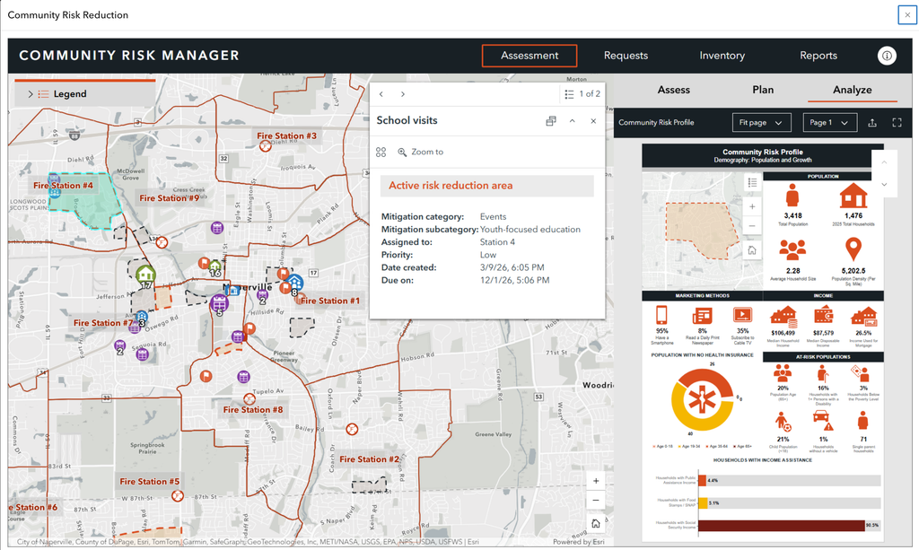
Community Risk Reduction
Community Risk Reduction (CRR), provided through ArcGIS Solutions, helps departments understand incident patterns, vulnerable populations, and risk concentrations across their service areas. As departments move toward risk-based deployment models, these capabilities become increasingly valuable.
CRR workflows support:
- Risk identification
- CRR planning
- Public education targeting
- Vulnerability analysis
- Incident trend analysis
Standards of Cover and Response Analysis
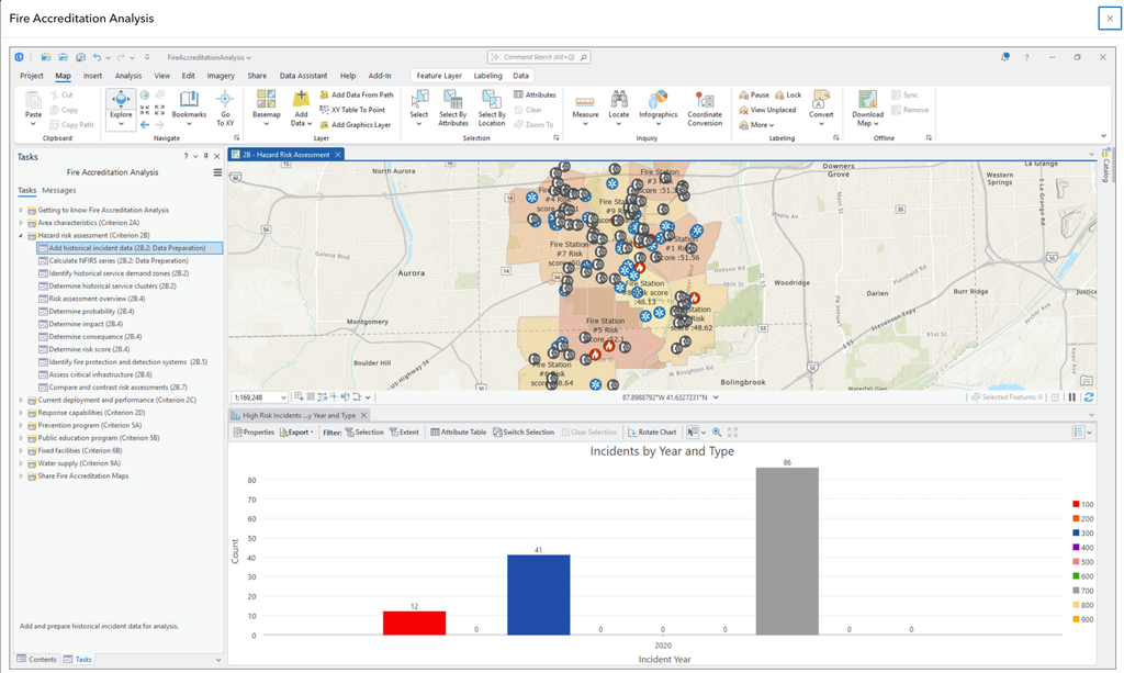
The Fire Accreditation Analysis solution delivers a set of capabilities that help fire agencies complete a standard set of spatial analysis workflows and generate a series of maps that conform with the spatial requirements included in the CFAI Accreditation Model Information Technology Specifications. More importantly, it provides a way to visualize these findings in a format that command staff, city managers, and elected officials can understand. The solution supports:
- Response time analysis
- Station coverage studies
- Drive-time modeling
- Effective response force analysis
- Service area evaluation
- Future growth forecasting
Target Hazard Intelligence
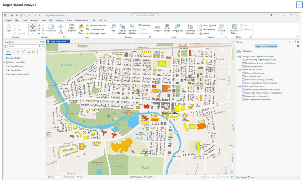
Esri’s Target Hazard Analysis solution can help agencies develop a more comprehensive understanding of target hazards throughout the jurisdiction by integrating occupancy information, inspection records, preplans, critical infrastructure, hydrant networks, and incident history.
This target hazard intelligence supports:
- Deployment decisions
- Resource allocation
- Pre-incident planning
- Strategic planning
- Capital improvement discussions
Mobile Application
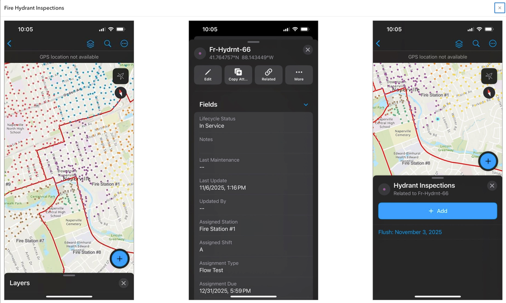
Many fire departments already have access to Esri’s mobile applications such as ArcGIS Survey123 and ArcGIS Field Maps. These workflows help ensure data remains current rather than becoming another binder that sits on a shelf until needed. These include:
- Preplans
- Target hazard surveys
- Community risk assessments
- Hydrant inspections
- Building inspections
- Post-incident assessments
Final Thoughts
As I listened to Buchanan and Downey on the podcast, one message stood out. NFPA 1750 is asking departments to understand their communities at a deeper level. It’s asking leaders to measure what matters. It’s asking agencies to move beyond simple response times and develop a more complete understanding of risk, capability, reliability, and performance. For many organizations, that may feel daunting. But I would argue that most departments are closer than they think.
Many already own the technology. Most already collect the data. Many have already started the journey through community risk reduction programs, accreditation efforts, standards of cover studies, pre-incident planning initiatives, and target hazard assessments.
The opportunity now is bringing those pieces together into a framework that supports the intent of NFPA 1750. And that may ultimately be the most important change of all.
The future conversation is no longer simply, “How fast did we get there?”
It’s becoming, “Did we understand the risk, deploy the right resources, and reliably deliver the level of service our community expects?” Learn more about our ArcGIS Solutions for the Fire Service online or please reach out to us to understand the geospatial capabilities you already have within your depar