In the heart of Arizona’s red rock country, Sedona Fire District (SFD) faces a unique set of challenges. With a sprawling jurisdiction that straddles two counties, covers extreme terrain and hundreds of miles of scenic trails, and serves a booming tourist population, SFD’s mission to protect lives and property is anything but simple.
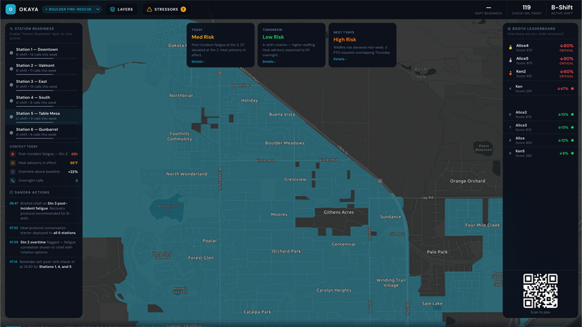
When the Pocket Fire ignited in the summer of 2026, interagency incident management teams quickly took command of the complex wildfire. While SFD’s direct tactical role in the response was minimal, the district’s digital readiness proved valuable to the broader effort. By sharing data via hosted layers in ArcGIS Online, SFD ensured that incoming teams were starting with the exact same baseline local intelligence. Beyond data sharing, SFD actively worked with the city, counties, and law enforcement to effectively communicate “Ready, Set, Go!” evacuation messaging to residents and visitors. Simultaneously, SFD relied on an internal dashboard system to ensure that responders coming on shift were briefed on current conditions. As the fire operations wrapped up, operational data collected in the field was shared back to the district, ensuring that all responding agencies were working from the same, best available data.
As this cross-agency collaboration demonstrated, effective emergency response requires current, actionable, location-based intelligence. Paper maps, static data, and manual processes are becoming a thing of the past as SFD continues to transform its workflows, leveraging the power of ArcGIS to prepare for, respond to, and recover from incidents.
From Map Books to Modern GIS
SFD has a rich history of using geographic information system (GIS) technology, pioneered over two decades ago by a forward-thinking dispatcher who recognized the need for better routing and preincident planning. Working with Esri account managers, the City of Sedona, and both Yavapai and Coconino Counties, SFD staff built the first digital maps for the district. This Herculean task—which included developing detailed map books—resulted in what became a lifeline for crews and laid out the essential groundwork for both the district’s future and the broader adoption of Next Generation 911.
As the years passed, the district’s GIS program grew in step with the needs of the community and the increasing complexity of response. The COVID-19 pandemic accelerated the adoption of online surveys, digital workflows, and even some third-party apps, but the pandemic also highlighted the need for a unified, cloud-based system.
When GIS analyst Matt Spinelli joined SFD in 2022, his objective was to honor and scale these efforts. “My predecessors created an incredible geospatial foundation,” Spinelli says. “My goal was to take that groundwork; build out our cloud-based services; and transition our data, maps, and apps into a cohesive ArcGIS Online environment to make it even more accessible and actionable for our responders and command staff.”
Building a Collaborative GIS Ecosystem
Today, SFD’s GIS program is focused on building relationships and collaborating effectively with regional partners. “We work closely with the City of Cottonwood, the City of Sedona, and our regional dispatch center,” says Spinelli. “ArcGIS Online allows us to validate and share data, ensuring that first responders and support staff have access to the most current information.”
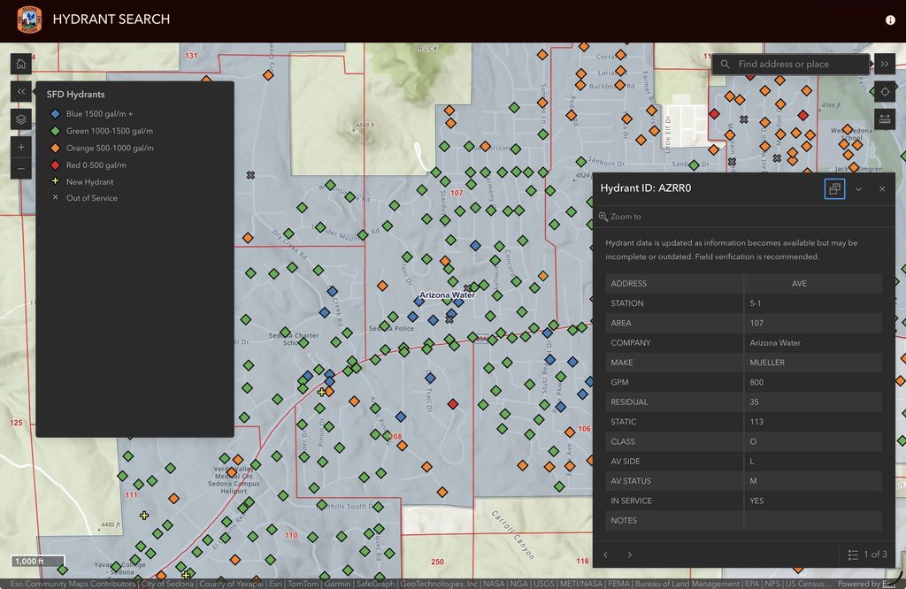
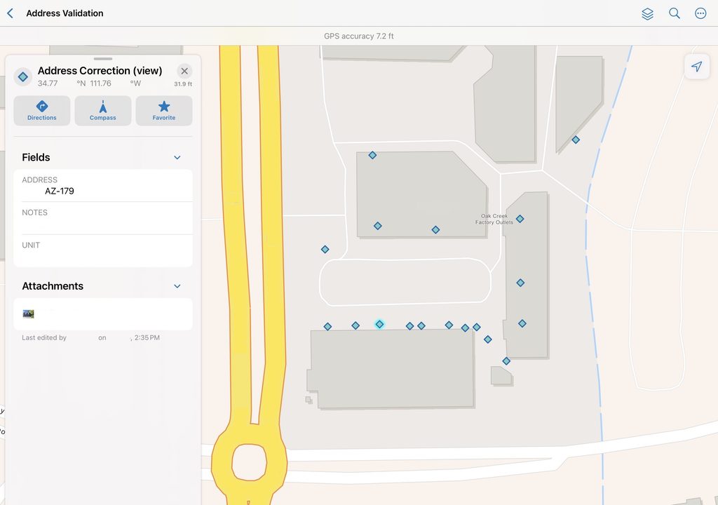
While SFD is not the authoritative source for all data, the district often is the first to observe what’s happening in the field. When crews discover an addressing mistake or a hydrant that’s out of service, that information is quickly relayed to the data owner, who then makes the necessary updates. “We are continuously improving,” Spinelli explains, “fixing errors, improving reliability, and making sure the next response is fast and effective.”
Real-Time Information for First Responders
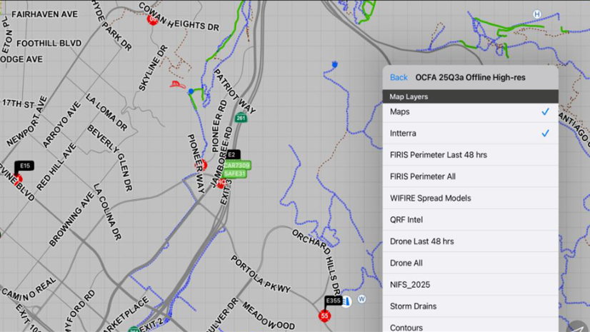
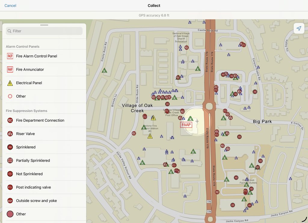
Key to SFD’s GIS modernization is the real-time information that’s now available to crews in the field. Using connected, cloud-based applications like ArcGIS Field Maps, responders can collect information directly in the field, enabling the live updating of preincident plans. This mobility gets responders hands-on with GIS and gives them a personal stake in the system; they know that the better the data they collect today, the more beneficial it will prove when they receive a call and need to reference it. Key maps and data are also preloaded for offline use, ensuring that if a response call is coming from deep in a canyon or outside cell range, teams still have the critical information they need to safely respond.
“This capability has proven invaluable during wildfires, floods, and search-and-rescue operations, allowing responders access to the latest evacuation zones, trail closures, and hazards. It has been a game changer in the way we operate as an agency,” says Brian Espiau, fire engineer/paramedic and operations program manager at SFD.
The district’s modernization extends well beyond mapping. ArcGIS Survey123 has allowed SFD to digitize and improve a massive range of daily processes. The app is now used to streamline administrative workflows, submit training and budget requests, track resources, and even report water usage when staff are conducting routine pump tests. By integrating Survey123 surveys with the Make automation platform and Microsoft Power Automate, SFD automates the routing of these submittals so that personnel with management responsibilities can instantly review and approve requests without relying on paper trails.
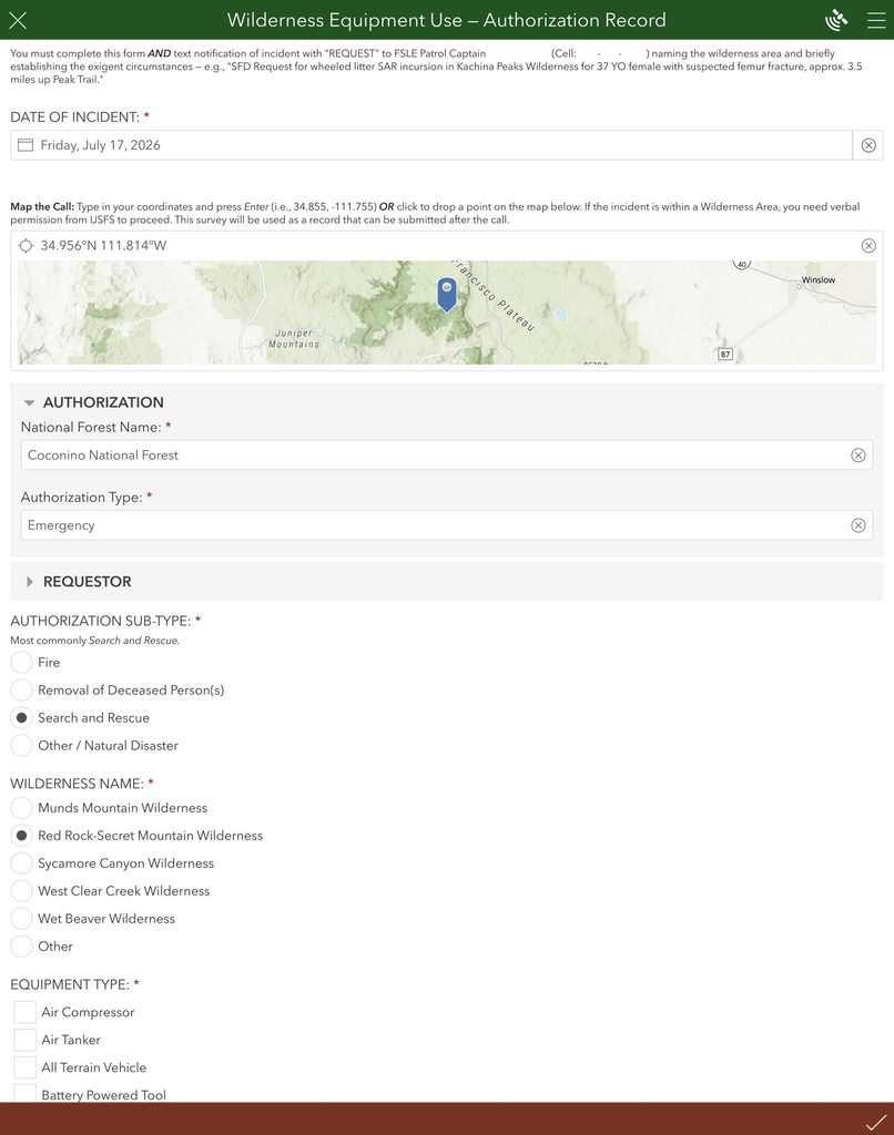
Wilderness rescue is another area greatly improved by this automation. To meet the requirements of the US Forest Service and ensure that incursions are appropriate, fast, and effective, a specific survey was developed to formally request authorization when motorized hardware or equipment is required in protected areas. The form captures the location, the date, the time, the type of emergency, and the equipment needed. Once submitted, the system automatically routes the request to the SFD duty chief as well as Forest Service law enforcement via email and text message. This replaces an antiquated workflow with a rapid, automated process that minimizes response times, satisfies all reporting requirements, and captures structured data for future analysis.
Looking Ahead: A Culture of Innovation
The transformation at Sedona Fire District is ongoing. Spinelli and Espiau are exploring new ways to leverage ArcGIS, including improving preincident planning with drone imagery, creating targeted dashboards with ArcGIS Dashboards, and developing custom applications for command staff. Spinelli and Espiau are also committed to sharing their knowledge with neighboring agencies, fostering a regional approach to public safety GIS.
“We’re not just building maps,” Spinelli emphasizes. “We’re building a culture of data-driven decision-making. Every improvement we make—every tool we build—helps us serve our community better.”
For the residents and visitors of Sedona, that means faster response times, safer rescues, and a fire district that’s ready for whatever challenges the future may bring.
For more information on how GIS can be used in the fire service, visit Esri’s Fire, Rescue, and Emergency Medical Services web page and reach out to the Esri public safety team with any questions.