Real-time command and control system and security planning
Observe, orient, decide, and act
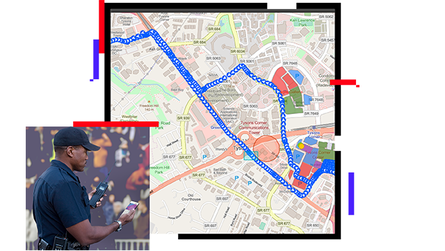
Leverage a command and control system that enables collecting and analyzing data, managing resources, sharing information, monitoring situations, and executing a plan. A geographic information system (GIS) improves command and control with the unique ability to manage, communicate, and operationalize data in a swift and agile manner—directly supporting diverse, shifting missions. Streamline security planning with timely information and decision-making, authority and direction over field resources, and real-time executive briefings and after-action assessments.
Track and operationalize field teams
Operationalize data
Track teams
Empower communication
Enable decision-making
Optimize security briefings
Build tactical plans in real time
Build operational plans that can be configured around high-risk operations. GIS helps you effectively organize people, processes, and operational data for safe and efficient mission execution. Interrelate maps with operational data to visualize your entire mission environment, improve security planning, and conform to evolving needs.
Track operational resources
Deploy and track tactical teams and vehicles in complex security situations by leveraging location intelligence. Allow teams to visualize each other's current location and historical GPS tracks to achieve real-time situational awareness. Implement a proper command and control system through a "one mission, one operational picture" strategy.
Facilitate bidirectional communications
Enable persistent communication between the field and a command center as well as peer-to-peer communication in the field. Use location intelligence to create a connected operating environment while defining a common view for all mission participants.
Inform executive leadership in real time
Reflect the status of incidents, personnel, and field assets in real time. Use data to fuel executive dashboards through configurable web apps that allow security planners to create information products—maps, charts, graphs, and other visual indicators. Monitor and share event progress that supports informed decision-making.
Simplify after-action reports
Combine authoritative maps and apps with narrative text and images for security briefings or after-action reports. Interrogate data in live applications and convert complex scenarios into simple stories using the power of GIS.
Esri Blog
Real-time technology secures the World Series
Cobb County used ArcGIS Mission to provide safety and security during the World Series and the Atlanta Braves’ victory parade.
Read the article
ArcGIS Blog
Observing activity through a mission dashboard
Leverage a single, interactive view of any mission that can be created automatically to aid in mission-critical decision-making.
Read the article
ArcGIS Blog
Announcing ArcGIS Mission 10.8.1
All-inclusive command and control software streamlines operations while providing teams tactical situational awareness.
Read the blog
0:00
Video
Movement Analysis tools in ArcGIS Pro
The Movement Analysis toolset helps national security and intelligence professionals make sense of movement data and uncover hidden relationships.