Skip to Content

Response

Real-time tools for humanitarian impact assessment and response

Quickly locate the people in greatest need

GIS provides a suite of powerful humanitarian response tools for impact assessment, needs analysis, prioritization, field mission management, and progress monitoring. With real-time location intelligence tools, humanitarian agencies and organizations can quickly and effectively make sense of chaotic and volatile situations and take optimal steps to meet their most urgent objectives.

How GIS supports disaster response

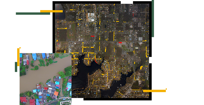
Humanitarian impact assessment through maps

Maps and imagery provide the essential base for understanding the aftermath of disaster. Overlay these with data collected from the field to create informative dashboards, quickly analyze impact, and assess needs.

Humanitarian response plans in real time

Spatial analysis tools help derive humanitarian response prioritization plans from impact evaluations. Use mobile devices and GIS field applications as a coordination mechanism to assign tasks to teams in the field, dynamically and in real time.

Coordinated emergency relief and reporting

Implement and monitor an effective and coordinated humanitarian response through constant situational awareness. Stay engaged and monitor progress of field teams through mobile applications and rapid mapping and dashboard updates. Communicate up-to-the-minute progress in the delivery of relief to all stakeholders.

Blog

Direct Relief solves supply chain problems

Direct Relief uses GIS to monitor supply chains and analyze demand versus capacity due to COVID-19 to direct medical supplies to areas most in need.

Go to the blog

Products for disaster response

Previous
Next

Contact sales

Connect with the Esri humanitarian team