Skip to Content

Risk Reduction and Prevention

Decrease exposure to hazards and increase resilience with GIS

Know where to build to reduce future risk

GIS supports disaster risk reduction efforts and hazard vulnerability analysis to mitigate humanitarian crises. By deploying spatial data and modeling tools, teams can analyze and understand the sources of risk, identify where people are most vulnerable, predict the impact of event scenarios, and support risk-informed (re)investment policies. Location-based analysis helps decrease community exposure to hazards and increase their resilience and coping capacity.

How GIS supports disaster risk reduction

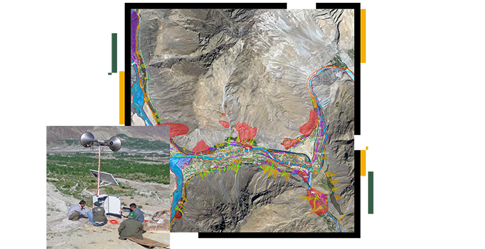
GIS for hazard vulnerability analysis

Mobile or field data collection and drone imagery acquisition apps help identify hazards and their proximity to people and assets to evaluate risk. By applying spatial analysis through a geographic information system, teams can quantify and visualize the hazard probability, exposure, and vulnerability of a community.​

Disaster risk reduction strategies and plans

Combine geography with geodesign to enable risk-informed decision-making. Coupled with site suitability analysis, this helps identify alternative land-use scenarios to support risk mitigation. Using maps for community engagement, stakeholders have an active voice in designing risk management strategies and plans.

Dashboards for community engagement

Through spatial proximity analysis, you can continually evaluate the impact of prevention policies on the level of risk. Engage with the community and share the status of hazards through public-facing dashboards. Report on risk reduction measures and implementation progress.

Story

Getting to know the Flood Impact Analysis solution

Prepare flood depth data for impact analysis and understand flood impacts on infrastructure. Prioritize evacuations and stage equipment effectively.

Go to the story

Products for risk reduction and prevention

Previous
Next

Contact sales

Connect with the Esri humanitarian team