October 9, 2018 |
May 26, 2022
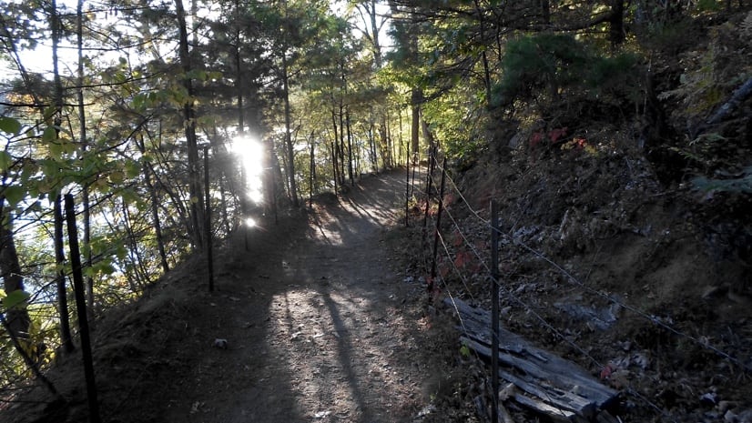
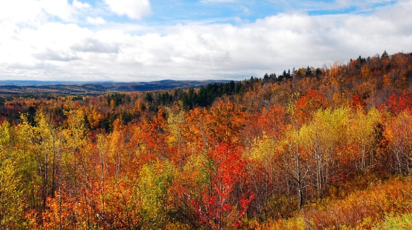
The wilderness of Essex County, Massachusetts, has long inspired explorers and free spirits to wander its paths. Henry David Thoreau, a Massachusetts native who wrote extensively of his love for the local woodlands, wrote, “To be admitted to Nature’s hearth costs nothing . . . You have only to push aside the curtain.” For residents interested in exploring the vibrant trails of the northeast corner of the state, in pushing aside that curtain, it can be hard to know where to start.
This is the challenge the county’s Greenbelt Land Trust set out to meet with its new GreenbeltGo app, detailing and mapping data on hundreds of miles of hiking trails. For 60 years, Greenbelt staff have been working with 34 cities and townships, using geographic information system (GIS) technology to map priority places and preserve land throughout the county.
Their work helps to promote sustainable ecosystems and maintain equitable access. “The core goal was making our properties as accessible and welcoming to as many people as possible,” said Abby Hardy-Moss, director of conservation technology and planning at Greenbelt. “We wanted to help people be comfortable out in the woods and at all the Greenbelt properties.”

Hardy-Moss and others within the organization knew visitors were ready for a mobile tool for finding and using trails. “We already had interactive web maps for all our properties online, as well as a countywide one,” Hardy-Moss said. “The maps are an extremely high-traffic part of our website.”
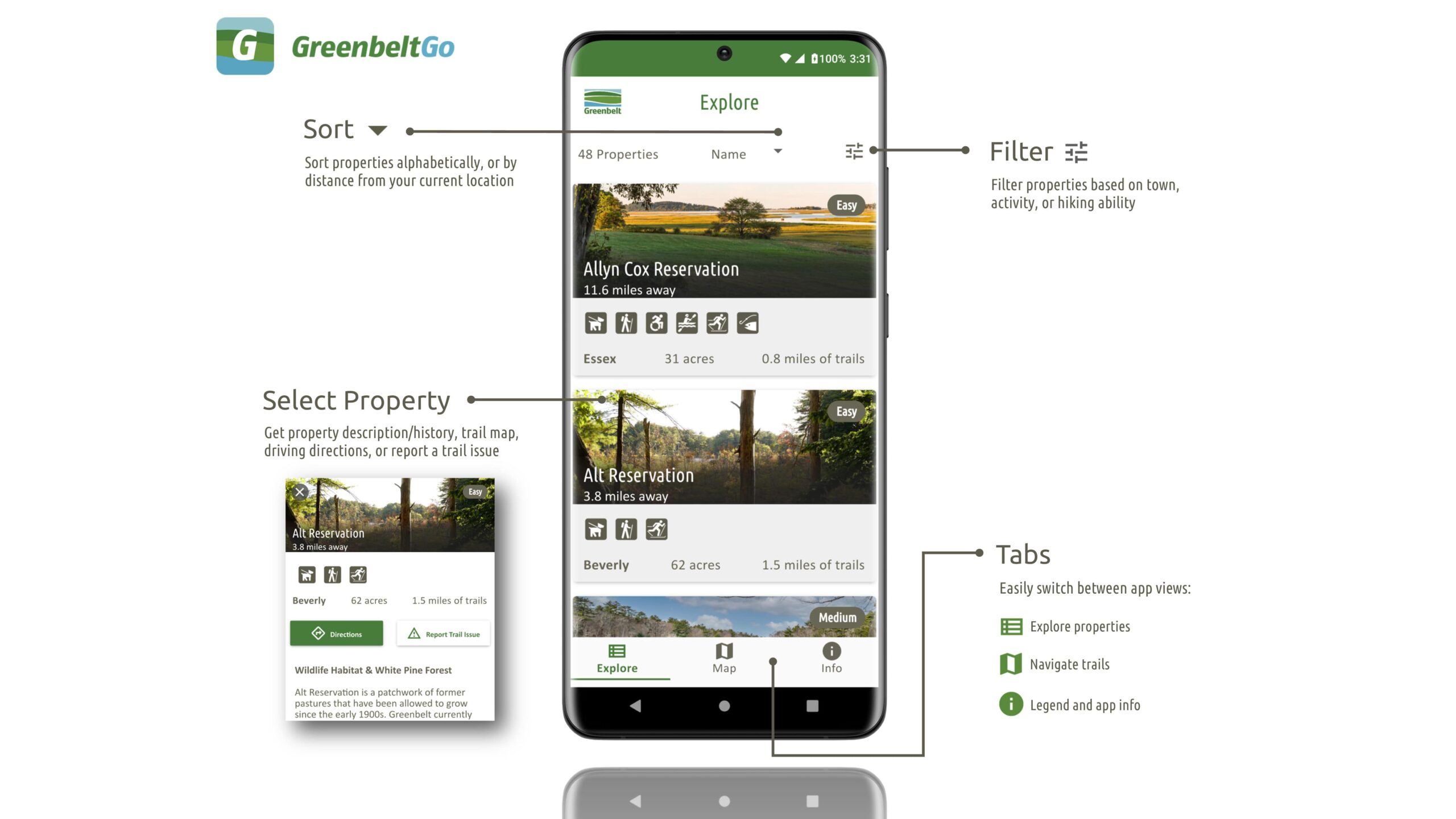
The app advances the online maps by offering trail selection, live navigation, up-to-date advisories on changing trail conditions, and information about the features that make each trail special.
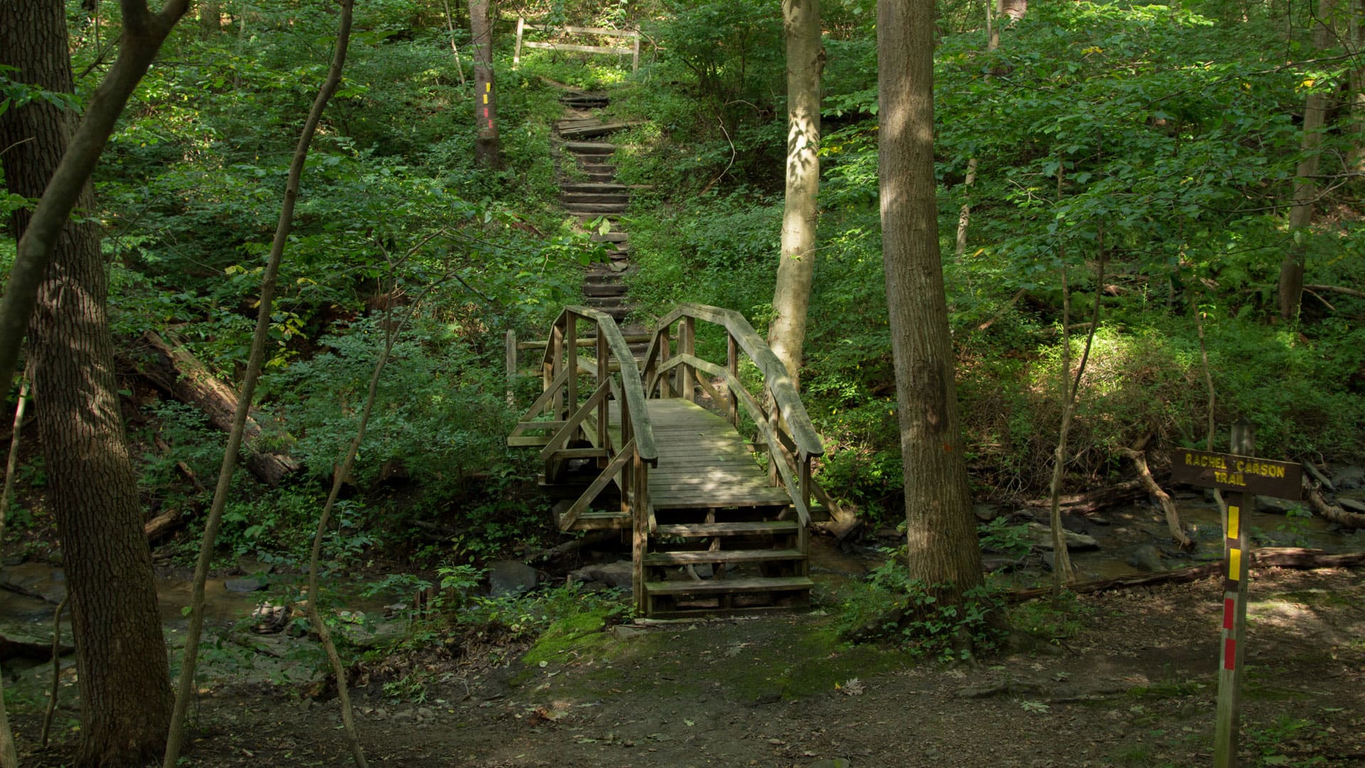
Visitors seeking to experience the natural and historical wonders of Massachusetts can find such features as Chadwick Pond on the Bailey Reservation, where Algonquians fished long before European contact, and Clamhouse Landing on the Allyn Cox Reservation, now a river headland, which began as a shell heap started by Pawtucket clam diggers over 2,500 years ago.
Before Greenbelt released its map-based app, people who wanted to explore the lands under Greenbelt’s conservation had to consult static trail maps or an interactive map on the land trust’s website. The data was kept as up-to-date as possible, but information on trail conditions was still limited, and these maps couldn’t effectively help hikers orient themselves while they were on the trails.
“We talked to a number of partner land trusts and similar organizations who had created trail apps,” Hardy-Moss said. “We spoke with people from Allegheny County GIS, who made an incredibly generous offer to share a lot of their existing code with us, and now if we have updates, they can use that and vice versa.”
Working with their colleagues at Allegheny, Greenbelt developers were able to move quickly. By June 2021, they were already working on GreenbeltGo, with a goal of launching the new solution by early spring 2022. “We could see a clear pattern of visitors to our maps based on the season, so we wanted to try to release the app by spring, because that’s when people really start getting out onto our properties the most,” Hardy-Moss said.
To ensure the foundational information was as current as possible, the Greenbelt team went into the field to collect trail data using GIS equipment. The endeavor required them to hike 120 miles of trails in about six months. A great deal of this was accomplished by Rebecca Smalley, a senior at Salem State University and Greenbelt’s GIS intern during this project. Smalley, who is pursuing a degree in GIS and cartography, was also responsible for editing and organizing the resultant data.
“The most rewarding part about this whole experience was being able to physically see the trail data I collected and edited in the app and knowing that so many people are already enjoying it,” Smalley said. “I’m confident that the app will encourage people to get outside and understand the importance of land conservation.”
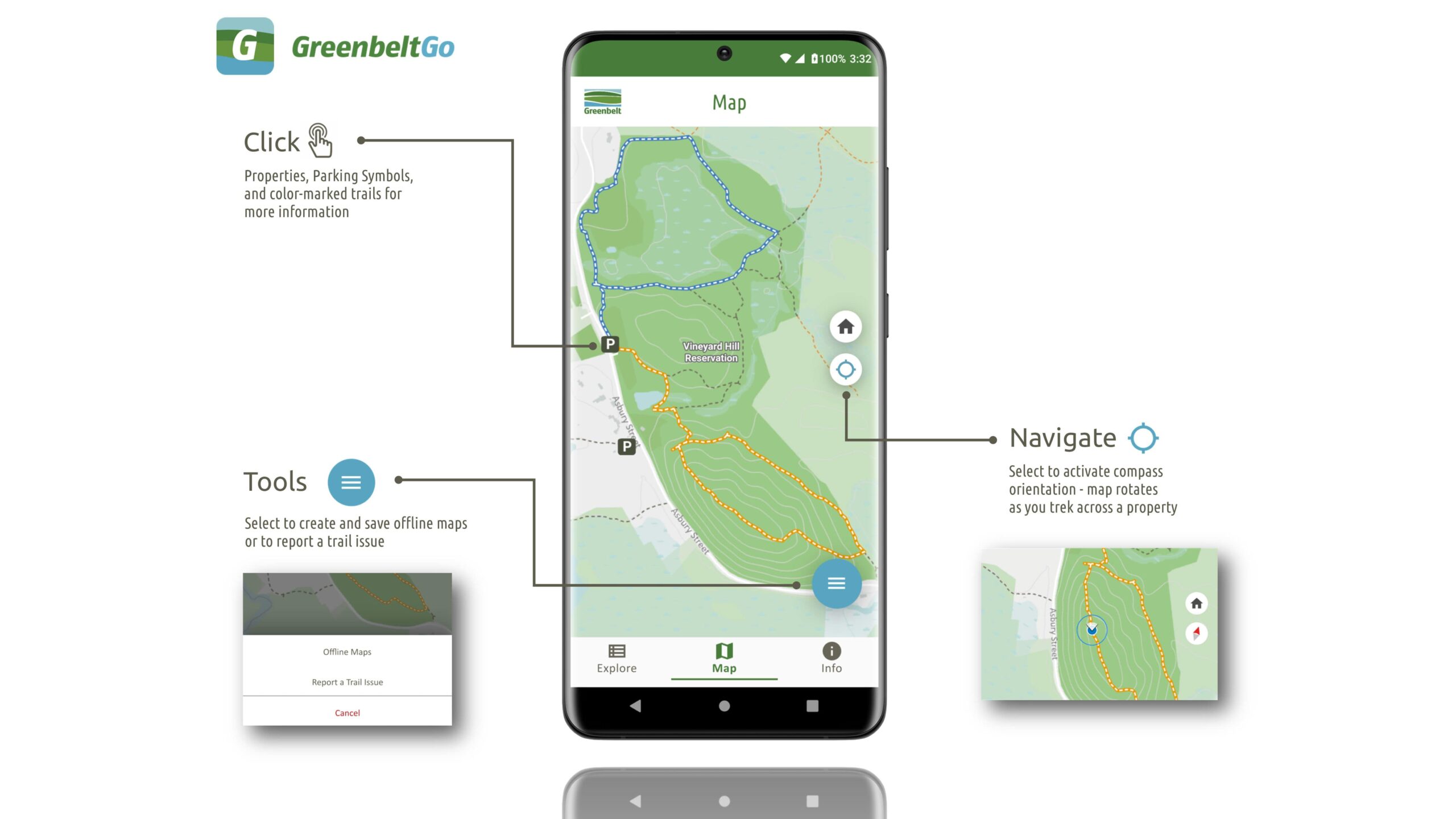
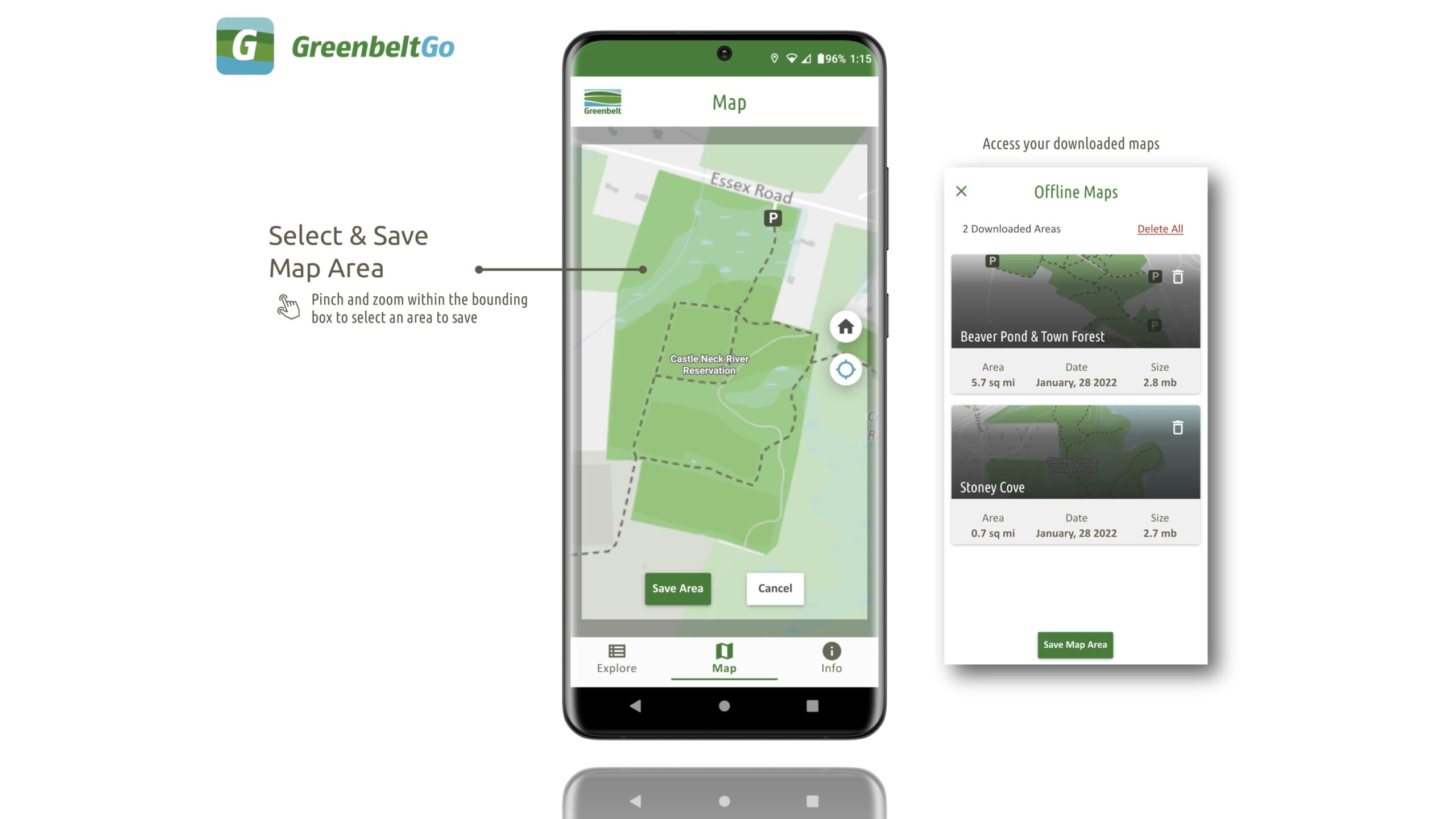
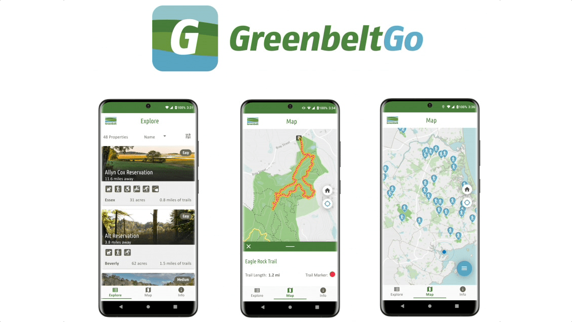
GreenbeltGo was released on February 14, 2022, covering 49 protected properties as well as state owned properties such as Bradley Palmer and Maudslay State Parks, with plans in place to expand to additional areas in the future. People can plan their visits by type of activity, proximity to their community, and degree of hiking experience. Via an interactive map, users can explore points of interest and elevation contours, access up-to-date information on trail conditions, and track their locations on the trails live as they go. They can download offline maps if desired, and receive notifications on upcoming outreach and educational events organized by Greenbelt.
By placing a new level of detail on natural and cultural resources at hikers’ fingertips, GreenbeltGo acts as an advanced guide for local exploration. “So far, the feedback has been really positive,” Hardy-Moss said, who notes a lot of interest and engagement from the community.
The app also provides a way for visitors to participate in the stewardship of the Greenbelt lands, using the power of precise location and technology to communicate clearly.
“Before, people would report a tree down or another issue, and our people would have trouble finding the spot they were talking about,” said Dave Heacock, Greenbelt’s geographic and technical support specialist. “Now, people can report trail issues using their actual location and pictures of the problems—data for us to act on.”
This app feature ensures the most accurate and immediate information possible on trail issues while giving visitors a new way to truly be invested in the welfare of Massachusetts’s natural spaces.
“My biggest takeaway, and the thing I’m most excited about, is just people being more confident visiting our properties,” Heacock said. “People are potentially using trails and properties more often than they were before, because the app is easier to use and more trustworthy and up-to-date than a web map or handheld map.”
Learn more about how land managers achieve sustainable conservation with GIS.

October 9, 2018 |
April 24, 2019 |
January 4, 2022 |