ArcGIS Living Atlas of the World Offers Data for Fire Mapping
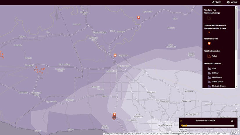
Live feed layers available from ArcGIS Living Atlas of the World offers fire departments and other organizations useful information during fires.
Live feed layers available from ArcGIS Living Atlas of the World offers fire departments and other organizations useful information during fires.
You can use ArcGIS Living Atlas of the World to create a custom basemap gallery. Esri technology evangelist Bern Szukalski shows you how.
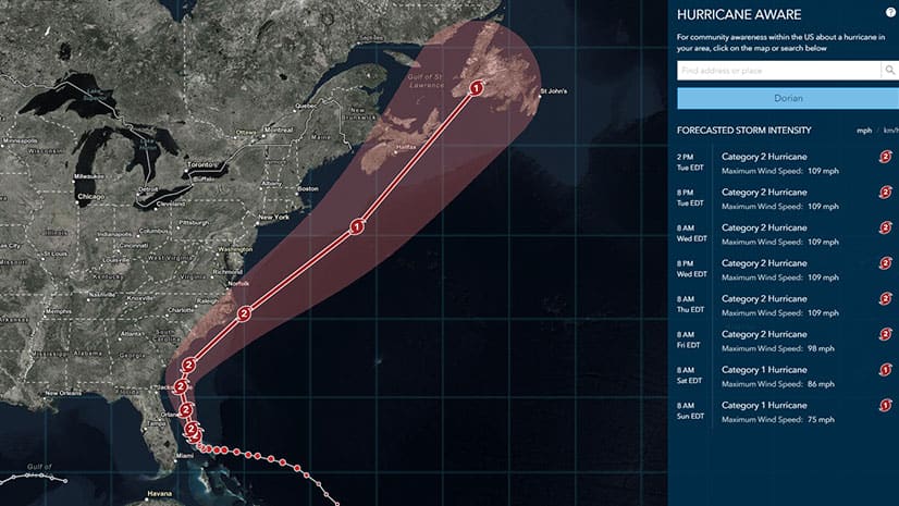
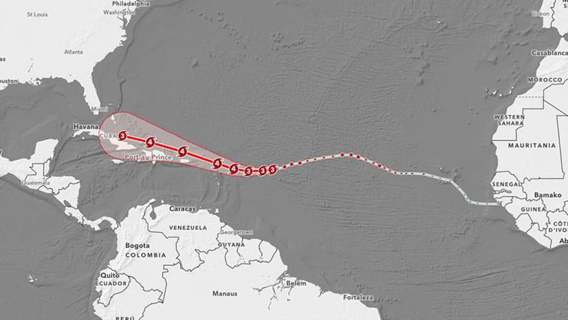
The Hurricane Aware app provides the latest forecast information for all hurricanes, cyclones and typhoons worldwide.
Use data from the National Oceanic and Atmospheric Administration, available in ArcGIS Living Atlas of the World, to build a heat index map.
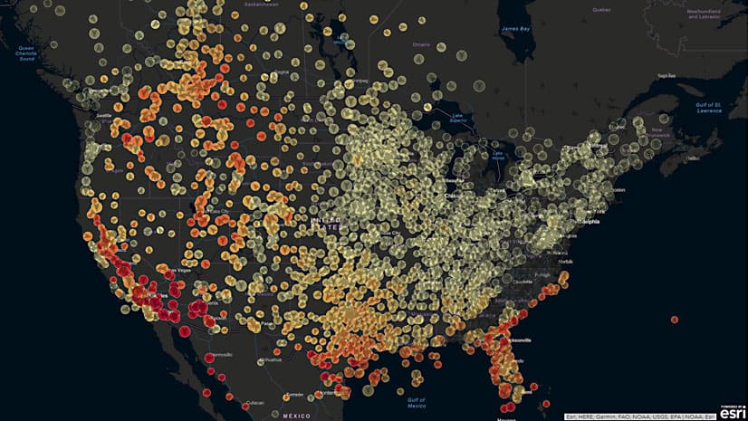
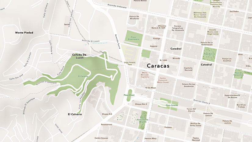
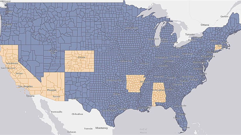
Map content from 128 cities, towns, and university campuses were just added to or updated through Esri's Community Basemaps Program.
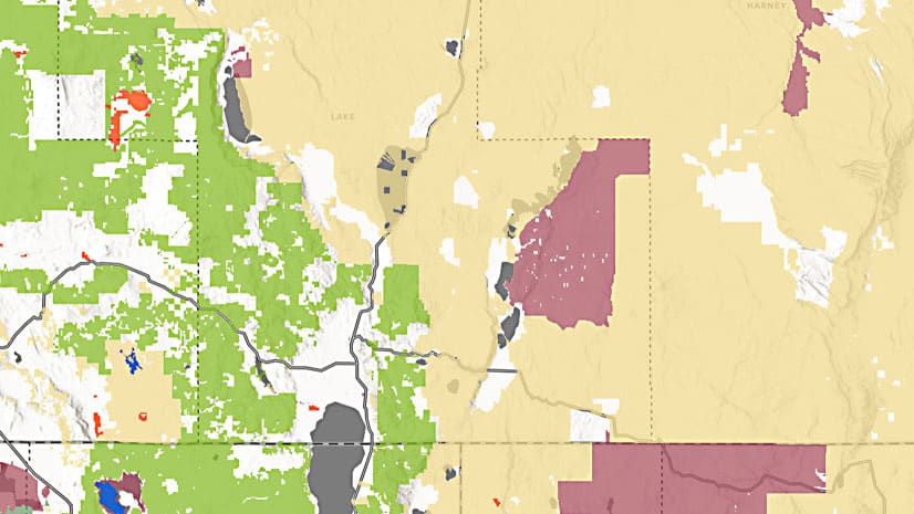
GIS-ready versions of new, authoritative Protected Areas Database of the United States s available through ArcGIS Living Atlas of the World.
Emily Meriam, an Esri cartographer, shows how to create an Arccade expression that makes your symbols scale as you zoom in and out of your map.
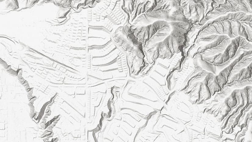
World elevation layers in ArcGIS Living Atlas of the World were just updated with high-resolution data.
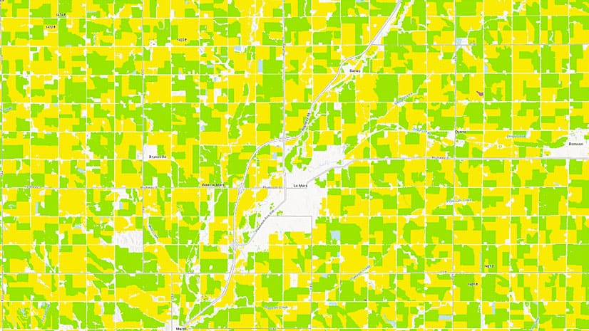
ArcGIS Living Atlas of the World now includes a time-enabled imagery service called USA Cropland, which shows the rotation of crops over time.
Diana Lavery of Esri explains several techniques to use to turn a flat file of raw data into a feature layer.
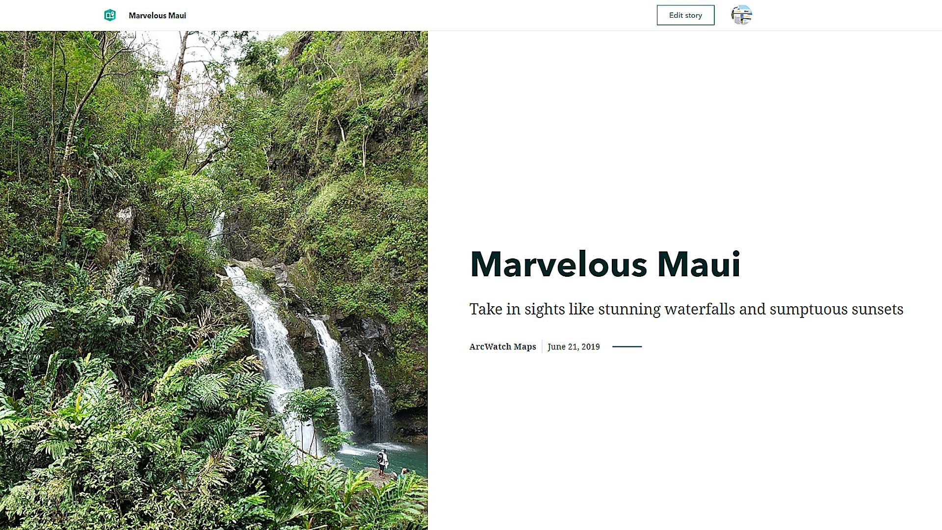
Try the new ArcGIS StoryMaps for yourself. Allen Carroll from Esri takes you through the steps of using the builder to make a story map.
Whoever wins the 2019 StoryMapper of the Year Contest receives $5,000 for a GIS-related community project.