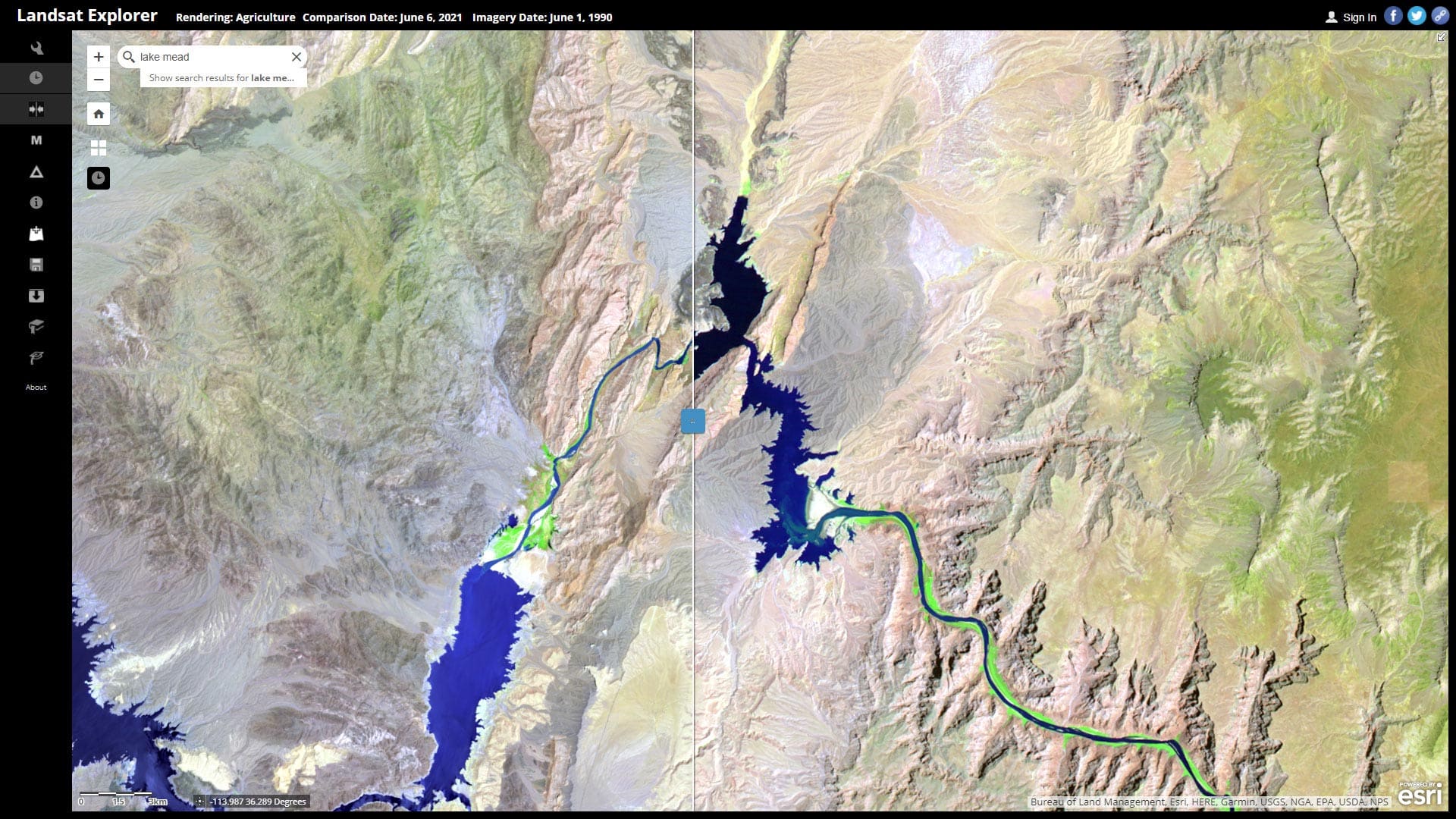
Map the Water Level at Lake Mead in a Minute
Learn how to explore Lake Mead water levels over time using ArcGIS Living Atlas of the World content and Landsat Explorer.
Learn how to explore Lake Mead water levels over time using ArcGIS Living Atlas of the World content and Landsat Explorer.
Make a map of the route of the Colonial Pipeline, which experienced a cyberattack this year, using ArcGIS Living Atlas of the World content.
Explore the potential of soils with and without irrigation using two new image layers in ArcGIS Living Atlas of the World.
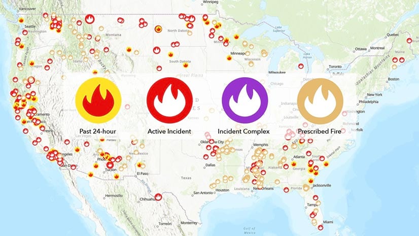
Updates to the USA Current Wildfires map layer in ArcGIS Living Atlas include additional incident age fields and cartography changes.
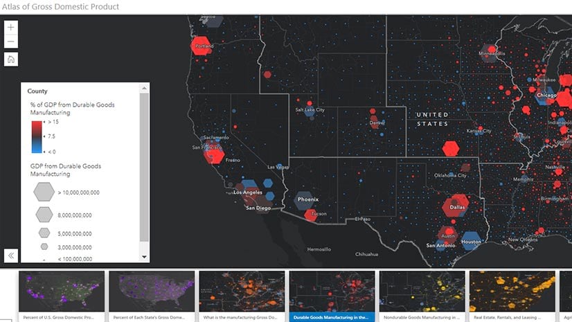
Use the Atlas of Gross Domestic Product app in the ArcGIS Living Atlas to view gross domestic product (GDP) information in the United States,
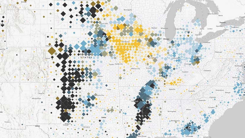
Learn how ArcGIS Online tools can be used to create a relationship map.
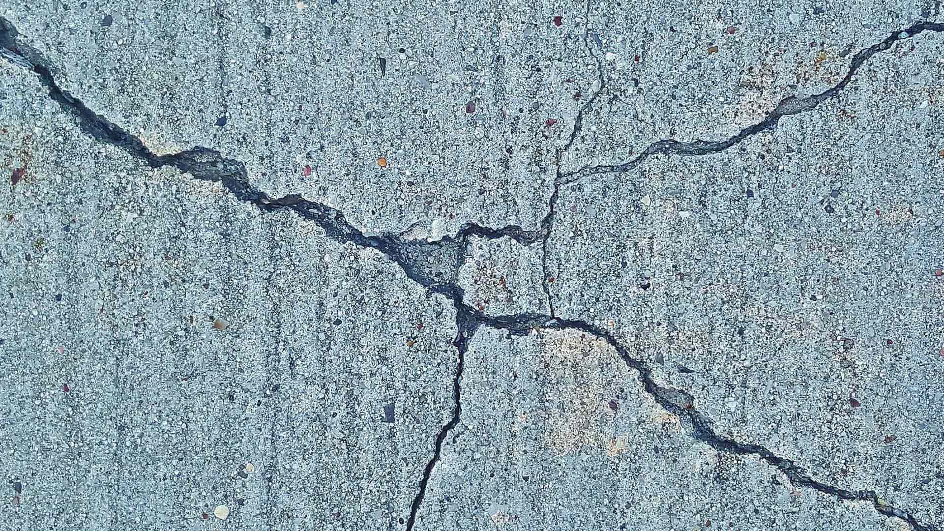
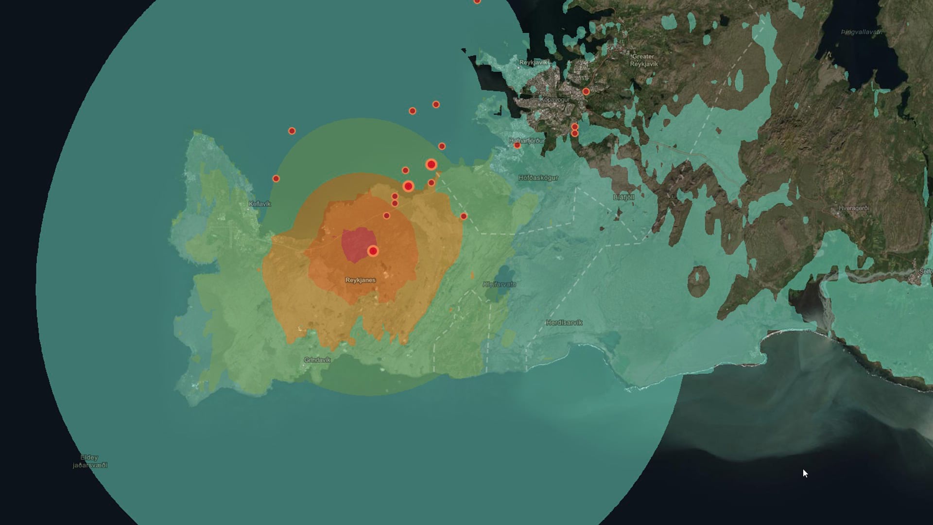
Discover the impact of earthquakes using some analysis tools in ArcGIS Online and content from ArcGIS Living Atlas of the World.
The Live Stream Gauges layer in ArcGIS Living Atlas of the World is now more scalable and new networks were added in Canada and England.
ArcGIS Living Atlas of the World content can be used to explore current events such as earthquakes.
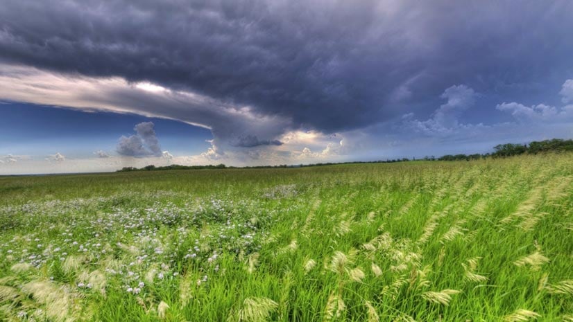
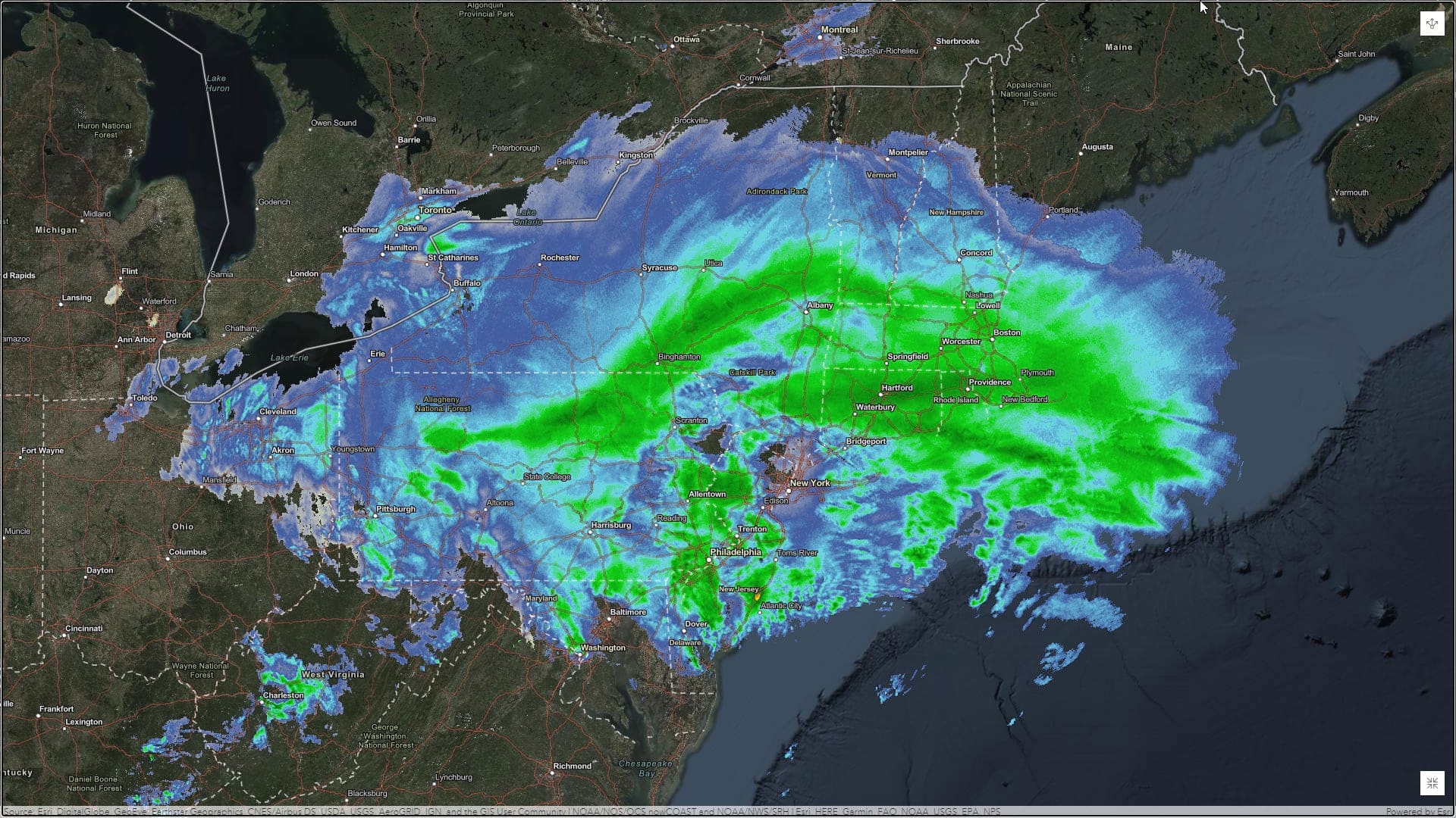
Learn to use ArcGIS Online and the feeds and content from ArcGIS Living Atlas of the World to make a weather map in a minute or less.
Esri technology evangelist Bern Szukalski walks you through how to use the World Imagery Wayback app, including how to use the new swipe mode.
Find the latest county-level hospitalization and mortality rates for heart disease and stroke from the CDC in ArcGIS Living Atlas of the World.