Science on the Move: Auburn’s Mobile Geo Explorer Lab Inspires Young Students
A 35-foot solar-powered RV doubles as a mobile science lab to provide immersive geoscience education for K–12 students.
September 2025
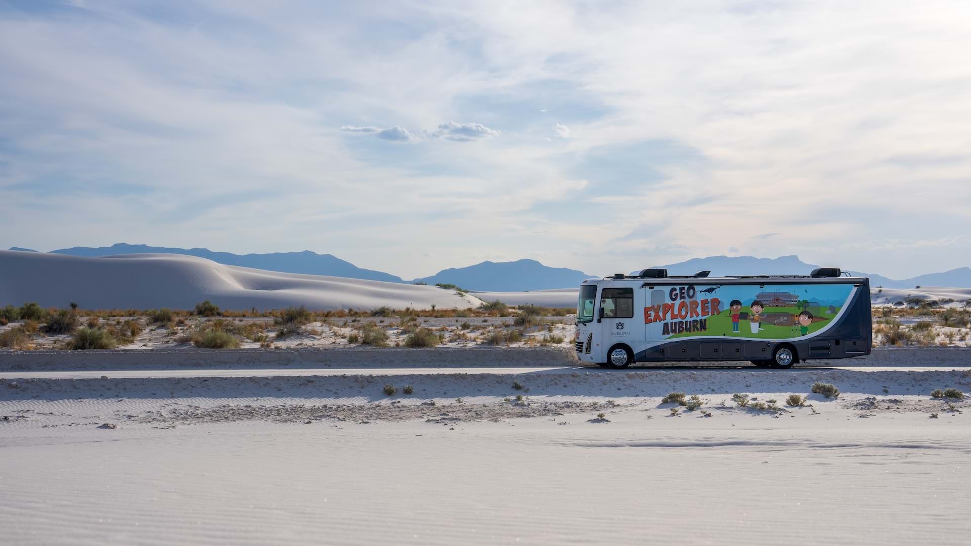
A 35-foot solar-powered RV doubles as a mobile science lab to provide immersive geoscience education for K–12 students.
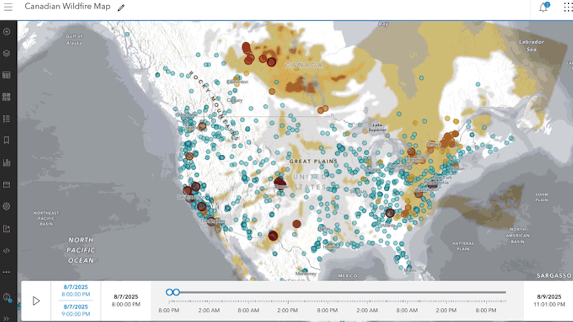
Use data from ArcGIS Living Atlas of the World to make a Canadian smoke and fire map that explores current smoke conditions and air quality.
The Ohio fire department is using ArcGIS Mission to manage resources and personnel locations and share data to enhance situational awareness.
James Neufeld, founder and CEO of Samdesk, explains how his company integrated corporate security management with geospatial AI.
Top 20 Essential Skills for ArcGIS Experience Builder offers instructional guides to create various types of apps and visualize your data.
Showcase your storytelling skills in this global competition, cohosted by Esri’s ArcGIS StoryMaps and ArcGIS Living Atlas teams.
Consult with Esri experts and partners, network with industry professionals, and learn new skills at the conference in October.
This new book from Esri Press shows readers how to use geospatial tools and data to analyze complex issues.
In part 1 of this video series, use the Vector Tile Style Editor to make textures such as a water-sourced wave texture in ArcGIS Online.
From basemaps to feature layers, explore the new ways this data will enhance existing content and add new content offerings in ArcGIS.
Create effective policy and advocacy maps for various stages in the policy lifecycle with these tips.
The Department of Law Enforcement is using virtual reality and digital twin technology to enhance security and situational awareness.
This is Argentina’s first conviction for ecocide. It also allowed for the expansion of the Punta Tombo Natural Protected Area.
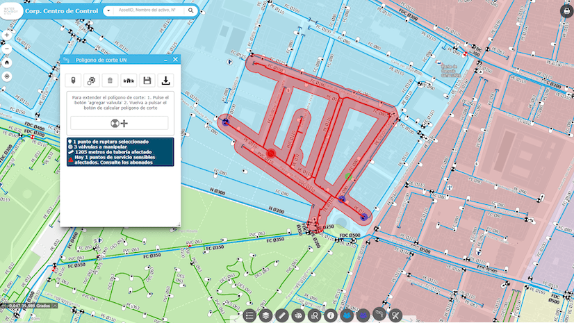
The Spain-based water utility developed a dynamic replica of the company’s infrastructure that enables forecasting and sustainable planning.
In this instructor-led course, discover how analyzing data based on location can reveal previously unknown patterns and relationships.
Join this seminar on October 23 to learn about a new capability that supports an easy-to-follow, dynamic to-do list for mobile workers.
Join this free course to learn how GIS and imagery work together to enhance workflows from visualization to analysis.