July 25, 2024 |
Katie Olson | Conservation
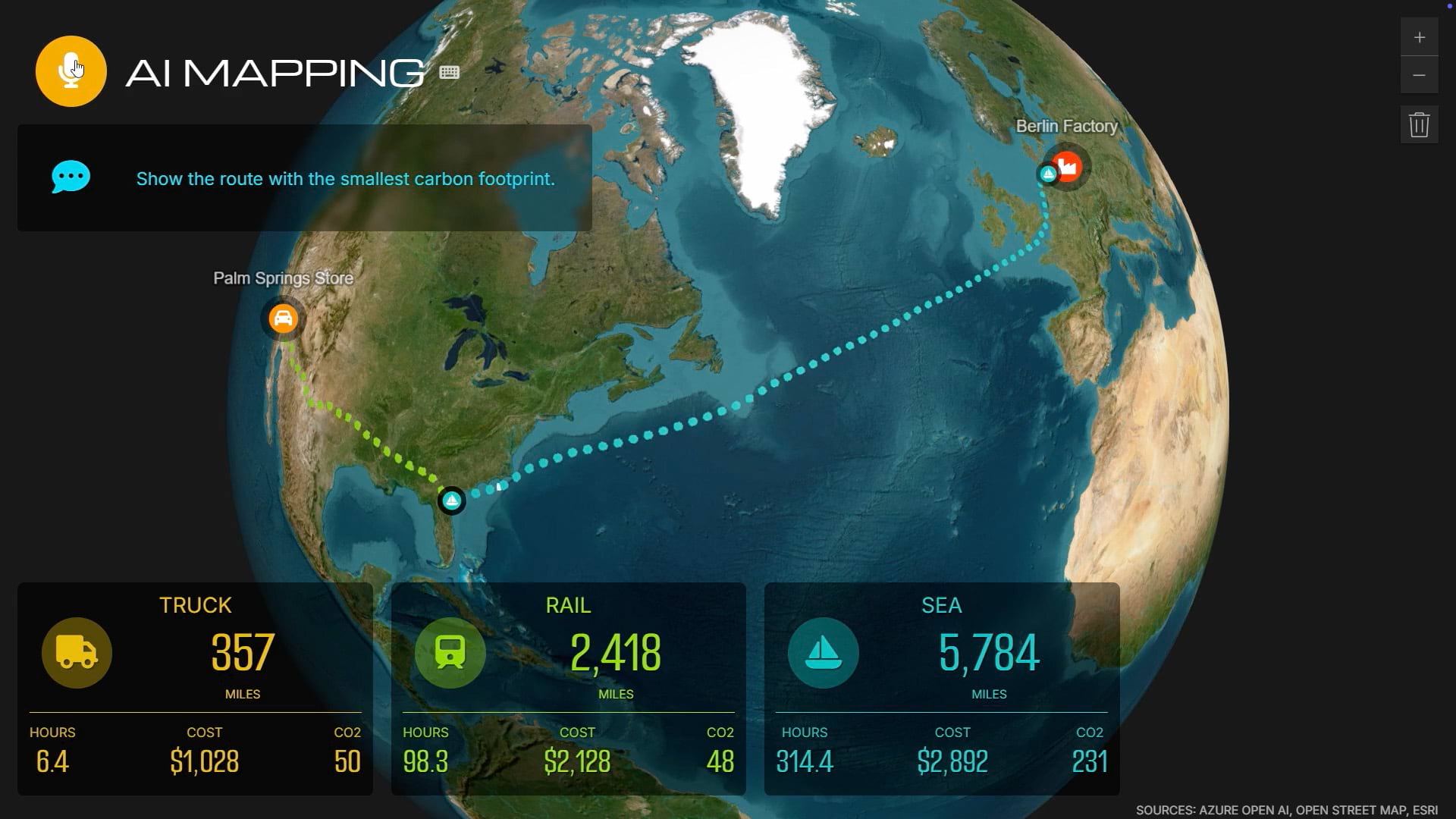
People solve urgent challenges—like predicting wildfires, preparing for hurricanes, and managing water during droughts—by connecting data that’s otherwise disconnected. GIS provides the framework. On maps and digital twins, teams integrate real-time and historical data on the environment, operations, and the surrounding community. They can see right away when aging systems or extreme weather put infrastructure at risk—and act quickly to prevent problems.
Explore how GIS empowers people to connect systems for smarter infrastructure management