Working in a community, without engaging with the community, is like being a foreigner. They need to understand the technology and what it is for.
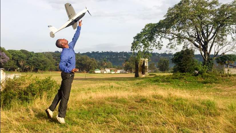
Yussuf Said Yussuf
September 27, 2017
The island of Zanzibar, off the coast of Tanzania in Eastern Africa, expects its shoreline to shrink due to rising sea levels. As a developing country, there are few national resources to gain an understanding of how its communities will be impacted by this challenge.
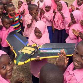
Tanzania Flying Labs, a regional outpost of the global nonprofit WeRobotics, has partnered with locals to create a high-resolution map of the island using drones. Drone imagery provides evidence to comprehend the changes to the coastline as well as the effects on the island’s ring of protective mangrove forests and human settlements.
“The first impression locals have of drones is fear,” remarked Yussuf Said Yussuf, the local coordinator for Tanzania Flying Labs in a video produced by WeRobotics. “We have to take the time to teach how the technology can be helpful.”
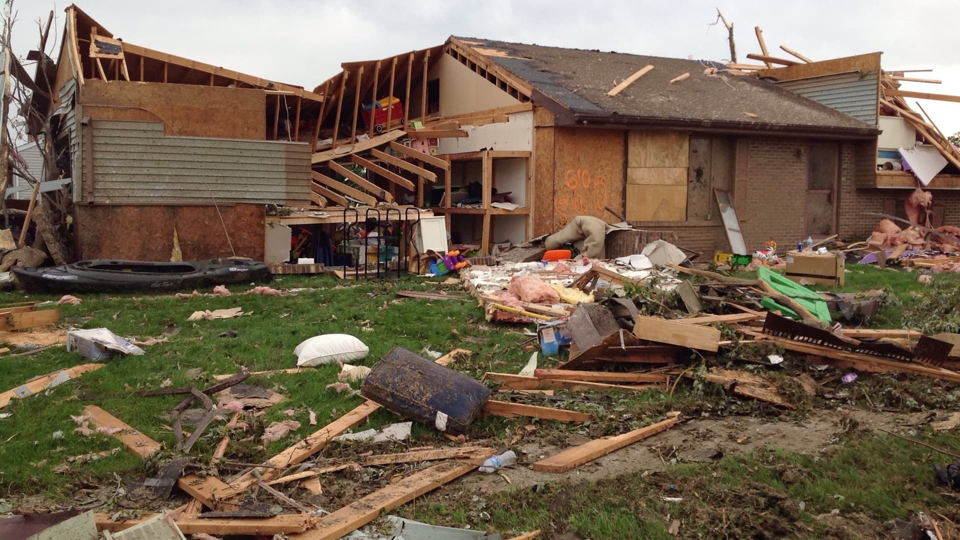
From their first mapping forays, Tanzania Flying Labs has partnered on forestry and agriculture mapping solutions, and has surveyed earthquake damage from a tremor that left hundreds of families homeless.
Working in a community, without engaging with the community, is like being a foreigner. They need to understand the technology and what it is for.
Remote robotics
The ubiquity and low cost of drones has democratized aerial data capture for a wide range of use cases. The field of humanitarian aid and disaster response has been quick to adopt these tools.
WeRobotics leads this charge, working with local communities and international organizations to apply robotics technologies to accelerate aid, development, environmental protection, and global health. The organization has taken a distributed approach, creating a network of local labs around the world while building local technical capacity and incubating new businesses.
WeRobotics focuses on solutions and capacity-building around everyday problems with tools and workflows that can be applied in the event of an emergency. The organization got its start trying to apply drones to disaster relief after the devastating Nepal earthquakes in 2015. That experience, running into language difficulties and local regulations, led to the new approach with a focus on local needs first.
“We need to ground technology and capabilities with people that live in those areas that are subject to high risk of extreme events,” said Andrew Schroeder, co-founder of WeRobotics and director of research and analysis at Direct Relief. “We aim to work as close collaborative partners for the long term.”

Improving understanding
For WeRobotics, the aerial perspective that drones provide addresses a larger objective of understanding why things are happening and how they relate. Instead of just understanding where disease occurs, they want to look at other health-related factors—infrastructure, poverty, conflict—and try to think ahead about what might impact vulnerable people.
“Spatial data allows us to think accurately about problems in the world,” Schroeder said. “Nonprofits have a history of focusing on the emotional issues, the reasons why you should respond. But it’s just as important to deliver on the motivations behind those issues.”
The use of drones and satellite imagery help inform a deeper grasp of the dynamics of a place, such as water flows and settlement patterns. That higher-order awareness helps identify the different elements at play and empowers stronger planning and decision making.
“Understanding that integrative tissue has been crucial,” Schroeder said. “It provides accuracy on how to respond.”
Rapid response
Drones allow WeRobotics to retrieve high-resolution data rapidly, in a semi-autonomous way. This ability is crucial in a disaster response scenario, where information can be quickly gathered about road closures, infrastructure damage, flooding, population displacement, and more.
“In the past, we relied on first-person reporting, going out and doing surveys, or satellite imagery, which might run into issues with cloud cover,” Schroeder said. “Now, with robotics systems, we can capture quickly in most weather conditions, and the decision loop gets very fast.”
Rather than plan specifically for quick response when things go bad, building local capacity around solutions ensures that skills are being developed and local relationships are being forged.
“Working in a community, without engaging with the community, is like being a foreigner,” Yussuf said. “They need to understand the technology and what it is for.”
The tools are used to help farmers understand how water flows, to help aid workers understand population settlements, to integrate property data in order to provide financial services, and to improve livelihoods.
“In a disaster response, you don’t want to just import technology,” Schroeder said. “You want to make sure the technology and the data, and all of the surrounding relationships, are in place so that you’re able to respond in the first 24 hours.”
Listen to the full Esri & The Science of Where Podcast with Andrew Schroeder, co-founder of WeRobotics and director of research and analysis at Direct Relief. He explains how advanced spatial analysis and location technology accelerate the delivery of aid. For more information on how spatial analytics and GIS help with economic development, visit esri.com/industries/sustainable-development


August 28, 2017 |
September 1, 2017 |

August 16, 2017 |