

January 10, 2023 |
Multiple Authors | Infrastructure
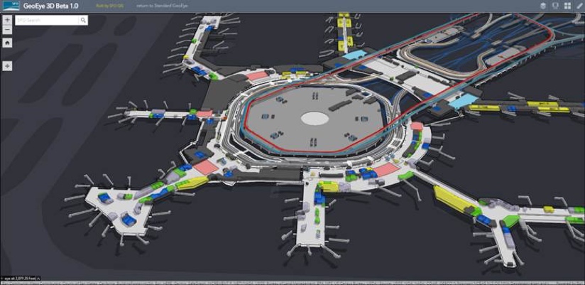
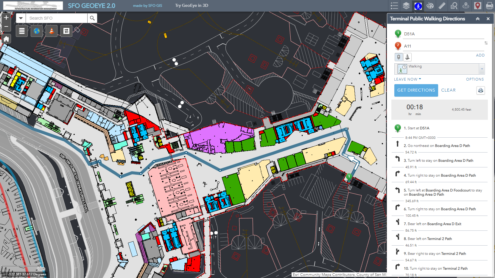
Weary travelers lost in San Francisco International Airport (SFO) can access a map of the facility on their cell phones. The map, built with geographic information system (GIS) technology, provides the information to get them where they need to go. But there’s much more to the map—it guides operations.
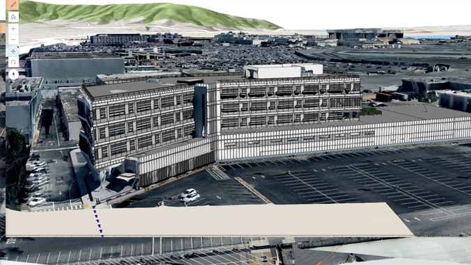
These additional layers, accessible to the people who run and maintain the airport, reveal the airport’s dazzling complexity. All 1.8 million square feet of the International Terminal are included. Every individual component—from the 15,000 doors to the 2,000 trees—is present and accounted for.
Peel back those layers and peek underground. You’ll find the 400 miles of labeled subsurface utilities, including water, electrical, and wastewater. The airport’s exteriors are pictured, gathered through lidar and other methods, seamlessly integrated into the GIS.
For operations detail, building information models (BIM) find their place on the map. Closets, walkways, plumbing—it’s all there, ready to aid in repairs or long-term projects. Informative GIS layers, such as the location of wireless access points, augment the detailed BIM information.
And this is just the static map information. Indoor tracking shows the position of critical equipment. Outside, the current locations of maintenance vehicles are revealed.
From the public version to the sensitive high-security layers, it’s all the same GIS-supported map. But it’s more than that. This is SFO in its entirety: the permanent parts, the semi-permanent, and those items always on the move.
So let’s not call it a map. What SFO has built is a geospatial digital twin.
The concept of the digital twin is not new, although it has undergone radical alterations. The earliest digital twins appeared in the manufacturing world, as far back as the 1980s. They were a way to measure the performance of factory machinery and processes, down to the level of individual components.
Although helpful for understanding plant operations, the utilities of these early digital twins were limited. An analyst could note strengths and weaknesses in the system, and detect problems and bottlenecks, but would struggle to apprehend its totality.
Modern digital twins provide this totality, without compromising granularity. Just as the human body relies on the interconnection of systems such as the respiratory system and the cardiovascular system, complex systems in organizations function through constantly flowing interactions. A modern digital twin recognizes that interactions among systems are just as important as the individual systems themselves.
How does a geospatial digital twin create the conditions for this nuanced view?
First, by offering clarity of vision. From the time GIS first debuted over a half-century ago, the technology has pioneered the concept of digital twins.
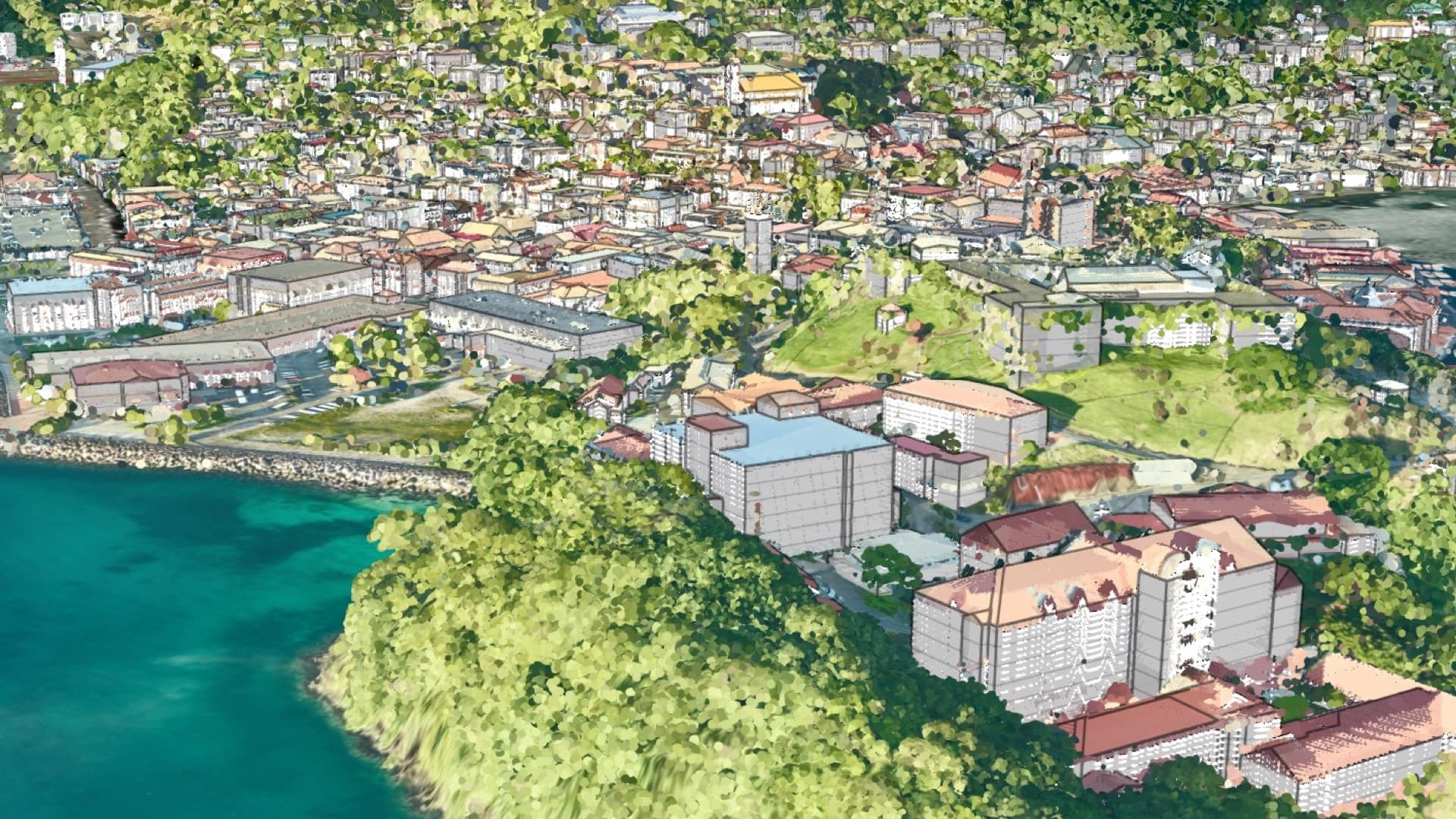
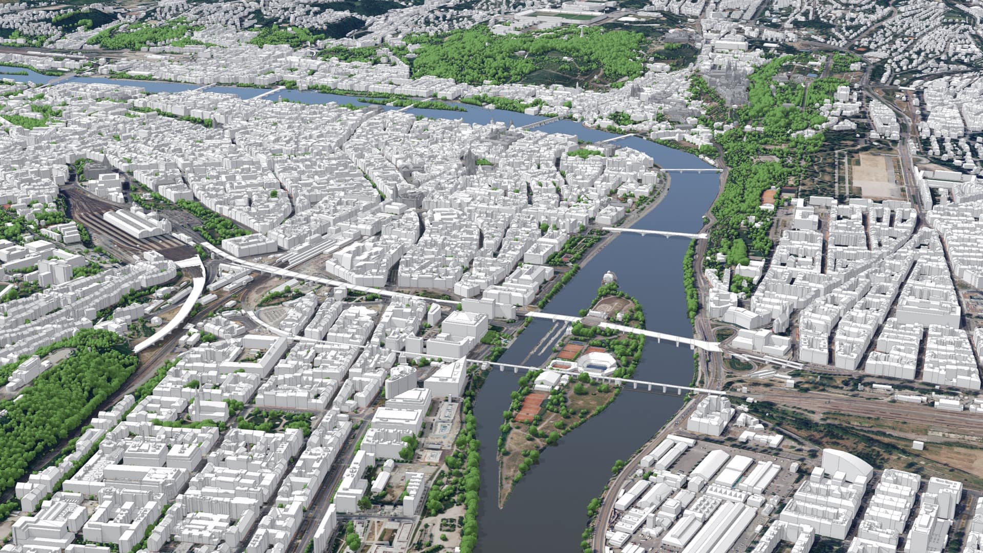
The visual language of GIS is the map. Just as a paper map is, to varying degrees, “an analog twin,” many GIS-derived maps can be thought of as digital twins. GIS maps contain details about attributes, data can be traced to its source, and they transcend the static maps of the past.
GIS can produce realistic digital twins because the technology can now seamlessly integrate immersive 3D environments, including details obtained via drones and reality capture techniques.
Geospatial digital twins go further than 3D models by adding the dimension of time. Like the systems they mirror, digital twins evolve. By compiling information regarding the past and present, digital twins can be used to query what happened when and even what’s likely to happen based on past patterns. Advanced analytic techniques reveal trends and hotspots.
As more people have grasped the potential power of geospatial digital twins, use cases have multiplied. It is now possible to speak of many categories of digital twin:
This application is designed to continuously monitor real-time sensors and critical data feeds and analyze risk to facilities and employees around a refinery. Real-time IoT sensors are used to monitor methane emission levels at the facility and analyze potential risk to onsite personnel. Real-time incidents are used to analyze risk to the facility and offsite personnel, based on proximity. The application also analyzes the real-time AIS stream and the Open Sky feed to understand potential risk to the facility from nearby vessels and aircraft.
The most exciting digital twin model to emerge in recent years attempt to combine all of the above into something that mirrors the complexity of entire cities, or even nations. Grenada, for example, has built an impressive country-level digital twin that helps the Caribbean nature understand and prepare for climate change.
The mirroring ability of digital twins can obscure qualities that are more prosaic, but no less powerful, than the ability to mirror dynamic systems.
Digital twins foster collaboration and communication. They provide a common view for stakeholders to understand how systems may evolve. And their visual intuitiveness is a way explain progress to communities, regulatory agencies, or anyone else who may be affected by evolving systems.
Finally, there is the power that has long made GIS an optimal way to organize spatial information.
The many data flows that comprise complex systems may originate from disparate sources. Oftentimes, the only thing these groups of data share is that they have a spatial component, a shared location. GIS-based digital twins honor this similarity while visually emphasizing it.
Geospatial digital twins offer something that approaches complete contextual awareness. By helping us visualize the crosspollination of data flows, these digital twins connect abstract data with concrete experience. By answering the constantly shifting question of “where?”, geospatial digital twins offer the ultimate contextual understanding.
Learn more about how GIS creates digital twins of the natural and built environments.