

January 19, 2023 |
Multiple Authors | Conservation
August 22, 2023
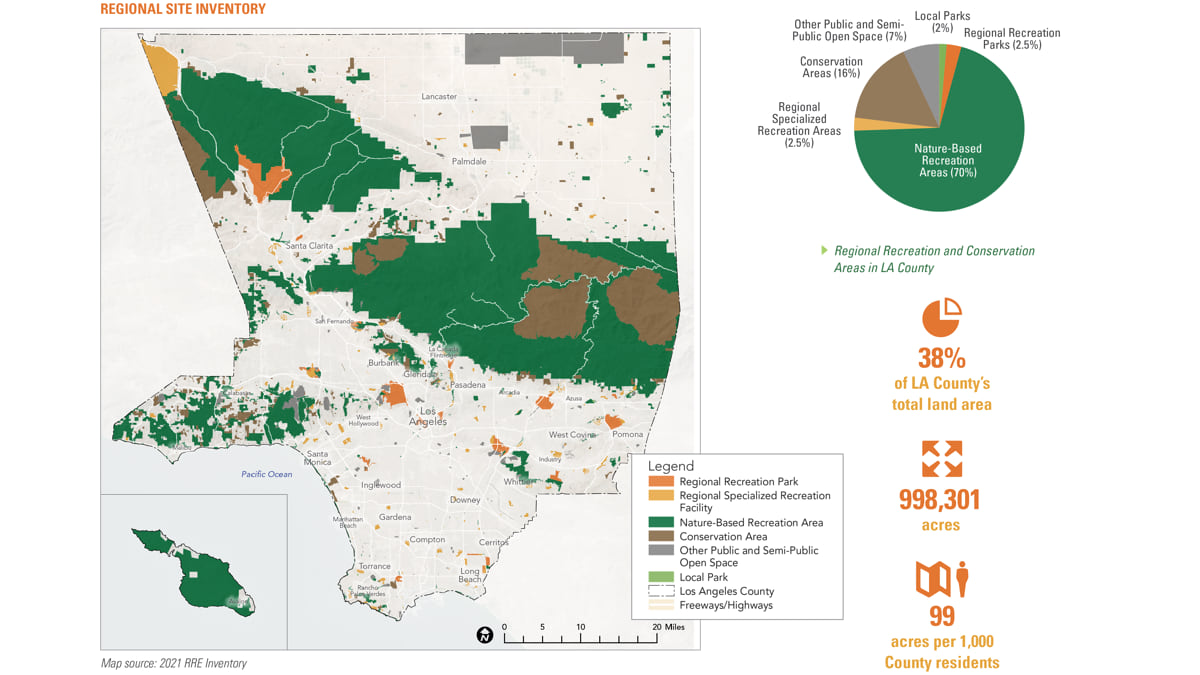
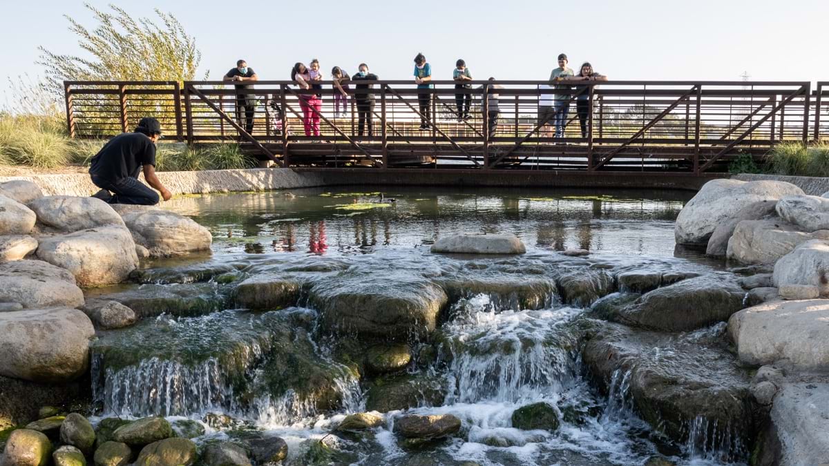
More parks are coming to LA County, many of them in neighborhoods where more green space is greatly needed. The Los Angeles County Department of Parks and Recreation has begun restoring degraded lands—brownfields, landfills, and oilfields—as future parkland. These former industrial sites are part of the county’s pledge to conserve 30 percent of lands and waters by 2030, what’s known as the 30×30 Initiative.
The county’s 30×30 plan, called the Parks Needs Assessment Plus (PNA+), builds on efforts by the State of California, the Biden administration, and nations around the world. The commitment aims to improve environmental health and biodiversity in this time of rapid habitat loss due to climate change. In LA County, the plan will also address the needs of vulnerable populations, including people who live in places deprived of nature.
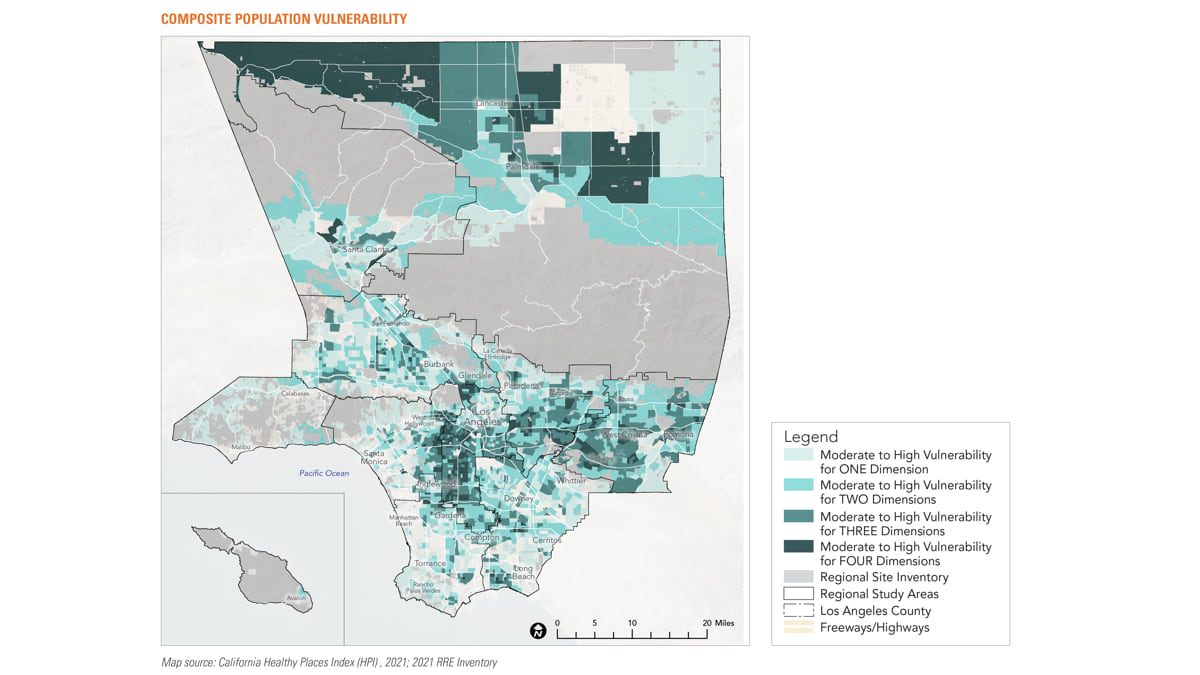
To determine which areas should be prioritized for environmental conservation and restoration and regional and rural recreation—using equity as a guide—LA County Parks relies on geographic information system (GIS) technology.
“In the 30×30 Initiative, the focus is more on traditional conservation which involves protection of additional natural lands,” said Clement Lau, departmental facilities planner with LA County Parks. “At the county, we’re emphasizing the need for restoring degraded lands, especially in park-poor communities. We’ve developed parks on brownfields before and are working on converting a landfill into a regional park in Puente Hills. There are also opportunities to convert oil fields into additional parkland in Baldwin Hills.”

Lau noted that communities of color are overrepresented in areas in need of restoration.
“There’s certainly an environmental justice angle to it,” Lau said. “Supervisor Holly Mitchell referred to our underserved communities as unfinished. They’re a work in progress—in need of more attention—to have the infrastructure like parks and recreational services they deserve.”
LA County Parks’ planners pioneered an equity-based approach in 2016. Their needs assessment used GIS technology to map existing facilities and identify demand for parks in communities countywide. They found that Los Angeles has the least amount of accessible park space among major US metropolitan areas, with the worst access to parks in communities of color.
The analysis of park equity helped fuel the passage of Measure A, a tax on property improvements that now funds park improvement and development projects in perpetuity. Measure A mandates that dedicated funding be set aside and allocated to very high and high park need areas.
“Since we did the needs assessment, the whole county has been more equity driven,” Lau said. The pioneering work now has a follow-on focus to review the needs of rural communities, look at park needs regionally, and identify priority areas to conserve and restore land for parks and open space.
In December 2022, the LA County Board of Supervisors adopted the final report, PNA+, that analyzes and maps land conservation, rural recreational needs, and restoration priorities along with transit options to parks.
“We mapped health indicators, access to public transit or personal vehicle, and the combination of those things in the rural north of the county,” Lau said. “These communities are land rich, but park amenities poor. They are surrounded by open land but do not have the things urban folks take for granted, like swimming pools, splash pads, playgrounds, and ball fields. That analysis gave us a much better understanding of rural recreational needs.”
Melissa Erikson, principal and director of Community Design Services at MIG, the planning firm that LA County Parks contracted with to conduct the GIS analysis, credits the PNA+ report with an expanded view of conservation.
Erikson and her team gathered an inventory of parkland in rural parts of the county and conducted proximity analysis to transit stops, driving distances, and biking options.
LA County is divided west to east by the San Gabriel Mountains, contained mostly within the Angeles National Forest. The Santa Monica Mountains mark the northern boundary. And the Mojave Desert begins in the northeastern part of the county. In these northern rural regions, it gets cold in the winter, which limits the distance people are willing to walk or bicycle.
“Many people in LA County don’t have cars,” Erikson said. “If it takes you two and a half hours to get to the beach using public transit, that’s a pretty big burden and barrier to access.”
Analysis of anonymized cell phone data was used to see who visits park facilities, regional parks, trails, beaches, and open spaces. “The snapshot showed that visitors are predominantly wealthy and white,” Erikson said.
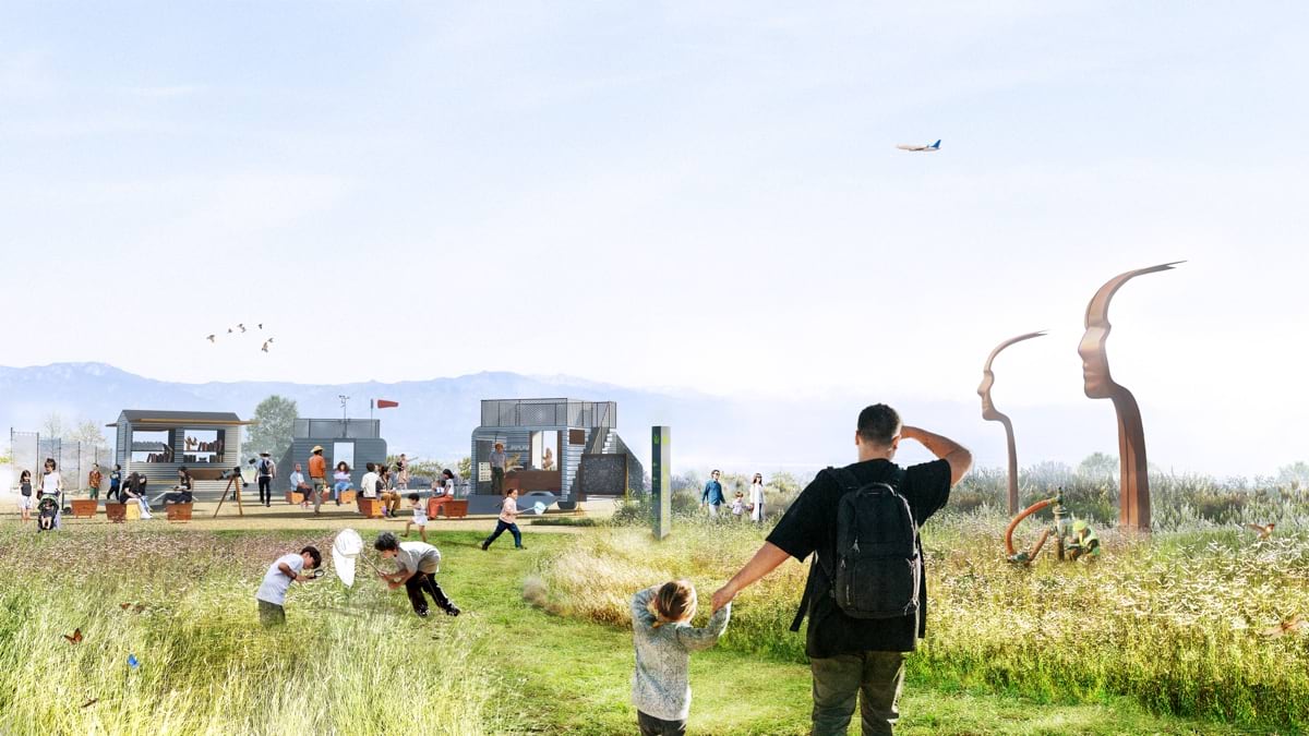
That’s one of the reasons that remediating degraded lands looks so attractive—to create parks near people of color who disproportionately live near those lands.
“LA County wants to address land where people live,” Erikson said. “That’s smart, because how can someone appreciate the need to conserve some pristine location if they have no connection to nature?”
Considering who visits parks changed some of the strategies of the PNA+ report.
“Originally this was just the regional and rural edition of the park needs assessment,” Erikson said. “But as we started digging into these disconnects, it allowed us to ask, ‘Why just look at traditional conservation?’ There are some significant improvements that can be made on degraded lands to counter the conditions.”
LA County has expanded the idea of creating parklands by adopting utility corridors and looking for opportunities to create small parks on vacant land.
“Typically, where powerlines are fenced off, they become places where people dump their trash,” Lau said. “We see those areas as win-win opportunities because if they’re not a park, they’re a nuisance, and a lot of that land is located in areas that lack parks.”
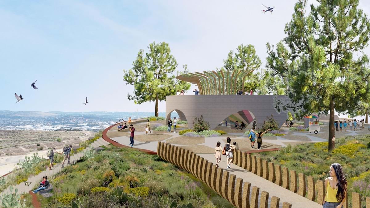
The Puente Hills Landfill Park would restore 140 acres, and it would be the first new regional park in over 30 years in the county. That’s because most of the vacant land in the county is owned or in need of clean up.
“We need to figure out the level of remediation needed,” Lau said. “We’re moving toward a parcel-by-parcel analysis to determine which sites should be prioritized.”
Learn how communities advance racial equity, social justice, and sustainable, inclusive development with GIS. Communities follow four steps to Develop an Equity Strategic Plan. Equity has become a focus across environment and conservation work.