
October 27, 2020 |
February 16, 2023
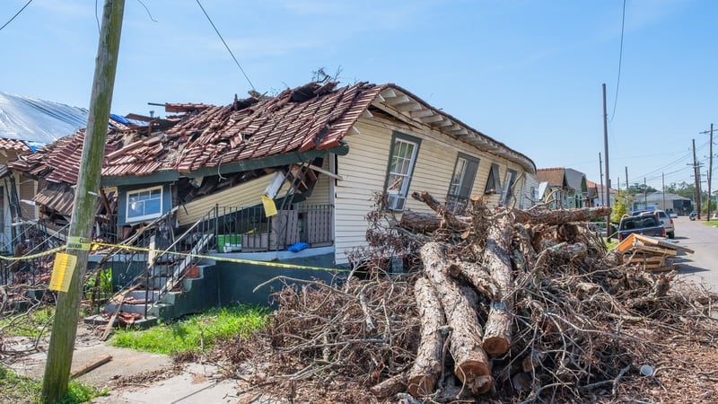
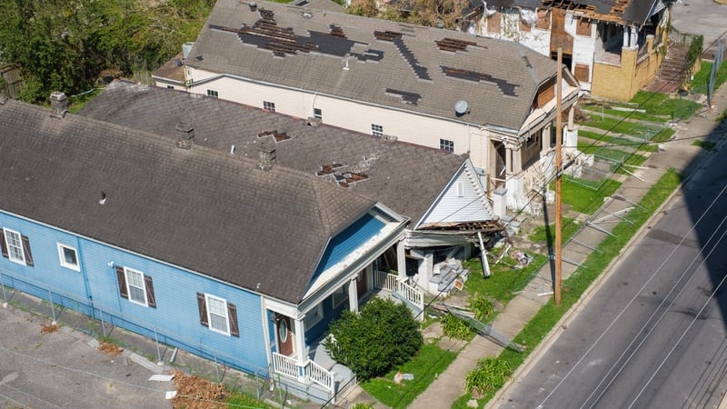
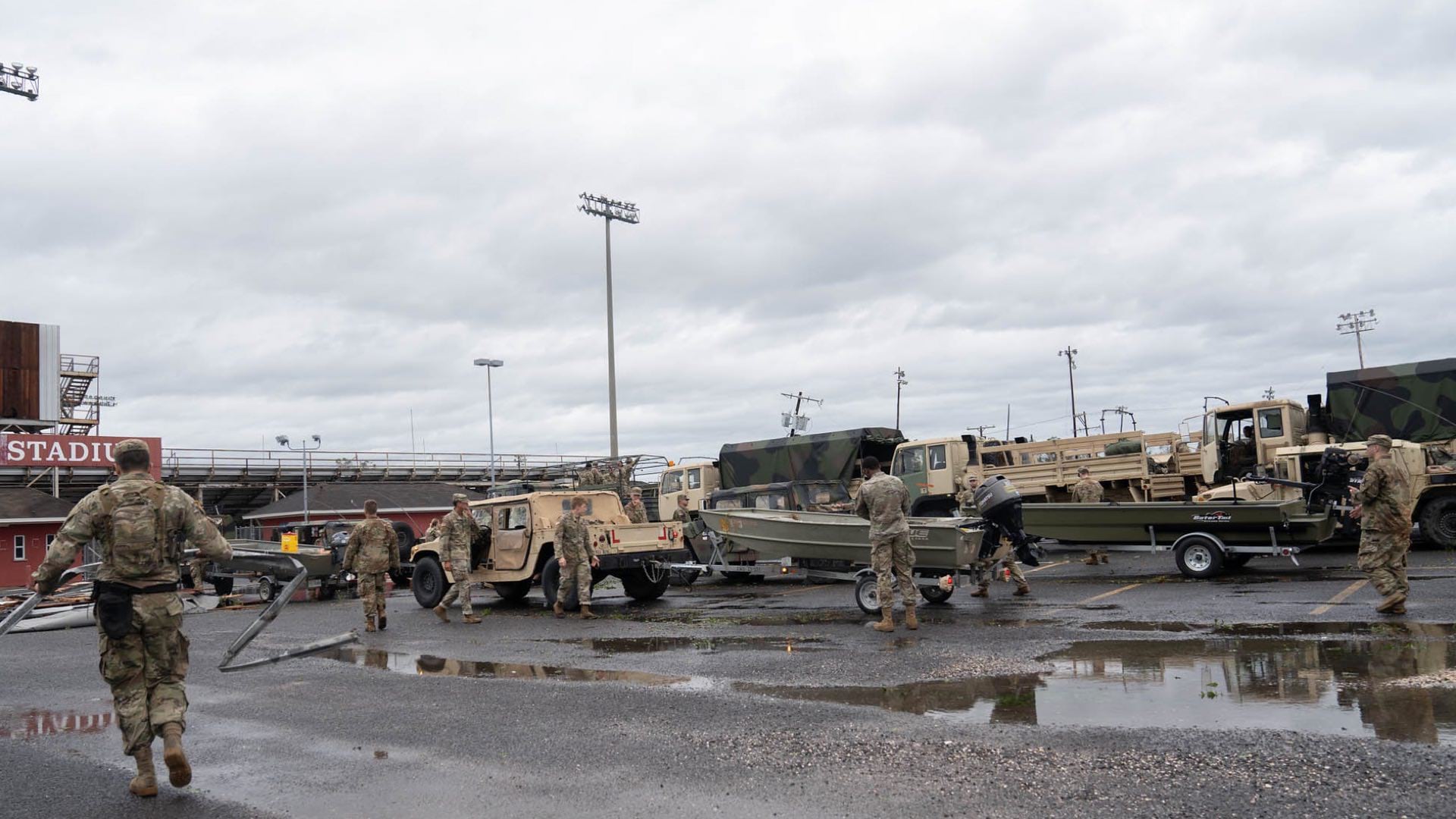
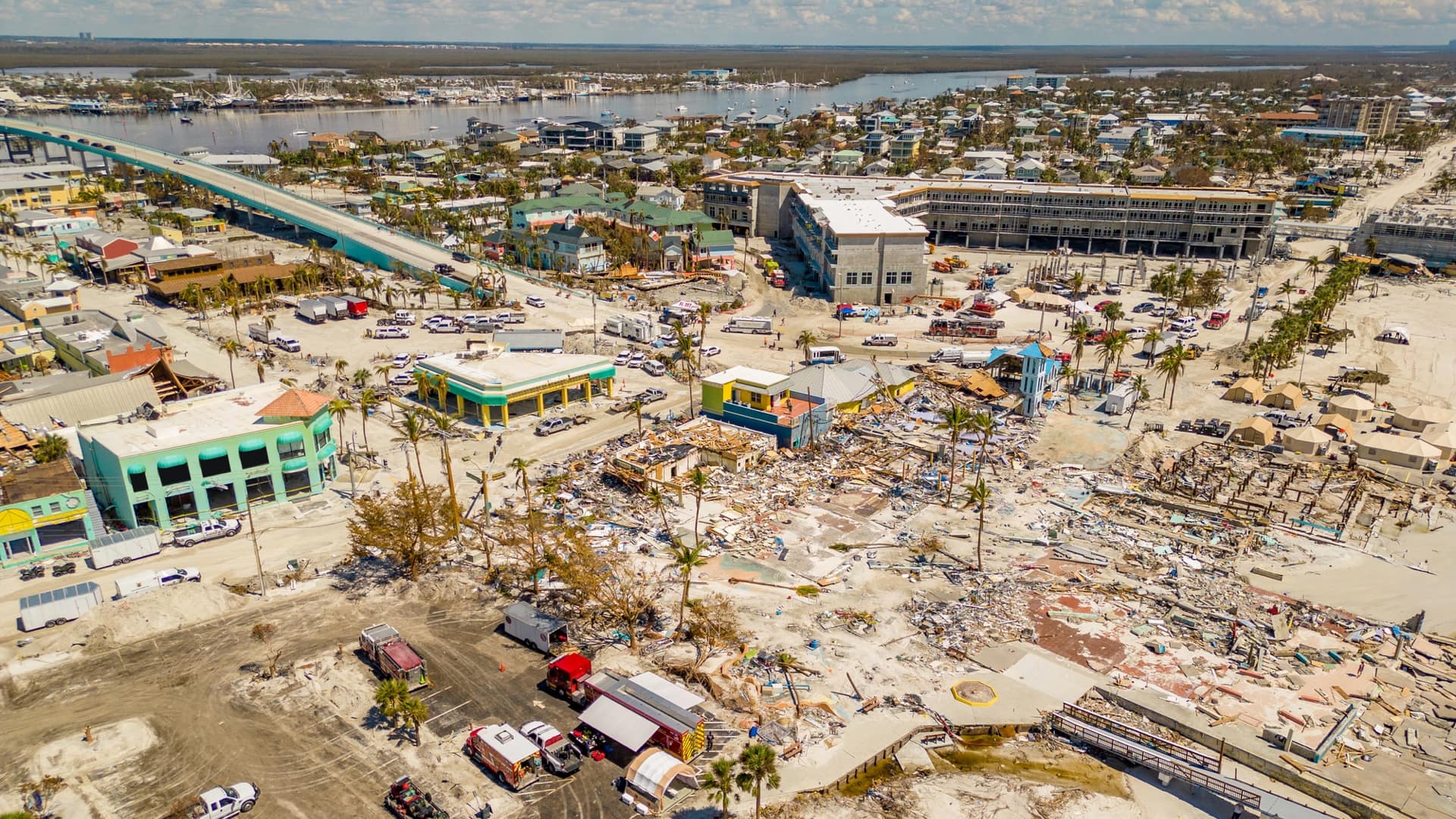
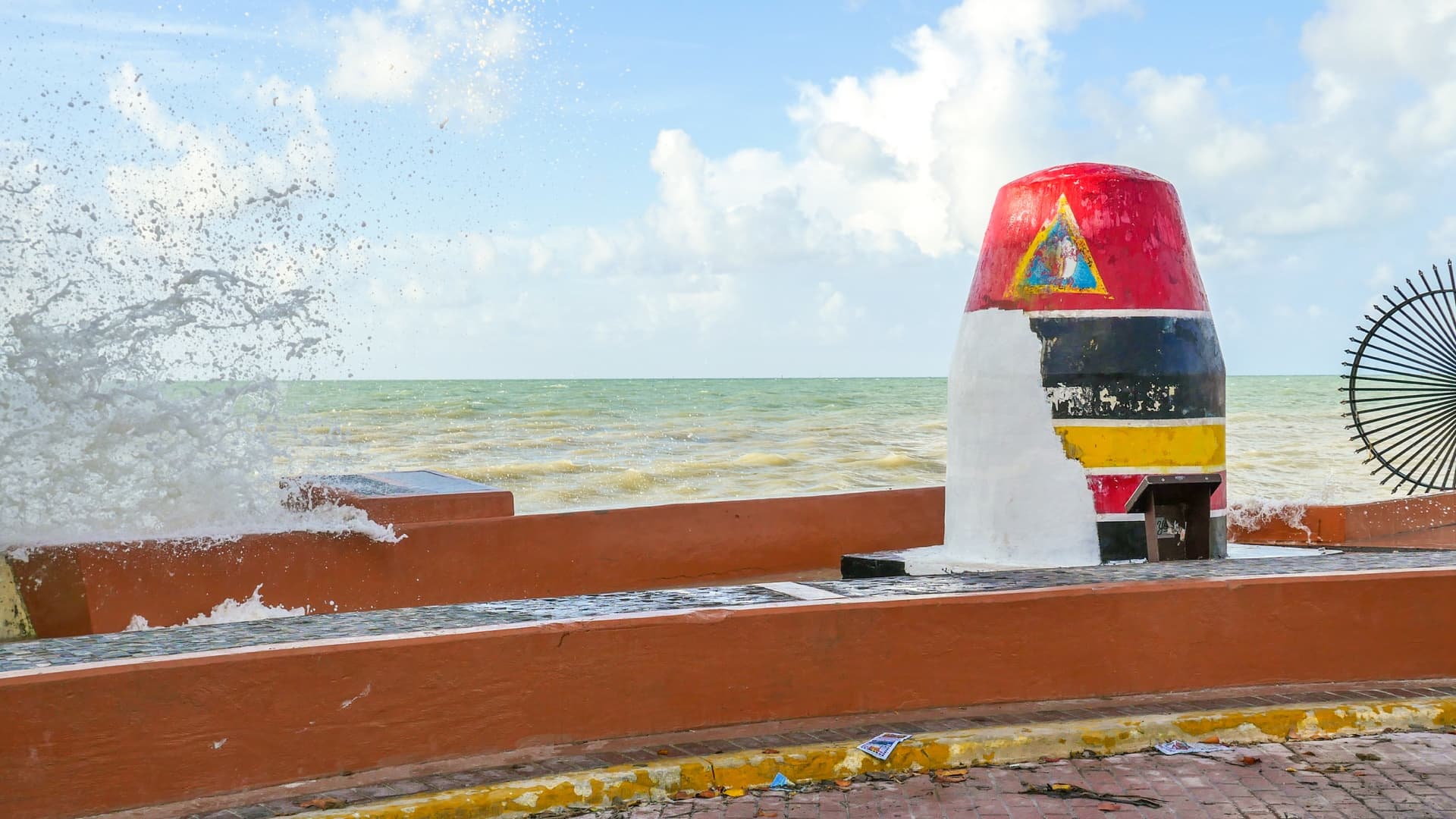
There was a feeling of foreboding in Louisiana on August 29, 2021. Hurricane Ida, with powerful category 4 winds, was bearing down on the coast exactly 16 years after Hurricane Katrina had submerged much of New Orleans. Ida was closely followed by Hurricane Nicholas, which drenched already saturated ground. Together, these hurricanes caused more than a billion dollars in damage.
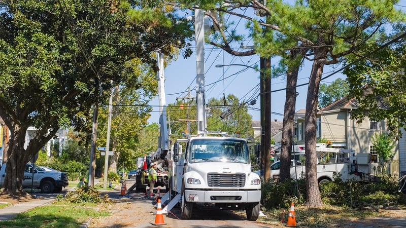
Since 1980, the cumulative cost of damages in Louisiana has exceeded $270 billion, second only to Texas and ahead of Florida—the top three disaster-prone states. Fortunately, Ida was far less deadly than Katrina for numerous reasons including an upgraded flood protection system and 16 years of innovations to address lessons learned. This time, the state also had a central online hub for emergency responders and local leaders to share critical information during severe weather events as they happen.
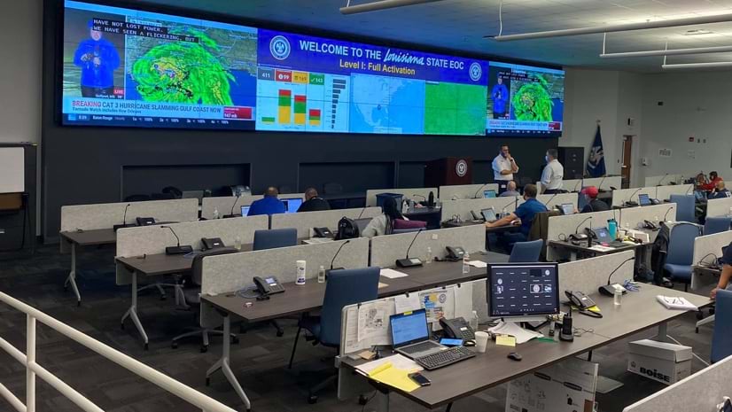
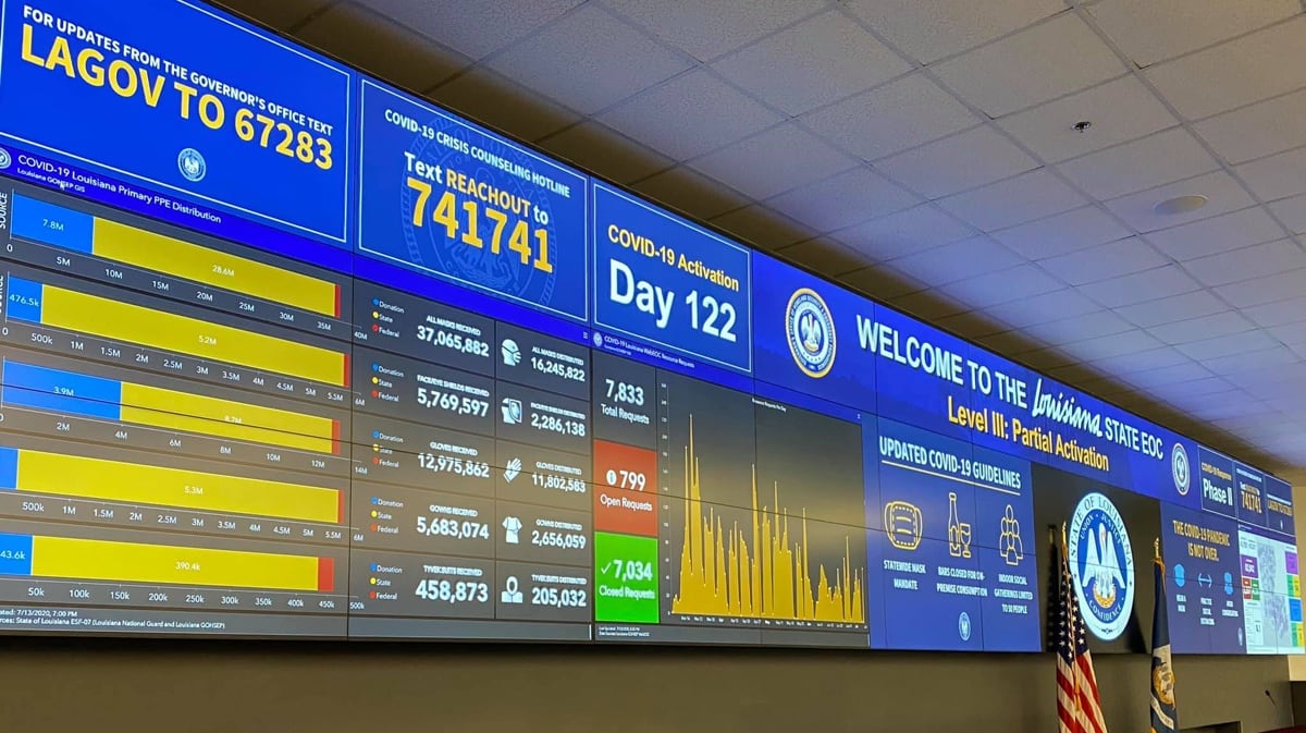
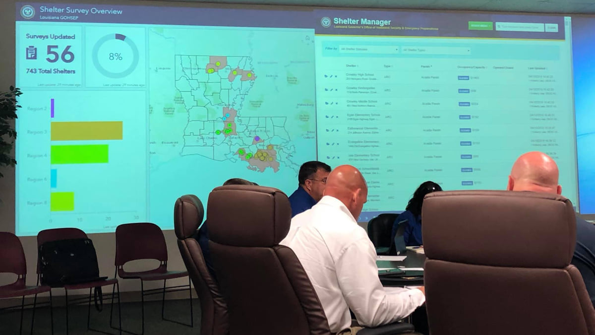
Virtual Louisiana, rebuilt with geographic information system (GIS) technology by the Louisiana Governor’s Office of Homeland Security and Emergency Preparedness (GOHSEP), contains comprehensive disaster data and information. The site includes real-time weather forecasts, information on evacuation routes and shelter locations, and a way for residents to report damages to their homes.
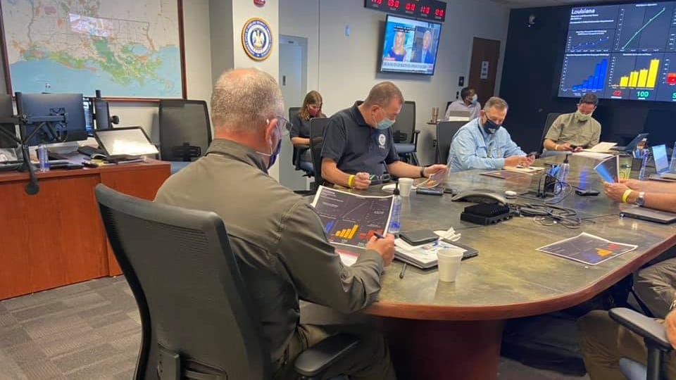
Behind the scenes, Virtual Louisiana creates a conduit for state, federal, and local collaborators—including 64 separate parishes. All responders can stay informed, share details securely, and collaborate on actions during emergencies. A suite of location intelligence tools helps the state accelerate disaster assessments to attain federal recovery funds. Responders collect data that is compiled and displayed on GIS dashboards to automate damage assessments.
GOHSEP has become a model for other metropolitan and state agencies because of its approach to sharing data related to extreme weather events.
“Other states have asked, ‘What’s the secret sauce?,’” said Austin Dixon, WebEOC administrator at GOHSEP.
The not-so-secret recipe for reviving Virtual Louisiana has been years in the making. In 2020, the site was relaunched using ArcGIS Hub to organize people, data, and tools for emergency management. Since then, the site proven valuable for response to the COVID-19 pandemic and four hurricanes (Laura, Sally, Delta, and Zeta).
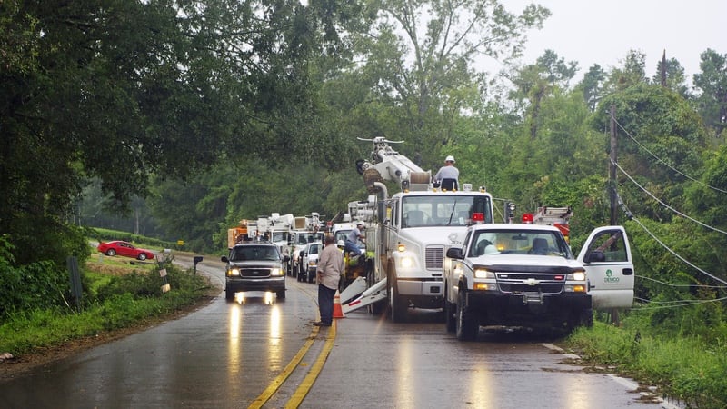
In any given year, Louisiana endures a variety of extreme weather, including hurricanes, floods, tornadoes, tropical cyclones, and freezing rain.
In August 2016, what is now called the Great Flood occurred, a result of a slow-moving storm system that stayed put for several days. The flooding became the worst US natural disaster since Hurricane Sandy in 2012. Baton Rouge and much of southern Louisiana were underwater, causing at least 13 deaths.
“That really opened everyone’s eyes,” said Andy Venuto, IT statewide applications senior developer with Louisiana’s Office of Technology Services. Venuto manually mapped flood damage during that 2016 event. He had only recently begun providing part-time GIS support to GOHSEP, and the agency hadn’t had a dedicated GIS analyst or internal GIS workflow for several years.
The 2016 flood made it clear to both Venuto and Dixon that with the right mapping tools, the state could be more responsive to disasters. It could also become better connected to the Federal Emergency Management Agency (FEMA) and the state’s parishes for more coordinated emergency response. That meant moving away from the agency’s reliance on paper maps and server-based desktop computers.
The two envisioned Virtual Louisiana as a way for the team to share disaster information securely and efficiently with first responders and the public, without needing a full-time GIS staff.
Grounded in the direction set by Dixon and Venuto, Virtual Louisiana has become a critical destination during disasters. And the two have taken every opportunity to make it better.
In 2020, during the COVID-19 pandemic, GOHSEP staff tracked positive cases, supplies of masks, and available hospital beds. Virtual Louisiana displayed a statewide status on dashboards for all to see. The agency also contended with two major hurricanes, with damages that caused Election Day plagued by power outages.
These compounding calamities provided an opportunity for Virtual Louisiana to demonstrate its critical value. Dixon recalled updating 13 dashboards at one point, because there were so many adverse situations to track at once.
“We want to automate as much as possible,” Dixon said.
Fast-forward to 2023 and Virtual Louisiana has many automated tasks, including crowdsourced home damage information that speeds up the collection of details necessary for a federal disaster declaration and funding.
The new tool allows reviewers to complete hundreds of damage assessments in an hour and instantly share findings with FEMA.
Moving from manual paper mapping to shared real-time maps and analysis of damages has been a major accomplishment for this small GIS team.
Venuto and Dixon now live by and share this piece of advice: “anticipate and automate.”
Louisiana faces some of the most extreme weather events in the world—with tornadoes materializing as late as December and hurricanes posing a threat throughout the year, often laying waste to neighborhoods in low-lying areas. But now Virtual Louisiana helps everyone in the state better prepare for these events, collaborate on responses, communicate damages, and document recovery efforts.
Learn more about how GIS supports all types of emergency and disaster management operations.
October 27, 2020 |
December 13, 2022 | Multiple Authors |
December 27, 2017 |