
October 18, 2021 |
Ryan Lanclos | Public Safety
In many ways, a map today is the same as one of civilization’s very first ones. It synthesizes where to go, how to get there, and the hazards to avoid—but in smarter and more collaborative fashion.
Now, we need maps not so much for finding our way through forests, but to show us how to save them, and us.
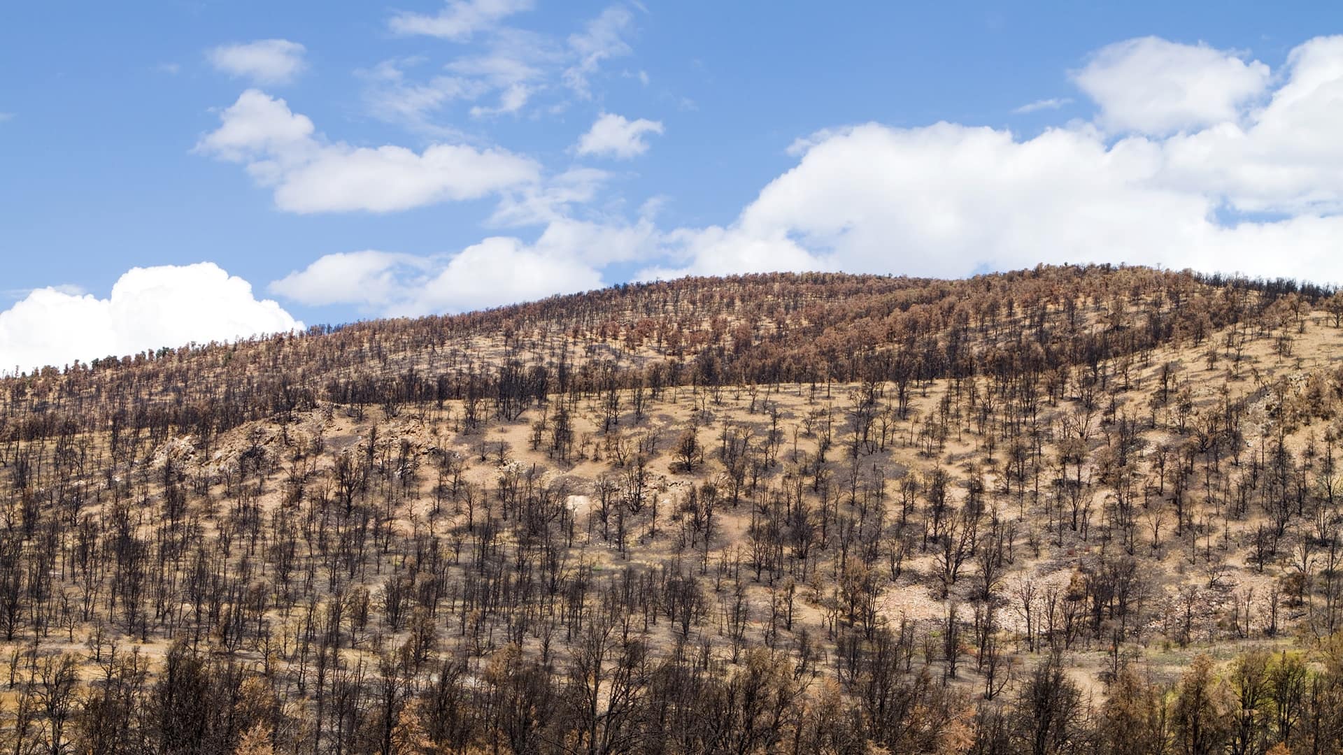
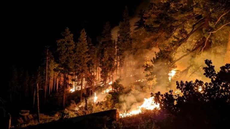
In just two years, wildfires have destroyed nearly 4 million acres of California forest. Entire towns have burned.
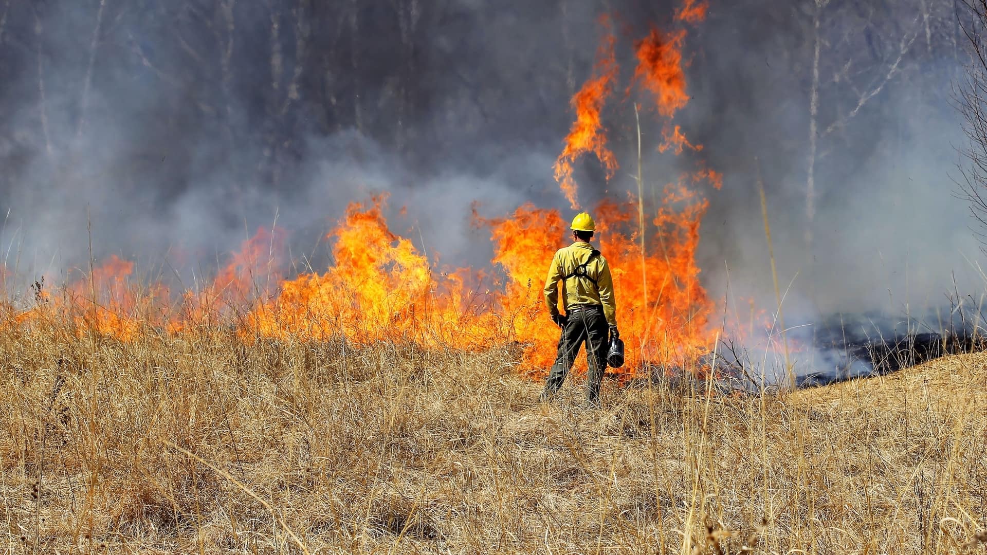
Modern mapping tools are beginning to help fire crews both tamp down these combustible events made more unwieldy by climate change and guide practices to improve forest health.
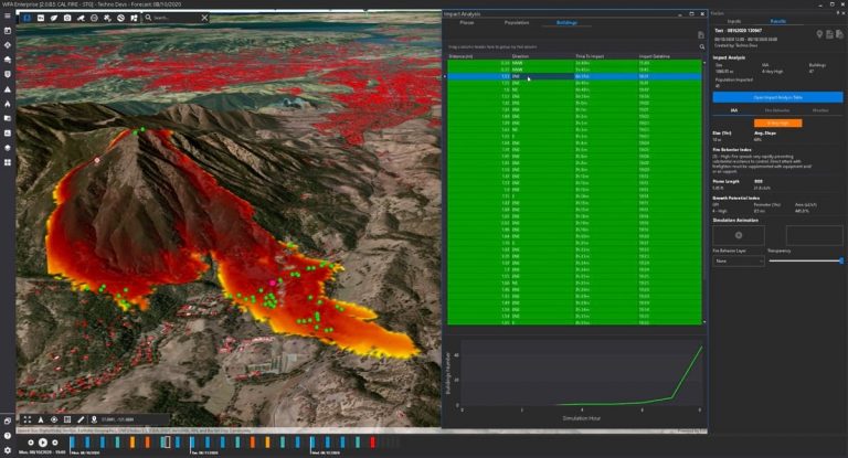
CAL FIRE deployed new mapping strategies this year from Esri partner Technosylva, with both a predictive capability (to see where fires are sparking and might spread) and a tactical application (to track in real-time where trucks, dozers, field crews, helicopters, and other assets are at any moment on a shared map).
Unlike the earliest maps, drawn in the sand or carved on tablets, dynamic digital maps safeguard lives and property.
Nonetheless, a near-record number of acres burned exposing the root problem that mapping technology can also help solve. Forests haven’t been allowed to naturally burn for more than a century. Loaded with dry or dead branches and trunks, the fuel has led to megafires. Analysts of fire suppression tactics have shown—on a map—how we’ve disrupted important natural cycles in the forest by putting out fires when we should have allowed a controlled burn to consume them. Now, our intervention is needed. We must thin forests to take on the role that fire has played in the past.
Thinning is one step toward a future with better forests that burn less and ultimately store more carbon so it doesn’t warm the atmosphere. To get there, we must map how things should be and reveal what has been broken. We must map to restore the balance.
Whole landscapes are changing because of climate change, and trees take centuries to slowly march across the landscape on their own. It’s up to us to intervene and expedite this process when possible. Modern maps are guiding that ecosystem transformation.
Where the Camp Fire burned in Butte County, a new climate-aware reforestation plan is being put in place by the US Bureau of Land Management. Instead of planting back what burned, foresters are planting trees a thousand feet higher in elevation where they will stay cooler, longer, in soils where they will thrive. That’s because rising temperatures are making it harder for many species to survive where they have been for centuries. Maps depicting these changing conditions and the combination of factors necessary for healthy forests, such as soil characteristics, elevation, aspect, and precipitation forecasts are the foundation upon which restoration efforts are based.
Governor Newsom secured major funding increases for active forest management in California, and just this week the US Forest Service released a 10-year strategy to confront the wildfire crisis with the $3 billion from the Bipartisan Infrastructure Law. Both plans acknowledge the need to improve forest health as part of climate action, with funding focused on preventing wildfires and restoring forests. Both plans will require advanced mapping to inform current conditions, spatially allocate mitigative measures, and simulate expected outcomes.
We’ve learned a great deal during the pandemic about how to work together toward common goals, using dashboards and maps to mark our progress, as illustrated by the Johns Hopkins COVID-19 Dashboard. Many collaborative statewide mapping efforts are currently underway, including efforts spearheaded by the California Natural Resources Agency (CNRA) in a public-private partnership with Esri. The shared mapping resources of these efforts brings together the knowledge of diverse experts to provide a sophisticated understanding of California’s lands, forests, and waters. This information will guide forest transformation.
To address the challenges of climate change and combat devastating fires, we must continue to enhance forest maps. Using the tactical and analytical tools of modern maps, we can navigate this treacherous terrain and save our communities and our forests.
Learn more about how GIS helps firefighters prepare, suppress, rehabilitate, and manage for wildfire.