


January 14, 2020 |
Alexander Martonik |
October 18, 2021
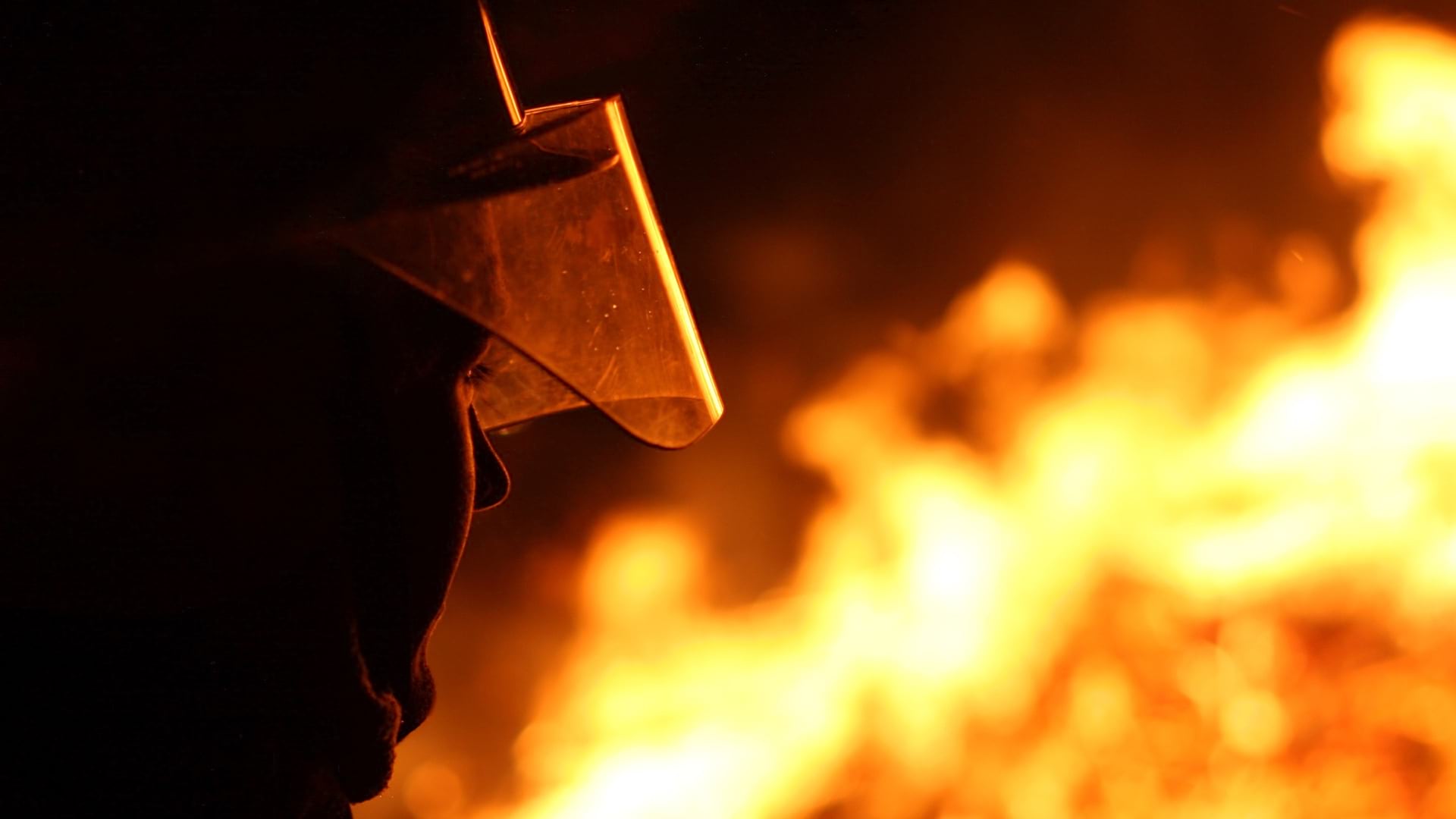
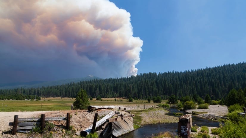
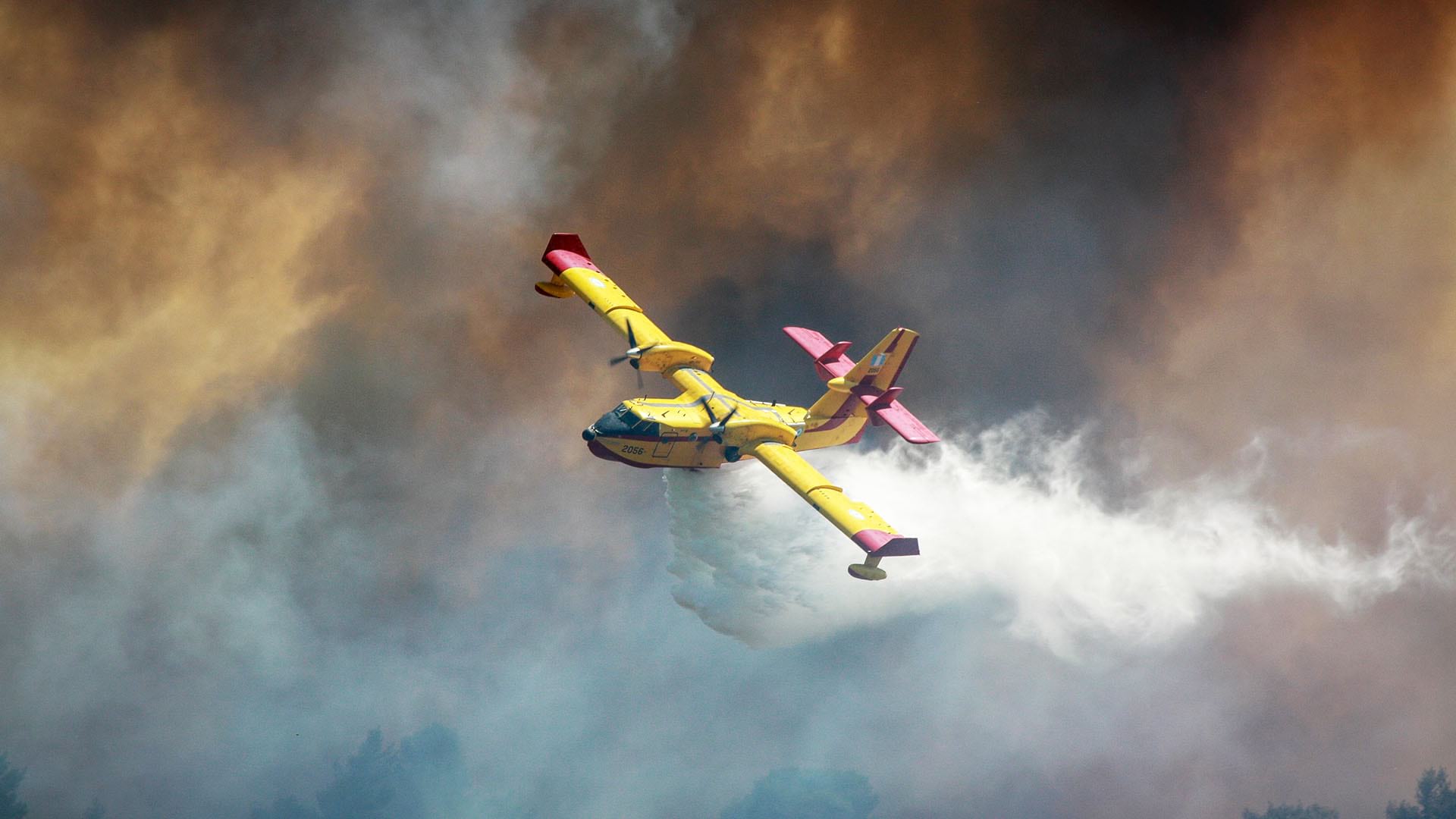
Already in 2021, California has experienced the second most destructive wildfire year in its history. The Caldor Fire became the nation’s top priority in August as it threatened to jump into the highly populated Lake Tahoe Basin. The Dixie Fire destroyed the towns of Greenville and Canyondam and more than 1,000 homes, businesses, and other structures. In early October, the start of the strong Santa Ana wind season, the Alisal Fire near Santa Barbara spread quickly and temporarily closed Highway 101. Owing to dryness and fuel loads, this year’s blazes even generated their own weather. Thunder clouds massed above, causing lightning strikes that sparked spot fires ahead of advancing flames.
California Department of Forestry and Fire Protection (CAL FIRE) officials—who say they have never seen so many acres burn with such intensity—are trying to be ready for what the fires will do next. Firefighters are now using imagery, smart maps, and computer simulations to monitor and forecast fire behavior. “The technology helps us understand that without suppression, this is where the fire could go,” said Phillip SeLegue, CAL FIRE’s deputy chief of intelligence.
Every day, CAL FIRE officials must continuously reprioritize resources for new and emerging fires. On a single day—August 16—the agency was fighting 10 wildfires with 10,700 firefighters, 795 fire engines, 192 hand crews, 265 bulldozers, 276 water tenders, and 45 helicopters.

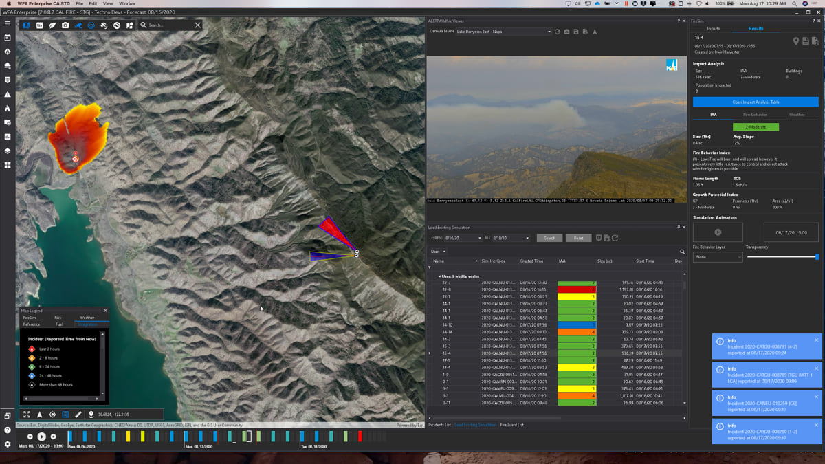
“Thankfully, we have a lot of resources here in California, but we also have a lot of ground to cover and people to protect,” SeLegue said. Using a tool called FireGuard, CAL FIRE officials can see when and where fires spark, then create strategies to match specific needs with strained resources.
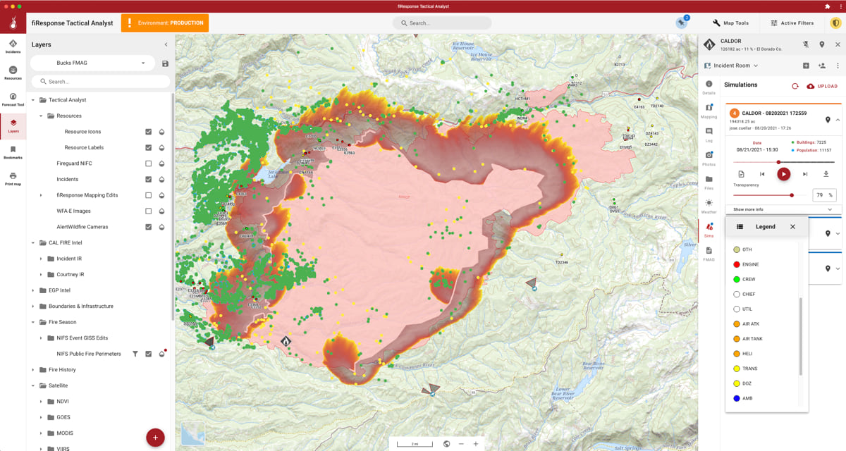
FireGuard gives CAL FIRE access to video and images captured by classified US military drones and satellites as well as non-classified imaging and weather satellites. Firefighters use the visualization tool on an hourly basis to monitor the fire’s location, the heat it’s generating, and the corresponding changes in weather conditions.
“The ability to immediately see that communities or houses are being impacted has brought more awareness to the situation,” SeLegue said.
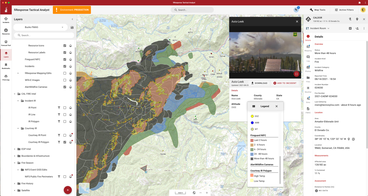
CAL FIRE couples FireGuard with Technosylva’s Wildfire Analyst and Tactical Analyst products built on Esri’s ArcGIS technology.
“Seeing at a moment’s notice where all spot fire reports are coming in and coupling that with modeling tools from Technosylva lets us see where pinch points or problem areas are throughout the state,” SeLegue said. Keeping on top of new and emerging fires helps address the issue CAL FIRE faced in 2020 when several fires combined to create the August Complex Fire that burned more than one million acres.
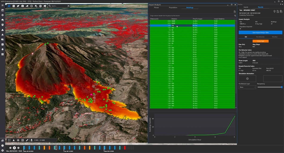
Analysts with CAL FIRE can now run simulations; plan actions; and locate all firefighters, engines, helicopters, and other resources on a single shared map. In the field, firefighting crews can view this map on their mobile devices for alerts and fire activity awareness.
A bulldozer driver, for example, can see on a map where someone is scouting ahead and the locations, in real time, of arriving engines. “Instead of having to hail someone on the radio to ask their location, they can quickly see where they are. And if it reaches a critical stage, they can start building a safe refuge area that everyone in the vicinity can fit into,” SeLegue said.
The tactical and analytical tools from Technosylva add significant new capabilities beyond CAL FIRE’s prior mapping and analysis tools. This fire season represents the first time an incident commander has had a shared map with input and visibility from every crew.
“You can see your objective, capture your job, and see your edits as they go onto the map,” SeLegue said. “The shared map provides a sense of accomplishment and encourages the use of this technology.”
SeLegue’s team has also found it helpful to have someone in the office, with access to other resources and analysis, updating the map with additional information such as weather and spot fires for those in the field.
“All edits are uploaded so others can see it visually and assist with the strategic plan or the overall goal,” SeLegue said. “And I don’t always have to start from zero, asking where all my resources are. It’s just a click and I can see them.”
Next, SeLegue hopes to integrate data, imagery, and videos collected from drones, which have become a flexible way for fire observers to monitor fire behavior without risking their lives.
The new levels of information and automated workflows also support disaster recovery.
“We can use the data to create a Fire Management Assistance Grant, so communities can put in for federal loans and prop themselves back up and have better resilience,” SeLegue said.
To SeLegue, the pain of fire damage became personal when the Carr Fire roared through his neighborhood and destroyed 14 of his neighbors’ homes in July 2018. He lives in an area that is still bouncing back.

“These are cascading disasters,” SeLegue said. The first is the fire itself. The second is the recovery—removing hazards, planting new trees, rerouting electrical lines and roads, and rebuilding. “As more fires occur, it continues to personally impact more folks in the fire service. It has pushed us to have a greater understanding of the effects of incidents. After the emergency is gone, what are you left with?”
The Dixie Fire and other recent blazes mark a pattern of rapidly expanding wildfires with erratic and unusual behavior, fueled by a large number of dry forests and severe drought conditions. The back-to-back blazes year-round leave little room to rest.
Firefighters like SeLegue are aware of the impacts on people’s lives and the fact that firefighting conditions have become increasingly difficult around the world.
“The same issues that are happening in Spain or Perth or Queensland are the same issues we’re dealing with here,” SeLegue said. “I think the digital age has brought us together and made us more aware of other incidents and the solutions or tools we can draw on.”
And SeLegue knows that being better prepared is not just limited to wildland fires. “CalFire is an all hazards agency,” he said. “We may be fighting fires today and responding to an earthquake or technological hazard tomorrow. These tools allow us the same level of situational awareness no matter what challenge we face.”
Learn more about how GIS aids wildland firefighters.