Identify risk
Analyze historic trends, identify wildland fire risk on the landscape, and help prepare and engage the public in holistic planning efforts that identify, inform, and prioritize future fuel mitigation projects.

Prepare, mitigate, suppress, and recover with location intelligence

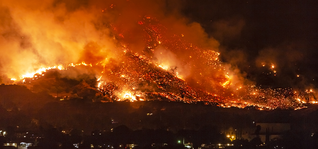
As wildland fires occur more frequently, burn with greater intensity, and impact more acreage, the fire season has transitioned to a fire year. The increase in wildland fire severity exposes new communities to wildland fires and exacerbates the risk to traditionally threatened communities. GIS software supports improved understanding of the surrounding landscape and strategic mitigation efforts that can break the wildland fire response cycle. This executive brief shares how GIS helps decision-makers build resilience across each phase of a wildland fire.
Use this collection of Esri solutions, applications, and blog articles to help plan and manage your wildland fire strategies.
Get maps, datasets, applications, and more to support wildfire preparedness and response efforts.
View resourcesThe Wildfire Aware app provides information about the current status and potential impact of wildfire incidents in the United States.
Launch the appTo be more accessible, engaging, and relevant, CWPPs need to shift from paper-based plans to dynamic digital alternatives. Esri's new CWPP template supports this change.
Read the blog postThis free ebook explains how organizations can use ArcGIS to strengthen situational awareness and improve decision-making before, during, and after fire events.
Access the ebookStay up-to-date on trends, technology, and best practices related to GIS in public safety.

View the latest GIS news, user stories, and resources for wildland fire professionals.