


January 21, 2020 |
Brent Jones, PE, PLS | Mapping
Access to public lands—for mining, for oil and gas, for the right-of-way corridors that connect resources to markets—depends on the accuracy of the underlying land records and the ability to retrieve them. The Bureau of Land Management’s Public Land Survey System (PLSS) is the legal framework and collection of records of land ownership across nearly 656 million surface acres and 713 million acres of federal mineral estate.
For generations those records lived in paper and early digital silos. Now, the Bureau of Land Management (BLM) and partners can directly access and edit the data, and a land tenure question can be resolved in days rather than months.
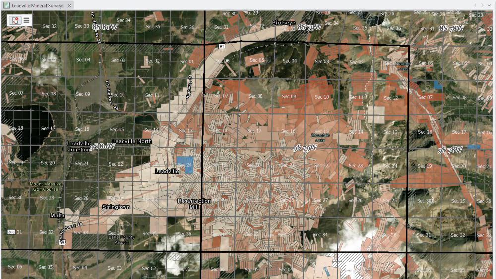
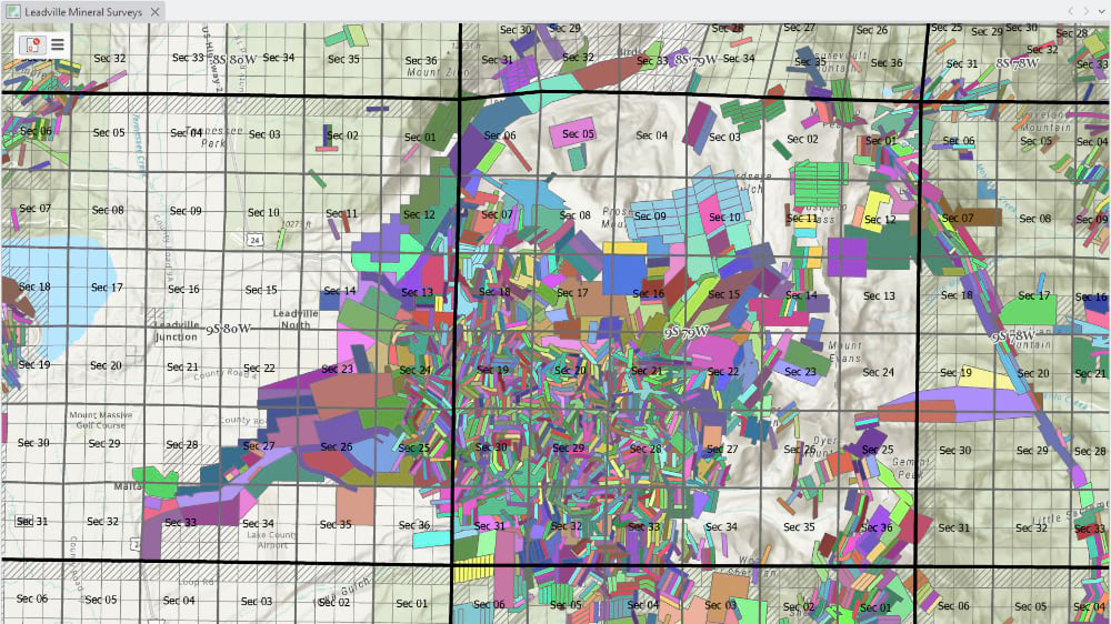
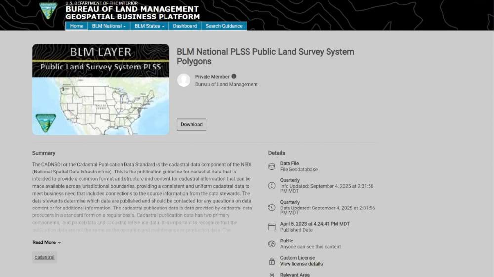
A BLM team recently migrated more than 26.5 million parcels across 27 states into the ArcGIS Parcel Fabric, software used for managing land parcels. This milestone represents the largest known US parcel modernization effort that enables faster, more informed decision-making and reduces ambiguity. Furthermore, having a single authoritative GIS representation of the PLSS framework ensures the accuracy, integrity, and accessibility of geospatial and survey datasets used in land management decisions on public lands.
These are the land record collections represented in a geographic information system (GIS)—the digital map database where parcels are drawn, ownership is recorded, and answers are sought. Every royalty check, every mineral claim, every permit tied to a right-of-way traces back to survey performed on the ground and entered into that system of records.
The system dates to 1785, when the Continental Congress established the survey system proposed by Thomas Jefferson, which supported the legal framework for transferring public land into private hands, generating the revenue a new nation needed to survive. The economy that grew from those surveys still runs on the same foundation. Now it’s modernized.

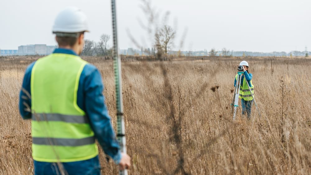
Surveyors once measured the land with transits and chains—steel links stretched across terrain, counted out and manually recorded. Today, a GPS receiver on a surveyor’s pole can fix a monument’s location to within centimeters. Although the tools to map, preserve, and maintain it have evolved, the founding principles of the PLSS remain steadfast.
For most of its digital history, which began in the late 1980’s, the digital record was an approximation. When BLM first transferred survey records into GIS, coordinates were established using topographic maps. They were the best available source, but the accuracy was inconsistent enough to matter—sufficient for orienting a decision but not for grounding one, such as whether a hunter is on the right property, a pipeline crew is accurately staking a right-of-way, or a mineral developer is calculating the right lease acreage.
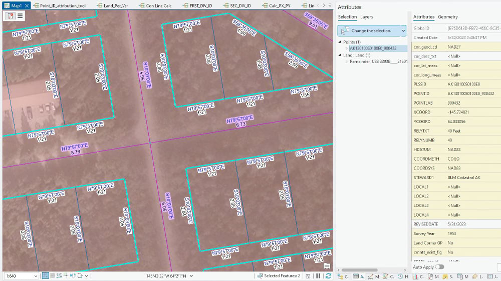
Modernizing the PLSS and improving the digital record has meant making continuous improvements by sending survey teams into the field to collect more accurate coordinates for the monuments that mark controlling corners, feeding those back into the ArcGIS Parcel Fabric, and letting improved control points lift the accuracy of every line around them.
Boundary lines are complex, containing the decisions, compromises, and errors of everyone who drew it before. A section corner is a record of a moment in time, embedded in landscape and in law. GPS, aerial imagery, and connected field tools have made cadastral surveying faster and better-informed. They haven’t changed what the work requires.
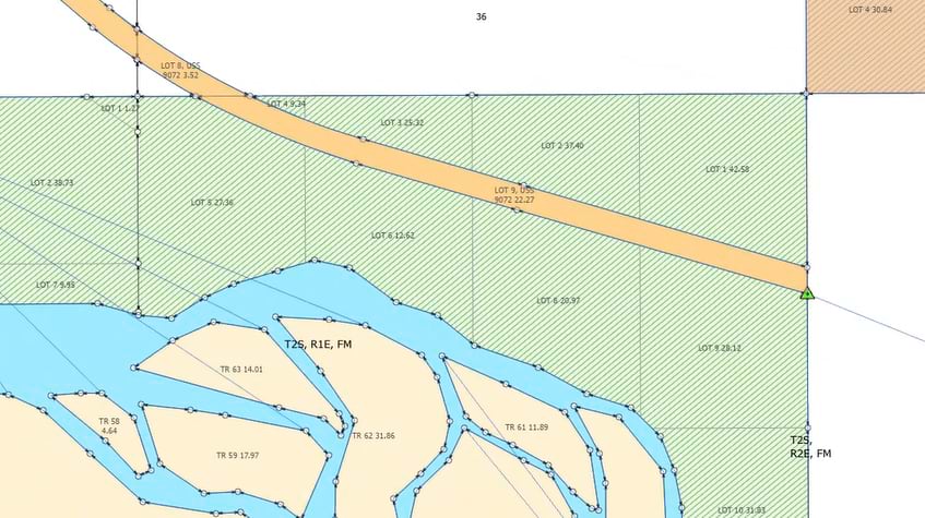
Complexity compounds when surveys don’t agree. The PLSS was laid down in waves: different surveyors, different eras, different equipment. Where those surveys meet, they don’t always agree. A township platted in 1850 and resurveyed in 1910 may describe the same land differently. Most of the time this clears up land tenure issues but sometimes the result is either an overlap, where two surveys claim the same ground, or a gap: a strip of earth that falls between them with no clear legal owner.
Gaps and overlaps are rare, but they both require updates to the records. An overlap can put two mineral leases on the same acre. A gap can leave a corridor of land in limbo, blocking the right-of-way a pipeline needs to cross it. Resolving either scenario requires the specialized expertise of a land surveyor.
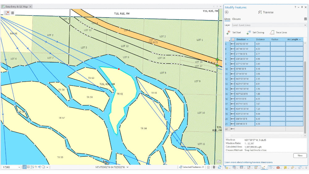
When a discrepancy is identified, surveyors research the original records to determine whether a new survey is required. If so, when the survey is complete and the record updated, it is entered into the shared GIS dataset. The work is painstaking by necessity because these are legal determinations, not merely data corrections. The effort, and the ultimate goal, is to propagate the fix immediately to everyone working from that record: BLM permit officers, county assessors, energy developers planning their next lease.
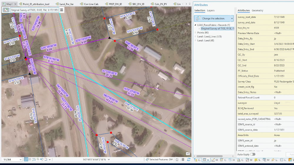
BLM’s first digital transformation of the PLSS began in the late 1980s on systems never designed for GIS. This earlier transformation was built before the need to overlay, visualize, and query cadastral data alongside other federal datasets became central to how the agency worked. Migration to a modern enterprise platform meant leveraging those records for new audiences and use cases. It involved retrieving 200 years of survey records (surveyor, date, technical specifications) and embedding them so that clicking a line in the parcel fabric reveals details about the survey that produced it.
Somewhere between a hotel conference room and today, the vision to make the records more accessible became real. The people who spent careers digitizing, standardizing, and integrating 30 million parcel records, heirs to a survey tradition that formed the country’s economic foundation, can now securely login to access and edit the data from anywhere.
“We’ve had lots of dreams,” said Jerry Neff of S&P Global, a contractor who has worked on the PLSS dataset for decades, “and the technology just wasn’t quite there.” It’s there now, thanks to the geospatial system engineering team at BLM who migrated data to a scalable and performant cloud-based architecture.

What that means in practice is a shift in how the records are governed, not just stored. The ArcGIS Parcel Fabric, the connected databases of survey records, accommodates user roles, provides workflows, and manages access permissions. BLM maintains the authority where there’s a federal interest. Once that interest has been conveyed from the federal government, then the authority falls on states, counties, and tribes. To provide a cohesive and seamless representation of the PLSS, BLM has found ways to efficiently work with their partners so others can contribute updates to the data. The right people can edit the right data—and only that data. Every change is logged: what was edited, when, and by whom. That audit trail matters as much as the accuracy.
One breakthrough during record migration eliminated a manual calculation step that surveyors had worked around for years. “Almost like warp drive in terms of productivity,” Neff said. The migration also exposed what earlier software had concealed, records that had appeared clean but carried hidden distortions, boundaries that were correct, but having been surveyed at different times using different datums, didn’t stitch together as expected.
The shift to a shared enterprise approach changed BLM’s relationship to its own data, including data that others hold. Monthly coordination meetings now bring the Forest Service and Bureau of Indian Affairs around one source. “By setting our egos aside and embracing alternative control and other data sources, we can more accurately depict the locations of historic surveys in today’s parcel fabric,” said Christopher McDonald, cadastral surveyor, and PLSS dataset manager at BLM. States and counties calibrate their records against the PLSS fabric. The State of Wyoming uses BLM parcel points to keep its own data aligned. The authority flows both ways: BLM centralizes the records, and the records improve by everyone working from them.
The State of Utah shows what that produces. For years, when Utah identified updated control points for lands it manages, those coordinates would be sent to BLM and wait—sometimes more than a year—before making it into the shared dataset. Not for lack of effort, but because the process and technology made it unavoidable. Now Utah inserts updated coordinates directly into the shared database. The lag is gone. Surveyors across agencies and states share a single workflow: check out a version, do the work, check it back in, reconcile, then post it. The central dream has been achieved: one record collection, shared authority, every survey and coordinate making the digital record in the PLSS better.
Knowing where the record is strong, and where it is less so, is itself a form of progress. The PLSS team ran a script against Wyoming data, comparing record acreages from the survey plats to the GIS geometries. They found that two percent of legal descriptions account for 20 percent of the acreage errors in GIS geometries. This finding tells surveyors to check the description closely to find where it diverges from the digital record. Finding the errors prioritizes field work to fix them.
Old surveys are reliable within themselves. Distortion comes where an old survey meets a newer one: the GIS’s interpretation of the boundaries stretch or shrink, and the acreage between skews. “We know where it’s distorted,” McDonald said, “and that helps us determine where to bring in more control.”
Suzie Sparks, chief cadastral surveyor at BLM, holds the same standard: “This is where the data is tied to tight control, and this is where it’s less reliable—and that tells us a lot. We just have to pay attention to it.” Reliability is paramount for the dataset’s many stakeholders.
That attention to fixing areas of low reliability has new tools. AI can scan for errors at a scale no team could manage manually. But locating a problem and resolving it are two different tasks. In one case, an AI tool produced a citation the team couldn’t find. When pressed, the system admitted fabricating it. “Trust but verify,” McDonald said.
The record is only as reliable as the judgment applied to it. “AI is only going to be as smart as the data it evaluates,” Sparks said. “We’re making sure that as we build the data, we maintain integrity.”
That honesty about where the record is authoritative and where a better source may exist is what the shared enterprise approach enables. Being the designated authority and holding the most current data are not always the same thing.
The current focus on energy development, critical minerals, and efficient permitting has given this work new visibility. Access to public lands for mining, for oil and gas, for the right-of-way corridors that connect resources to markets relies on the underlying records. A land tenure question that can be resolved in days rather than months changes what’s possible.
The timelines in this domain are long by nature. Developing a mine from discovery to production spans decades. Federal land transactions move at the pace of due process. What a modernized land record system changes is not just the pace, but the quality of every decision made along the way.
New Mexico and Alaska show what full commitment to the modernization looks like and how different that path can be depending on what a state starts with.
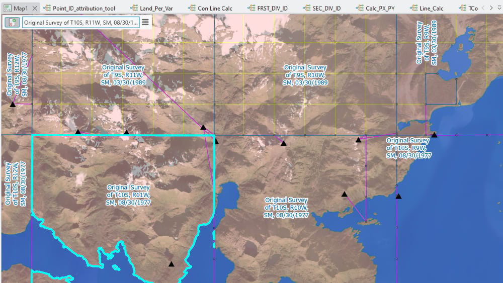
Earlier Surface Management Agency and Mineral Estate datasets were aligned to an older version of the PLSS survey data, so the BLM New Mexico GIS and Cadastral Survey team and S&P Global launched a project to re-snap and align them to the updated PLSS. Each township was thoroughly reviewed against Master Title Plats and other land records to correct errors, confirm jurisdictional and ownership boundaries, and incorporate them into the PLSS parcel fabric. The result is the most rigorously validated SMA and Mineral Estate dataset in the national collection, setting a new standard for quality.
Alaska presented the opposite challenge. There was no land data infrastructure to build from. BLM and its partners had to create one from scratch, surveying terrain that in many places had never been formally measured, establishing the legal boundaries that resource development, land exchange, and public access all require. More than 3,600 official surveys have been entered into the parcel fabric so far. “That would have been unimaginable in the old days,” Neff said.
What New Mexico and Alaska have demonstrated, other states are still working toward. The bigger picture is still being assembled. Jefferson’s grid was designed to be used, and it has been. For nearly 250 years, surveyors have leveraged it and have added their own work. They understand that the work is never finished, only expanded.
The professionals who are stewards of the records today see further than any previous generation. They are careful about what they claim, clear-eyed about what remains, and are still building toward a concept they once drew on a hotel whiteboard and believed in long before the tools existed to deliver it.
Explore how modern cadastral systems support government decisions at every scale.