
March 4, 2020 |
Ryan Lanclos | GIS for Good
November 10, 2022
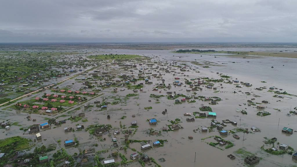
Two back-to-back cyclones battered Mozambique in 2019, destroying more than 800,000 hectares of farmland during harvest season. The devastation to crops and livelihoods left nearly two million people facing acute food insecurity.
The United Nations (UN) World Food Programme (WFP) responded quickly, with two helicopters to ferry supplies and rescue stranded people. Given flooded roads, the air support was crucial but not nearly enough to distribute food and find stranded people across such a wide area of impact.
“When your primary tool for flying over large bodies of water is a helicopter that costs $2,800 an hour, you need to find a better way,” said Patrick McKay, drone data operations manager for WFP.
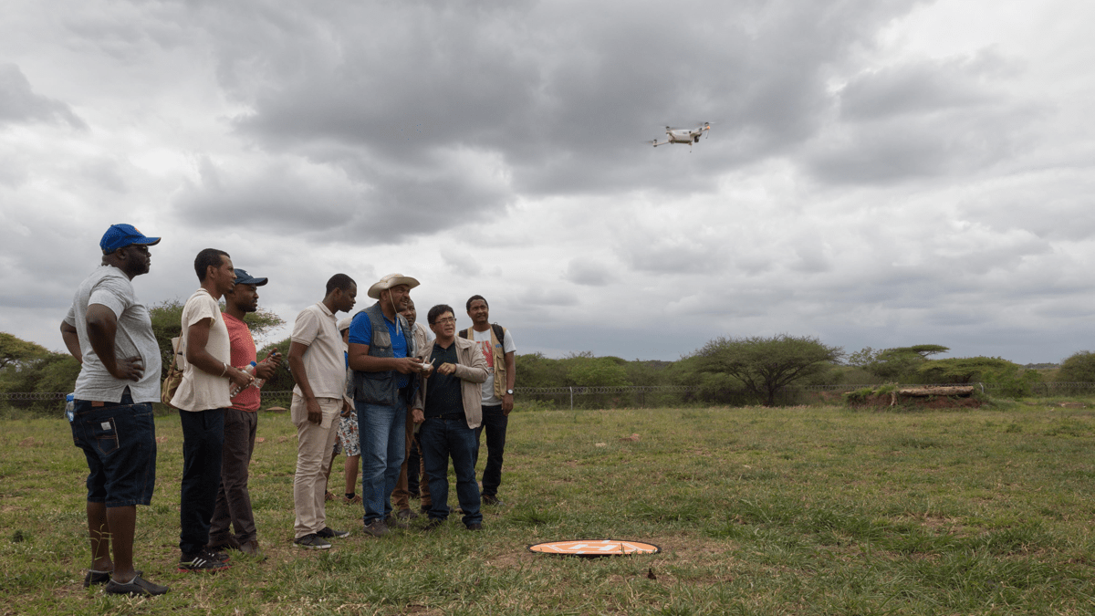
Cyclone Idai was the first time WFP coordinated a fleet of drones for disaster response. The timing was right because WFP had conducted drone training with Mozambique’s National Institute for Disaster Management and Risk Reduction (INGD) to build in-country drone pilot capacity. Also, Idai was an unusual storm in that it parked over land, dumped rain for days, and flooded an area spanning thousands of square kilometers.
“Each time the pilots came back, they told us the flooded area had gotten bigger,” McKay said. “They’d go by a stadium, and people were climbing higher and higher in the stands every time they flew past.”
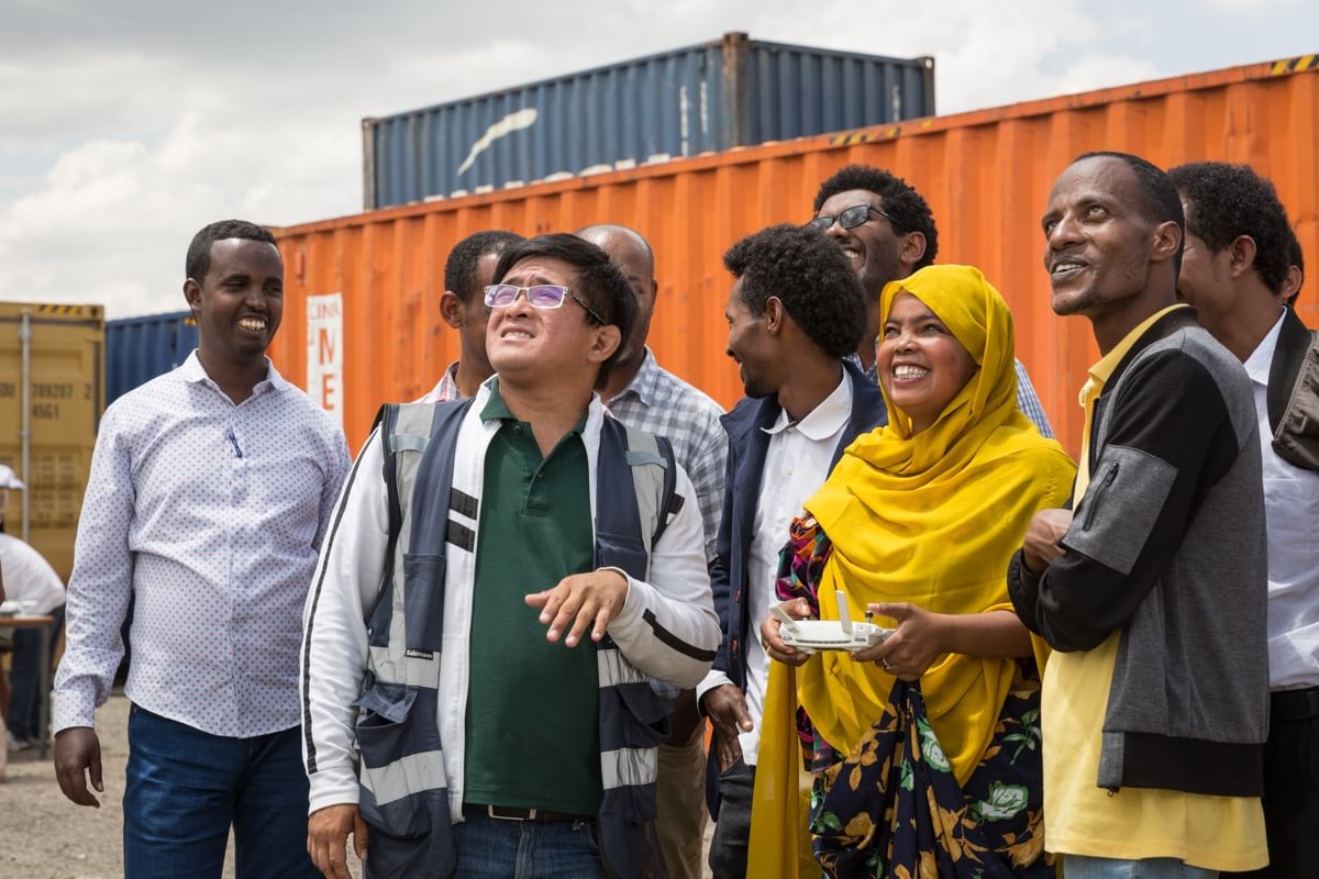
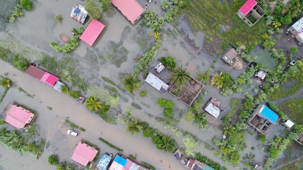
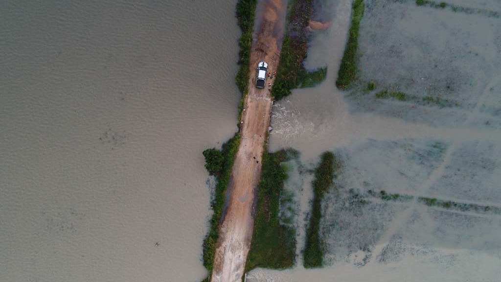
The drone pilots mapped the damage and searched for survivors, freeing up helicopter pilots to conduct rescue and supply missions. The images and videos the drones collected fueled updates to maps created with geographic information system (GIS) technology that let all responders see what was going on.
Drones are now standard for every WFP emergency response, used early and often to find out how many buildings have been damaged and how far floodwaters reach, scout for survivors, and map changing conditions.
WFP is usually among the first on the scene, because it has offices in more than 120 countries and leads clusters of UN emergency telecommunications and logistics staff who need to go in and set up before other teams arrive. WFP’s use of drones helps UN Children’s Fund (UNICEF) inspect schools, assists the World Health Organization (WHO) assess the status of clinics, and supports other UN organizations and in-country first responders rapidly understand conditions on the ground. GIS brings together drone-collected data—with details about people and structures—in purpose-built maps and apps to meet each organization’s mission.
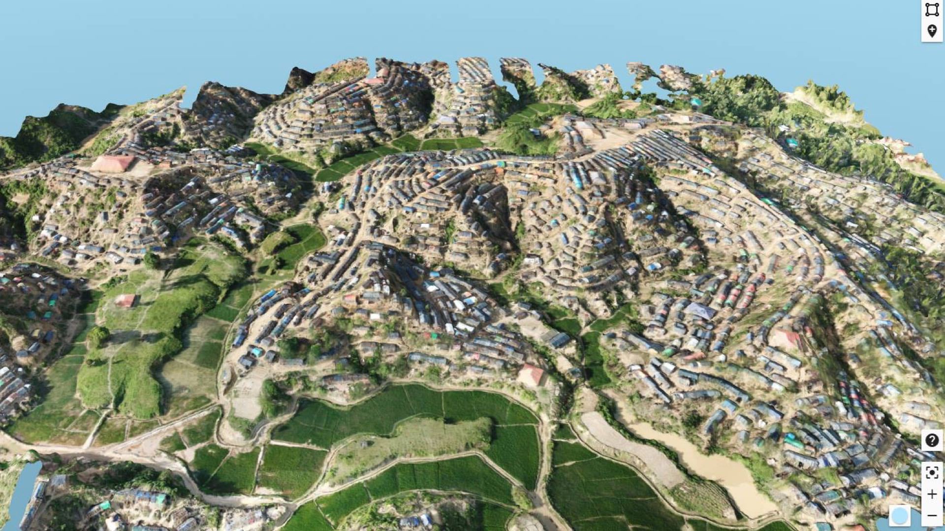
“Before, only the people with access to a helicopter could see the damage and do assessments,” McKay said. “But now with drone pilots mapping in really high detail, down to two-centimeter resolution, we could share that information with everyone, and even do remote inspections.”
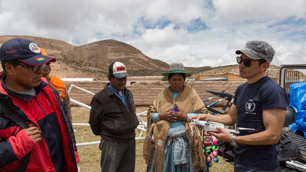
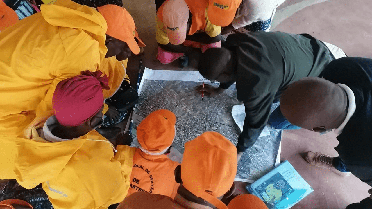
WFP worked directly with Antonio Jose Beleza, deputy director of National Emergency Operations Center (CENOE) at INGD. Eight of the pilots came from the Mozambique government, and with their local knowledge they began mapping where they thought people were and still might be.
Every day, drone teams would meet in the morning, disperse, and meet in the evening to coordinate activities and process images to update maps. Evening meetings were for coordinating the next day’s flights and the areas to cover. In the morning, the teams would assign people to ground vehicles, helicopters, and boats to reach flooded areas. The drone teams would check on villages, relate if they were flooded or clear, and document the people walking through floodwaters toward safety.
Cyclone Idai displaced hundreds of thousands of people in Mozambique. Six weeks later, Cyclone Kenneth brought powerful winds and heavy rains to the same, devastated area. The quick revisit was the first time in recorded history that two strong tropical cyclones hit the same country in the same season.
Flooding in Mozambique had started even earlier, with Tropical Depression Desmond that dropped more than 400 millimeters (15¾ inches) of precipitation in less than 48 hours in Beira, the country’s second-largest city, in January 2019. The entire city was flooded, which led Beleza to try drones to assess the damage. “At that time, it was just me and my colleague Agnaldo Bila with two drones,” he said. “We couldn’t map very large areas, but we were able to cover critical areas and share the footage in real time. The images we collected on the ground were integrated in real-time and for the very first time into the European Union’s Copernicus Emergency Mapping Service, which was activated at the request of WFP to conduct rapid assessment of flooded areas.” The map helped establish accommodation centers in places that weren’t flooded and showed others in the government the value of drones and mapping.
“Initially, we were focused on disaster response, but we wanted to be proactive,” Beleza said. “Disasters will occur, and we want to be more prepared. We don’t want extreme events to turn into disasters anymore.”
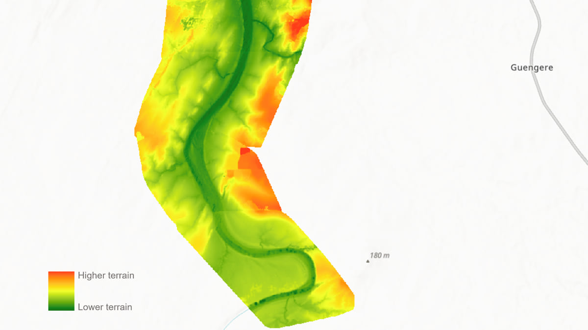
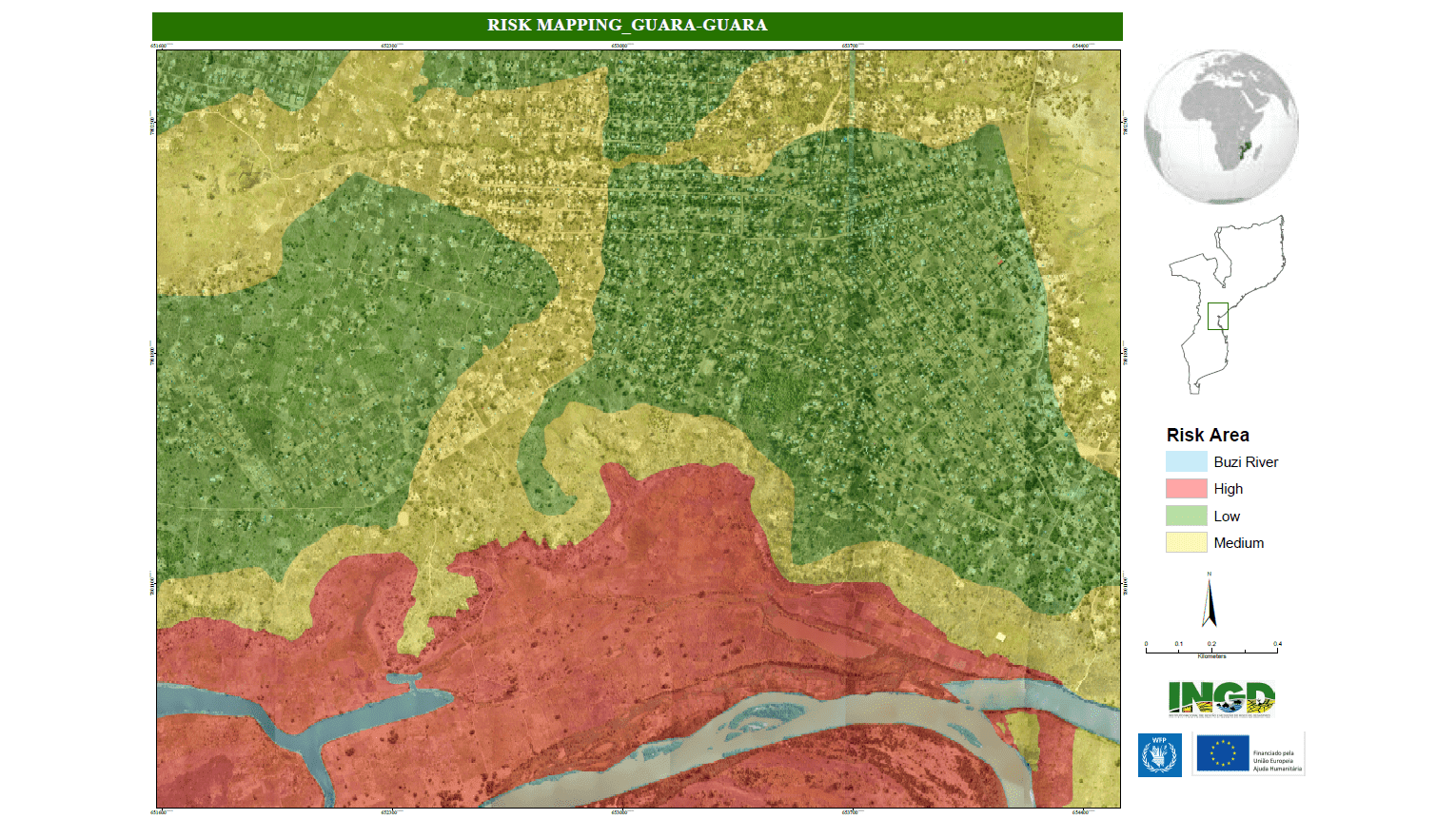
Beleza and his team have been working with the Italian Centro Internazionale in Monitoraggio Ambientale (CIMA Foundation) on hazard mapping. The CIMA Foundation has created a hydrological model for the Buzi River watershed using satellite imagery, and recently drones were flown to improve the accuracy of the model.
“We flew the drones over 850 square kilometers of the Buzi River, then we processed the data and created a very high-resolution digital terrain model (DTM),” Beleza said. “When the rainy season comes, local governments can simulate floods and determine when and where the water will arrive downstream. We’re sure that this will trigger community early actions and save lives.”
GIS is used to look at different layers of data to model different flooding scenarios, design evacuation routes, and identify the safest places for accommodation centers.
“We combine science, technology, and local knowledge to prepare the communities and local governments in a participatory manner,” Beleza said. “Every year we are seeing more frequent flooding. That has motivated us to go there and do something for these people.”
WFP is greatly encouraged with how people in Mozambique continues to grow their skills.
“They’ve got the expertise and drone equipment, so when the storms hit this year, they didn’t call us because they knew exactly what needed to be done,” McKay said.
For Beleza’s team in Mozambique, the drones and AI analysis have been a game changer.
“We’ve been saving lives,” Beleza said. “We are taking the opportunity to learn from the drone deployments we have made so far to improve the way we deal with this technology when it comes to disaster preparedness and response.”
Learn more about how GIS helps organizations deliver effective humanitarian assistance.