

It’s about delivering advanced knowledge to the user and the passenger, so they feel more in control of the experience going through the airport.
Director of Infrastructure Information Management at SFO
Josephine Pofsky
October 21, 2021
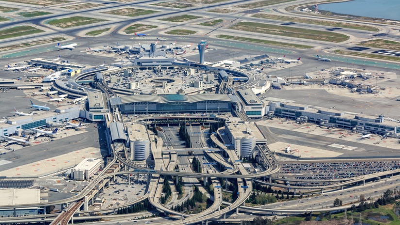
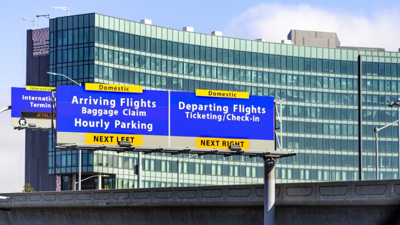
The dramatic decline of air travel during the pandemic gave many airports the opportunity to make progress on construction and renovation projects. At San Francisco International Airport (SFO) all 15 gates on the ‘A’ concourse of the international terminal were closed on April 1, 2020, when international carriers curtailed their routes due to COVID-19 travel restrictions.
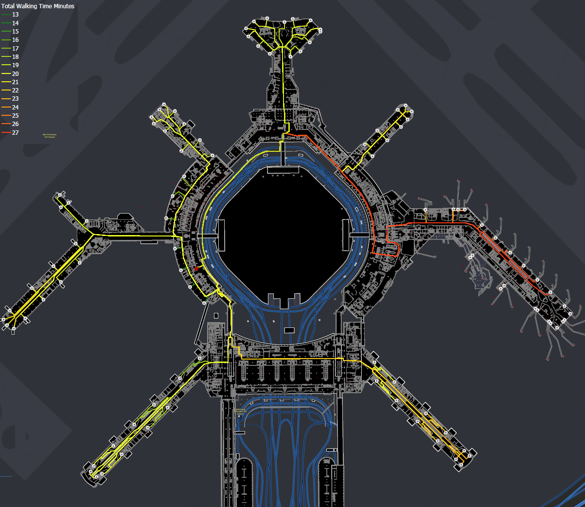
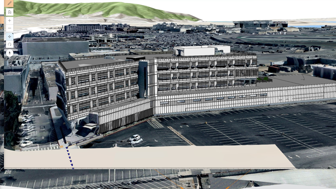
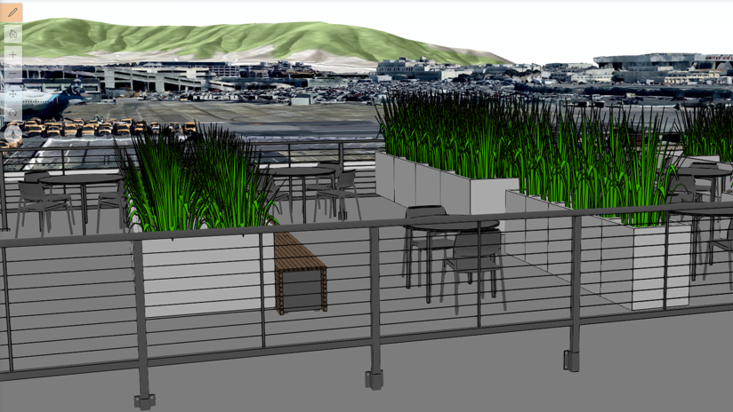
At SFO, improvements are guided by a dynamic spatial environment that combines the detailed building plans and data captured from its owner-driven building information modeling (BIM) processes with the landscape-scale understanding provided by a geographic information system (GIS).
“We use GIS as the window of entry to all of our infrastructure information,” said Josephine Pofsky, director of Infrastructure Information Management at SFO.
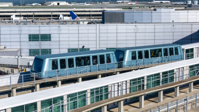
SFO began using GIS 15 years ago and implemented BIM five years ago to provide the foundation for its ambitious and transformative $7 billion-plus airport renovations. The vision to establish a centralized source of infrastructure management information through BIM and GIS provides a contextual awareness that guides SFO’s capital improvements, the largest such program in the US when it launched. Some of the work includes a new hotel, modernization of two terminal buildings, a new long-term parking garage, new office building, and the extension of the AirTrain system.
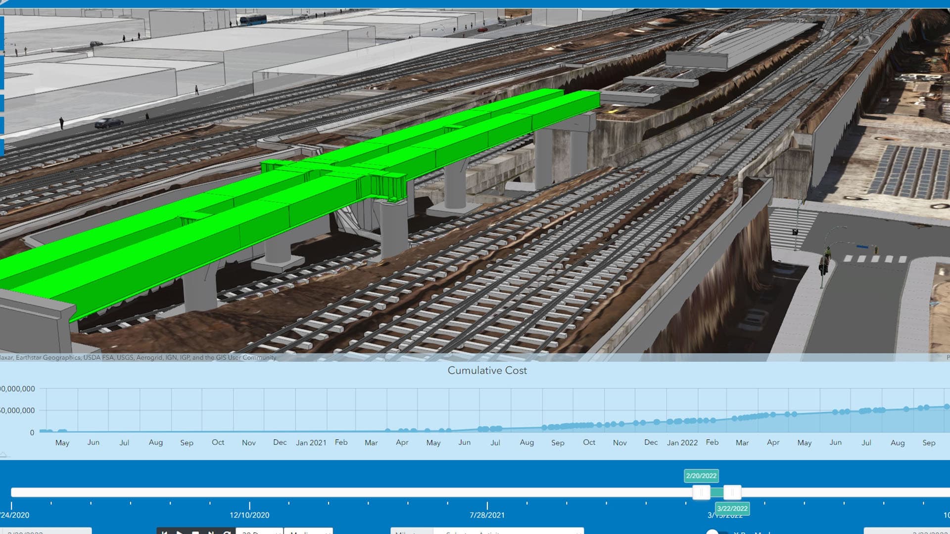
This animation of the demolition and reconstruction of terminal 1 at SFO shows the value of the dynamic twin to plan, design, and execute a complex construction project with the ability to go backward and forward through time. Getting the steps and sequence in the right order in the virtual environment ensures fewer surprises. The added efficiency of Virtual Design and Construction is helping SFO’s infrastructure projects become more streamlined to reduce costs and time to completion.
The Federal Aviation Administration (FAA) mandates that airports provide data in a GIS format to support the satellite-based approach procedures of its NextGen program, an 18-year modernization initiative that began in 2007. With the better maps and sensors of NextGen, the FAA can guide aircraft more precisely and free up airspace to allow for such things as drones and drone taxi services.
The FAA’s move to NextGen is what prompted SFO to adopt GIS technology. It was the first airport in the Western Pacific Region to receive a grant from the FAA to achieve compliance using GIS. While the FAA focuses on GIS use for detailed awareness of the horizontal infrastructure—runways, taxiways, pavements—SFO saw an additional opportunity to apply GIS to the interior to support facility management operations such as construction, maintenance, emergency response, and space planning.
“Data accuracy is important,” Pofsky said. “Our integrated world of BIM and GIS strives to provide that through a robust project engagement process from the very beginning of a project, from design collaboration all the way to the end. Virtual Design and Construction has really become the focal point of how we deliver exceptional projects.”
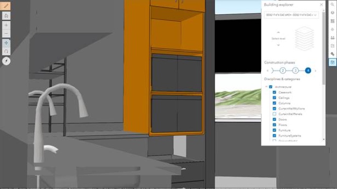
For interior maintenance, the 3D GIS campus contains a phenomenal level of detail, such as the manufacturer and model number for furniture, including the fabric, color, and when it was installed.
The BIM models consumed by GIS also become the means to guide workers to each task and to integrate with other systems.
Facility personnel have commented that the integration helps them proactively plan their day. For instance, when it’s time for HVAC filter replacements, they can query how many are needed in the terminal, ensure there is sufficient stock, and decide how to transport replacements. “They can even see their closest entry point and if they need to bring a ladder,” Pofsky added.
The term digital twin is being adopted and defined differently by many industries.
“We deliberated about it—is it a fraternal twin, an identical twin or a distant cousin,” Pofsky said.
At SFO, perhaps the best description is a dynamic twin: the continuous alignment of the virtual representation with the ever-changing real-world environment. The goal is not to preserve each as-built model captured right after construction, but to transition it into an as-managed model, where it can continue to serve stakeholders. “It’s up to us as the owner to keep it alive throughout the life of the infrastructure,” she added.

Because so many people rely on spatial intelligence for so many purposes, there’s a vested interest to keep the source data within GIS up-to-date, which includes design data within the BIM model as well.
The area of leased space is a critical one to meet the needs of travelers and to maximize airport revenue. The space management team uses the tool to find the best location to add a new kiosk or a specific retailer. That team recently adopted GIS for its ability to filter and query information to get answers and recommendations.
Similar to cities, airports have a variety of service-oriented departments, public safety offices and 911 dispatch systems; SFO’s 911 network was recently updated and integrated with GIS to provide accurate and up-to-date information.
“With that integration into the 911 system, our first responders, including our communication dispatchers, are looking at the most up-to-date floor plan information and in 3D so they can do what Jack Bauer did in 24 and virtually walk through a space in 3D,” Pofsky said.
It’s about delivering advanced knowledge to the user and the passenger, so they feel more in control of the experience going through the airport.
When responders approach a door, the spatial viewer tells them whether it’s automated or secure. If they require egress through a turnstile, the viewer tells them if it requires a key or a badge. They can see the distance from an office and can compare incident locations to the locations of officers to see who is the closest.
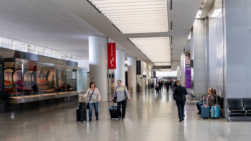
One of the upcoming initiatives is to enhance traveler experience by developing indoor navigation capabilities that utilize SFO’s dynamic spatial environment.
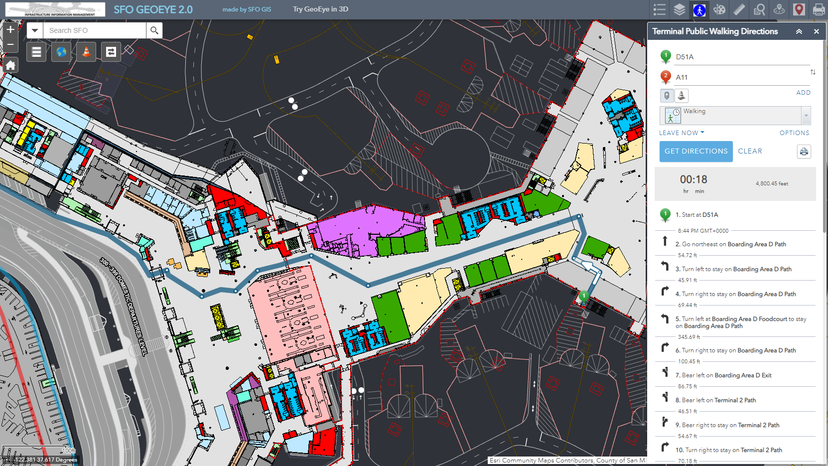
“Airports can be stressful in the eyes of many travelers ,” Pofsky said. “It’s about delivering advanced knowledge to the user and the passenger, so they feel more in control of the experience going through the airport.”
Achieving this multi-utility model involved crafting standards to stabilize the details. It also took a lot of work to establish the processes that keep the spatial campus current. A geo-ecosystem encompassing data from airspace to buildings, from airfield to underground utilities.
“I’m a process enthusiast,” Pofsky said. “It can be overwhelming, because we are changing the industry and organization’s mindset by leveraging the power of Virtual Design and Construction through integration of BIM and GIS. The capital program provided the opportunity—the train we needed to catch.”
As the world gets back to the air following the pandemic, the focus on an improved experience should help comfort travelers understandably anxious after years of curtailed movement.
Learn more about how location intelligence improves airport operations at the 2021 Ports and Airports Modernization Summit.

January 21, 2021 |
July 27, 2021 | Multiple Authors |

June 9, 2020 |