
November 20, 2017 |
Ryan Lanclos | Public Safety
On a given day, the Toronto Police Service (TPS) receives 70 mental health crisis calls. A dedicated Mobile Crisis Intervention Team made up of a nurse and police officer juggle the demands of the crisis—they make sure the person doesn’t threaten the safety of others or themselves and defuse the situation by connecting them to support services.
A new Community Asset Portal (CAP) application links the team to a list of services near their location. The app filters the data from Findhelp 211, a 24/7 helpline that catalogs services and providers, to make quick connections.
“The web application gives our officers access to relevant information in real time as they’re interacting with a member of the public,” said Ian Williams, manager of Business Intelligence and Analytics at TPS. “Those accessing the portal at home can also know the resources around them.”

Help in Hand
TPS worked with a group of students from Ryerson University to create the CAP application. The students designed the app and connected it to Findhelp 211 data, gaining kudos for its ease of use with a simple location-centered interface. In addition to mental health facilities, the app presents meal services, housing, education, employment, transportation, and financial services.
“We’re hoping that the referrals will lead to fewer calls to the police since the community can connect to resources to get proactive and not reactive assistance,” Williams said.
“This unique partnership has increased collaboration between police and support services,” said Sue Wilkinson, Executive Director, Findhelp/211 Central. “It has raised awareness of community supports and offered police 24/7 211 navigation support through the push of a button. Ultimately, this increases access to services for those in need, and makes the difficult job of community policing a bit easier.”
The CAP application is one of many solutions in a broader modernization push at TPS that focuses on community-based policing. Community revolves around places, so the solutions often include tailored map-based apps to guide officers in the field.
“We have a quick way to stand up map-based tools for unique business processes,” Williams said. “We’ve created tools for traffic safety, organized crime enforcement, neighborhood safety, and individual investigations.”
Modernizing Policing
The increased availability of data and more easy-to-use technology has fostered an apps-based approach to law enforcement that builds on the long tradition of intelligence-led policing. Connecting officers to applications in the field, backed by data and ongoing analysis in the office, leads to more informed approaches.
“Our focus is on standing up tools to present information they need to know about the location they’re in at that time,” Williams said. “We can present all of the incidents that happened recently or if they’re coming in after days off, they can know what happened in the past four or five days.”
The data-driven app-based approach addresses multiple levels of operations:
“We provide data and visualizations to show what’s occurring in a neighborhood,” Williams said. “That facilitates a discussion about what we’re going to do about it, and then we maintain that view to know whether it has been addressed and to what extent our approach was successful.”

Conduits for the Community
Toronto, one of the world’s most multicultural cities, includes 140 unique neighborhoods with populations that have very distinct needs. TPS assigns officers to work with neighborhoods for the long term, building partnerships with community leaders and citizens to strengthen safety beyond the resolution of individual incidents.
TPS conducts ongoing analysis of neighborhood demographics, languages spoken, cultural backgrounds, countries of origin, education levels, and other variables. Officials want to make certain they understand who lives there in order to appropriately guide officer engagement. They also conduct analysis by comparison, matching patterns of crime in neighborhoods with similar cultural makeup to see if there are trends that might impact other like areas of the city.
The map-based Public Safety Data Portal provides an open data conduit to details on crime and the work that officers are doing in any one geography. This allows citizens to drill in and see their neighborhood or intersection, for councilors to look at their ward, or members of parliament to look at their district. The data is regularly refreshed, often in real time, to provide the authoritative view of public safety information in the city.
By providing the information transparently, both members of the community and members of the Toronto Police Service share the same understanding of public safety challenges.
“The apps and mapping tools have helped us partner with other city departments and citizens within the city of Toronto,” Williams said. “Because we’re all responsible for the safety and well-being of the communities in Toronto.”
Learn more about how a geographic information system (GIS) is used for law enforcement and national security.
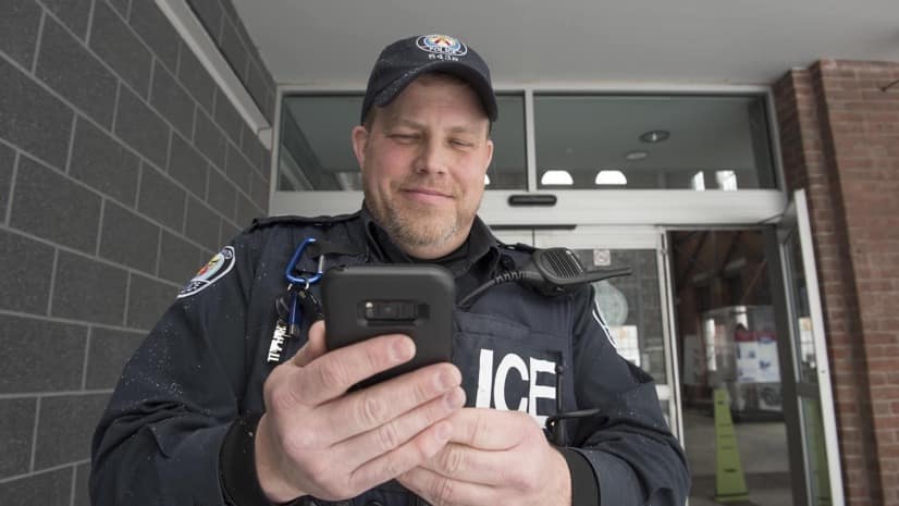
The top photo shows Police Constable Dave Smith from the 51st Division of the Toronto Police Service checking the apps on his phone before going on patrol. Photo courtesy of the Toronto Police Service.