June 4, 2019 |
Ben Conklin | Public Safety
Part 3 of 3 Detailing the US Navy’s Innovation Battle Lab
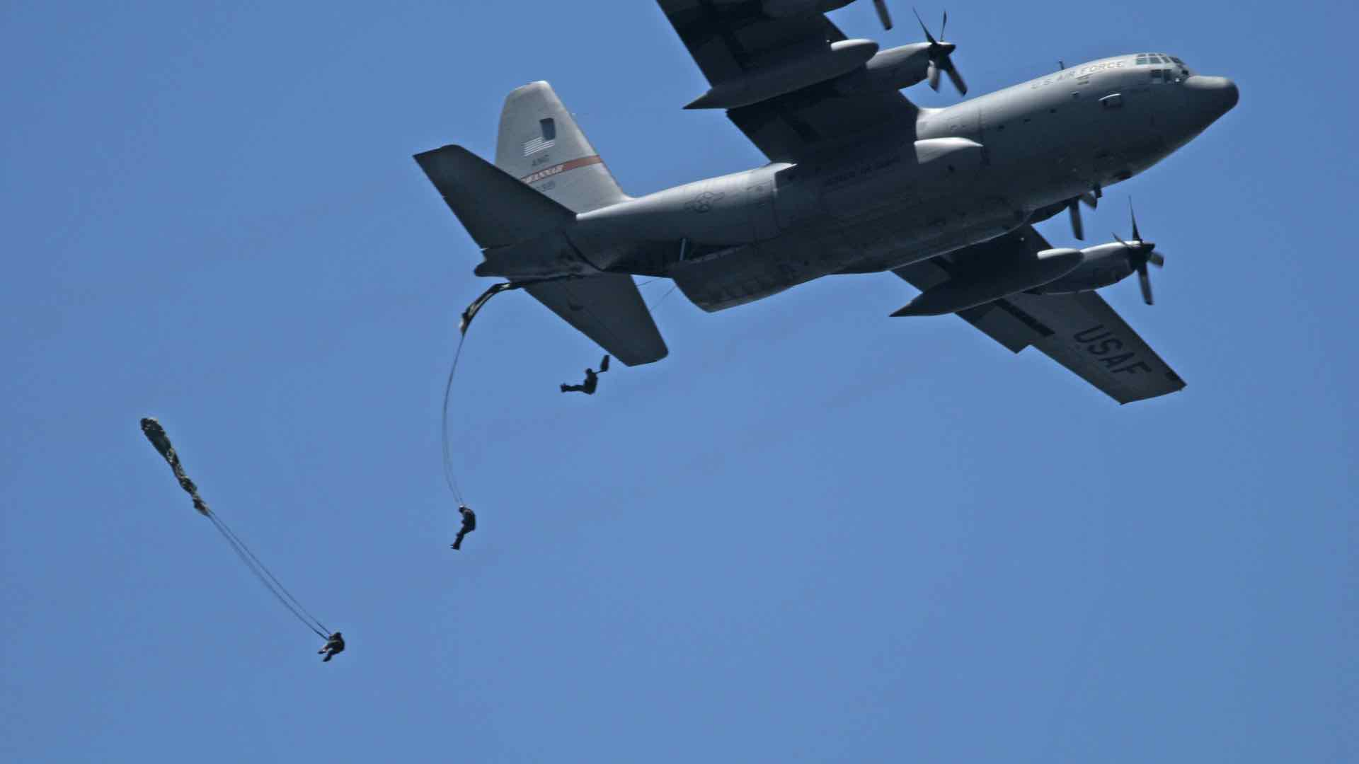
As the United States recently commemorated 100 years since the end of World War I, a number of stories surfaced. The First World War marked the first wide use of airplanes for scouting and reconnaissance. Before radio, intelligence units would communicate to aircraft by arranging white sheets on the ground in coded arrays or flashing signals with lamps using Morse code. Pilots would scrawl notes and roll them into tubes that trailed streamers, carefully dropping them near command posts. Not much information could be conveyed using this system, and pilots had a difficult job flying a plane while writing or looking over the side to make sense of the signals.
It’s hard to imagine this pre-digital communication in light of the wealth of information that today’s warfighter sends and receives. In fact, too much information is often the challenge. In response, one of the central goals of the US Navy’s Innovation Battle Lab is to reduce the cognitive load on soldiers by integrating information.
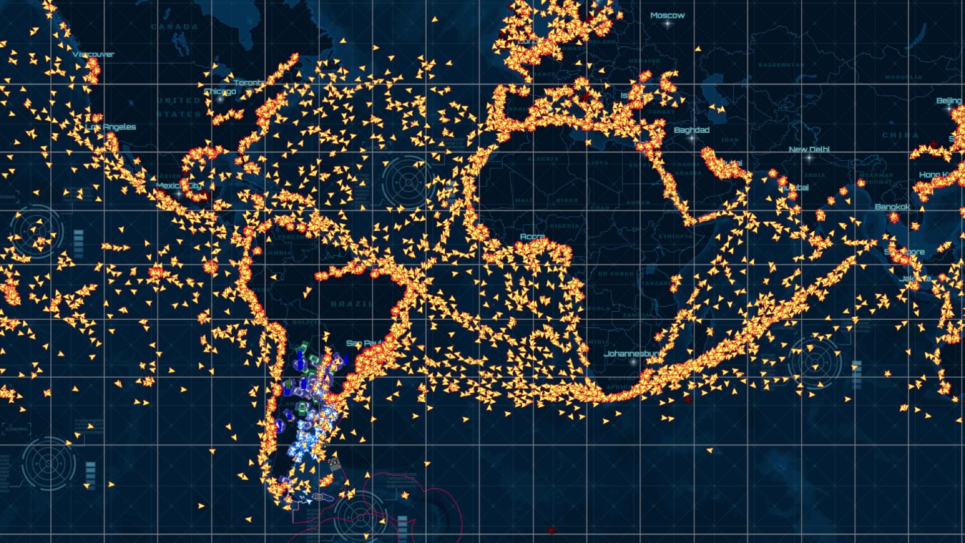
The impetus for the event came as more digital technologies were being applied to situational awareness, and command and control. Those in conflict zone operations centers had recently achieved the ability to watch troops in contact situations. But, their view was challenging—an array of monitors displaying seven or eight different systems that weren’t integrated.
“A lot of our work stems from getting away from the swivel chair effect,” said the lead interoperability engineer. “If you’ve got a bank of monitors showing different systems or camera feeds, you’ve got to constantly watch those monitors to understand what’s going on.”
Conveying Critical Information
Many event participants have recently returned from conflict zones. The fresh perspective and heightened awareness honed by war helps them evaluate whether the newest technologies could have reduced the chaos of combat.
When every second counts for life-and-death decisions, quick and clear communication is critical. The US military has developed many methodologies over the years to aid clearer communication, such as the 9 Line report that is used to communicate unexploded ordnance, medical evacuations, and other critical information.
The 9 Line goes all the way back to radio reporting. Line 1 communicates the location, line 2 reports how the reporter can be contacted, line 3 shares the details about the scope (such as number of patients), and onward until all critical details have been conveyed. Orienting both the reporter and the receiver to the information required by each of the 9 lines helps both parties understand what’s being said and what’s being received.
During the Innovation Battle Lab, handheld apps used the 9 Line format to report threat inspection details on a survey form. By sharing information via a form-centric app, users were able to speed up the transmission of inspection details for chemical, biological, radiological, or explosive hazards. The details were sent directly to a dashboard and quickly aggregated on a map view.
“That’s a pretty revolutionary thing,” said Dave Shultz, business development executive at Tactical Electronics speaking from his personal experiences in Iraq and Afghanistan.
Gathering Up-to-Date Details
Making quick, prudent tactical decisions requires an improved understanding of what’s happening now. During the Innovation Battle Lab, teams used two real-time event reporting servers to map and analyze sensor feeds. One server was used to ingest more than one million records of sensor data. The other was used to conduct point-to-point integration with the technologies of other vendors.
The types of sensor feeds varied, with information displayed as aggregated data or as a direct feed from the sensor.
“We imported feeds from cameras at route intersections,” said Jim Bennett, an Esri expert on naval special operations.“When teams moved into the area around a camera, an operations dashboard view could automatically flip to the nearest camera at that moment to show what else was around there.”
This level of real-time information delivery and analysis helps optimize limited resources and capabilities to support the mission at the moment.
Providing Immersive Experiences
Low-altitude flight drones and imaging cameras are making it easier for the military to collect 3D details of what’s happening on the ground. Previously, teams used drones to capture imagery and elevation data for the entire area prior to an event. They used common data formats to import this information into other systems, including the gaming platform known as Unity.
“We shared the drone outputs with a virtual reality company who were working to create immersive visualizations using the HTC Vive VR headset with controls,” Bennett said. “Learning the terrain in advance of a mission or viewing what a soldier is seeing in the operations center provides an important edge for improving combat outcomes.”
Throughout the event, participants used the common operational picture provided by GIS to synchronize perspectives between people in the operations center and the field. While GIS proved beneficial, there was also an ongoing reminder that technology is just an enabler—that it’s about the human applications of technologies, not just about the technology itself.
“We really want to help promote the connectivity and bring pockets of innovation together,” the lead interoperability engineersaid. “I believe we’ve helped accelerate solutions to the warfighter, and that’s really what this event is set up to do.”
Read part 1 about preparations for the exercise, and part 2 about integrating technologies into a common operational picture. Learn how GIS is being applied to national security.
Photo courtesy of US Navy.