May 29, 2025 |
Katie Olson | Public Safety
November 13, 2025
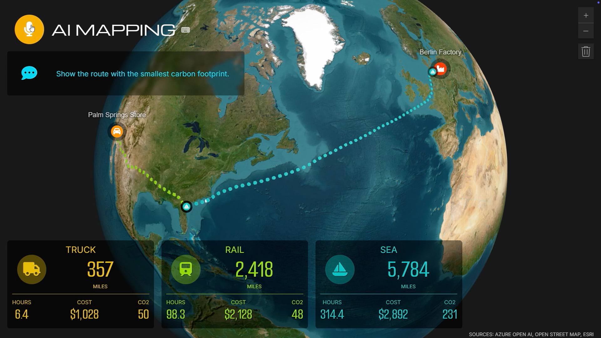
PG&E has reduced its wildfire risk by 90% across California by mapping assets with GIS and automating inspections with drones and AI. It’s part of the utility’s grid modernization, mapping everything with precision to support power demands now and into the future. This new approach helps keep costs and emissions low while meeting increased power demands from electric vehicles and data centers.
Explore how GIS helps energy utilities rethink infrastructure and protect communities.