displaying 254 results
This tutorial combines 2D and 3D data in an ArcGIS Pro Local Scene to visualize the topography, imagery, and cultural features of a region.

The third in a series of tutorials on improving the text elements of your maps in ArcGIS Pro.

A tutorial showing the workflow used to support a grant request by a district in Pierce County, Washington.
On November 15 and 16, 2017, public safety agencies in the United States and Canada and supporting government and industry entities plan to cond…

New books from Esri include GIS Tutorial for ArcGIS Pro 2.8 and GIS for Science, Volume 3: Maps for Saving the Planet.
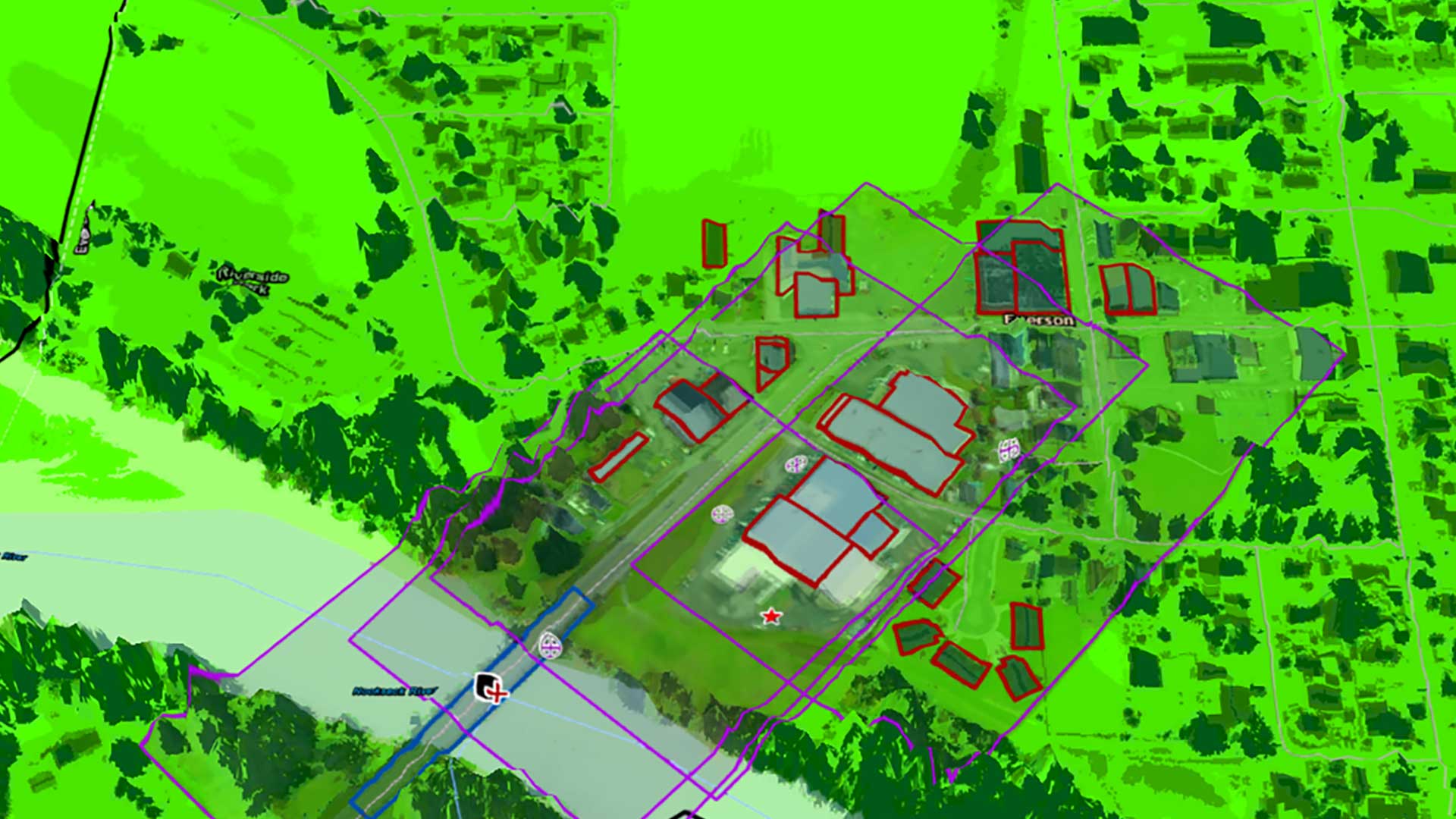
This tutorial walks you through the process of generating a precision reference map using data from a statewide portal.
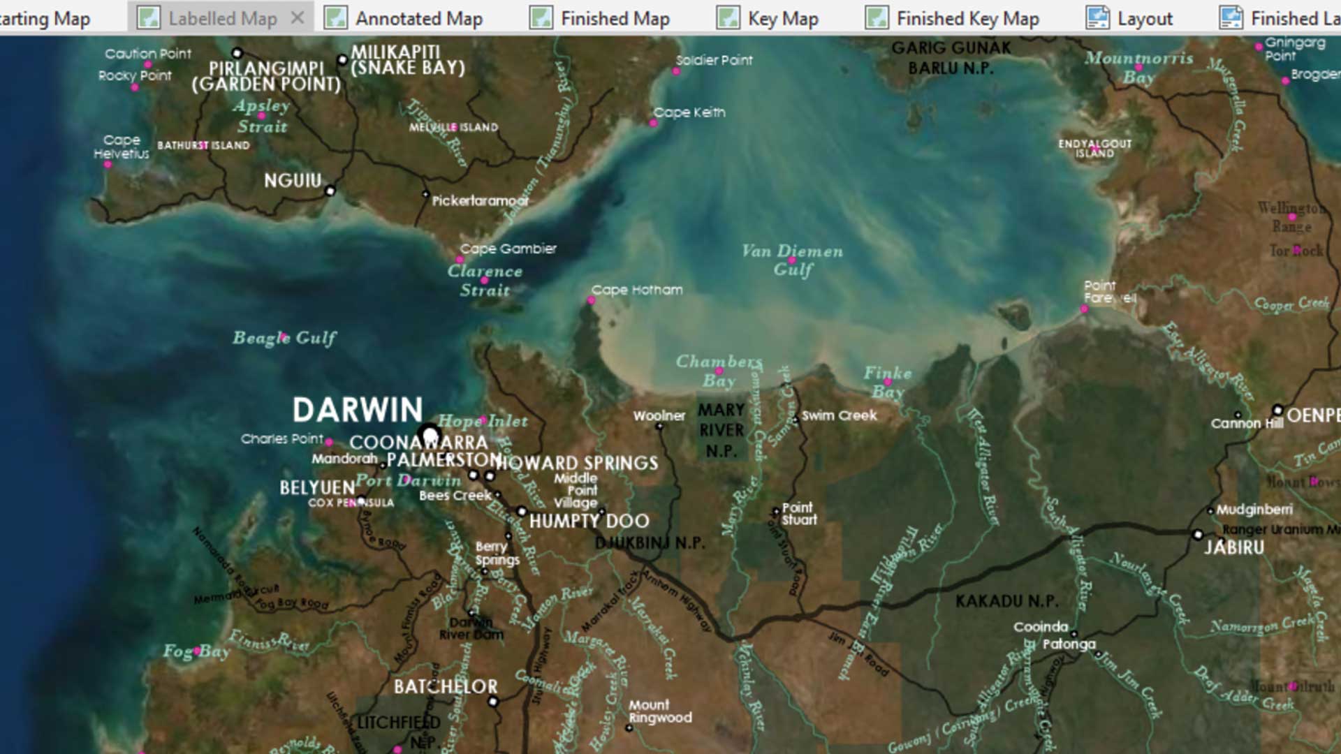
Take labeling in ArcGIS Pro to the next level.

Recreate the planning and presentation maps used by Graham Fire & Rescue to obtain a $3.5 million grant.
This tutorial introduces georeferencing techniques available in ArcGIS Pro using imagery collected by drones during a multi-day training exercis…
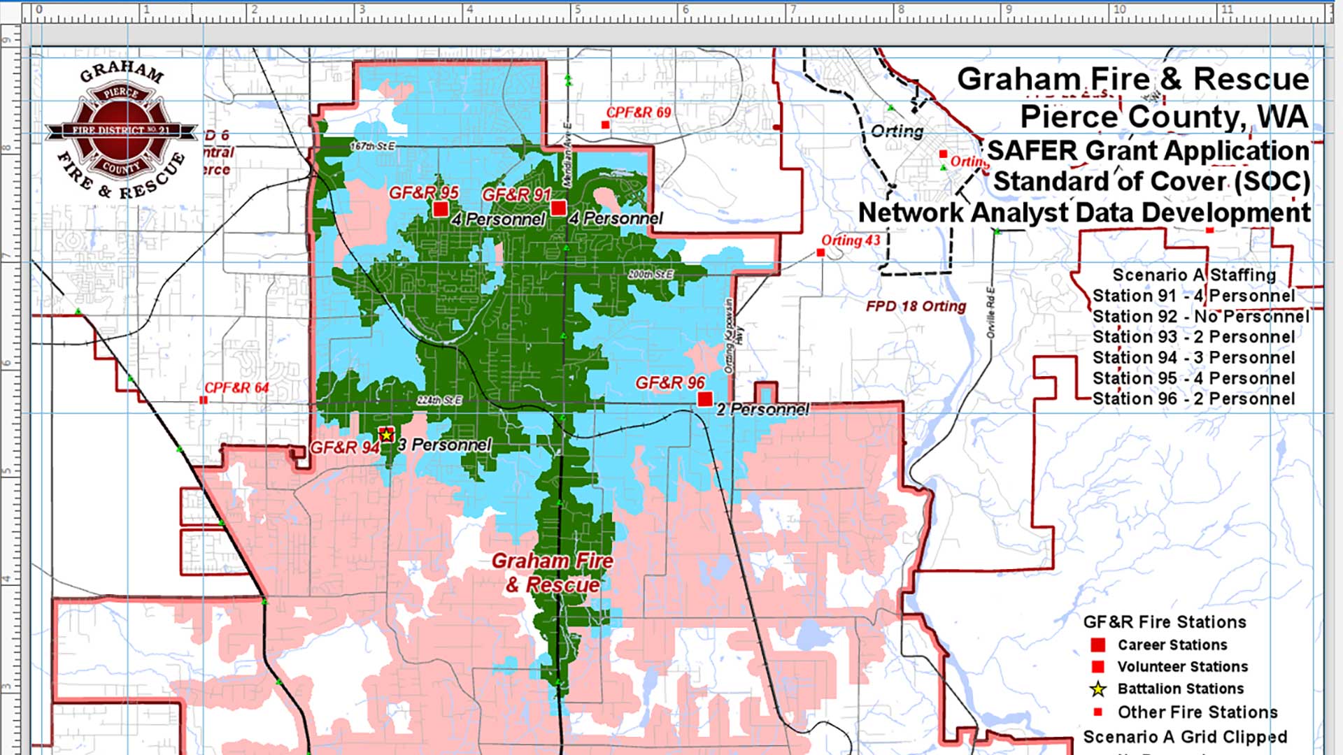
The Mike Price tutorial walks you through analyzing the effective response force for a fire district given different staffing scenarios.