displaying 956 results

Real-time awareness helped Bergen deliver a well-coordinated nine-day bicycle race, leading to a new public safety approach for all of Norway.

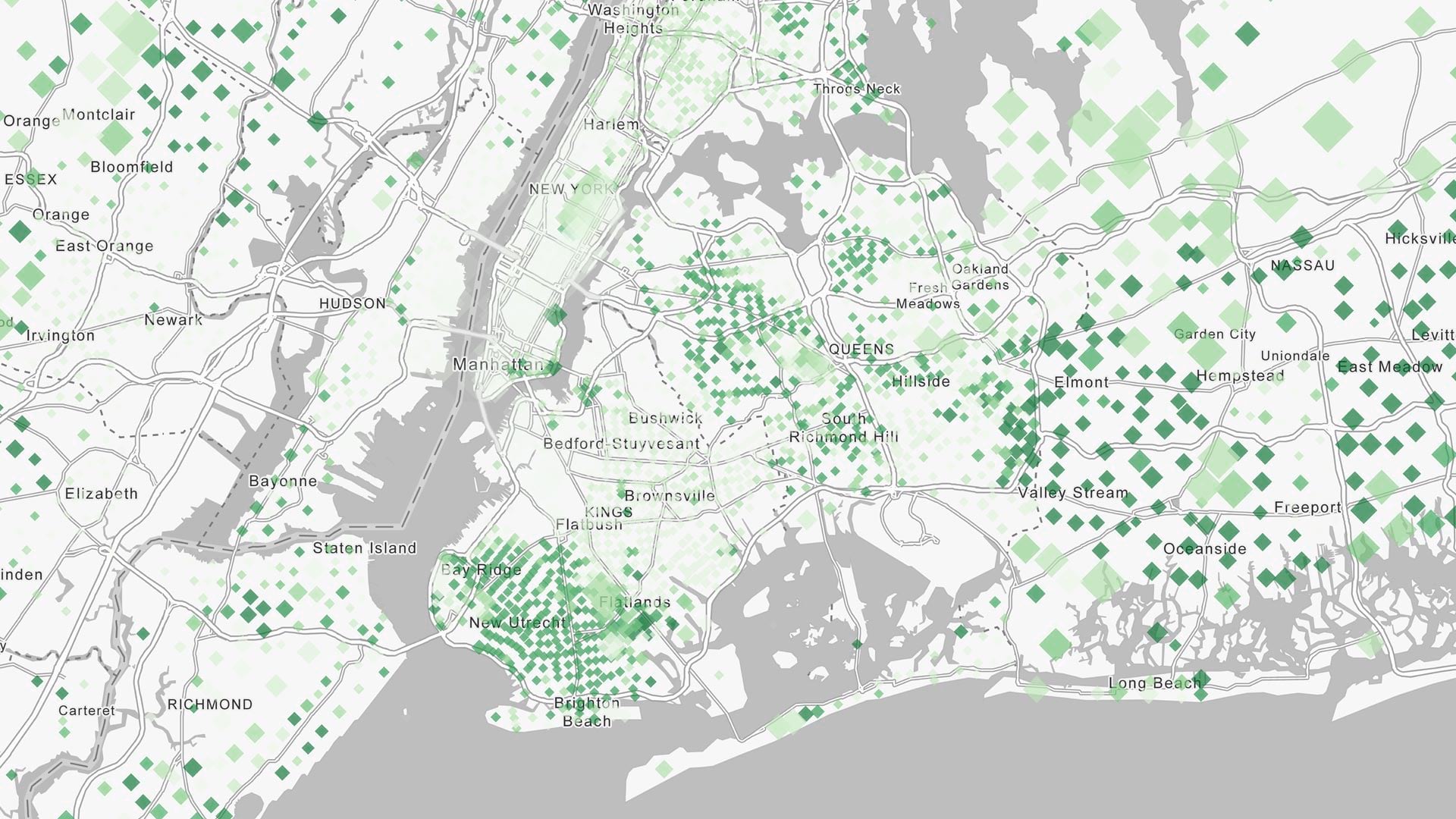
In Norfolk, Virginia, the city needed a way to alert the public about flooded roads. That’s where FloodMapp comes in.

Combining the ArcGIS platform with industry expertise, Esri partners are contriving innovative ideas that solve complex problems.
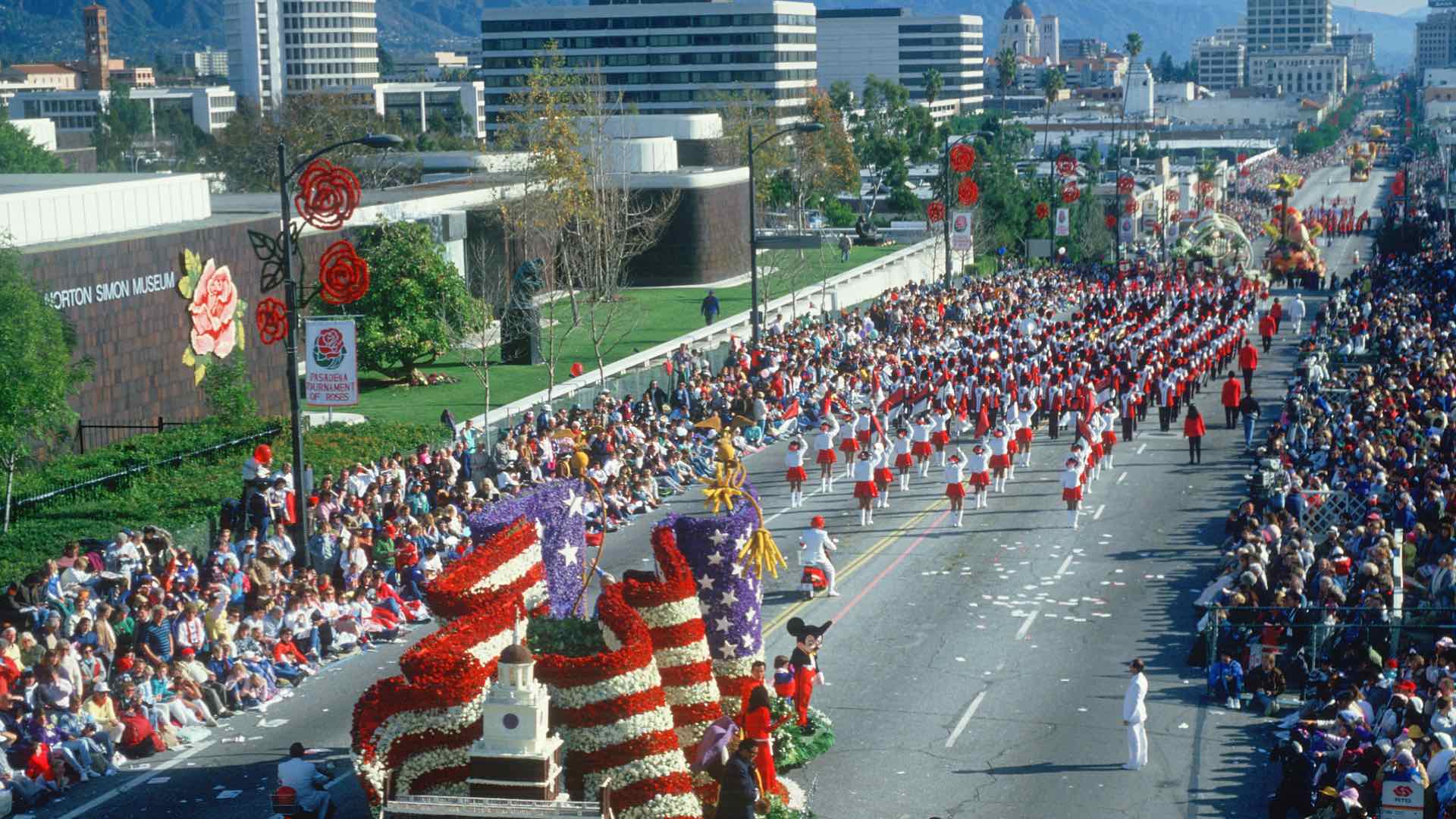
A real time understanding of weather helped the Pasadena Fire Department manage public safety at the 2019 Rose Parade.
Recent updates focused on real-time and big data analysis, working with imagery, additional options for designing urban plans, and more.

The all-in-one app enables firefighters to easily find asset information, collect and edit data on the go, and report real-time locations.
Q&A with Jeff Dulin, International Association of Fire Chiefs (IAFC).

Esri’s new Real-Time GIS can handle any organization’s big data needs and keep pace with the Internet of Things.

Esri is refocusing the conversation around smart from vague promises to a specific geospatial strategy that can deliver the results.
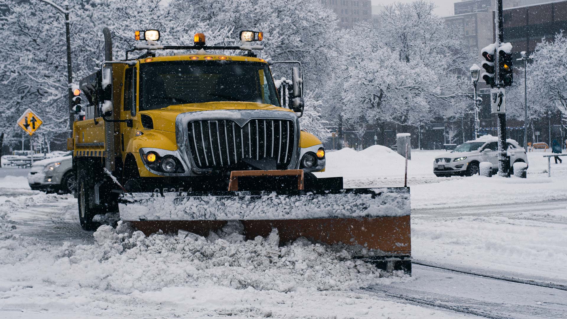
Real-time snowplow monitoring proves successful, opening doors to implement the cloud-based product for additional public works projects.