displaying 1006 results
New businesses that join the Esri Startup Program receive online services, software, content, training, and support so they can incorporate mapp…
Recent updates focused on real-time and big data analysis, working with imagery, additional options for designing urban plans, and more.
Esri Emerging Business Partner GroundVu Gives Texas County a True, 360-Degree View of the Hurricane Harvey Floods
The US EPA is moving from paper maps and aerial photography prints to GIS and imagery.
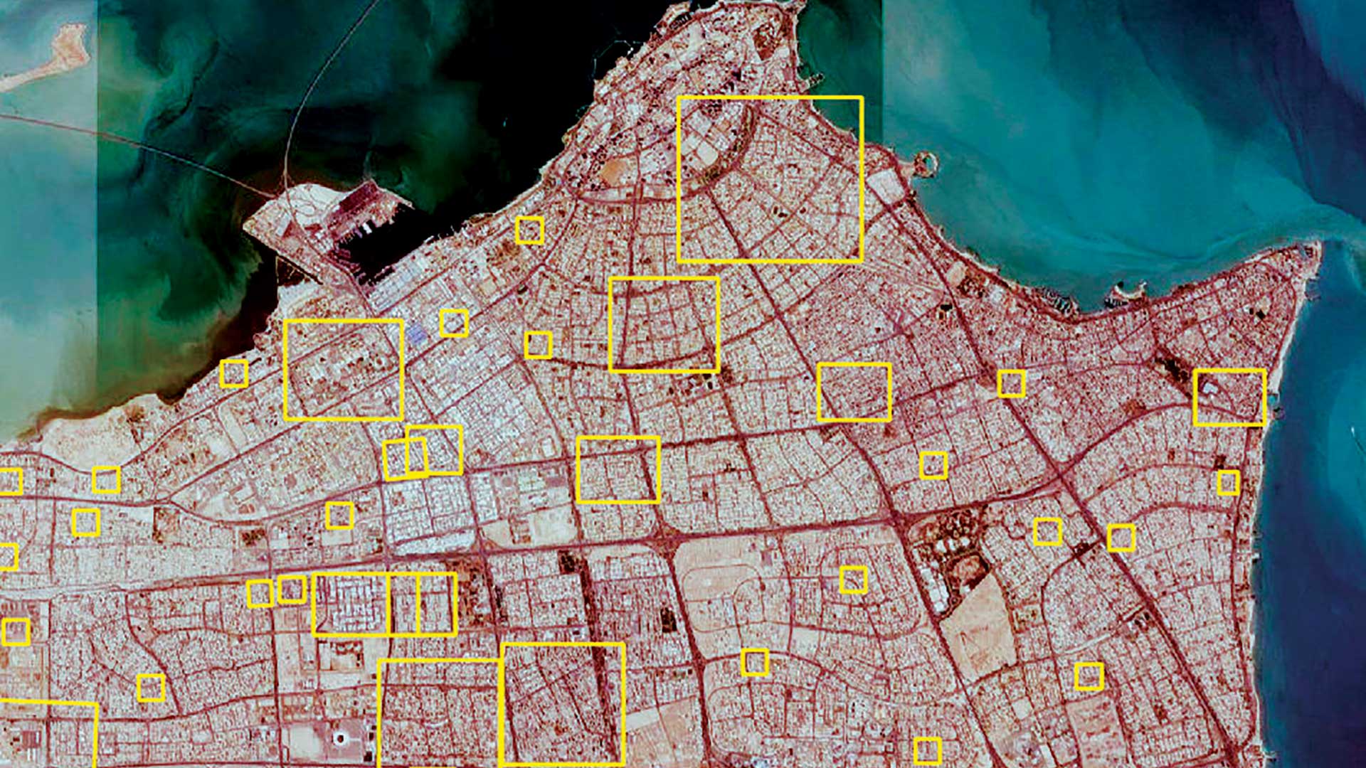
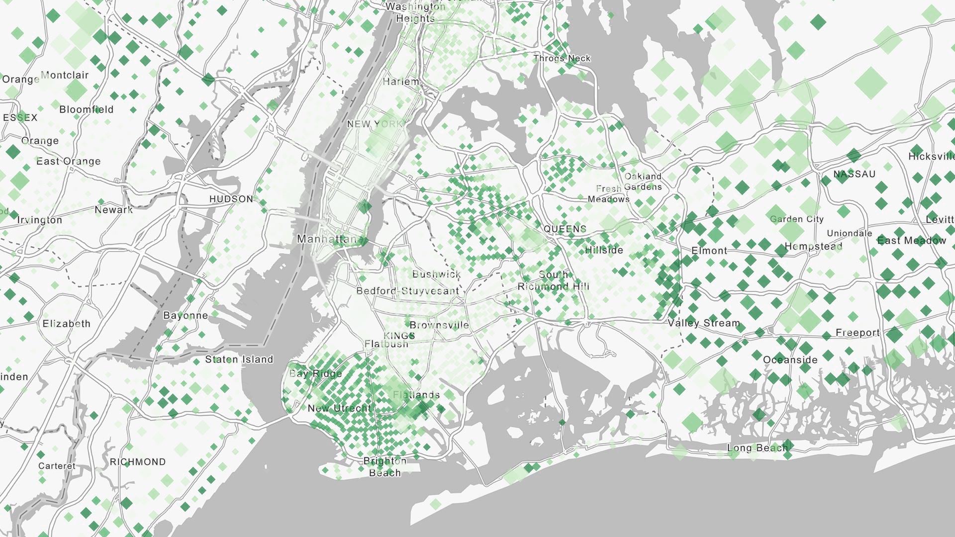
Kuwait, an early adopter of GIS, is now blazing trails in machine learning.

Geospatial Data Act passed; New System Tracks Vessels in Real Time; Wayback imagery accesses 80 versions of world imagery.
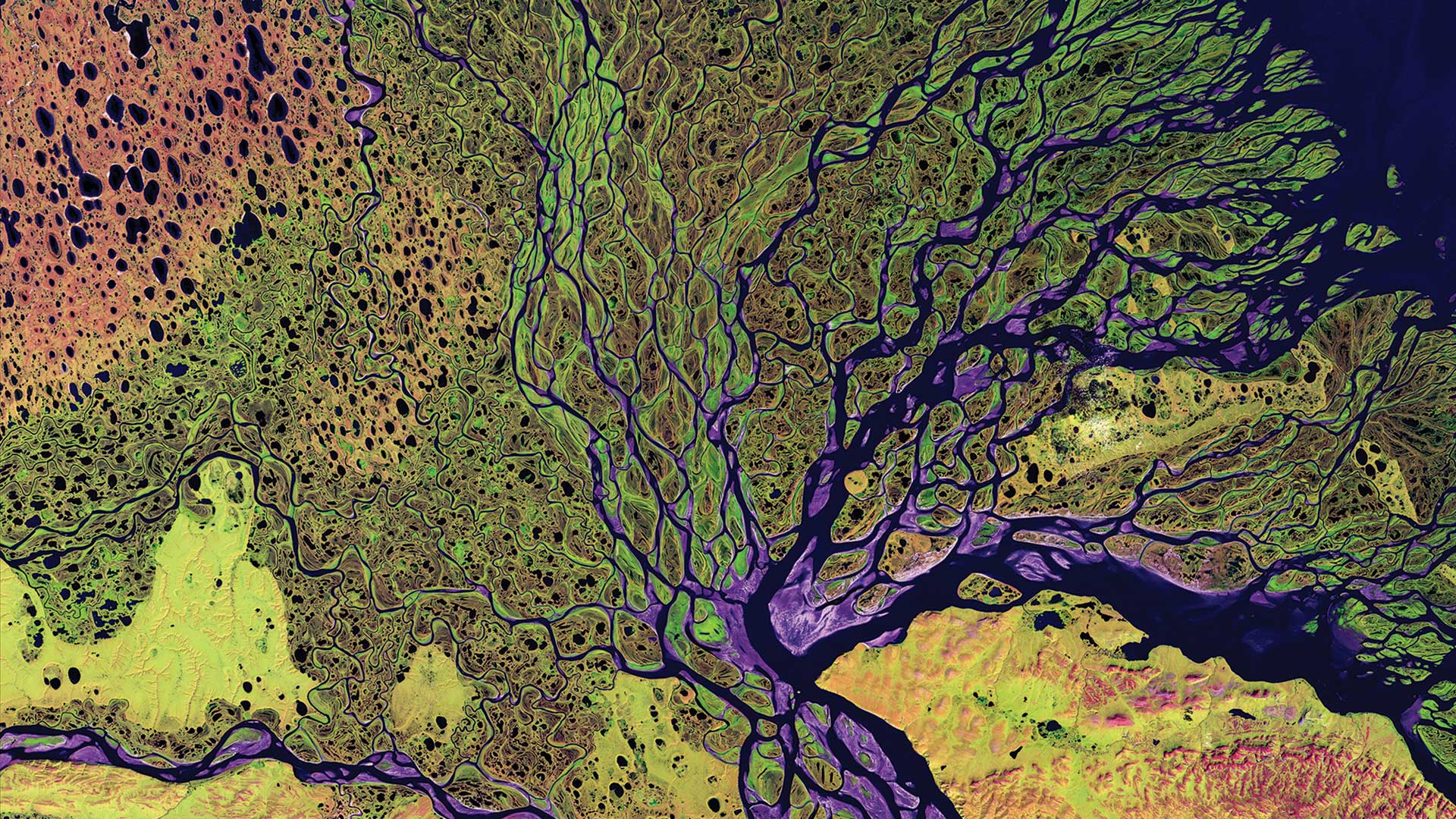
A special relationship exists between remote sensing and GIS.
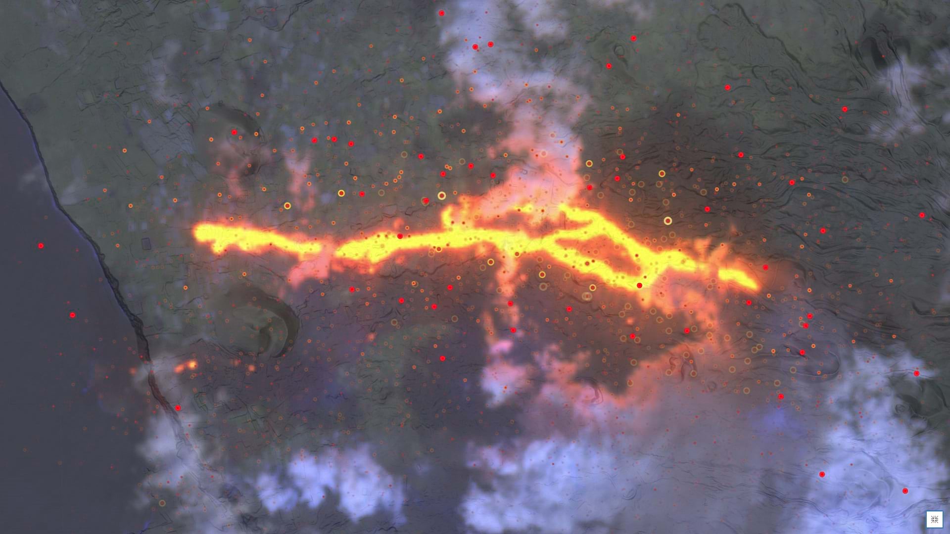
Learn how to make a volcanic activity map in a minute using ArcGIS Online and ArcGIS Living Atlas of the World.
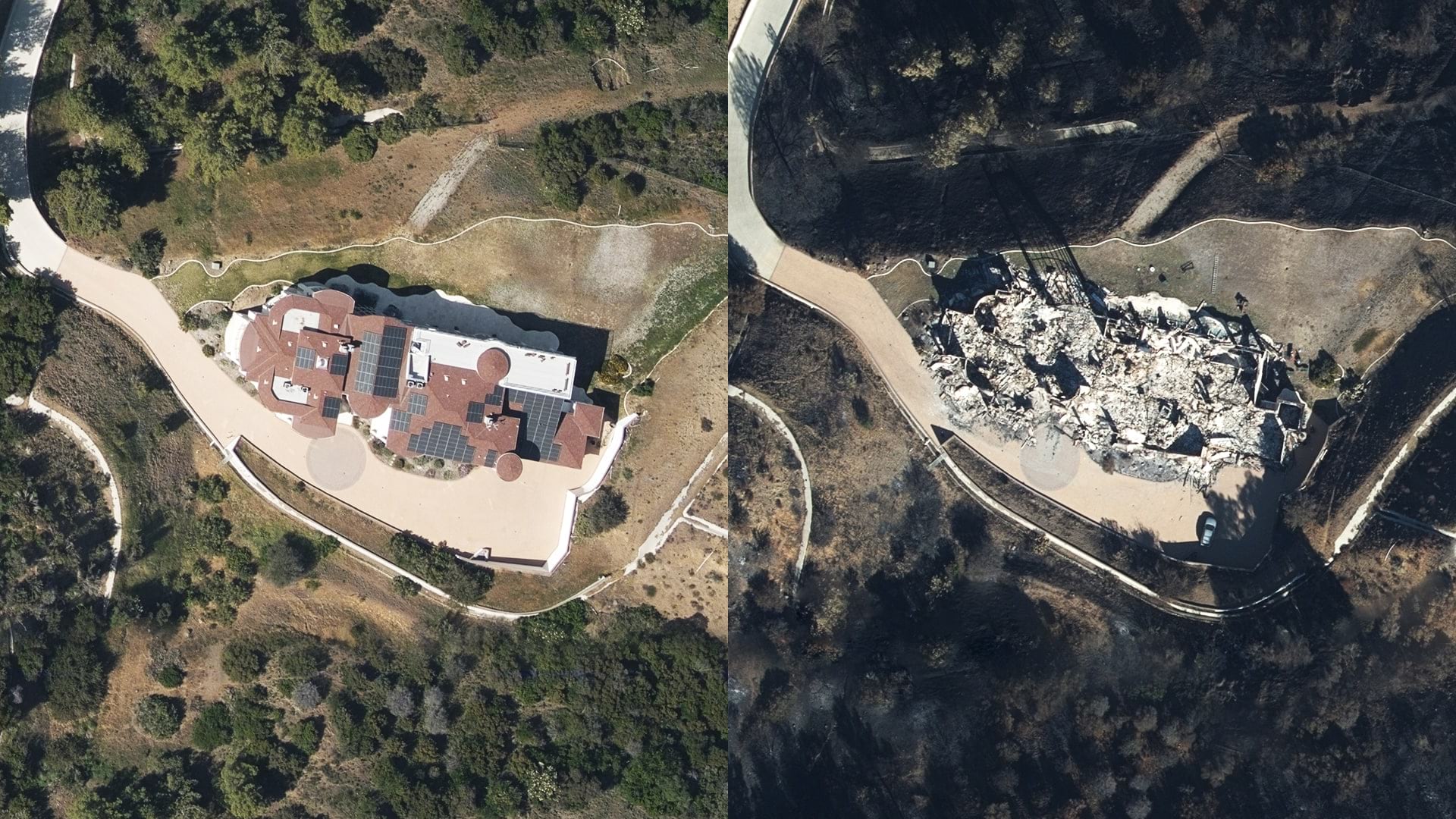
New technology on the ground and in the sky is helping insurers see what they haven’t seen before and assist clients more quickly.

Satellite imagery firms are applying machine learning to imagery analysis to measure natural resource inventories and predict commodity trading.

Kuwait has been on the cutting edge of geospatial technology for decades, and now it is blazing trails in machine learning.

The USSOUTHCOM uses deep learning capabilities to monitor ship movements.