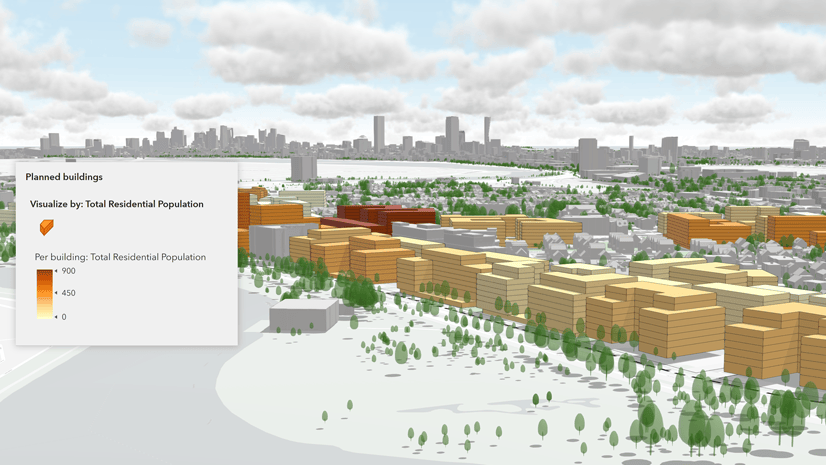
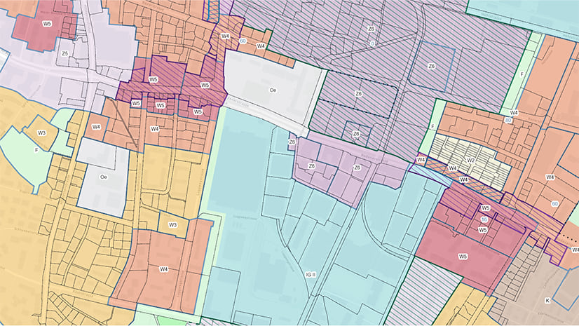
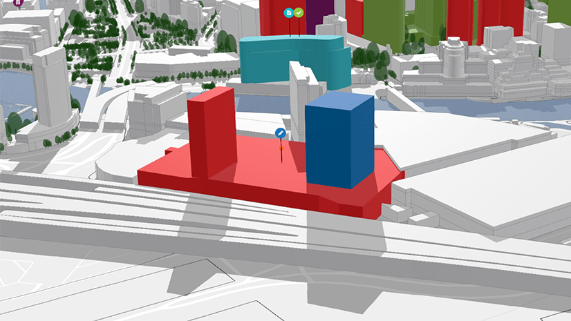
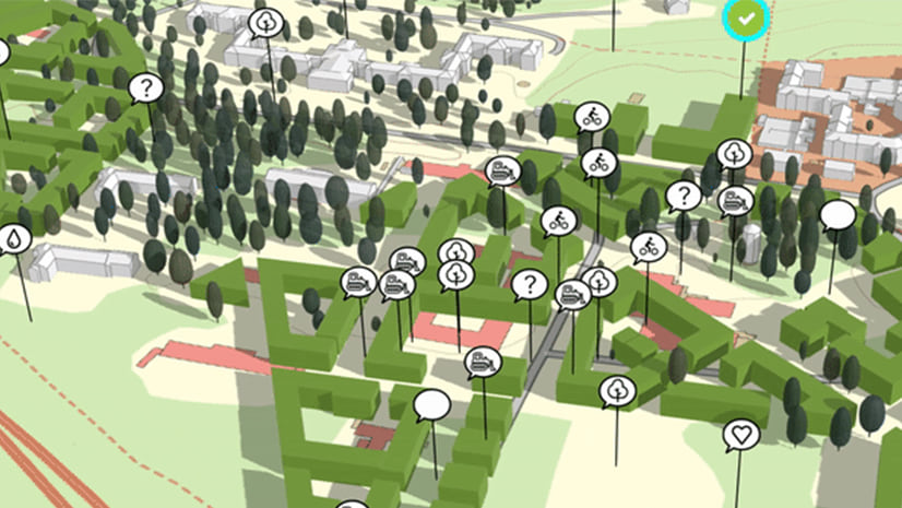
Lisa Staehli
Connect:

Lisa studied Geomatics Engineering at ETH Zurich with an emphasis on GIS, Cartography and Urban Planning. In 2016, she started as an intern at the Esri R&D Center Zurich where she developed C-Through, a prototype for interactive 3D urban planning analysis based on the ArcGIS API for JavaScript. Currently, Lisa is part of the ArcGIS Urban team especially driving efforts around urban indicators.

Posts by this author
What’s new in ArcGIS Urban (February 2023)

A new version of ArcGIS Urban released in February 2023. The big new feature is an improved way to create web scenes from plan scenarios.

Continue Reading

What’s new in ArcGIS Urban (June 2022)

A new version of ArcGIS Urban released in June 2022. New features include undo/redo, city web scene creation, and improved zoning map styling.

Continue Reading

Visualizing Uncertainty in 3D for Urban Planning

A call for best practices on visualizing uncertainty in 3D for urban planning.

Continue Reading

Improved sharing workflow in ArcGIS Urban (February 2022)

We simplified the workflow to make plans and projects public in the February 2022 release of ArcGIS Urban by using the sharing capabilities.

Continue Reading

What’s new in ArcGIS Urban (June 2020)

A new version of ArcGIS Urban released in June 2020. New features include land use plans, project editing, public feedback and more.

Continue Reading

What’s new in ArcGIS Urban (December 2019)

ArcGIS Urban 1.1 is here: try it out with the new sandbox cities and read about what's new (street view, exporting and more).

Continue Reading

Spatio-temporal Urban Design in Geneva with ArcGIS Urban

Learn about how the urban planners of the Canton of Geneva, Switzerland have helped to improve ArcGIS Urban.

Continue Reading

Turbulence Ahead – Using ArcGIS API for JavaScript to Design and Evaluate a 3D Web-Based Aviation Weather Visualizer

Prototype to display weather forecast data in a 3D Web Application using the ArcGIS API for JavaScript.

Continue Reading

C-Through – A Prototype for Interactive 3D Urban Planning Analysis on the Web

An interactive 3D web-based application based on the ArcGIS JavaScript API aiming to support decision making in urban planning.

Continue Reading