ArcGIS Indoors visualizes indoor locations such as a building’s floors, rooms, assets and occupants on a digital map. This gives stakeholders insight into their workplace and its activities to enable coordinated operations and collaboration. Employers can leverage location data to make informed decisions on asset and space utilization to reduce costs and streamline operations.
At the end of June, ArcGIS Indoors announced its launch of several exciting new capabilities and its extension to the online space. Learn about all the details in this blogpost.
ArcGIS Indoors Is Now Online
With the latest release of ArcGIS Online, ArcGIS Indoors is now also available as a software as a service (SaaS) offering in ArcGIS Online. This comes as an alternative to the on-premises deployment of ArcGIS Indoors with ArcGIS Enterprise.
By hosting ArcGIS Indoors in the ArcGIS Online “cloud”, users can now get easier access to all the capabilities and benefits that indoor mapping, space planning, an occupant/visitor experience, and location tracking software brings to organizations wishing to better leverage/manage their buildings and provide an improved workplace experience. Eliminating the step of setting up your own on-site server infrastructure reduces cost and effort to get started. You can now easily establish indoor GIS for your organization by purchasing ArcGIS Indoors as a SaaS via ArcGIS Online.
Indoor Space Planning and Management
The latest release introduces Space Planner, a new app template that supports space allocation, office assignment, and office hotelling. Indoor spaces are a major asset of any organization and space leases make up a significant part of operational costs for organizations. Therefore, it is vital to manage space at maximum efficiency. ArcGIS Indoors provides the tools to optimize space utilization.
Space Allocation
How is the space at my organization allocated and could it be optimized, both to save costs and enhance productivity? Should I consolidate or expand the office space? These are some of the questions organizations must continuously ask themselves to stay ahead of the game. Space Planner tackles this challenge. It is designed to help space planners match occupants up to spaces with an easy to use mapping interface.
With ArcGIS Indoors, spaces within a building can be associated with a purpose, e.g. as collaboration spaces, office hotels, meeting rooms, etc. If the current office plan is not ideal, space planners can repurpose rooms and spaces. For instance, a former personal office booth can be turned into an office hotel instead. In this scenario, the space will then be used more flexibly than before, supporting more staff and allowing them to book offices for use in proximity to initiatives they are currently working on.

Space Planner supports what-if scenario planning by allowing you to make modifications in a new plan that is a “copy” of the original, without affecting the current operational plan. When you are sure you want to operationally execute all the changes, the new plan can be merged with the initial one and this information is automatically published for use by the rest of the organization in Indoors Viewer and Indoors Mobile.
Space and Office Assignment
To ensure all teams and employees have access to collaboration areas, amenities and equipment to meet organizational goals in their day-to-day work, they can be assigned to specific buildings and the spaces within them. Organizations may choose to reduce their space holdings to reduce lease costs and that is where the Space Planner can be a great help to consolidate unused space and maximize the use of available space.
In Space Planner, you can filter by buildings and floor levels to get the visual representation of the space you want to assign people to in a seamless multi-building, multi-site map. Find the employee you would like to assign to the space in a list and simply drag and drop them onto the space on the map. It is also possible to batch-assign a complete team to spaces.

Workspace Reservation
With the new ArcGIS Indoors release, users can book workspaces, including office hotels, conference rooms and other office and collaboration spaces, effortlessly through an integration with Office365.
Office Hotelling
Office hoteling is the method of reserving office space in an office instead of assigning employees a regular workspace. This is very useful for staff that work from home and need a place to work in the office when they are on site or for staff that frequently travel.
ArcGIS Indoors supports office hoteling and allows them to book an office hotel for themselves prior to their visit. Indoors allows users to choose from hotels representing their department and criteria, e.g. “office with window”, to fit their requirements. After selecting a hotel from the list that will be generated, the location will be displayed on the map.
Once the employee is on site, they can use the indoor wayfinding functionality to effortlessly navigate to their hotel.
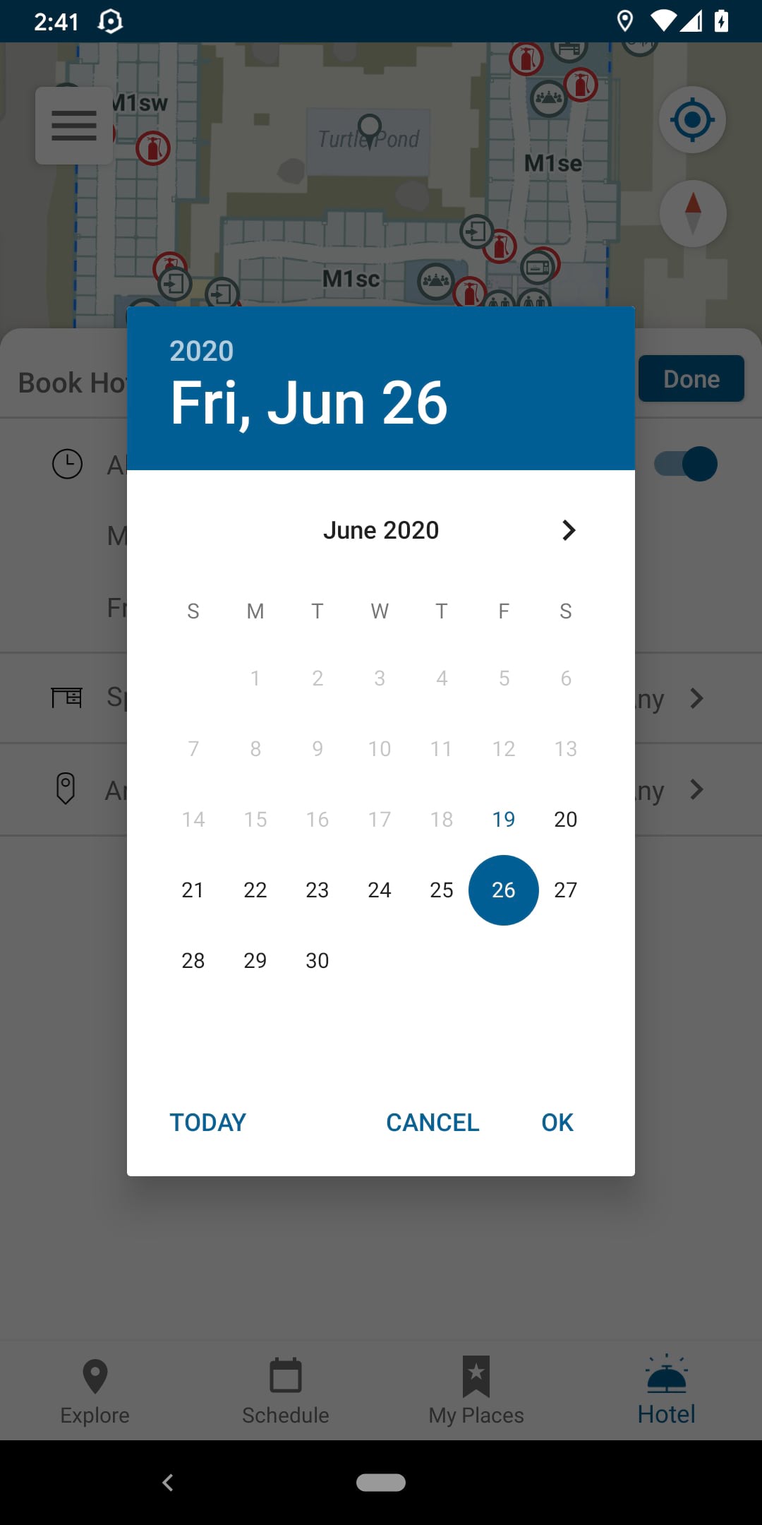
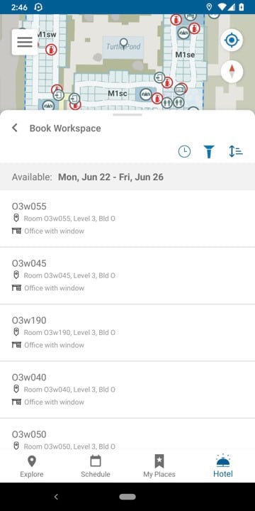
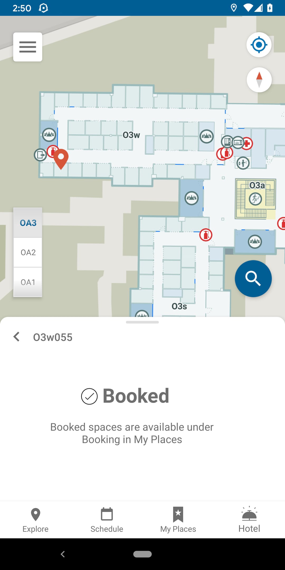
Employees can easily reserve a temporary office hotel that fits their requirements via the app.
Conference Room Booking
ArcGIS Indoors supports booking of conference rooms and collaboration spaces in a map centric mobile experience via an Office365 integration. Users can book available conference rooms near them or near the areas they will be. Scheduling meetings or making changes to them will automatically synchronize with your Outlook calendar and vice versa. At the time of the meeting, attendees can navigate to the right conference room using the wayfinding functionality.
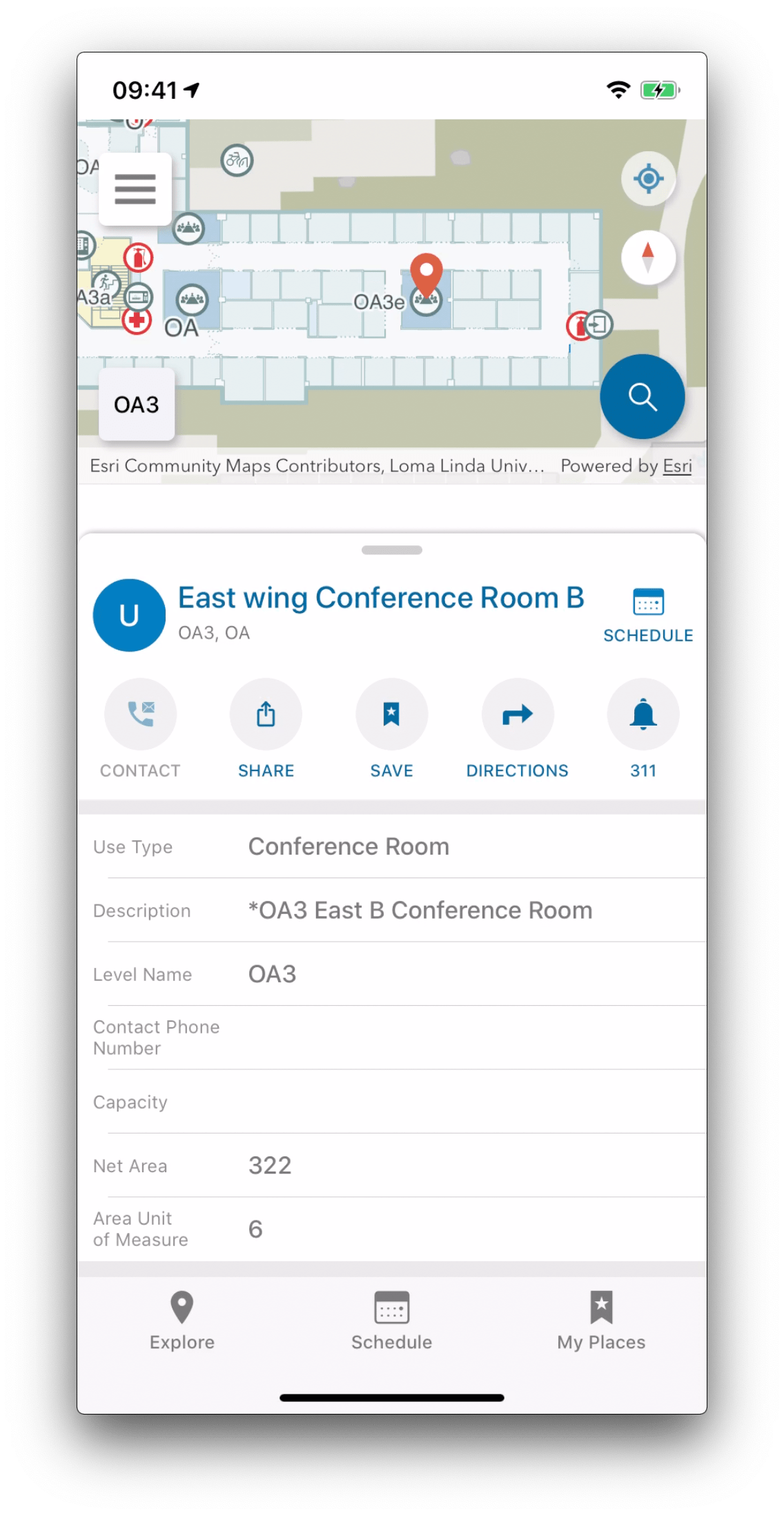
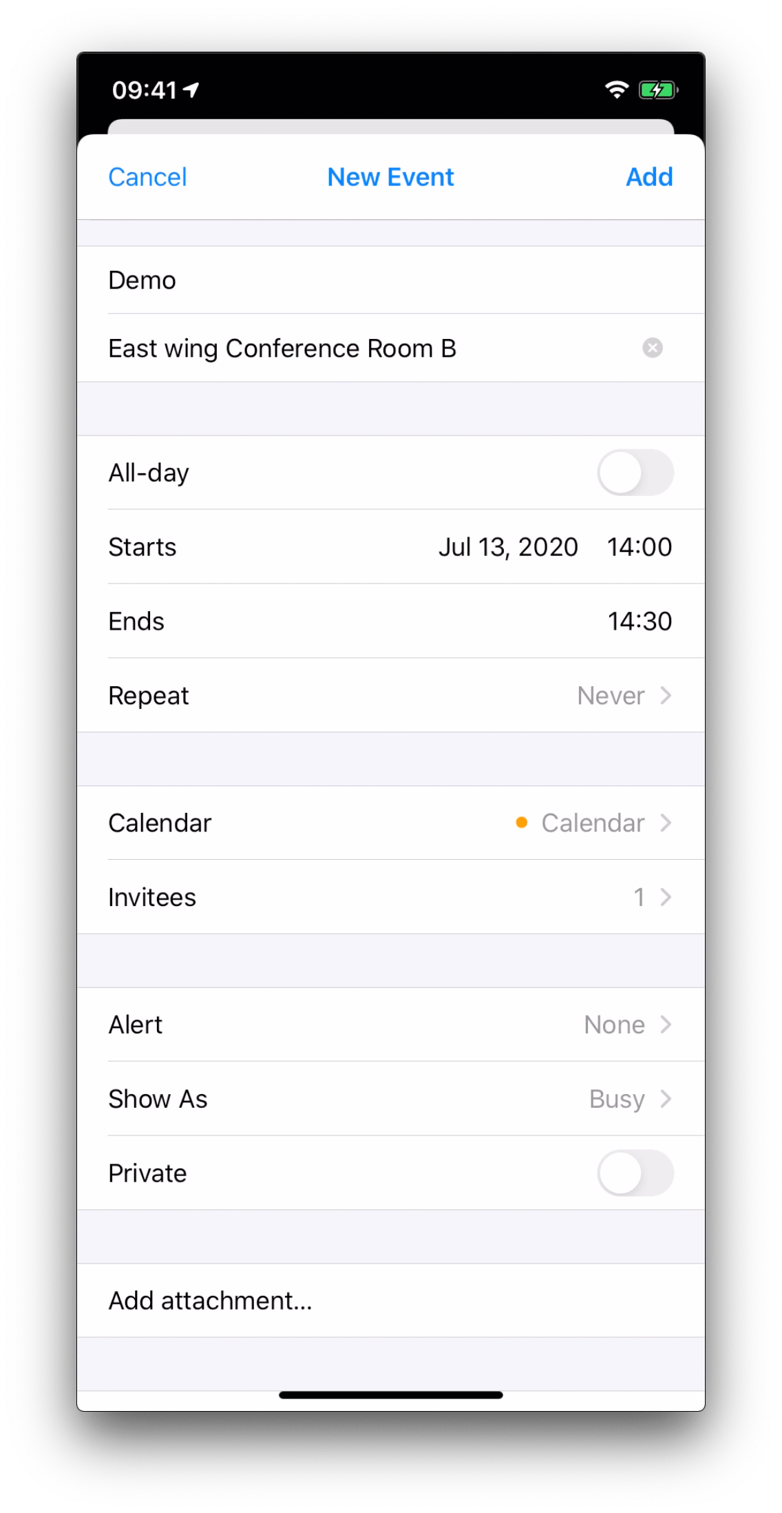
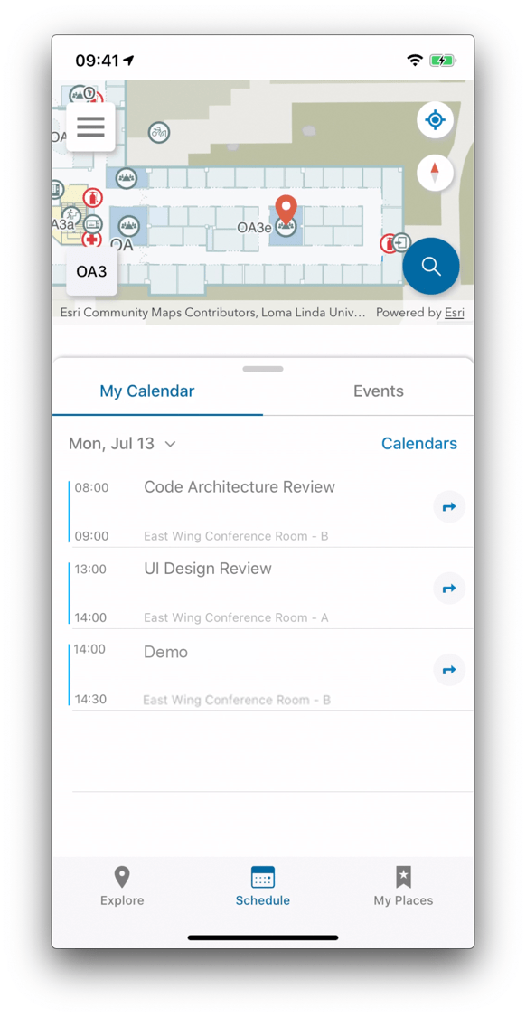
Schedule a meeting and reserve a conference room within Indoors Mobile for iOS and Android.
Reopening the Workplace
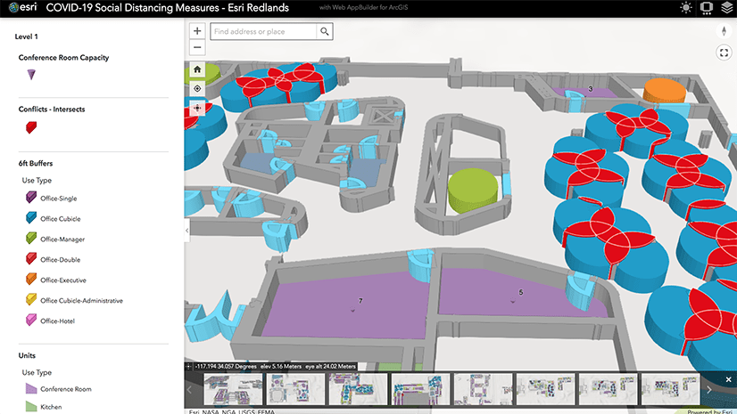
Organizations must make their workplaces safe for employees to return in the Covid-19 recovery phase. This includes adjusting office assignments so social distancing regulations and capacity guidelines can be complied with.
Narrow spaces and zones where the six feet of social distancing can’t be met, should be avoided. Hand sanitization stations need to be set up and easily locatable. Capacities must be reassessed. ArcGIS Indoors provides a clear overview of the complete office space and provides the location data needed to identify potential risks and take action accordingly.

Interested in learning more about the new ArcGIS Indoors release? Visit our webpage now and get in touch with an Indoors expert!
Also, make sure to register for the 2020 Esri User Conference and join us for our virtual presentations there. More information


Article Discussion: