Smart cities are connected, innovative, sustainable, inclusive, safe and competitive. The vision of a smart city is to create a living environment that is healthier, more convenient, more affordable and allows for smooth processes to enhance the quality of life for its citizens.
According to forecasts by the United Nations Organization, 70% of the world population will be living in urban areas by 2050 (compared to today’s 55%). While urbanization processes in developed countries have been completed for the most part, cities in developing countries are now quickly turning into metropolises of millions. This development causes ecological, economic, social and infrastructural concerns on a global scale.
Urbanization gives rise to new needs and challenges such as increased demand for living spaces, higher traffic volumes, increased energy consumption etc. and cities must be prepared to accommodate them. New technologies and innovative ideas help bring solutions forward that make cities future-proof.
Intelligent Transportation
Heavy traffic volumes and the big pool of alternatives to choose from nowadays have made self-owned cars seem relatively unattractive. Digitalization has propelled the rise of alternative forms of mobility in urban areas. In addition, mobile apps make it easy to engage in car sharing or use rental bikes and e-scooters. It is a win-win situation for users and the environment. Moreover, real-time data is helping cities control traffic flows and picking optimal routes for sanitation workers.
While self-driving vehicles are still a futuristic concept for many nations, in some places of Singapore, they have already become part of the daily routine. Shuttle buses move around 80,000 passengers per year at Nanyang Technological University and diverse other automated vehicles are being tested in various settings. For the future, the collection of location data should help make better informed decisions on when shuttle buses are needed where.
Green Living
In China, where skyscrapers are shooting out of the ground like mushrooms (in some cases 50+ story buildings are constructed in less than three weeks), cities are competing in a race to become the next megacity. The sacrifice of green spaces and natural water systems in favor of construction work, combined with increasingly extreme weather conditions that result in incremental floodings, has become a real problem.
Therefore, China is now investing in the development of so-called sponge cities. By creating green roofs, wetlands, planting trees that provide cover and using permeable sidewalks, cities want to manage rainwater better.
Other cities have adapted the green roof strategy to improve the air quality and reduce their ecological footprint. Copenhagen, which strives to become the first carbon neutral city by 2025, includes a green roof on every newly constructed building.

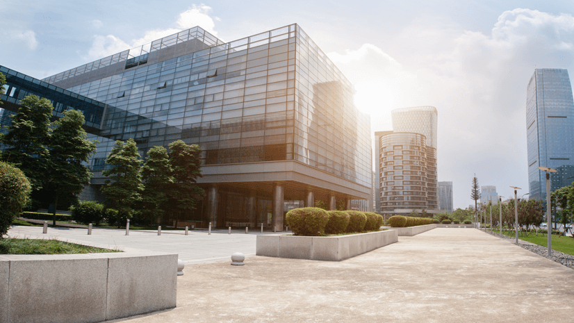
Smart Buildings and Indoor Space Management
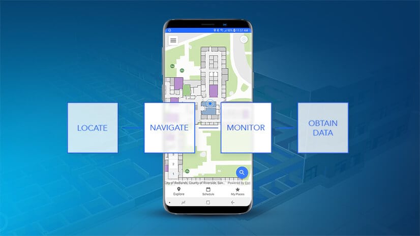
The smart city concept is all about enhancing the standard of living and doing business by improving efficiencies and convenience. An integral part of this is connecting indoor spaces to the IoT and using location intelligence to optimize processes happening inside buildings. ArcGIS Indoors is a comprehensive mobility platform that creates smart workplace environments and transparent operations. The system can be applied to diverse working environments, e.g. transportation hubs, hospitals, universities, corporate campuses and many more, to enhance efficiencies and make work routines easier.
Operations Management
ArcGIS Indoors provides a workplace map of the indoor environment, visualizing places, people and objects on the map. It helps provide a common operating picture to all stakeholders at a workplace by making processes more transparent.
Making the workplace environment location aware, allows employees to interact with it more and improve productivity. Managers have more information at hand to monitor workflows and make location-based decisions on employee, task and resource management. By allowing the whole workforce to be part of and actively contribute to the system, tasks can be resolved faster. Work order management, for example, can be significantly facilitated by enabling all employees to report incidents through the workplace map.
Resource Utilization and Allocation
More than 80% of a company’s resources are located indoors and it is imperative for businesses to manage them efficiently. Employees, for instance hospital staff, spend a lot of time searching for medical equipment that has been misplaced or taken, leading to a huge loss of time and money. ArcGIS Indoors can help tackle this problem by providing all employees with a quick overview of where resources are located via the workplace map. By consulting the map via desktop or mobile app, they see all resources and how to navigate to them quickly.
The system can also track who used which equipment and curate analytical data on utilization rates. This allows for estimates on whether more resources are needed and whether they should be reallocated to other areas in the building where they are needed most frequently.
Indoor Wayfinding
Big building complexes such as airports or corporate campuses often leave visitors as well as employees confused when it comes to finding a particular point of interest, a specific room or resource. In addition, employees, especially hospital personnel, often spend a significant amount of their work time giving directions to patients who are lost.
ArcGIS Indoors allows users to select a destination on the map they want to navigate to. Algorithms will then calculate the fastest/barrier-free/indoor-only route and show it on the map. In the mobile version, the user will see their own current position inside the building and can route to the destination in real-time. Providing visitors and employees with effective and efficient means to navigate allows the latter to save time and focus on their core tasks.
By building a network of objects that are able to interact intelligently and leveraging location data, managements can make better informed decisions, employees can be more productive and buildings and processes happening within run on maximum efficiency.
In a smart city, everything is connected, and future-proof approaches are set in place to deal with the challenges of increasing urbanization, climate change, security concerns, and others. While some cities like Singapore or Copenhagen serve as role models by introducing initiatives to counter CO2 emissions and facilitate mobility for everyone, others are just beginning to adapt novel approaches and technologies. Systems like ArcGIS Indoors contribute to the development of a smart city by connecting the workplace digitally.


Commenting is not enabled for this article.