From July 12-15, Esri User Conference 2021 will be held as a fully virtual experience. Join thousands of peers at the biggest global GIS event to network, engage with sponsors and exhibitors, and take technical deep dives in a multifaceted offer of workshops, special interest groups and other focused sessions.
In this blogpost, you can find an overview of ArcGIS Indoors sessions, as well as other related presentations you could find helpful for your indoor GIS endeavors.
Agenda
Meet us at the event!
Streaming Live
Meet us at the event!
This year’s virtual UC will again provide multiple opportunities to connect with our GIS experts, ask questions and get deeper insights into products in personal meetings. Here are a few ways to do that:
Throughout the User Conference, you can visit presenters’ and experts’ profiles and connect directly with them via Chat or schedule a 1:1 meeting! Another possibility to get in touch with our experts is during networking hours or live presentations (see below).
If you have any general questions around the User Conference, you can seek guidance and support at the Virtual Info Desk (VID).
Streaming Live
From Monday through Thursday, you have the chance to attend live sessions on ArcGIS Indoors and other Technical Workshops and Special Interest Groups related to indoor GIS and facilities you could be interested in.
During these live sessions, you can ask your questions via the Q&A and/or Chat tab or request Sales to follow up with a call. As mentioned above, you can access our presenters’ profiles there and reach out directly to them.
MONDAY

ArcGIS Indoors: An Introduction
Monday, July 12, 12:30 p.m. — 1:30 p.m. (PDT)
TECHNICAL WORKSHOP
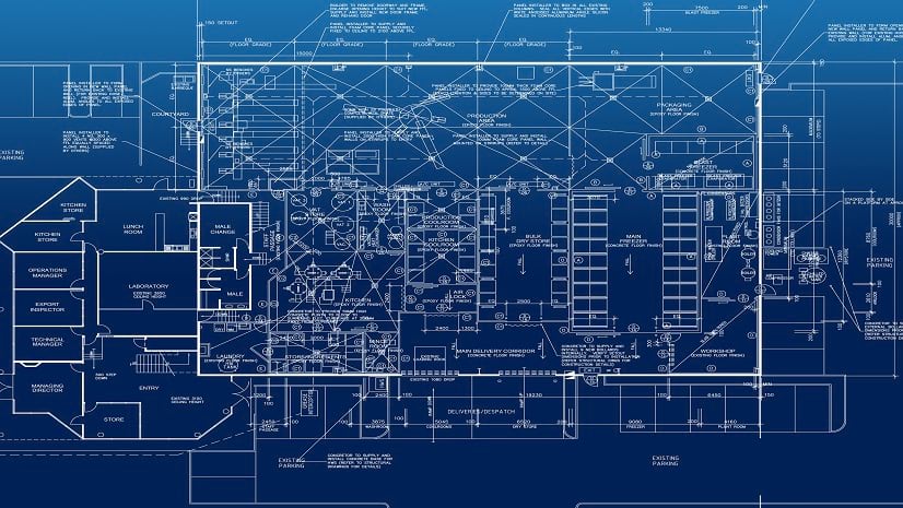
Learn about ArcGIS Indoors, Esri’s GIS for indoor mapping and space planning that provides an occupant experience for workspace reservations, facility incident reporting, location sharing, and way-finding. The indoor mapping capabilities of ArcGIS Indoors can be applied to a number of operational use cases, including indoor asset management, safety and security, emergency planning, and building a plan to bring your organizations workforce back to the workplace post COVID-19 “lock down”. Keywords: Indoors, Indoor GIS, Facilities Mapping, Facilities Management, Campus Mapping, FM
Beau Ryck, Andy Stewart, William Isley
3D Across ArcGIS
Monday, July 12, 3:00 p.m. — 4:00 p.m. (PDT)
TECHNICAL WORKSHOP
3D is an essential component of many organizations’ spatial systems of record and engagement. Esri provides 3D capabilities including customizable and tailored solutions for a wide variety of partners and users. Discover the latest improvements to ArcGIS, including the Voxel Layer, and receive an overview of Esri’s offerings including 3D desktop applications for creating, maintaining, and analyzing 3D content. Keywords: 3D, Scene layers, I3S
Steve Heidelberg, Ivonne Seler, Philip Mielke
TUESDAY
3D on the Web with ArcGIS
Tuesday, July 13, 7:15 a.m. — 8:15 a.m. (PDT)
TECHNICAL WORKSHOP
In this session we will show how you can leverage your 3D GIS data by making it accessible through web browsers. We will take an in depth look at authoring web scenes with Scene Viewer, and distributing configurable 3D GIS applications with StoryMaps app templates and Experience Builder. Leverage your ArcGIS Online content to create exciting and intuitive 3D web experiences. Keywords: Web 3D, Configurable apps, Configurable 3D
Janett Baresel, Philip Mielke
ArcGIS Pro: Introduction to Using CAD Data
Tuesday, July 13, 7:15 a.m. — 8:15 a.m. (PDT)
TECHNICAL WORKSHOP
GIS workflows often rely on CAD data generated by outside survey, Engineering, and Architectural sources. This technical session will discuss how your organization can leverage CAD data using proper techniques and data Integration tools in ArcGIS Pro. This functionality includes ArcGIS for AutoCAD, ArcGIS desktop support for AutoCAD Civil 3D and connection to Autodesk’s BIM 360 software.
Cici Xiao, Richard Horrocks
ArcGIS: Data Interoperability and Integration
Tuesday, July 13, 11:45 a.m. — 12:45 p.m. (PDT)
TECHNICAL WORKSHOP
Are you trying to pull data into ArcGIS from other cloud data platforms (e.g. Snowflake or AWS)? Or integrate data from ancient or unstructured formats? Or embed maps into business workflow applications (e.g. Salesforce or ServiceNow)? This presentation walks through the key tools and patterns you can use to achieve interoperability in your heterogenous IT environment. As an open, interoperable and standards-compliant platform, ArcGIS enables integrations at the data, metadata and services levels. Come discover which paths will work for you. Keywords: Open standards, Interoperable, APIs, Cloud data, Enterprise integration
Adam Martin, Satish Sankaran, Bruce Harold

ArcGIS Indoors: Turn Your CAD and BIM Data Into Floor-Aware Maps
Tuesday, July 13, 1:00 p.m. — 2:00 p.m.
TECHNICAL WORKSHOP
Convert your project-based CAD and BIM engineering files into a spatial system of record for your facilities. Build a 2D and 3D indoor, floor-aware GIS that is capable of supporting indoor asset management, safety and security, workspace reservation, space planning, and more. In this session, learn how to use ArcGIS Indoors to transform CAD and BIM formats into the ArcGIS Indoors Information Model and leverage indoor mapping capabilities of ArcGIS. Keywords: Indoors, Indoor GIS, Facilities mapping, Facilities management, Campus mapping, FM
Maya O’Brien, Patrick Wallis
ArcGIS Pro: Using BIM Data
Tuesday, July 13, 2:15 p.m. — 3:15 p.m.
TECHNICAL WORKSHOP
Building Information Models (BIM) are attribute-rich digital models of buildings and infrastructure. ArcGIS Pro can now help you not only visualize this information, but also access the rich attributes and 3D content in your GIS by directly reading industry Foundation Classes (IFC) and Autodesk’s Revit files.
David Alvarez, Karen Hodge
WEDNESDAY
ArcGIS Velocity: Real-Time and Big Data Analytics
Wednesday, July 14, 7:30 a.m. — 8:30 a.m.
TECHNICAL WORKSHOP
ArcGIS Velocity is a new real-time and big data processing and analysis capability in ArcGIS Online. Join the discussion showcasing how to create real-time analytics to detect patterns of interest from continuous streams of events. As real-time data accumulates, learn how to create and schedule big data analytic models to process high-volume historical data in order to gain insights into patterns, trends, and anomalies in your big data. Keywords: ArcGIS, Velocity, IoT, Real-time, Big data, Visualization, Analytics, Analysis
Ken Gorton, Peter Nasuti
GIS + BIM for AEC Project Delivery and Operations
Wednesday, July 14, 7:30 a.m. — 8:30 a.m.
TECHNICAL WORKSHOP
Improving BIM and GIS integration has enabled users to support project delivery and operations by adding context throughout an asset’s life cycle, enabling new capabilities for Digital Twins of entire systems connected by location. With improvements to 3D capabilities in ArcGIS, desktop integrations across systems, and a new web integration coming soon in ArcGIS GeoBIM, both consultants and owner/operators can interrogate, derive useful information, and connect datasets that add value to their workflows. Get an overview of ArcGIS connectors within design, discuss Esri investment in BIM connectivity in ArcGIS Pro and reality capture, learn how it can supply GeoBIM workflows, and hear about other road map advancements. Keywords: GIS and BIM, Building information modeling, CAD, Project delivery
Anthony Renteria, Erika Bocian, Steven Santovasi

ArcGIS Indoors: Working with Facility Management Systems
Wednesday, July 14, 10:00 a.m. — 11:00 a.m.
TECHNICAL WORKSHOP
In this session we will cover ArcGIS Indoors interoperability with facility management systems. Learn how to augment your existing CMMS, IWMS, RTLS, or BAS with indoor maps and apps to support asset inventory and inspection, workspace reservation, building incident reporting, real-time person and asset tracking, spatial dashboarding, location sharing, way finding, and more. Keywords: Indoors, Indoor GIS, Facilities Mapping, Facilities Management, Campus Mapping, FM, IWMS, CMMS, RTLS, BAS
Beau Ryck, Mohd Faraz Siddiqui, Tom Hahka, William Isley
ArcGIS Pro: Taking Advantage of 3D
Wednesday, July 14, 10:00 a.m. — 11:00 a.m.
TECHNICAL WORKSHOP
In this workshop we will explore why 3D should be an important part of your GIS workflow, and how ArcGIS Pro’s 3D features will strengthen your visualization and analysis capabilities. If your new to 3D, this workshop will highlight setting up your 3D environment, Base Heights, Illumination, Shadows, Local vs Global Scenes, Symbology, and more. Additionally, the workshop will explore 3D Analysis, Animation, and the new 3D Object Feature Layer. Keywords: Desktop, Scenes, 3D, Animation, Analysis
Steve Heidelberg, Nathan Shephard, Ivonne Seler, Michael Contreras
ArcGIS: Understanding SDI and Geospatial Infrastructure
Wednesday, July 14, 11:15 a.m. — 12:15 p.m.
TECHNICAL WORKSHOP
Are you integrating data from multiple sources as the framework of your geospatial infrastructure? Do you need to make data more findable, accessible, interoperable, and reusable (FAIR)? Integrated geospatial infrastructure helps deliver on-demand data that people can access and use many times in decision-ready products. Explore new patterns to integrate and share current authoritative data in Spatial Data Infrastructures (SDI), including Open Data sites, OneMap initiatives, Data Spaces, and INSPIRE. Learn about new workflows for web services integration, open APIs, Data Catalogs, and more. Keywords: Spatial data infrastructure, Open data, FAIR, INSPIRE, NSDI
Jill Saligoe-Simmel, Marten Hogeweg, Bruce Harold
ArcGIS GeoBIM: Connecting GIS & BIM
Wednesday, July 14, 12:30 p.m. — 1:30 p.m.
TECHNICAL WORKSHOP
Recently, GIS and BIM integration has seen tremendous growth on multiple fronts: extending GIS to design applications, consuming BIM content directly into GIS, and visualizing these in new web experiences that can be shared with project or operation teams. While these have enabled some users to interact with aspects of their asset data, all stakeholders require access to these datasets together for awareness and coordination without multiple desktop or web applications. Come learn how ArcGIS GeoBIM empowers users to quickly configure cloud-to-cloud integrations between ArcGIS and Autodesk Construction Cloud to share simple digital twin applications for reviewing interconnected BIM and GIS to transform the asset life cycle.
Anthony Renteria, Stephen Brockwell
THURSDAY
AEC: Construction Management SIG
Thursday, July 15, 6:45 a.m. — 7:45 a.m.
SPECIAL INTEREST GROUP MEETING
Join your infrastructure peers and colleagues at the AEC Construction Management Special Interest Group meeting. This is a unique opportunity to hear from industry leaders, who will share their insights on Scheduling & Planning, Supply Chain Logistics, Jobsite Workflows, and Project Handover.
Sid Pandey, Michelle Oldfield, Anita Soni
AEC: Environmental Consulting and Management SIG
Thursday, July 15, 8:00 a.m. — 9:00 a.m.
SPECIAL INTEREST GROUP MEETING
Join your infrastructure peers and colleagues at the AEC Environmental Management & Consulting Special Interest Group meeting. This is a unique opportunity to hear from industry leaders, including GHD and GZA, who will share their insights on Permit & Planning, Site Assessment & Restoration, Environmental Construction, and Management & Compliance.
Scott Woods, Jeffrey Pearson, Janine Latham, Daniel Boudreau
AEC: Design and Engineering SIG
Thursday, July 15, 9:15 a.m. — 10:15 a.m.
SPECIAL INTEREST GROUP MEETING
Join your infrastructure peers and colleagues at the AEC Design & Engineering Special Interest Group meeting. This is a unique opportunity to hear from industry leaders, including Ferber Engineering and QSIT who will share their insights on Permit & Preliminary Design, As-built workflows, Collaborative Design Reviews, and Jobsite & Field workflows.
Linda Foster, Andy Lovell, Hesham Gafaar, David Pritchard

Facilities and Indoor SIG
Thursday, July 15, 1:00 p.m. — 2:00 p.m.
SPECIAL INTEREST GROUP MEETING
Are you a facilities manager? Are you a GIS professional that collaborates with facilities managers? Join us to hear from industry leaders how they’re using indoor GIS to organize, share, and use facilities information across their organizations. Learn about indoor GIS user workflows, the applications enabling them, and their implementations. Look forward to hosting you!
Beau Ryck
On Demand Library
Besides live sessions, we also offer a broad range of pre-recorded presentations that you can watch anytime at your convenience. Here are some recommendations of user presentations you may be interested in.
Virtual Prototyping for Construction Management
USER PRESENTATIONS
The design and construction of today’s modern and complex buildings can benefit from many of today’s advancements in digital tools and technology. By moving beyond the standard computer aided design and stepping into the advanced world of 3D modeling, virtual reality, concept visualization, and precision spatial orientation, one can optimize the design of construction to maximize analysis of the construction conditions and its accuracy, capture data as the building is constructed, and provide an accurate build from design to construction.
Christopher Forsgren
GIS, BIM and Augmented Reality to Support Enhanced Visualization and Geodesign
USER PRESENTATIONS
The AEC industry is leaning on emerging technologies such as GIS, BIM and Augmented Reality to support enhanced visualization and design understanding of capital projects. HNTB Corporation is finding new and exciting use cases that help support better communications between project stakeholders – including agency executives as well as impacted land owners. This presentation will highlight a few project case studies from significant transportation projects leveraging the integration of these technologies.
William Cozzens, Adam Horn
Navy Real Property Virtual Audit Tool: Existence & Completeness Web Applicatio
USER PRESENTATIONS
NAVFAC Real Property audits went virtual due to the COVID-19 pandemic. To ensure success, Real Property staff, GeoReadiness GIS teams, and GIS Inc’s application/infrastructure support techies came together to devise a solution to support the auditors as they inventory the Navy’s assets. E&C applications (built with Enterprise Web AppBuilder) provide asset data and useful tools, as an automated data processing workflow ensures that the assets under review are clearly defined and presented.
Sarah Vorona, Anthony Scardino, Elena Wells
Utilizing Dashboards for Information Dissemination at Port NOLA
USER PRESENTATIONS
The Port of New Orleans implemented the Esri ArcGIS Enterprise Platform to solve operational and analytical problems for current operations. Dashboards were created for waterfront inspections, real estate management, environmental compliance, and weather monitoring. Join us to learn more.
Maggie Cloos, Andrew Milanes
We hope you find this agenda as exciting as we do and are looking forward to meeting you virtually soon! Please reach out to us if you have any questions or would like to schedule a meeting with our indoor GIS experts for Esri UC 2021!


Commenting is not enabled for this article.