US policymakers face a constant challenge of how best to invest federal, state, and local funding for pressing infrastructure needs. Whether they are designing policy around housing, schools, transportation, or other infrastructure, they face the same question: where should funding be allocated? In recent years, multiple policies have been passed to prioritize funding into low-income communities, largely because these areas experience the greatest need.
According to the IRS, a low-income community is a Census tract which meets certain requirements. According to Tax Code Section 45D(e), low-income Census tracts are based on the following criteria:
- The poverty rate is at least 20 percent, OR
- The median family income does not exceed 80 percent of statewide median family income or, if in a metropolitan area, the greater of 80 percent statewide median family income or 80 percent of metropolitan area median family income
Low-income communities have become a critical part of public policy. Many businesses can receive a tax credit if they invest within a qualified low-income area. For example, there is an Alternative Fuel Infrastructure Tax Credit based on the low-income definition for added fueling equipment for natural gas, propose, E85, and other energy sources. There is also an incentive as part of the Inflation Reduction Act of 2022 where renewable energy sources are incentivized to target their renewable energy sources into these communities.
Quickly Identify Low-Income Communities
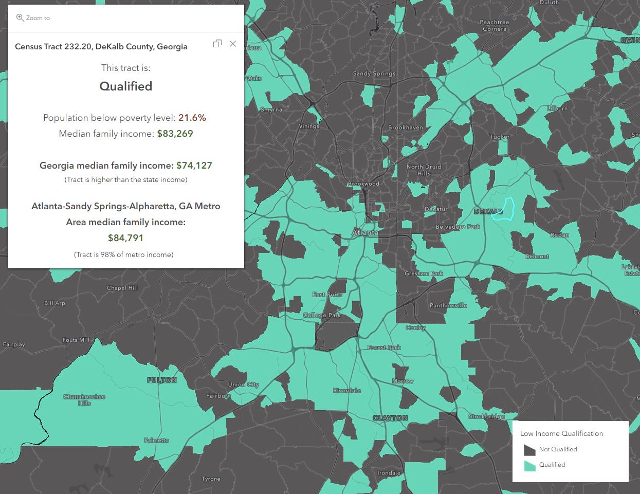
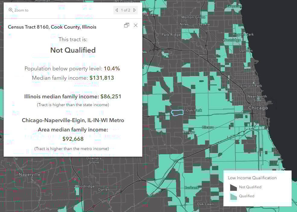
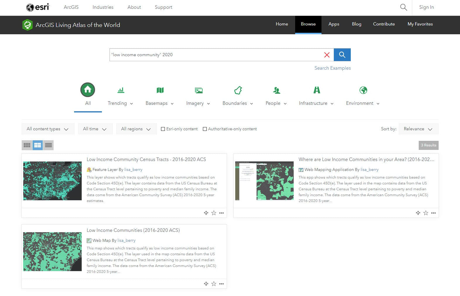
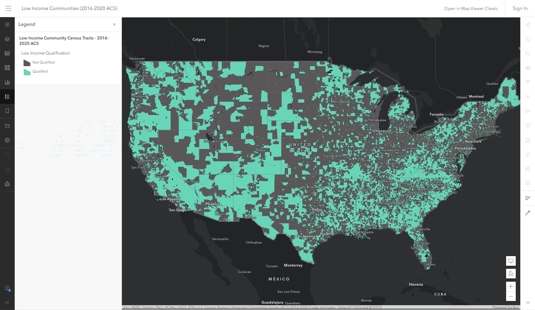
To quickly assess if a Census tract meets the criteria to be considered a low-income community, a new set of resources has been added to ArcGIS Living Atlas of the World to be used in mapping and policy efforts. The map simplifies the criteria by showing tracts as qualified or not qualified based on the guidelines. If you click on the map, you’ll get a detailed assessment of the factors considered for this qualification. This ready-to-use approach provides key information in an easy-to-read and understandable way.
Accessing the Data
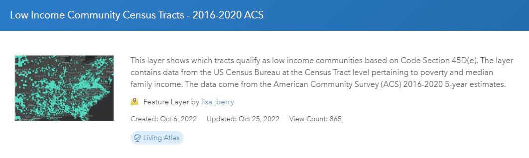
Using 2016-2020 American Community Survey (ACS) data from the U.S. Census Bureau, a layer, map, and application have been created to help quickly visualize and assess these low-income areas for 2020-based Census tracts.
Depending on your workflow and needs, you can access the data in various ways:
Layer
For those who may need to use the data layer within their own GIS workflows, the Low-Income Community layer offers the data as a hosted service which can be used within ArcGIS Online, ArcGIS Pro, and other mapping tools. The layer contains the symbology and pop-up, and can be queried or customized for your needs.
Web Map
For those who would like a pre-configured map and just need to save to their area, the web map might be a more suitable option. This uses a dark basemap suitable to match the colors of the layer. It can easily be altered by zooming to an area of interest or by filtering the layer. Once the map looks as you want, you can choose to save the map within your organization.
Ready-to-use Application
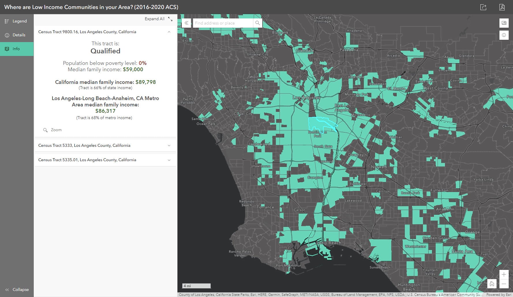
For those who need a quick way to assess the data, or if they have a non-GIS audience, the Low-Income Community application is the easiest way to access the data. Simply type in your area of interest and the map will zoom to that area. You can click on any tract and the key information will appear on the left panel. This option is great for end users who may not have GIS experience or an ArcGIS Online login.
Note about 2020 Boundaries
This layer uses 2016-2020 American Community Survey (ACS) estimates from the U.S. Census Bureau, so the boundaries are based on 2020 Census population. These tracts will be different than the previous 2010-based boundaries. This means that if you are viewing a previous vintage of the data, the tracts will not be the same. To learn more about the changes between the 2010 and 2020-based tracts, check out this blog for more information.

Article Discussion: