Last year, a set of layers were added to Living Atlas that contain over 80 popular tables from the most current data sourced by the U.S. Census Bureau’s American Community Survey (ACS). On December 19th, 2019, ACS will release the newest data values for their 5-year estimates. Shortly after the Census release, the ACS Living Atlas layers will be updated behind-the-scenes with the same data. What this means is:
- Your maps using these layers will automatically contain the newest ACS figures.
- There’s no need to go and download/join/process the new data on your own.
- You just saved tons of time!
What’s Coming
More Layers and Attributes Available
The Living Atlas ACS layers cover a wide range of topics such as housing, income, education, and more. This December, there will be a few new additions to the layers that are available in the Living Atlas:
- Education by Veteran Status – Did you know that 67% of veterans have higher education (more than high school) while 61% of non-veterans have the same education level?
- Population in Limited-English Households – Find linguistically isolated households where no person over 14 speaks English very well. About 5% of children live in linguistically isolated households. These households may need different resources during disaster response.
- Age Group by Labor Force Participation – Map patterns about the labor force. For example, 41% of those age 16 to 64 years worked full time, while 20% worked part time.
- School Enrollment – See how 84% of students are enrolled in public school while 16% are enrolled in private schools.
- Heating Fuel Type by Tenure – Heating houses around the US varies widely throughout the country, and varies by owner/renter status. For example, less than 1% of houses use solar energy in the US – only 0.17%!
- Housing Costs as a Percentage of Income by Age and Tenure – Did you know that 26% households headed by someone 65 years and over who own their home still spend 30 percent or more of their income on housing costs?
Highlights Layers
There will also be new “highlight layers” that group attributes from many topics that help us answer many questions with a single layer.
- Population and housing basics – learn about the population, housing, income and more
- Emergency response – map households without a vehicle, with no internet connection, and more populations vulnerable in an emergency
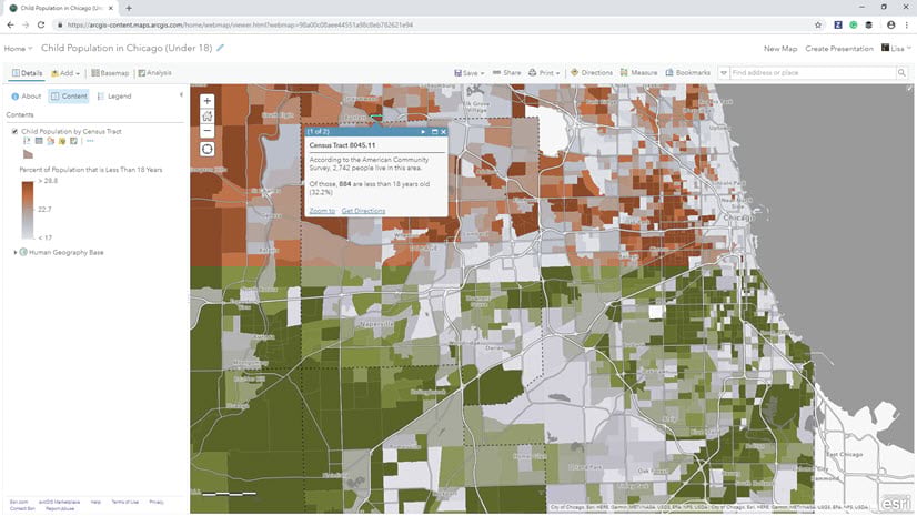
- Child well-being – learn about the youth of the country alongside factors that impact their wellness
- Senior well-being – see patterns about how seniors are living in the US
Field Descriptions and Value Types
A few other noteworthy updates will be made to the services:
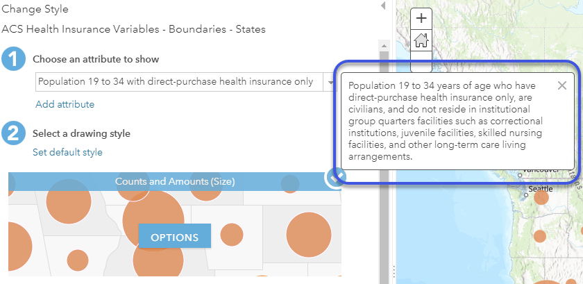
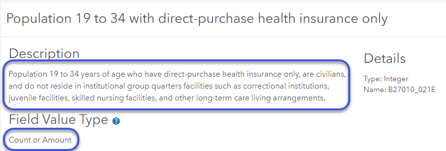
- Field descriptions and field value types– This ArcGIS Online ability allows you to learn more about an attribute when exploring the data. You can find this within the ArcGIS Online map and within the Data tab of the layer’s item details page. For example, the Health Insurance Coverage layers only include the civilian noninstitutionalized population. This December, an in-depth definition will be available just by hovering over the attribute when mapping, to help you as the map author understand the attributes better:
Within the map:
In the Data tab of the item description page:
Other Enhancements
- The boundaries layers will always reflect the TIGER boundaries that are appropriate for the newest ACS figures. In this December update, the 2018 TIGER boundaries will be swapped into the layers.
- The American FactFinder website is no longer being updated by the Census. Because of this, the links to existing American FactFinder nationwide figures on the description pages and REST endpoints of the ACS layers will be replaced with links to the new data.census.gov website.
- With the December update, you will now be able to export all ACS geographies to file geodatabase (FGDB) format. This is a suggested workflow if you need local or archived ACS data.
What’s Changing?
In 2019, the Census has changed the year of naturalization classifications within Table B05011. This means that some of the attributes will have new meaning in the ACS Nativity and Citizenship layers. If you have a map using these, the FAQ for the ACS layers will soon contain more information about updating your maps for this change.
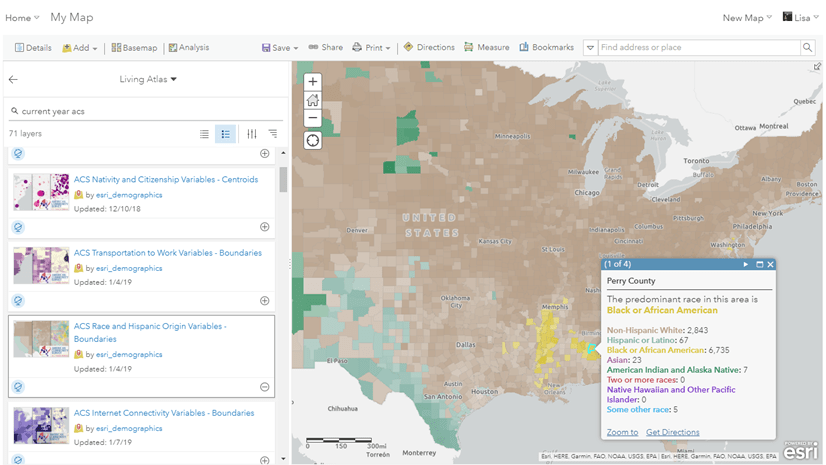
Using the Layers
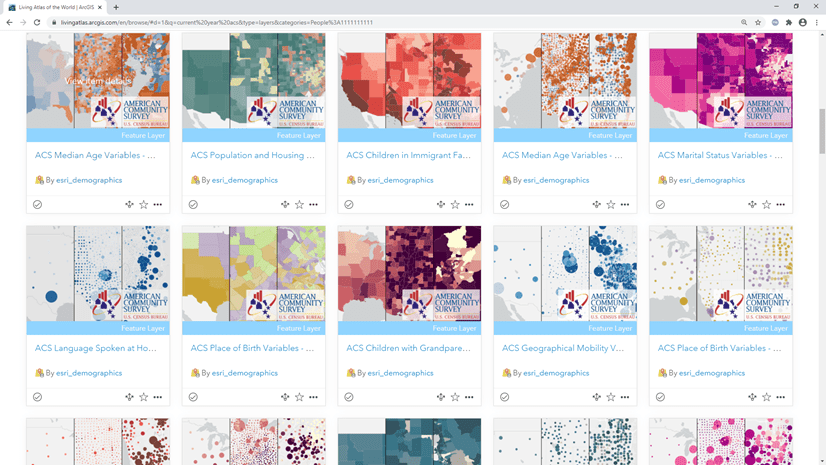
Find the layers:
Learn where to find these layers and start using them within your mapping and analysis workflows. Check out this story map to learn how.
Get started:
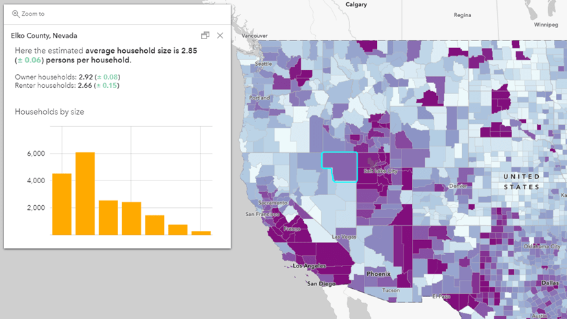
Learn how to make a map about your community in 4 easy steps in this blog. You’ll have your own custom web map in minutes!
Update your existing ACS maps:
Whenever new ACS figures are released by the Census, we encourage you to check the breakpoints being used in your existing web maps that use the Living Atlas ACS layers. After the December release, make sure your existing map breakpoints still make sense with the updated data.
Questions?
If you have questions about the layers, visit our FAQ site, or post on Esri Community’s Living Atlas space. You can also learn more about the layers in this blog.


Article Discussion: