3D GIS introduces remarkable strategies to understand what’s behind the immediate picture and better understand what’s happening with your data in 3D. This Scene Viewer release enables new interactive capabilities that help you better understand elevation and shadows, and visualization improvements enable better depth perception to make your scenes look more appealing. This combination of improvements is designed to help you leverage information gained behind the scenes and produce experiences that support essential interactive workflows.
Elevation Profile
Our users have had access to profile tools in several Esri desktop clients, and now the Elevation Profile Tool is available over the web in Scene Viewer! This interactive analysis tool enables the user to understand and compare the elevation between lines, ground and layers that visualize 3D objects, and this analysis can be performed on a sketched or a predefined line.
To leverage this tool and gather interactive feedback simply click on the Analyze button in the top-right of Scene Viewer user interface, and you’ll see the new Elevation Profile on the right tab. The default action is to click on the scene to place the first point of the line, and you can draw several line segments. You’ll see this interactive tool begin to provide immediate feedback for each line segment drawn, and you can double-click to create the last point and view the feedback.
When the line is completed, you’re now able to access information about the ground, layers and line. You’ll see where the drawn line falls on the ground layer, and you’ll also see where the drawn line coincides with above-ground feature elevation. Mouse over the graph, and you’ll see where that point in the graph corresponds to the line drawn in the scene. Clicking the 3 dots in the top right allows you to pick different units for elevation readings.
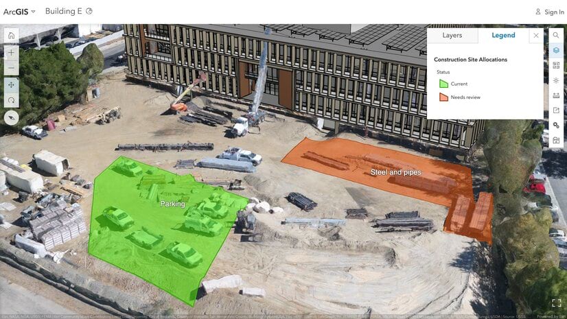
It’s also possible to select line segments from existing feature layer data in the scene. By selecting a line feature, you’ll be provided immediate elevation feedback on that line feature as well as the ground an additional layer. This is very useful information for utility and distribution lines like the example below:
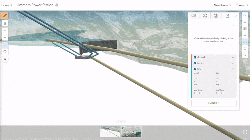
Aside from the immediate elevation feedback in the graph, you’ll notice a lot of other additional cumulative information expandable when you use the arrow to the right of Ground, Layers or Line. While we provide a default world elevation layer, this tool will also honor your own custom elevation services.
Shadow Highlight
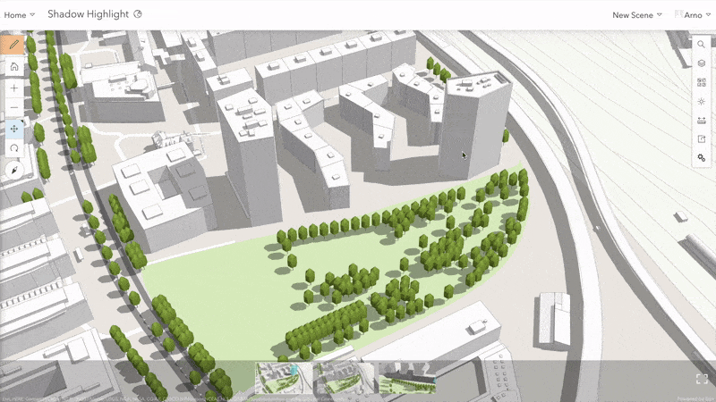
Scene Viewer has had the capability to model shadows in the Daylight Widget, and the results can be modified to show time of day and the day of year. While it’s very useful to understand the shadow impact features like buildings can have, it was not possible to discern which 3D object causes which shadow.
With this release of Scene Viewer, users are now able to identify what the shadow footprint of individual features are from the rest of the shadow. With the Daylight Widget and “Show Shadows” activated in Scene Viewer, simply click on the 3D object to view the shadow from that specific 3D object. Additionally, the highlight allows you to distinguish between shadow caused exclusively by the selected 3D object or overlapping shadow from other features.
Improved Visualization
In a previous release, Scene Viewer improved the rendering of 3D content like buildings, trees and symbols. Scenes were able to benefit from more contrast, better sense of depth or physically based material properties such as metallic shine. This improved lighting and shading previously required changing the Scene Viewer settings to “Quality”. With release 9.1 your scenes load with these visual improvements by default – without changing the Scene Viewer settings.
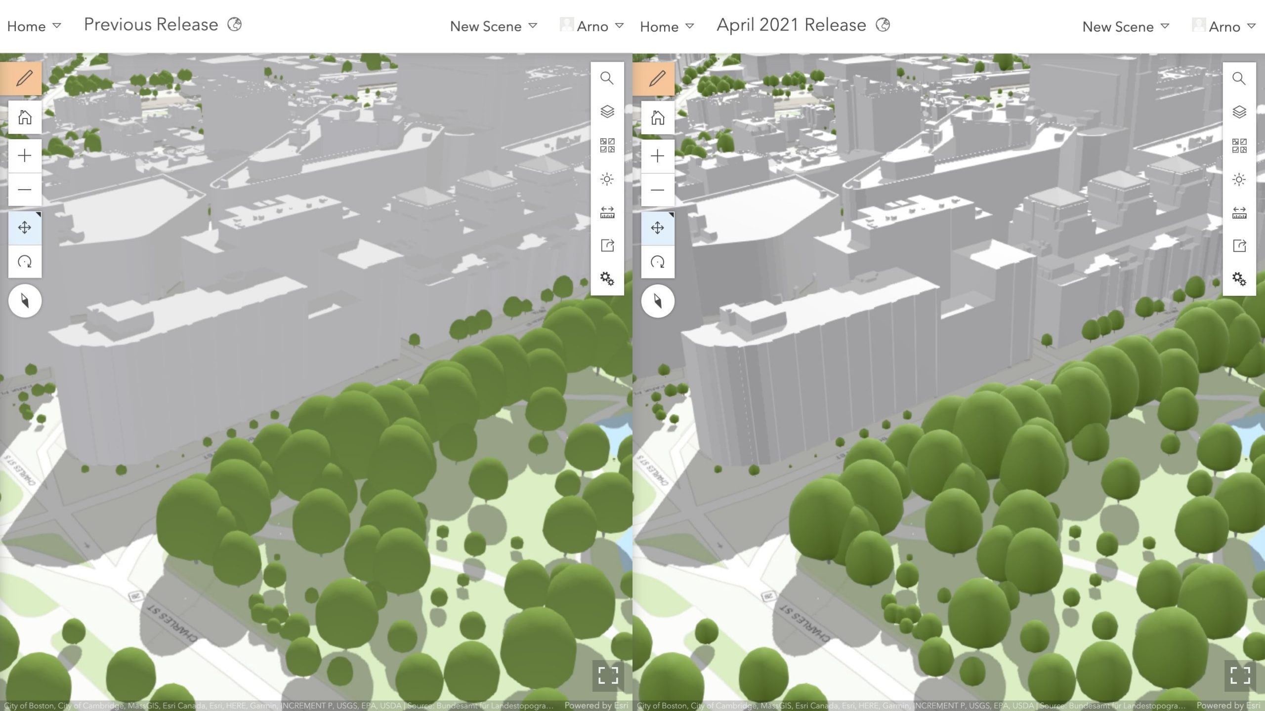
In the last December release we introduced order-independent transparency to assure rendering all semi-transparent features in a scene. We are rounding off this topic by also making sure a semi-transparent ground is visible behind 3D objects that are not fully opaque.
We can’t wait to hear about the problems you solve with these new interactive tools, and we’d very much like to hear about your use of these visual improvements. So much of our development is prioritized by users like yourself, so please contact us about your experience with Scene Viewer and the features you’d like to see!


Article Discussion: