Challenge 1: Coloring In
Challenge 2: A Forest of Color
Challenge 3: Middle-Earth Your Neighborhood
Challenge 4: Adventure Awaits
Challenge 5: This one!
Challenge 6: Living Atlas Cross-Stitch
Firstly, I wish you the best of health in these difficult circumstances. I hope you and those you love are doing well as the world flexes to adapt to preventative measures, as well as the work to outright fight this virus.
But what? It’s been over a month locked-down working from home with our kids? I know, it only feels like a week, amirite? Slinging GIS can be a real joy —you know that, and we are mega fortunate to be a part of such an amazing field. But do your kids know how cool it is? I mean, they realize you pretty much color in maps all day, right? Yeah yeah, there’s also the collection and cleaning, modeling and maintaining, analysis and assessments, and the like. But really we’re just big kids that get to color. Speaking of…
Challenge 5: Map Kids, Assemble!
In this, our fifth challenge, we invite you to explore with your younglings the vast and glorious planet we share…in black and white. Consult with your kids and settle on a place that sounds especially interesting…like Kathmandu, or Maracaibo, or the Panama Canal, or the Saint Lawrence Seaway, or the Aleutian Islands, or Cape Horn, or Sri Lanka, or the Lena River Delta, or Manila…you get the picture. Then print out a page to color from the new Outline Map created by Cindy Prostak (who routinely cranks out beautiful creative unreasonably fun vector basemaps). Check out these resources if you’d like to learn more about the Outline Map.

When you (yes, you too) and the kids have completed your masterpieces, snap a picture of them and link to them in the comments below, or share them on social media with the tag #TakeYourWorkToKidsDay
Inspiration
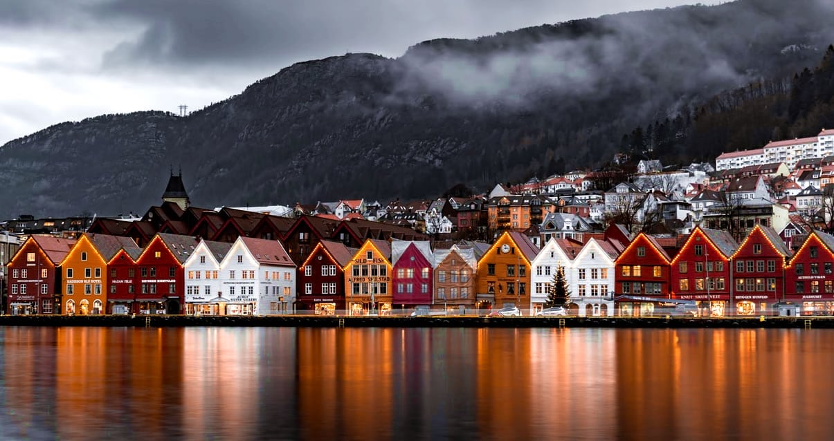
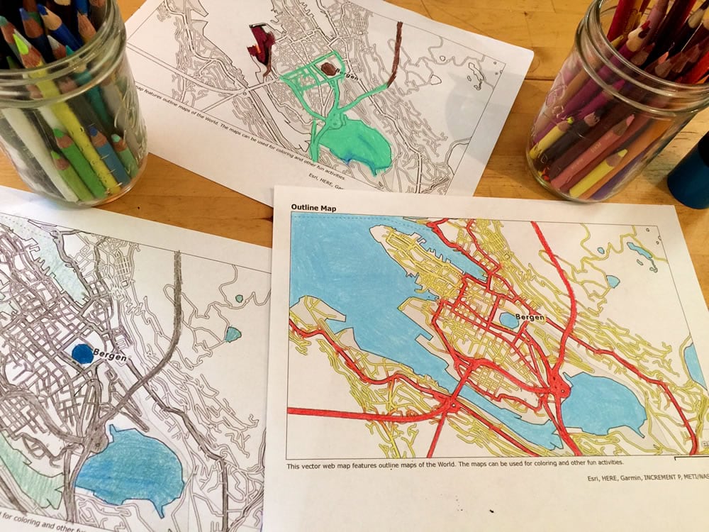
Think about your location of interest and kick it around on the internet. Do an image search. Does it have a distinctive look or vibe? Does it have cool colors? Incorporate that into your map-sterpiece. Since my family recently watched Trolls World Tour, I thought it would be a good opportunity to learn about Bergen, Norway, with them. Here is a picture of the colorful seaside buildings in Bergen we found on Unsplash.
Pencils sharpened? Let’s do this…
How To Print A Map
If you are cruising around Outline Map in ArcGIS Online, you can just hit that little print button at the top of the map.
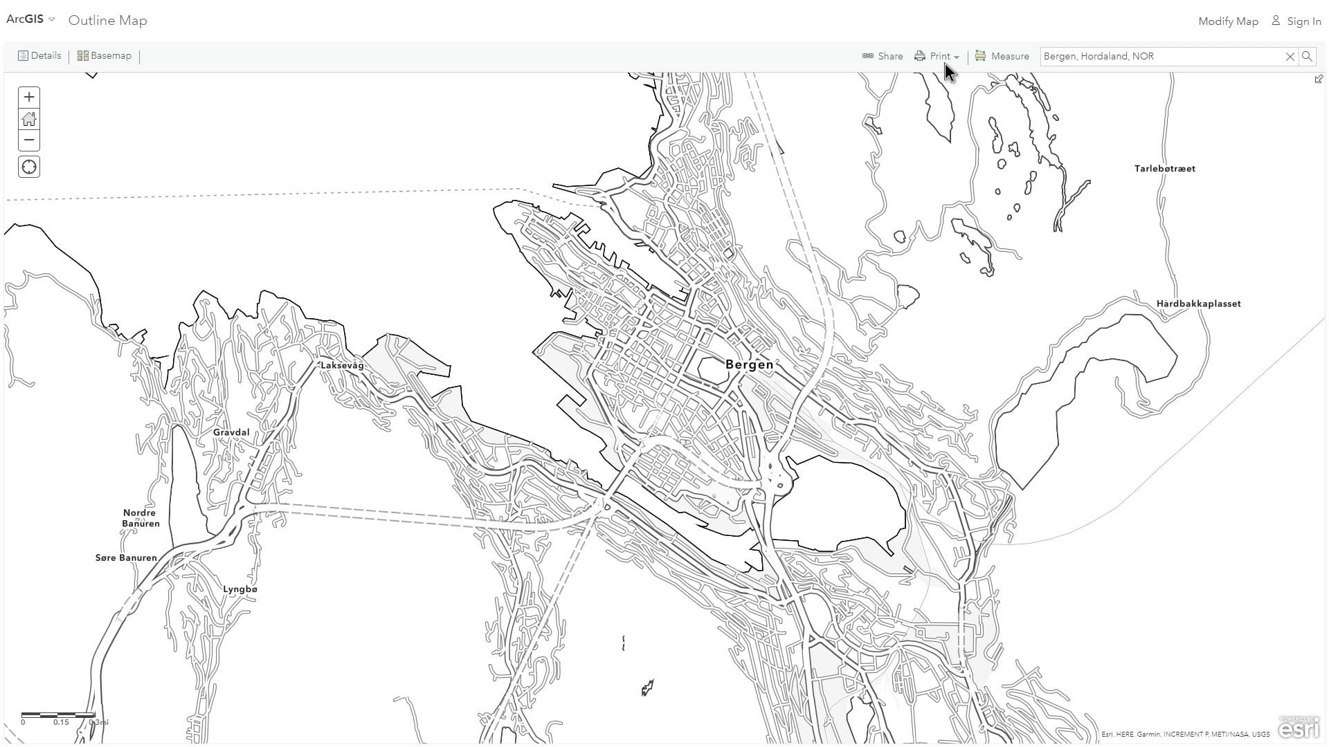
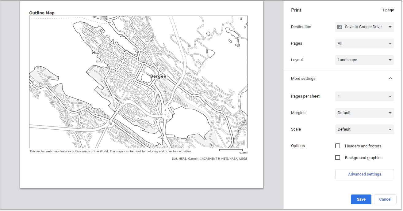
And it generates a static image of the map in a new tab. Ready to be digitally-gobbled-up and analog-spit-out by your printer…
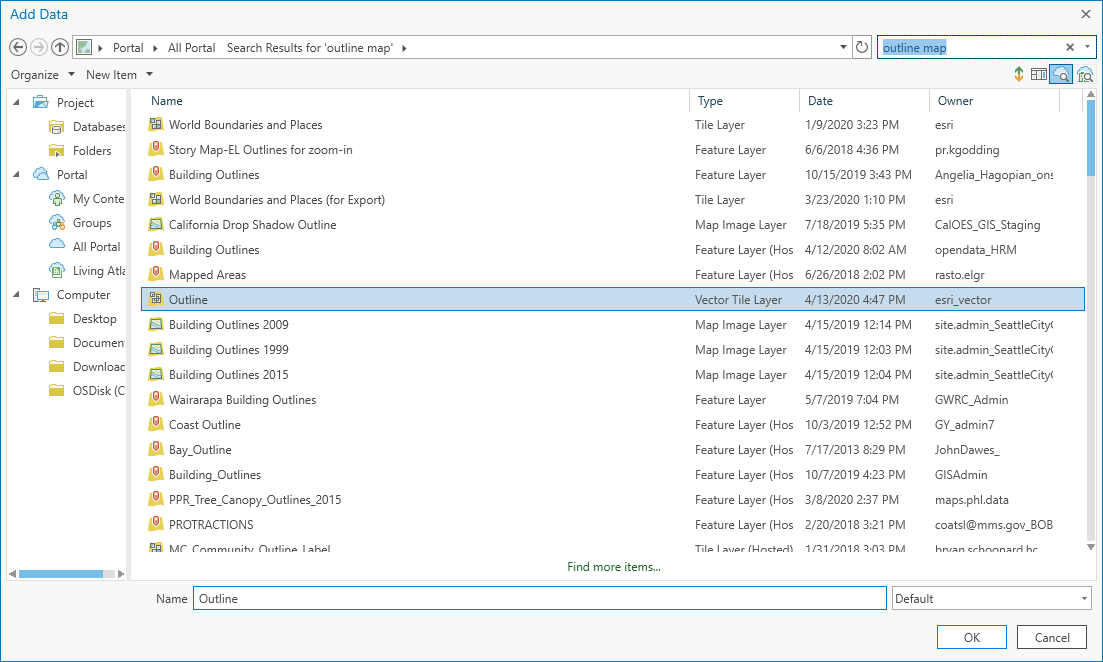
If you are using ArcGIS Pro you have some more options. First of all, though, there are a couple ways you can add Outline Map to Pro. You can copy the basemap’s URL, click the “Add Data” droplist and choose “Data from path” and paste in the link. Or you can just click the “Add Data” button, choose the “All Portal” tab and search for Outline Map. Whatever you like better.
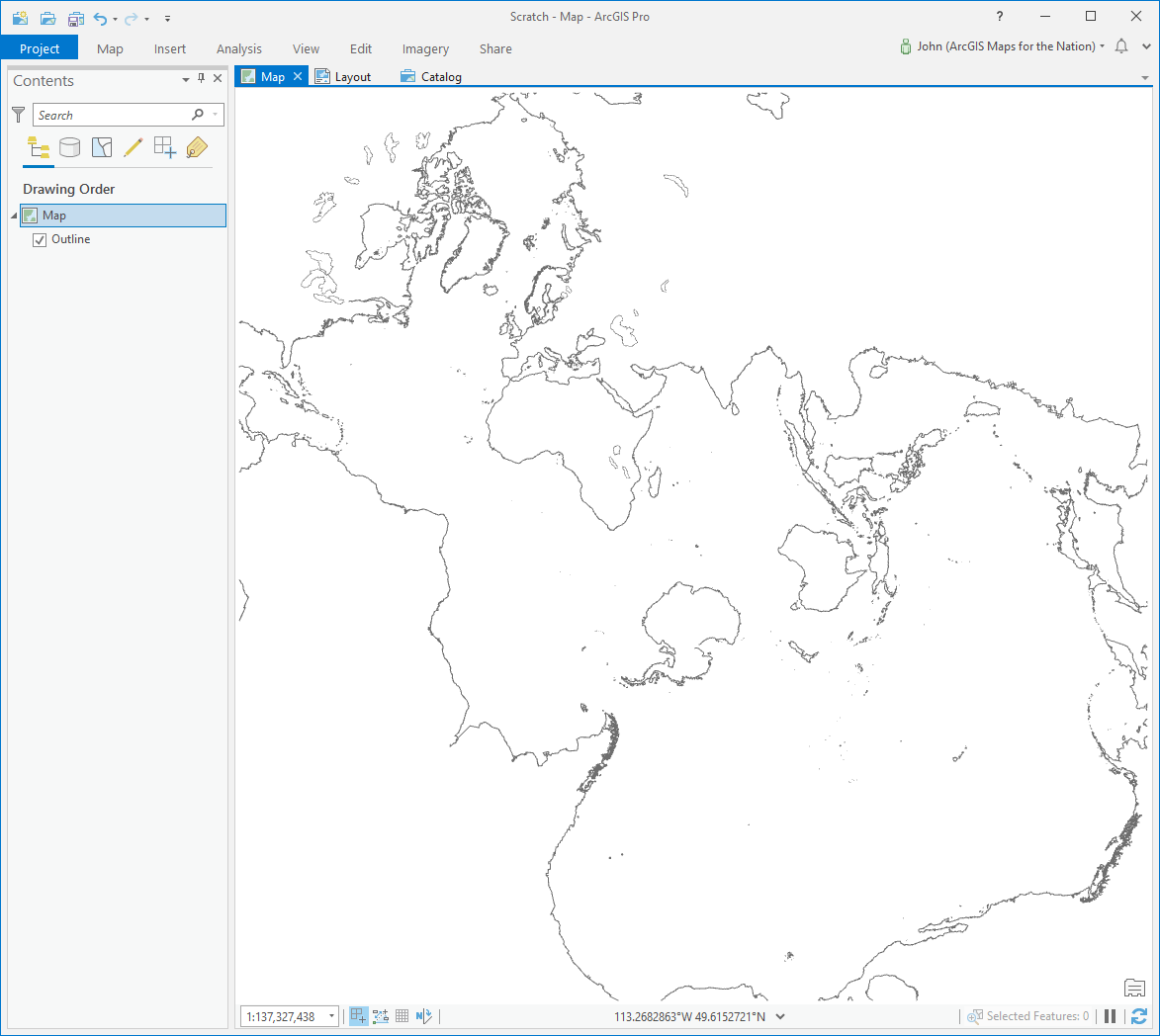
But because you are in Pro, you can twist and turn this basemap into whatever projection you want. It would be fun to color in the coasts and shallows of a Spilhaus map.
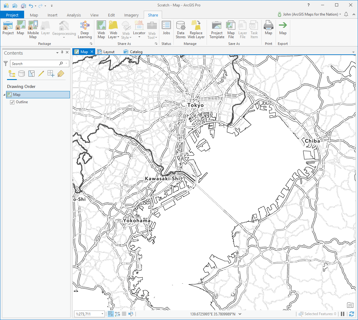
Here’s Tokyo in the Equal Earth projection. Would definitely make a cool coloring project.
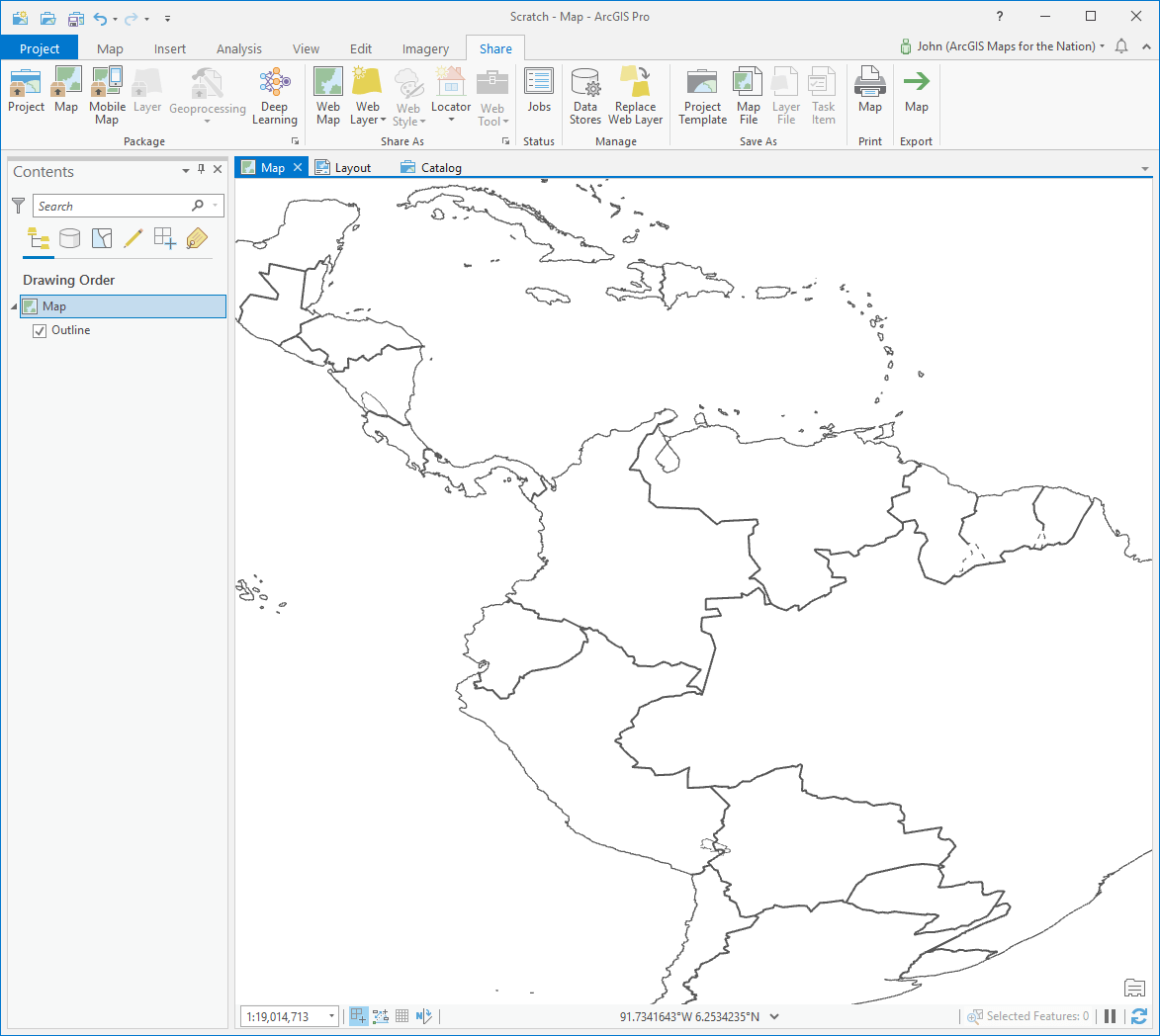
And here’s a cool oblique perspective of Central and South America in the World From Space coordinate system. I’d color that.
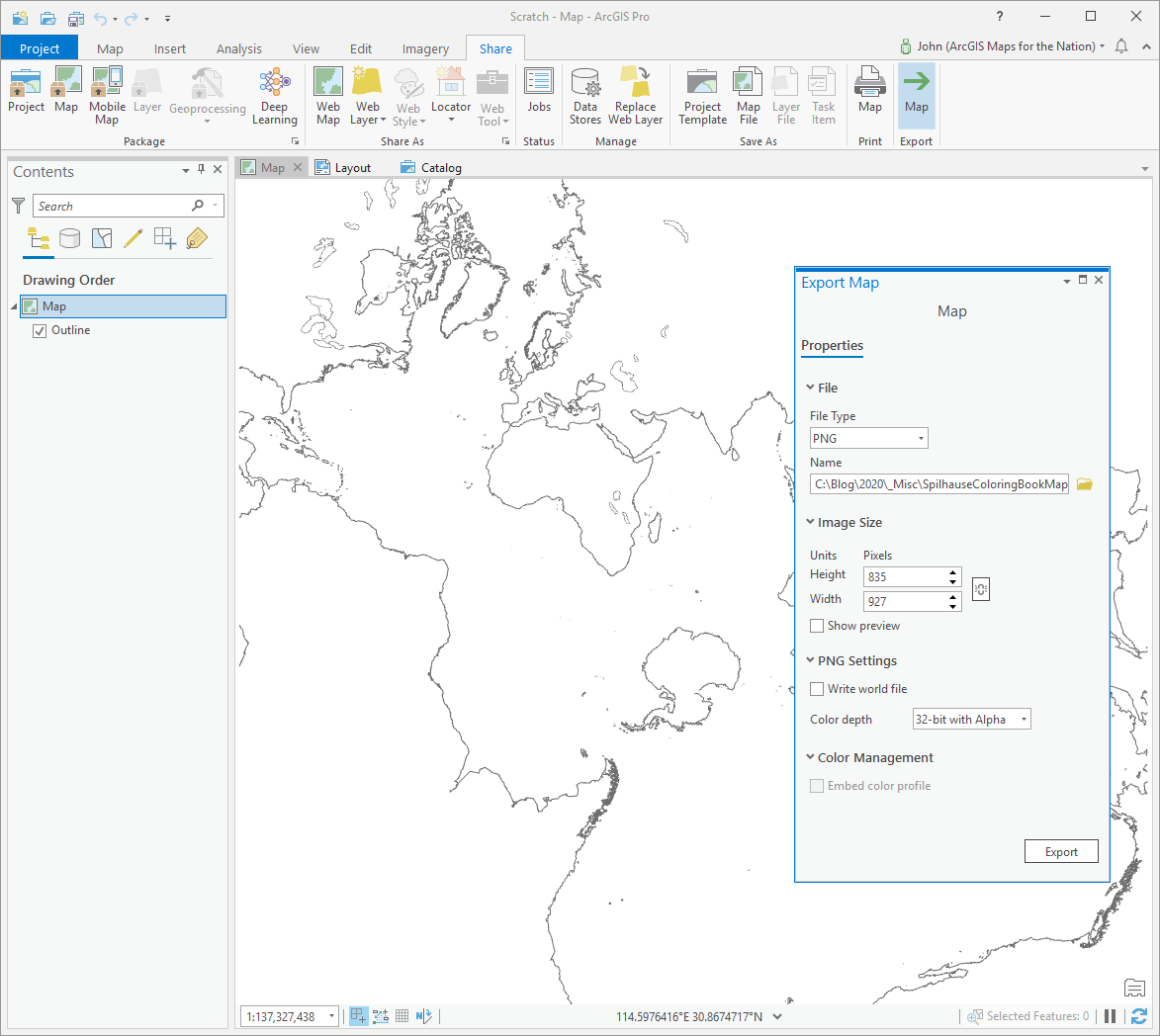
And one of the cool new features of Pro is that you can export map images in various sizes and formats right from the Map view if you want. Nice and easy.
Share It!
When you and your offspring are done, snaps some pictures and put the rest of us to shame! Show off your progeny’s burgeoning cartographic chops, either linked in a comment here or tagged with #TakeYourWorkToKidsDay (and hit us up in the post, we’re all over the place) wherever you socialize.
Here are some of the Nelson kids’. The seaside houses of Bergen informed Willow’s color choices.
It was fun, mappy, learny, and something we could do together. Give it a go!
Love, John

Article Discussion: