Restore local rivers. Track pink dolphins. And explore Indigenous territories with the 2023 Storytellers of the Year.
For this year’s ArcGIS StoryMaps competition, Esri and the International Union for Conservation of Nature (IUCN) challenged storytellers to create stories about equitably conserving the earth’s lands and waters.
And you responded with a record number of submissions from over fifty countries and with stories that represent voices from a diverse, global community.
On November 15, 2023 — GIS Day 2023 — we announced the finalists of the 2023 ArcGIS StoryMaps Competition. The twenty-nine inspiring stories stood out in three categories — storytelling, GIS, and conservation. Watch the video to learn more.
Today we celebrate the competition winners, runners-up, and student winners selected in two tracks, and we recognize the recipients of three special competition awards.

Track 1 stories follow a more traditional storytelling structure and highlight an Indigenous or community-led conservation project. Think success stories with character development, imaginative presentation, and the power of place. Read the outstanding stories selected by our guest judges.

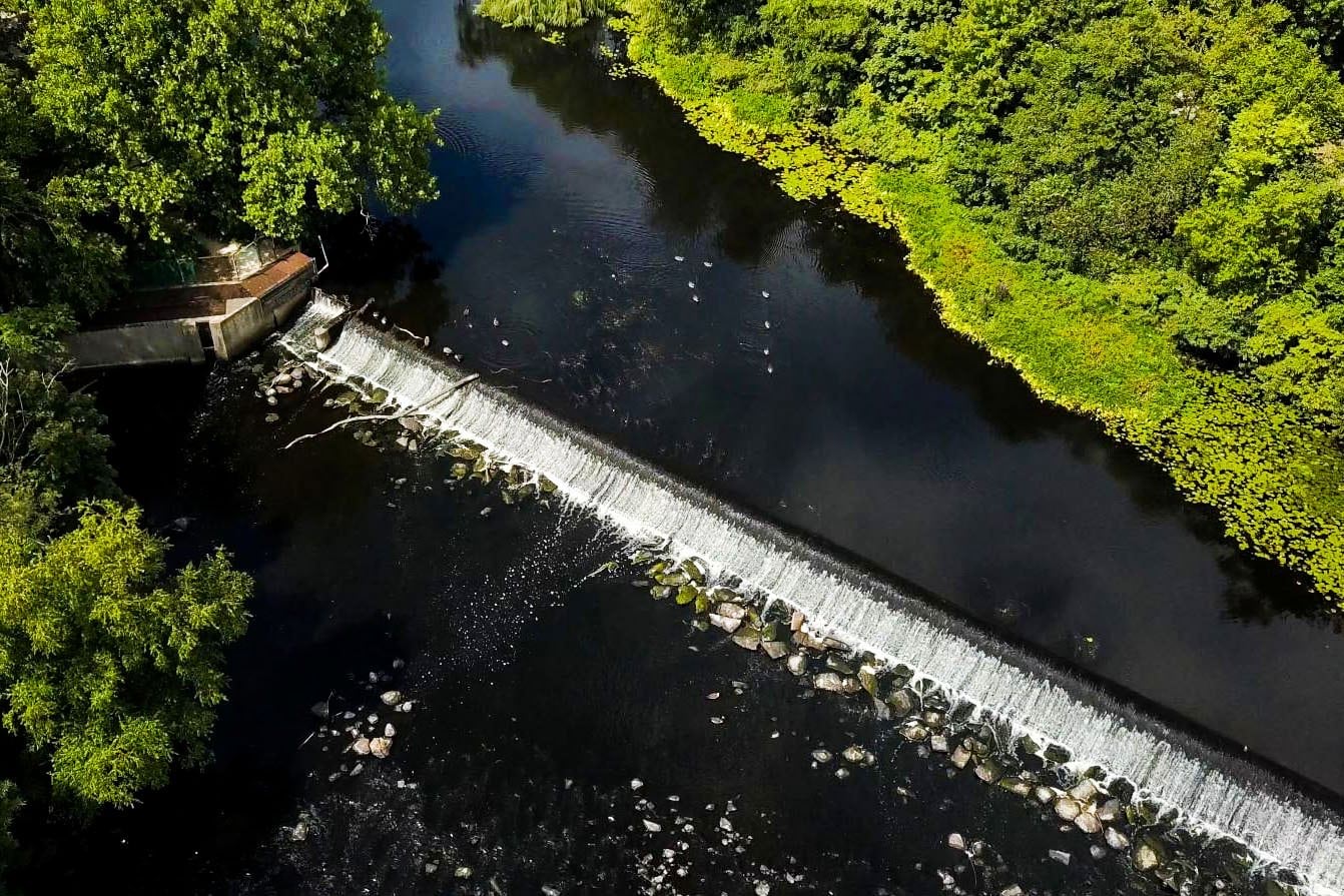
“A River Interrupted: Why Removing Defunct Dams is Critical for Restoring the Charles River” by Julia Hopkins and Robert Kearns, Charles River Watershed Association
“A River Interrupted” leverages ArcGIS StoryMaps as a persuasive advocacy piece for the removal of Watertown Dam from the iconic Charles River in Massachusetts. The authors introduce readers to the river and its importance to Indigenous communities with historical maps, photos, and documents. With the stage set, the story artfully presents the present-day impacts of the dam, one by one, with engaging media from photos and videos to maps and illustrations. After making a compelling case, readers are invited to join the cause with three clear calls to action including a “Share your story” button. The strong community involvement in the project, argument against the dam, and calls to action made this story a winner for our judges.

“Living Territories: Stories of Territorial Justice” by Brian Hettler, Amazon Conservation Team, with Pascual Gonzalez, María Paula Kairuz, Linda García, Libardo Chanchy, Germán Mejía, Carolina Gil, David Delgado, Alvaro Gil, Mateo Medina, Judah Marsden, and Jessica Villamil
“Living” Territories introduces a complex topic, Indigenous land rights, but with a clear message — Indigenous people, local environments, and the larger climate effort benefit when local land stewards rightfully manage those lands.
And just a few scrolls in, readers visually connect local people and place. The authors use the sidecar block in ArcGIS StoryMaps to create a scrolling experience that alternates between beautiful multimedia photos of Indigenous peoples in local landscapes and map choreography to place those landscapes geographically. In between, custom graphics sit atop or next to local maps, visually reinforcing the relationship between people and place. And within this organic flow of people and place, the authors let Indigenous people speak through quotes and their own stories.
Our guest judges were drawn into this immersive storytelling experience and the important topic for people and the planet.

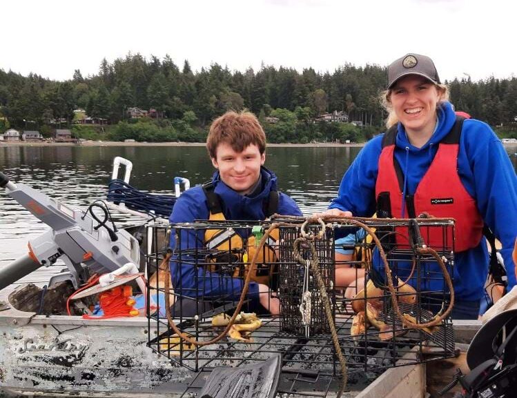
“Recovering Lost Crab Pots of the Salish Sea” by Ella Ashford and Riley Forth, Willamette University
Riley and Ella spent their childhoods in the tropical islands of Barbados and Hawai’i, and they witnessed firsthand the impacts of climate change. Those experiences have guided their academic pursuits and participation in conservation-related projects like conducting aerial surveys of ancient marble quarries in Greece, studying fertilizer plant impacts on tidal inlet biologic communities in New Zealand, and using an underwater robot to recover derelict crab pots in Washington State. Their story “Recovering Lost Crab Pots of the Salish Sea” goes behind the scenes with the Sea Dragons in Washington State, a student-run underwater robotics team, and their partners. With an education grant from NOAA, they built underwater Remotely Operated Vehicles or ROVs to locate and recover lost crab pots from local waters. The story uses multiple ArcGIS StoryMaps features — like the sidecar immersives, the quote and timeline block, plus video embeds — to explain the ROVs functionality to readers and the potential outcomes of utilizing technology and GIS for environmental cleanup.

Track 2 stories focus more on place-based research projects, scientific studies, and scholarly work built with ArcGIS StoryMaps. This was the first time that the ArcGIS StoryMaps competition specifically encouraged scientific communication from our storytelling community, and the results show us that science and business information can be engaging — even inspiring. See the stories that excited our guest judges and set the standard for scientific storytelling.
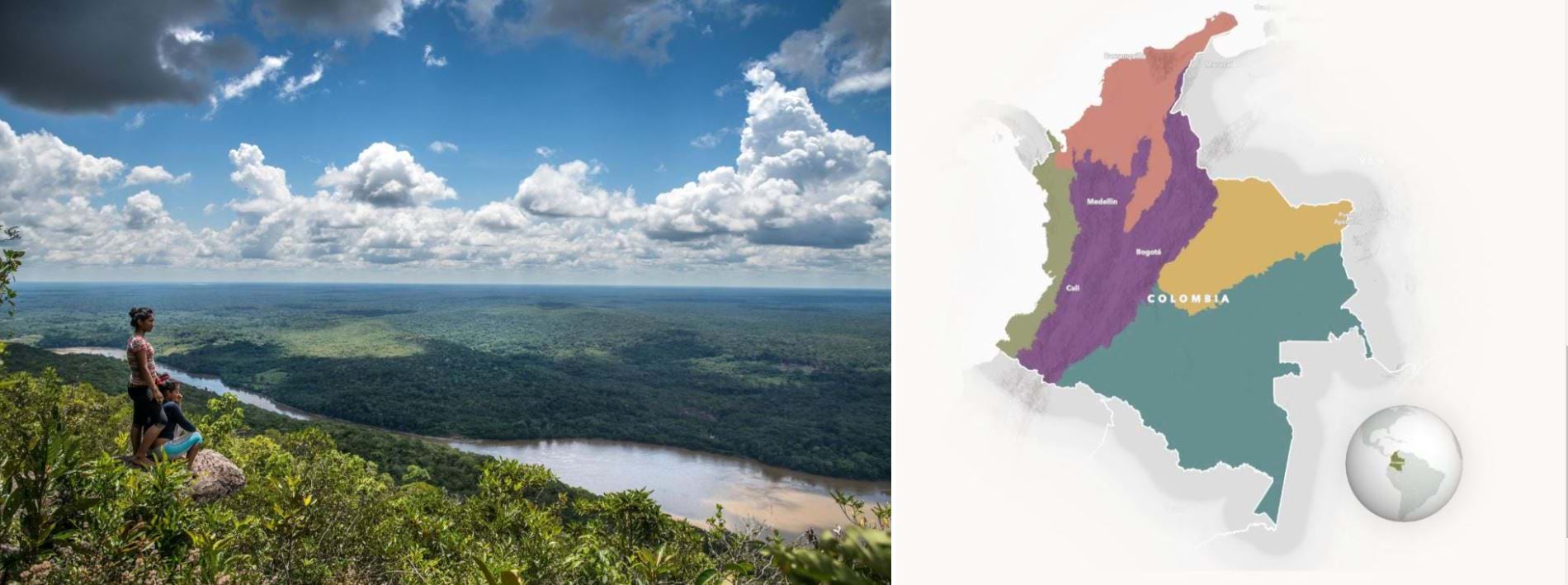
“Ambassadors of the Amazon: River Dolphins & Ramsar Sites Provide Hope for Cross-Boundary Conservation” by Blue Water GIS, National Geographic Society, and the Omacha Foundation / Fernando Trujillo
“Ambassadors of the Amazon,” available in English and Spanish, opens with Yatü and Ceiba, a pair of pink river dolphins. Their faces and voices invite readers into their home, the Amazon River, and their movements unlock secrets to their habitat and the survival of other dolphin species. National Geographic Explorer Fernando Trujillo and the Omacha Foundation, working with Indigenous communities, are tracking dolphins like Yatü and Ceiba with satellite telemetry tags.
“Ambassadors of the Amazon” is part educational story, part research report, and part advocacy — filled with engaging audio, videos, and maps. The authors introduce dolphin species with a map tour, show the basics of dolphin tracking with multi-media, and share telemetry data from Yatü and Ceiba with map choreography and map actions. They make great use of the ArcGIS StoryMaps platform for understandable — and fun — science communication.
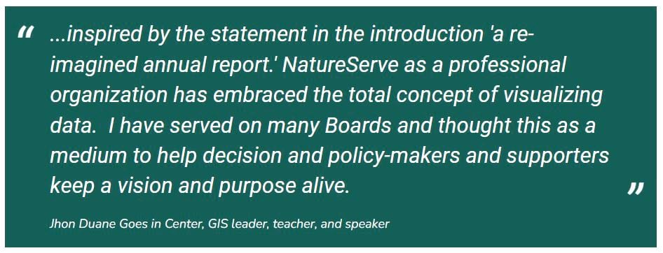
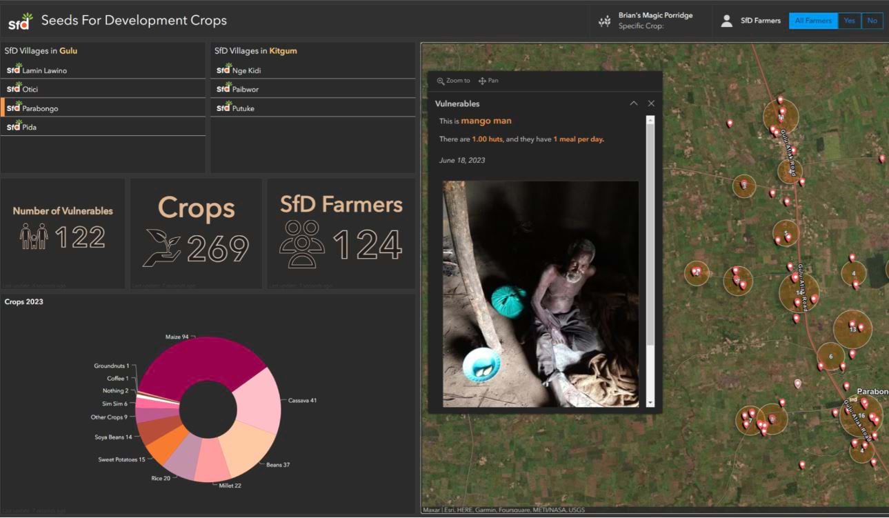
“2022 Annual Report” by NatureServe and “Satellites and Seeds: Improving Food Security in Northern Uganda with GIS and Geospatial Analysis” by Helen Mazalon, GIS Analyst at Alcis, and Alison Hall MBE, Founder Seeds for Development
Outcomes are important, but articulating those outcomes to the general public, stakeholders, and subject matter experts together can be a challenge. NatureServe’s “2022 Annual Report” makes a good show of it. With a personal introduction from their President and CEO, the report highlights innovations in data and maps with maps, including an interactive map for exploring. The authors share success stories through a multi-media sidecar block and an interactive map tour. And they use custom graphics to display donor and financial information.
The Seeds for Development organization works with Northern Ugandan communities to reduce poverty and hunger. Working together, Alcis and Seeds for Development are using GIS tools to identify the communities with the greatest needs and create feasible solutions for those communities. “Satellites and Seeds” walks readers through those GIS tools — including interactive maps, Survey 123, ArcGIS Dashboards — and the practical applications, considerations, and outcomes of technology. The judges were impressed with the design that relies on brevity and intuitiveness. It guides the reader while inviting them to dig deeper only when they choose to do so.
“Wind Erosion” by Petr Zálešák, Ph.D. program in Applied and Landscape Ecology at Mendel University in Brno, Czech Republic
As a part of his doctoral work, Peter integrates GIS and laboratory methods to study wind erosion. “Wind Erosion” outlines his complex research with a clear navigation structure and custom graphics to move readers through the content. Within story sections, illustrations, videos, and interactive maps offer a visual representation of scientific information. Guest judges were impressed with the original maps and embeds that show a high level of effort. But it was the original topic, not often addressed in conservation conversations, that impressed them most.

The 2023 ArcGIS StoryMaps Competition special awards — given by IUCN, the Esri Tribal Governments Program, and Our Towns Civic Foundation — recognize the important contributions of Indigenous and local communities to the 30×30 global goal of conserving 30% of the earth by 2030.

In addition to the Track 1 recognition, “Living Territories: Stories of Territorial Justice” by the Amazon Conservation Team received the notable IUCN Indigenous Peoples Governance and Rights Award.
The award, given by IUCN Protected and Conserved Areas Team, recognizes the critical and long-standing role of Indigenous peoples and their governance systems and customary laws in conserving nature. The award seeks to shine a light on innovative approaches and pathways led by Indigenous peoples towards achieving the recognition of their rights and governance that can lead to transformative change.
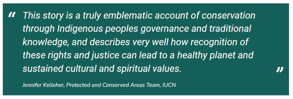
After many years of close collaboration with Indigenous communities, the Amazon Conservation Team has seen the vital importance of territory and secure land rights for Indigenous communities. “Living Territories” shares the perspective of Indigenous peoples in their own words — what territory means to them and how they protect it in return. The interactive maps throughout the story show how many community-based conservation efforts by distant communities come together to positively impact environmental management practices at a regional level.

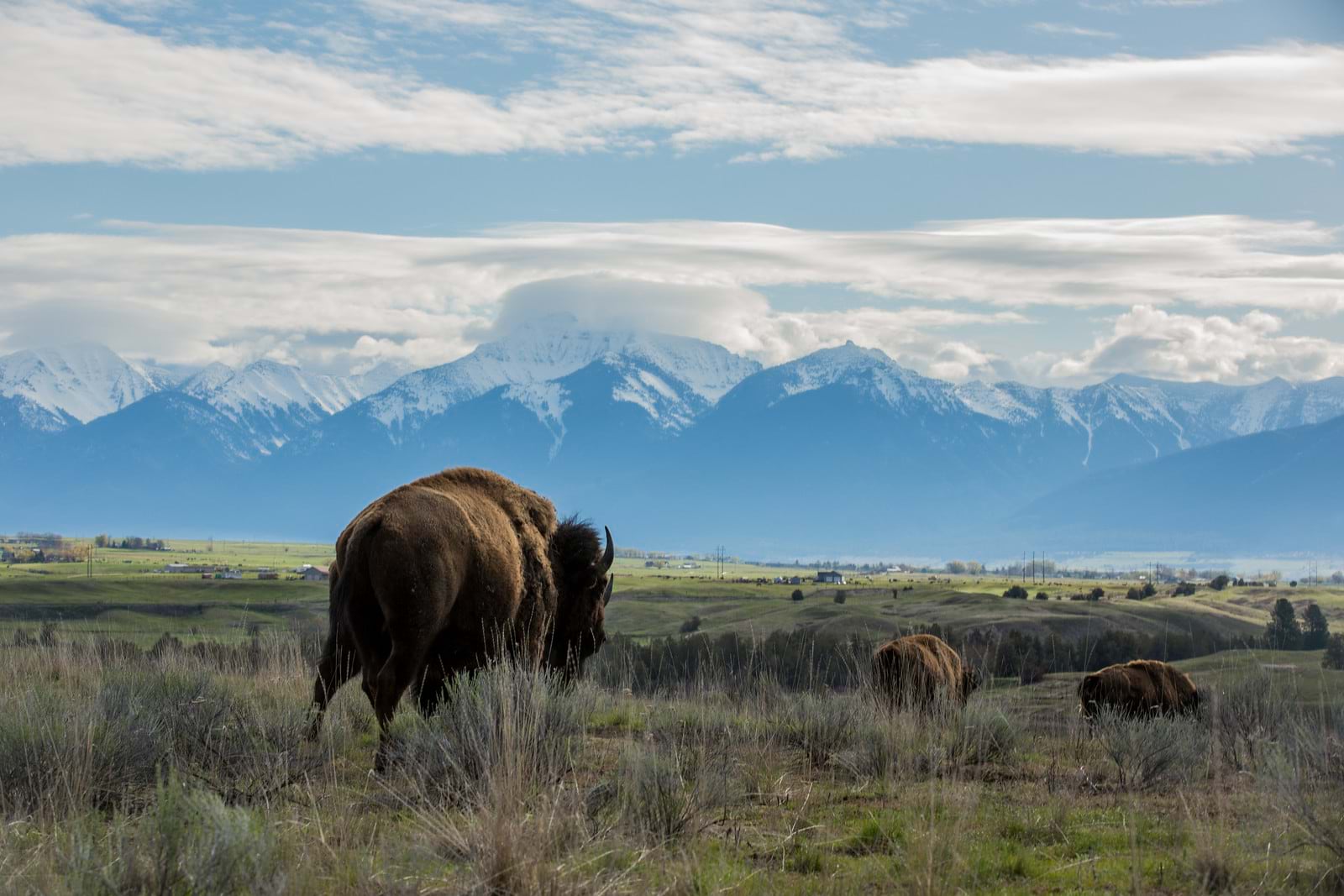
The Esri Tribal Governments Program awarded the Esri Native Nations TEK Award to the Confederated Salish and Kootenai Tribes (CSKT) Climate Strategic Plan: Explore Climate Actions on the Flathead Reservation story collection by Mike Durglo Jr, the CSKT Climate Change Coordinator; Annika Mayer, the Native Drought Project ArcGIS StoryMaps Developer; and contributors Kari Kingery, Casey Ryan, ShiNaasha Pete, Les Evarts, Erin Clinkenbeard, Cody Goklish, Blair Libby, and Martin Zobel.
The award celebrates the invaluable wisdom and cultural heritage of Indigenous communities in their deep understanding of the natural world. This award honors Native Nations’ remarkable dedication to the preservation of TEK, ensuring the continued vitality of their cultural identity and ancestral wisdom. It acknowledges their commitment to fostering ecological resilience, safeguarding natural resources, and promoting community well-being through the application of traditional knowledge in the modern world.

The CSKT Climate Change Strategic Plan collection utilizes the geospatial technologies of Esri in harmony with tribal environmental insights and Tribal Ecological Knowledge that dates back to time immemorial. It highlights environmental challenges in the region and the interconnected efforts to ensure a robust and healthy environment for generations to come. Funded by NOAA’s National Integrated Drought Information System, the project is a collaboration between the Confederated Salish and Kootenai Tribes, Salish Kootenai College, the Montana Climate Office at the University of Montana, and the Wilderness Society.
Read the blog post by the Esri Tribal Governments Program.

Our Towns Civic Foundation is devoted to discovering, sharing, and learning from stories of civic renewal. By showing what’s possible, they encourage success at the local level. Our Towns selected two competition stories for the Our Towns Community Mapping Award: A River Interrupted: Why Removing Defunct Dams is Critical for Restoring the Charles River and Recovering Lost Crab Pots of the Salish Sea.
“A River Interrupted,” from the Charles River Watershed Association outside Boston, uses mapping to connect historical data, photographic and artistic accounts, environmental readings, commercial-fishery data, and real-time civic information to understand what one “interrupted” water course has meant to the people and wildlife of a region, and how it could be restored.
“Recovering Lost Crab Pots of the Salish Sea,” by students Ella Ashford and Riley Forth of Willamette University, uses modern drone-and-sensor technology to reveal the environmental footprint of a region’s marine-fisheries industry, and to equip people to help restore a waterway’s health.
These stories explain, engage, and energize community members in local efforts for environmental sustainability and resilience.

Congratulations to our competition winners.
Visit our 2023 Storytellers of the Year collection of winners and finalists to get inspired and see engaging storytelling techniques in action.


Article Discussion: