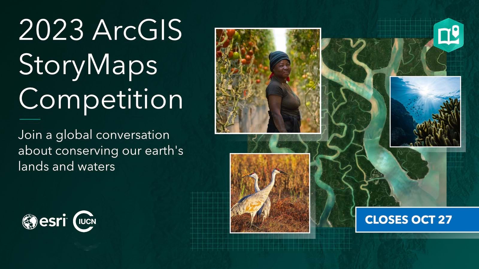
One month ago, Esri and the International Union for Conservation of Nature (IUCN) kicked off the 2023 ArcGIS StoryMaps Competition with great expectations—for innovative storytelling and a meaningful conservation conversation.
Among the submissions to date, there are stories created in multiple languages; a large number of science-focused narratives; and several ArcGIS StoryMaps collections. And we’re only a month into the open submission period!
Are you still working on your competition story? Not sure where to begin? We’ve got you covered.
Read through our competition story tips, and use the resources listed as you plan, build, and publish your story by October 27, 2023.

Tip 1. Select a competition track.
This year, the 2023 ArcGIS StoryMaps Competition includes two tracks for story submissions—one for more traditional story narratives and partnership stories, and another for research and science-based stories.
You’ll submit a story to one competition track only. Read sample stories for each below and select the best fit for your work.
Track 1: An ArcGIS StoryMap story or collection about an Indigenous or community-led conservation project
Explore a few sample conservation success stories:
- From Dying to Rewilding
- Indigenous Life on the Nansemond River
- Roaring Toward the Future
- A Homecoming for Gonarezhou’s Black Rhinos
Track 2: A place-based research project, scientific study, or scholarly article built with ArcGIS StoryMaps
Explore a few sample science-focused stories:
- For the Birds: Monitoring Breeding Landbirds in Alaska’s Interior
- Seagrass: A Struggling Ecosystem in a Unique Perspective
- Bear Necessities
- Nelson Climate Adaptation
Good to know: In each track, student story submissions will be judged against other student submissions only. To qualify as a student, you must be 18 years or older and seeking a degree at a two or four-year institution of higher education.
Tip 2. Don’t overcomplicate the competition topic.
Adopted by leaders worldwide, the 30 x 30 effort aims to protect 30% of the planet by 2030.
As of 2021, only 17% of the earth’s land surface and 8% of our oceans were protected or conserved. How can we achieve the ambitious 30 x 30 goal? It will take action from all of us—from local partnerships to Indigenous communities to global organizations.
We invite you to share your 30 x 30 ideas and actions through the competition.
What “counts” towards the 30 x 30 goal? What topics or themes should a competition story cover? It’s easy to get lost in the weeds. Watch the 30 x 30 video on @Esri_Maps TikTok for a high-level overview.
Each day, you contribute to the 30 x 30 goal when you:
- Recycle and plant trees in your own community
- Participate in citizen science projects or conduct academic research
- Support parks and outdoor education
- Practice sustainable agriculture on your land
- And so much more
Consider projects at work, school, or home that support healthy natural habitats and thriving, inclusive communities. Browse our 30 x 30 story and Conservation Story Showcase for inspiration.
Tip 3. Build your story together.
Whether you’re a student, part of a local organization, or a global agency, this competition is for you. All storytellers globally, 18 years old and over, are encouraged to submit new or existing stories created with ArcGIS StoryMaps.
As in previous years, a group can submit one story together—as an applicant. And this year’s submissions to date show a trend toward collaborative story creation.
Sample group efforts might include—
- A college course that breaks students into multiple storytelling workgroups
- A research study with multiple contributors
- A local partnership project with multiple partners
- An ArcGIS StoryMaps collection with multiple stories related to one project
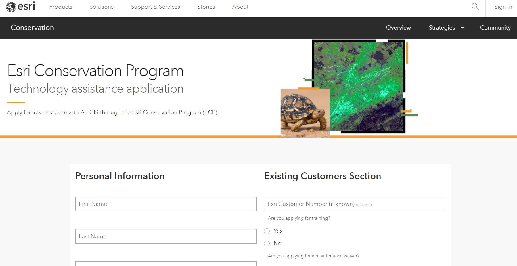
To encourage inclusion and collaboration, Esri invites organizations without ArcGIS access to use the Esri Conservation Program for their competition stories. Apply now or share the link with partners: https://www.esri.com/en-us/industries/conservation/program-application.
Tip 4. Take advice from other storytellers.
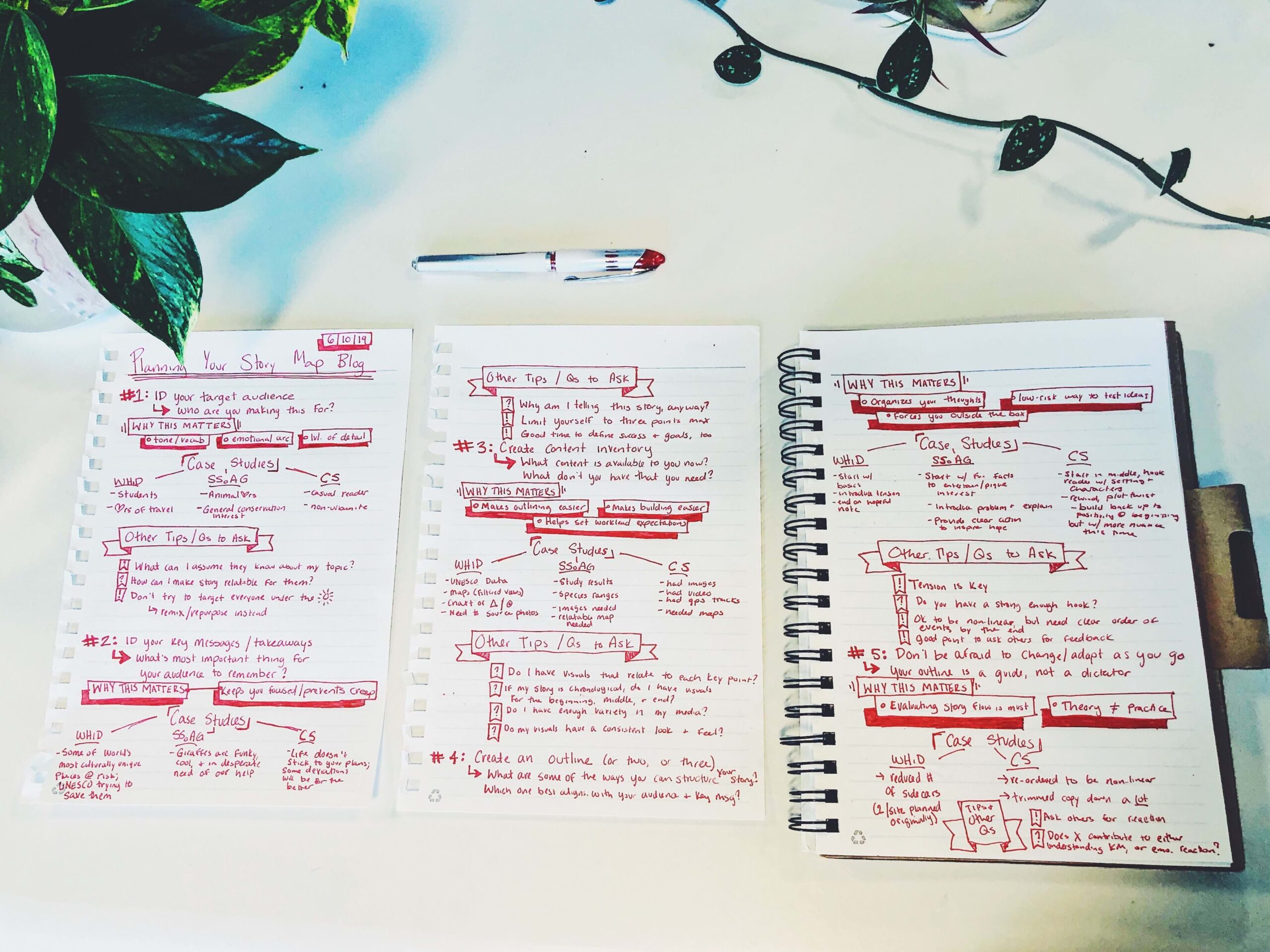
Honestly, getting started was the hardest part...I created a word document with one very long table and many rows. The table included two columns—one column with the story text and the other with the matching media assets like videos, photos, and maps...That initial planning process made the actual technical story building very easy.
The annual ArcGIS StoryMaps competition encourages innovative storytelling, mapping, and data visualization. The StoryMaps team interviews the winners—our Storytellers of the Year—to get a behind-the-scenes look at their storytelling processes and valuable advice for other storytellers.
Without fail, they share two tips for creating a winning story.
- Browse the ArcGIS StoryMaps gallery for inspiration and creative uses of ArcGIS StoryMaps features.
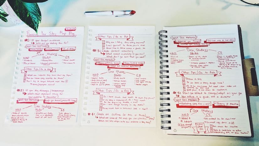
- Plan before you build. Our winners gather content and organize information before they create a draft story in ArcGIS StoryMaps. Some use a basic outline; others create a storyboard. Read the Planning and Outlining Your Story Maps blog post for ideas.
Read other expert advice from our Storytellers of the Year:
Tip 5. Make the most of new ArcGIS StoryMaps features.
The 2023 Esri User Conference marked the four-year anniversary of ArcGIS StoryMaps.
Since the launch, the product capabilities have grown exponentially. And your stories reflect the product growth with beautiful custom themes, advanced mapping features, and media-rich content.
Build your competition story with the most recent ArcGIS StoryMaps updates like new:
- Image editor options
- Map tour numbering and progress lines
- Film strip option for photo galleries
- Featured themes
- Collection enhancements
- And much more
Read our What’s New and the Road Ahead story to learn more about enhancements now available to you and what’s coming soon.
Are you new to ArcGIS StoryMaps or need a fresher before you jump in? Get started with these helpful resources.
Tip 6. Meet the competition judges.
Each year, the StoryMaps team and our partners host a virtual Meet the Judges webinar for storytellers globally.
Join the September 2023 event and meet the talented storytelling, mapping, and conservation experts who will be reading your stories!
- Deborah Fallows, Cofounder, Our Towns Civic Foundation
- Mike Frame, Associate Program Coordinator and Deputy Director, USGS Science Analytics and Synthesis
- Jennifer Kelleher, Lead of Governance, Equity, and Rights, Protected and Conserved Areas Team, IUCN
- John Duane Goes in Center, GIS leader, teacher, and speaker
- Dr. Kelsey Leonard, Water Scientist
- Joshua Stevens, Esri Cartographic Editor, Maps.com
- Sandra Mechelle Turner, National Geographic Certified Education and Emerging Explorer
Follow @ArcGISStoryMaps Twitter for the event date, time, and registration information.
So are you a 2023 Storyteller of the Year?
Visit the 2023 ArcGIS StoryMaps Competition website to get started.
We can’t wait to see what you create.


Commenting is not enabled for this article.