Digital Twins are virtual representations of the real world that incorporate physical objects, processes, relationships, and behaviors. Digital twins are used to represent accurate historical state, to observe and monitor performance, and to explore or predict future state. A digital twin of a fixed asset or real-world system benefits directly from the inclusion of GIS data about the asset and GIS context around the asset. GIS can be used to create digital twins of the natural and built environment and it can also be used to integrate many different digital representations of the real world.
In the last several years, the convergence of geospatial technology, building information modeling (BIM), and interactive 3D has driven a conversation about “Digital Twins” and how they may be used to simulate single facilities, entire cities, and even large natural systems. We frequently get asked how GIS plays into the digital twin strategy of our customers and here we provide some of our most common answers.
What is a digital twin?
Digital Twins are virtual representations of the real world including physical objects, processes, relationships, and behaviors. When we reference digital twins in GIS, we’re typically speaking about virtual models of real-world assets or natural systems along with information models, data, reports, analyses, and user experiences intended to capture state, monitor performance, and predict future outcomes. Digital twins may be used to represent current, past, or even future states of assets and may not reflect exactly what exists in the real world today.
The concept of a digital twin originated in the product manufacturing industry. Precise digital models of complex objects, such as airplanes or cars, can be captured in a database for purposes of reporting, analysis, and, eventually, simulating and testing an object’s performance. The original digital twin concept helped move the use of data about an asset from strictly used for finance and cost-accounting to use for performance and operational analysis that could then be iterated back into the financial perspective of the asset’s manufacture and sales.

Today, we’re involved in many discussions about how the digital twin concept can be applied to real world infrastructure management, buildings, and even for systems at scales as large as whole cities and natural environments. The idea that a model of fixed physical assets can be used to help understand performance, costs, and construction is compelling. Extending the digital twin concept to inhabited systems that include ongoing human activity including maintenance and operation becomes even more interesting, but also drives complexity to be high.
GIS has been used to model real world systems with high accuracy for years. Utility networks, legal parcel boundaries, and traffic networks have all been represented in GIS for purposes of asset management, maintenance, and planning. The digital twin concept builds on older techniques and technologies for data warehousing, federated systems, and object-based data models by adding realism, interactive user experience, and high-resolution 3D and 4D models of assets and systems. Ultimately, the digital twin must help the owner or operator of the real-world asset or system to solve business or mission-critical applications to justify the investment and process changes that will inform and maintain the twin.
What kinds of problems can a digital twin help solve?
The three main problems that digital twins address include:
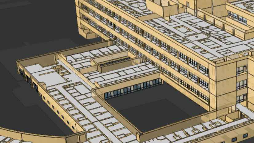
- Historical record – A digital twin can be used to archive a state in time of a specific asset or system. Parcel boundaries and utility network models both offer good examples of geospatial twins of real-world systems that can be captured for legal and operational purposes. Reality capture, such as the point cloud and textured mesh output of SURE for ArcGIS, can serve as a high resolution, 3D snapshot of the real world. From these snapshots, some vendors can even extract BIM data that can be used as either historical record or as a starting point for future renovation or operations.

- Operational performance monitoring – One of the benefits of having a 3D virtual model of an asset is that 3D experiences can provide a consumer-level experience for interaction and exploration. Every day users can look at the model and see the real world. For that reason, many digital twin efforts use the twin as a dashboard showing current performance of the actual system, often with live feeds and dynamically updated attributes. These systems also often link out to other, federated enterprise systems. One of the biggest benefits that GIS brings to the digital twin is that GIS can store, stream, and provide dynamic experiences to explore 3D assets as small as a building or as large as a city, all in the context of the built and natural world around the assets.

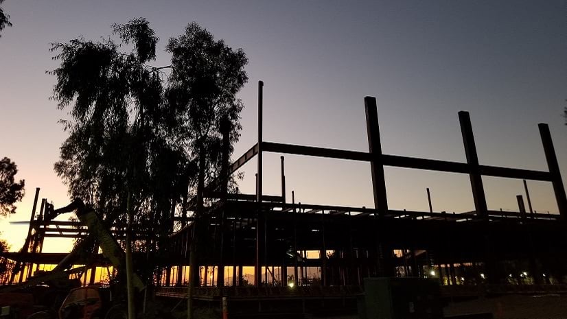
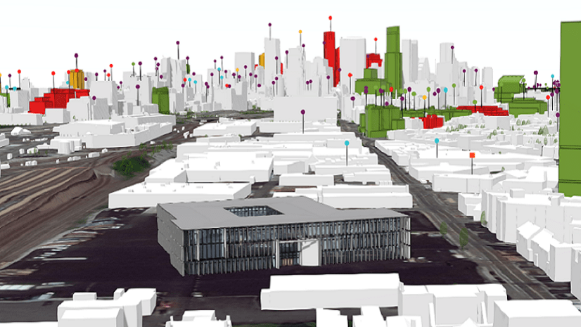
- Testing or predicting future performance – Some of the highest expectations around digital twins come from having the ability to use a high precision version of an asset to simulate, evaluate, and predict the future. In the automotive industry, digital twins can be used to explore aerodynamics of cars. In the AEC industry, aggregated BIM information is used in the practice of Virtual Design and Construction to play out planned construction to detect possible construction conflicts or safety issues. At the scale of a city, planners want to be able to simulate future change, such as the shape of a new building, changes in a planned highway, or improvements to sea walls. The hope with a digital twin at the scale of a city is that simulation and analysis of future changes can be used to understand and to optimize the performance impact of change while minimizing the cost of implementation.

Is GIS necessary to have a digital twin?
If the goal of a digital twin is to represent historical accuracy, view performance, or predict future state, then any digital twin of a fixed asset or real-world system benefits directly from the inclusion of GIS data about the asset and GIS context around the asset. GIS can be used to create digital twins of the natural and built environment and it can also be used to integrate many different digital representations of the real world.
For singular objects in the mechanical world, an entire object can be represented in a self-contained data schema that can be used for observation and hypothesis testing. For fixed physical assets or natural systems, data about soils, asset materials, weather, traffic, maintenance, and utilities will all be stored in different data models with diverse data quality, resolution, and ownership. GIS is the only technology that provides a simple key – ‘location’ – that allows complex analysis of such diverse data models and data sets.

In the last few years, Esri has invested in ArcGIS to dramatically improve capability that turns a GIS into the ideal technology to bring together federated data sets behind dashboards, StoryMaps, and 2D, 3D, and 4D maps to facilitate communication, observation, and analysis of complex systems, such as entire cities. One of the powers of GIS is that the more data that is added, the more benefit the system provides.
GIS data also powers many simulations of real-world dynamics and behaviors. For simple analyses, such as investigating the shadow impact of a planned structure, 3D GIS provides dynamic, easy-to-use experiences in a web browser. For complex simulations, advanced geoprocessing workflows may be used to simulate changes in large utility networks and then to see those changes in a simple dashboard. Where ArcGIS stops, partner solutions can simulate airflow through a major urban center or the power outages in a major utility. We have seen significantly increased demand for the use of GIS content in game engines to take advantage of their capabilities as well, leading us to release the ArcGIS Maps SDK for Unity and Unreal Engine.
What are some of the considerations that would help determine the scope of a digital twin project?
When approaching a digital twin project, much like approaching any complex system design, the ‘operator’ of the digital twin will need to identify criteria that will help limit scope while also supporting longer term maintainability.
Given some of the diversity of the uses of digital twins, here are some of the considerations that will help identify the scope and requirements:
- Time scale – Is the digital twin used for a single project? Or is it planned to be used throughout the life of an asset? VDC practice, for example, typically only really uses the digital twin for the life of a project and does not guarantee that the twin will be usable for operations of assets.
- Stakeholder diversity – Is the team of people who will be working on or dependent on the digital twin a single project team or a diverse ecosystem of participants from multiple domains?
- Systems complexity – The complexity of a digital twin will increase, probably exponentially, with the number of systems that are modeled. This is true for building systems, such as plumbing, electrical, mechanical, security, and telecommunications, and even more true for campuses and cities. To help limit complexity, the number of systems modeled in a digital twin should likely be focused on the problems the twin will be used to solve.
- Data ownership – Data ownership drives both access rights to data and opportunity for connectivity between data sets. Owners of a facility, campus, or portfolio of commercial buildings may find that they have good control over available data and the ability to set requirements for incoming data sets. Operators at the scale of a college campus or city may struggle assembling a digital twin that addresses their planned applications if not all utilities, facilities, or other systems that impact their operations are under their control.
- Data security – The security of a system, such as a digital twin, will be determined by the requirements of the most secure dataset in the system. Just because a highly secure dataset could be included in a digital twin doesn’t mean that it should be included if access restrictions will end up limiting stakeholder requirements or other capabilities of the digital twin.
A digital twin is a virtual model of a real-world object. In scientific context, a model is used to either test hypotheses or to predict future states of systems. Scientific models are typically tailored to test specific elements of the system and often can’t be stretched to test or predict scenarios that weren’t considered when building the model. When building a digital twin project, it’s worth considering that success may be dependent on limiting scope to achievable outcomes, not on planning to solve every future problem at once.

What are some of the successful elements that go into building a digital twin?
Many of the elements that go into a successful digital twin project are the same elements that drive successful IT implementation projects across industries. Fundamentally, the digital twin is deeply dependent on data, ability to connect data, and ability to create user experiences on top of the data that help solve problems and increase understanding.
- Well-defined outputs – The problem domains and requirements for reporting and analysis are going to directly drive the data requirements and experiences that will be built for the digital twin. Specifying a clear set of desired outcomes, reports, and analyses up front will help make the digital twin more achievable. No technology implementation is static and future iterations of the digital twin can incorporate more requirements.
- Design Thinking approach – A deep understanding of how a digital twin will be used to support existing business practices will help inform and design experiences that enable work to get done using the twin. Using a digital twin as a dashboard view into real-time systems will have different user experience than XR-based planning and simulation tools to explore future change. Experiences can only be understood by working with engaged stakeholders throughout the planning and design of the twin.
- Clear requirements for information architecture – As Nigel Stroud from Heathrow says, “Don’t ask, don’t get.” The owner of the digital twin needs to understand, deeply, how they plan to use the twin in the future… and then ask for data and services to be delivered according to specifications that will provide what is needed. This may require extra upfront investment, but it is also the only way to reliably obtain standardized, quality assured data to hydrate the digital twin.
- Open Data Standards and APIs – Because data and systems integration is so much of the problem set of creating a digital twin, customers need to specify open standards that will allow them to connect to data from many different applications, reliably and across long time periods. This is true for BIM models, that may be delivered according to an industry-standard file type, and it’s also true for real-time data feeds that may be accessed through an open REST API.
- Standardized authentication and licensing – If a digital twin is going to be used by a small team, access and authentication may not be a huge issue. If a digital twin is going to be used by a large set of collaborators and stakeholders across an organization such as a city, the requirements must specify how federated data sets will be accessed using standardized authentication and identity patterns. If a CAC card is going to be needed, make sure everyone knows that at the start of the project. ArcGIS Enterprise standard licensing, for example, is great for sharing within an organization, but ArcGIS Hub Premium licensing adds the capability for an organization to share content with everyday citizens and community participants.

What’s next with ArcGIS and digital twins?
Today, ArcGIS customers can combine reality capture, 3D, 2D, planimetric data, and real-time feeds in dynamic, interactive experiences to help describe individual facilities, large utility and transportation systems, or entire cities. Geospatial digital twins, built with ArcGIS, can be explored on mobile devices, in a web browser, or through rich desktop applications from Esri and from partners. The geodatabase portion of a digital twin, stored in ArcGIS Online or ArcGIS Enterprise, is accessible through a wide variety of Open Standard APIs, services, and data formats that facilitate exchange and integration with other enterprise systems such as IBM Maximo, Autodesk BIM 360, and many more.

Many of our customers are already jumping in and exploring the art of the possible today.
- Amsterdam Airport Schiphol has built a dynamic, digital twin of their airport premises incorporating open standard BIM data through Safe Software’s FME into ArcGIS with live data feeds for aircraft and ground vehicle locations.
- HNTB is using innovative web-based 3D ArcGIS apps to present time and cost visualization in construction projects. Their Long Island Railroad project allows teams to visualize project progress and even play out scenarios for future work to explore schedule and budget impacts.
- Hartsfield-Jackson Atlanta International Airport has built a digital twin using CAD, BIM data, GIS, and information about the surrounding environment that informs wayfinding and equipment placement, hazard analysis, and space management.
- Hazen and Sawyer helps customers deliver safe drinking water and limit water pollution and is using GIS as the aggregator for BIM data, reality capture, and systems information about entire water treatment plants to have a dashboard view into operations and maintenance status of facilities.
GIS has played a central role in helping customers model, analyze, and observe their assets and systems for decades. New technologies, such as game engines and real-time data feeds, have added exciting possibilities to create more interactive, richer experiences for users to explore, analyze, and experience their assets and the world around them.
You can expect from Esri that we’ll be investing heavily in reality capture, BIM integration, buildings system integration, IoT, and many more technologies and tools that will help our customers create the next, great Digital Twins of tomorrow with ArcGIS.
Visit our Digital Twins page to keep up-to-date on what were doing next!
Commenting is not enabled for this article.