The U.S. Census recently made public the first in a series of releases of the Census 2020 data. That dataset, known as redistricting data (Public Law 94), includes detailed population and housing data that, for the first time, are available down to the block level. Esri’s demographers have enhanced the dataset—appending additional information about ethnicity—and we are proud to offer the data as part of the December 2021 release of the ArcGIS Business Analyst Web App (Web App). The data is optimized for use through infographics, maps, and analytical tools.
This blog article shares key information about the integration of the first U.S. Census 2020 dataset in the Web App:
- Why the redistricting data matters
- How to access this data
- Variables in the upcoming data release
Why the redistricting data matters
Esri is committed to providing data pertinent to the needs of our users. From a pure data perspective, it’s an exciting time to access the latest 2020 Census standard geography boundaries, especially the redistricting data, which is used to redraw election boundaries. (States are required to make this process transparent to the public and to create maps with boundaries that are roughly equal in population size.) This data will influence who gets elected in the areas we live in and how resources are distributed for the next ten years. Unlike past decades, this data also includes the smallest geography level of Census data available: the census block level. For our users, getting this data before the regular summer annual data update provides access six months earlier than usual.
For ArcGIS Business Analyst users, this data is crucial to providing the most up-to-date site selection and market analysis results. Redistricting data can also provide transparency in public agency spending, planning, and economic development; show compliance with federal grants and reporting requirements in the healthcare industry; and inform emergency planning and disaster response and recovery.
Access the data
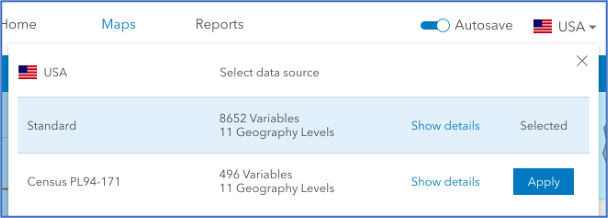
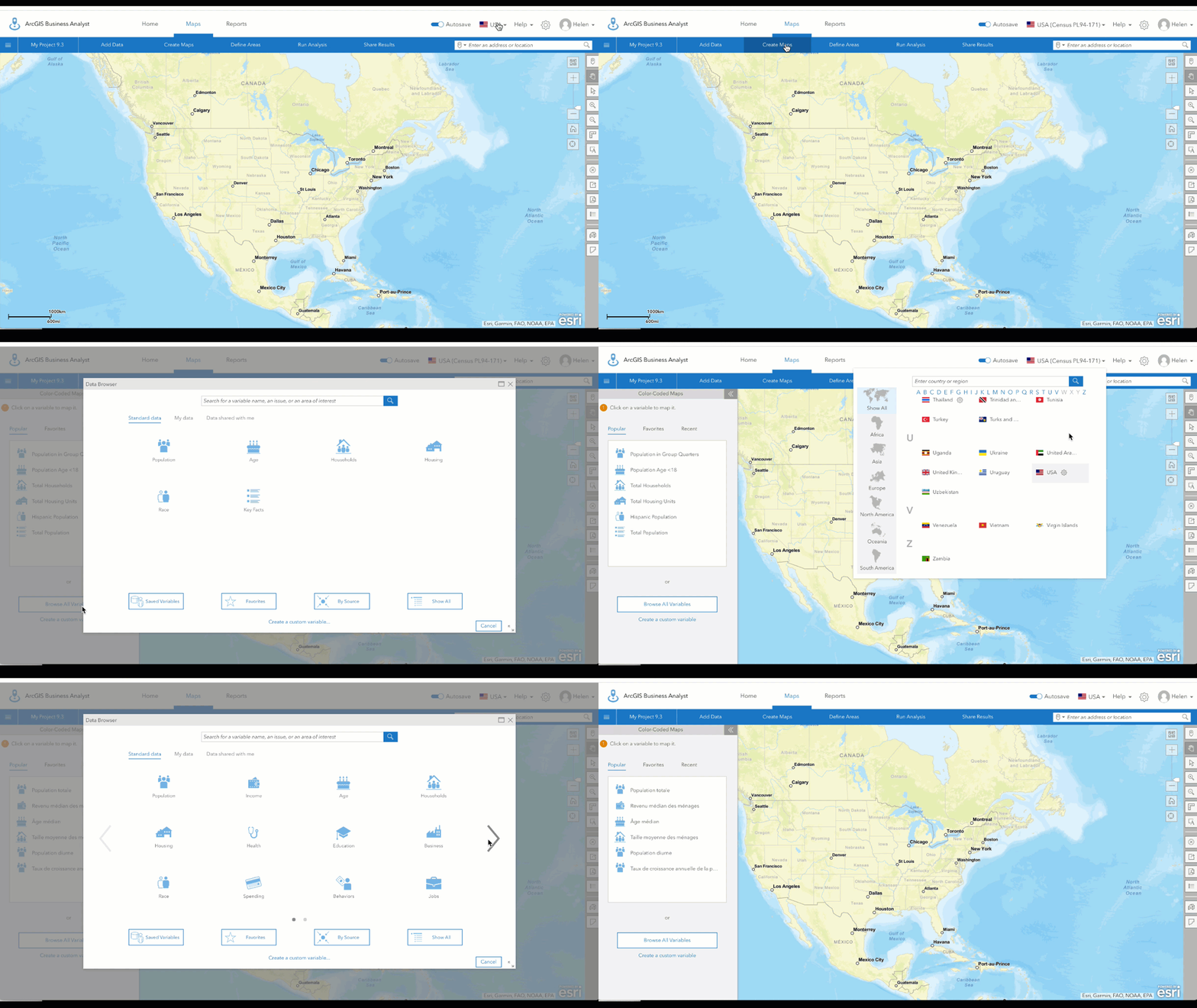
The December 2021 release will be the first time that the Web App provides access to two different versions of the U.S. Census decennial data within the app’s country selector. The two selection options for USA are “Standard,” which includes the Census 2010-based data currently available, and a new option for “Census PL 94-171,” which includes the Census 2020 redistricting data.
Variables in the redistricting data
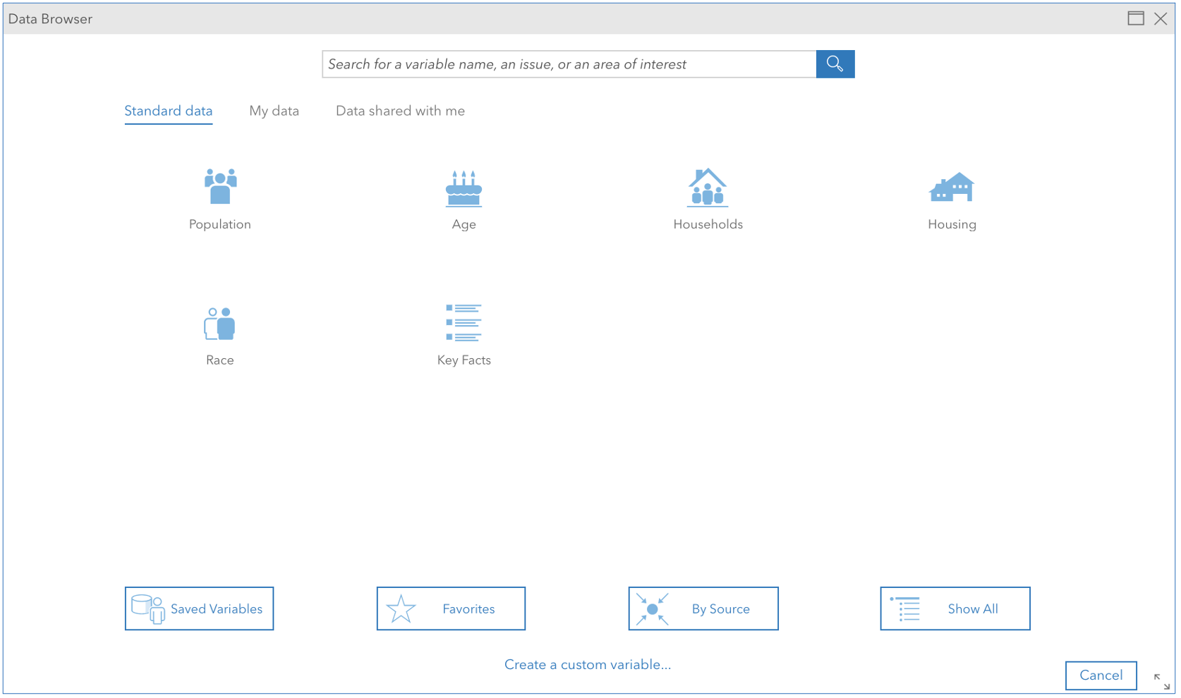
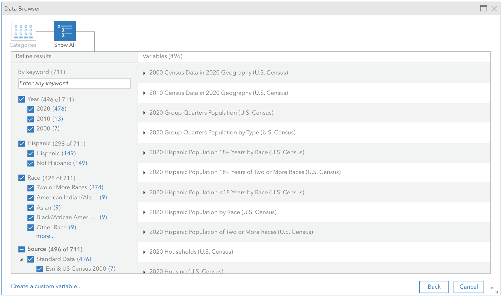
This data update includes many variables crucial to workflows in the Web App. The redistricting data includes:
- Total population
- Households
- Housing units
- Population by race and non-Hispanic origin
- Population age 18+ by race
- Housing occupancy
- Group quarters
In the December 2021 data update, the Web App includes additional datasets created by Esri’s demographers, including:
- Population by race and Hispanic origin
- Population age <18 by race
- Census 2010 and Census 2000 population, households, and housing units
Variable details
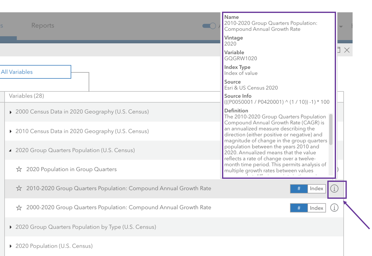
In the December 2021 release, we added additional metadata to the variables. If you hover over the info button shown for each of the variables in the data browser, you will now see new information for the redistricting data in addition to the ones we provided before the release (source, name, vintage), such as the source info, percent base, index types, and definition.
Infographic template
To help our users and their stakeholders make meaningful decisions based on the redistricting data, the Web App features a new infographic template to visualize it. The images below show the dedicated infographic template for the redistricting data, which includes information such as key facts, annual growth rate, household population, and population by race.
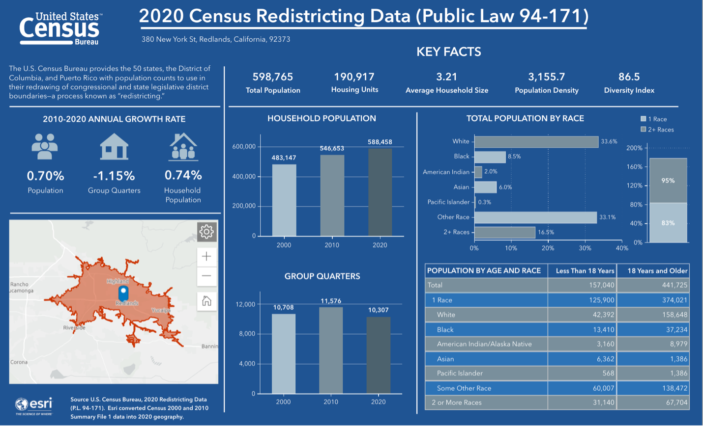
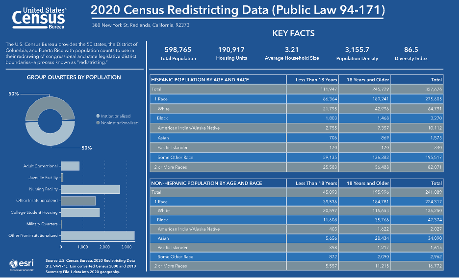
Please note that as the redistricting data is just the first step of a phased release of the Census 2020 data, the December 2021 release only includes the variables noted above (a total of 496 variables). The remaining variables will be integrated into the Web App as the Census releases them.
Update: Starting December 16, 2021, the Business and Facilities Search workflow can be used after selecting U.S. Census 2020 data as the data source.
Additional resources
Within the ArcGIS Business Analyst family of products, the data is now available in the Business Analyst Web App, Community Analyst, and Business Analyst Pro (extension to ArcGIS Pro) via ArcGIS login. Please note that the use of the dataset consumes credits and are not part of the downloadable dataset at this time. The on-premises, locally downloadable datasets for use in ArcGIS Business Analyst Pro or ArcGIS Business Analyst Enterprise will not be available until a future date.
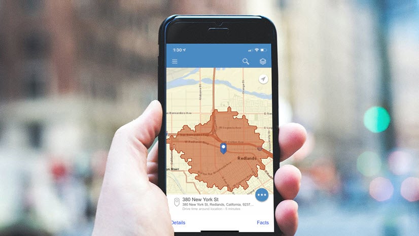
Please note: the Mobile App does not allow you to switch the data source by country, so this data is not visible in the Mobile App.
We hope you enjoy the redistricting data in the December 2021 release. Please visit the following sites for more information on ArcGIS Business Analyst:
- Business Analyst product overview page
- Review pricing and purchase Business Analyst
- Business Analyst resources page
- LinkedIn user group
- Business Analyst YouTube playlist
- Esri Community
- Business Analyst Web App login page
- Read the reviews of Business Analyst on G2
For more information regarding Census 2020 data throughout Esri products, please read the following articles:
- Access 2020 U.S. Census Data with Esri
- Esri Redistricting Solution Now Includes 2020 Census Data
- Esri’s Differential Privacy Resources
- Census redistricting data and maps available in ArcGIS Living Atlas
Note: This blog was updated to reflect changes on December 16th to allow the use of points-of-location data in Business and Facilities Search workflow with Census 2020 redistricting data.


Article Discussion: