ArcGIS offers multiple ways to work with building information modeling (BIM) data from Autodesk in geographic information system (GIS) workflows. Whether you need to work with BIM models on active construction projects or asset operations, ArcGIS has built-in capabilities for sharing 3D scenes over the web with the right amount of detail and collaboration to fit your needs.
Esri’s geospatial platform supports integrating BIM models from Autodesk Forma (formerly Autodesk Construction Cloud)—each tailored to different project needs. This article explores the two primary methods:
- Building layers with ArcGIS Pro: Ideal for highly detailed, element-level BIM analysis and asset management.
- Simplified 3D models with ArcGIS GeoBIM: Ideal for fast, lightweight visualization and frequent updates during construction.
Building layers with ArcGIS Pro
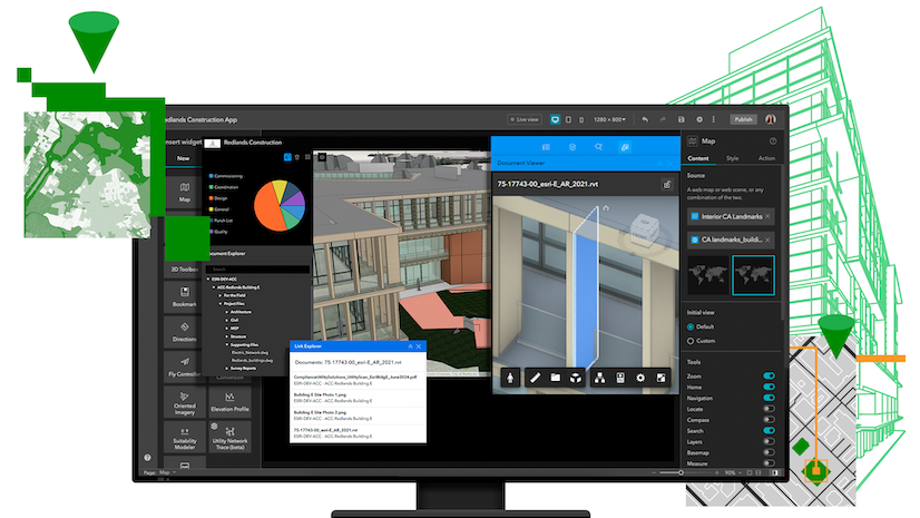
This method is ideal for users who require highly detailed, element-level interaction with BIM models stored in Autodesk Forma. Using a BIM Cloud Connection in ArcGIS Pro, users can import Revit and Industry Foundation Classes (IFC) documents from their Autodesk common data environment (CDE) and convert them into building layers.
Building (scene) layers are 3D layers for representing BIM models in ArcGIS and across the geospatial platform. They organize and preserve the full structure of BIM models in GIS form, including geometry, disciplines, categories, phases, and detailed architecture, engineering, and construction (AEC) attributes. This enables teams and stakeholders to not only visualize but also filter and analyze multiple aspects of BIM models, such as by architectural and mechanical elements or building level.

Building layers are created in ArcGIS Pro and integrated across the ArcGIS platform. Once published to 3D web scenes, they can be viewed in Scene Viewer and further leveraged in ArcGIS Experience Builder, ArcGIS GeoBIM, and other ArcGIS apps—enabling consistent, interactive 3D experiences across desktop, web, and mobile platforms.
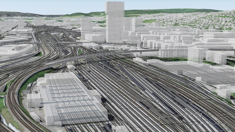
The primary advantage of using building layers is the ability to visualize and analyze buildings and infrastructure in their accurate, real-world geographic context. By combining multiple building layers in a single 3D web scene, you can explore an entire site, facility, campus or urban area to analyze how new projects will impact existing ones. For example, you can assess the proximity of a new building to existing utilities and parking areas, the impact of its shadows on surrounding vegetation, and the overall aesthetic integration.
During construction, building layers enhance project visibility by showing progress and site context—improving logistics, coordination, and stakeholder communication. After project handover, they support asset, space, and environmental management by linking BIM data from Autodesk to operational GIS systems. This enables spatial analysis and informed decision-making across the ArcGIS platform—from ArcGIS Pro to ArcGIS GeoBIM and beyond.
To learn how to get started with building layers from ArcGIS Pro, visit the BIM and GIS tutorial series or this tutorial for a detailed walkthrough.
You can also watch the video below on using BIM Cloud Connection in ArcGIS Pro to import BIM models from Autodesk.
Use a BIM Cloud Connection in ArcGIS Pro to import design files stored in Autodesk Forma, including Revit and IFC files.
Building layers are designed to preserve the highest level of detail and structure from BIM models, making them ideal for in-depth analysis, design reviews, and asset management workflows. As part of this approach, updates to the BIM model are republished with ArcGIS Pro to ensure that the most accurate and complete data is reflected in your 3D web scenes. The publishing process can be automated, helping teams maintain consistency and reduce errors across large or complex projects.
Simplified 3D models with ArcGIS GeoBIM
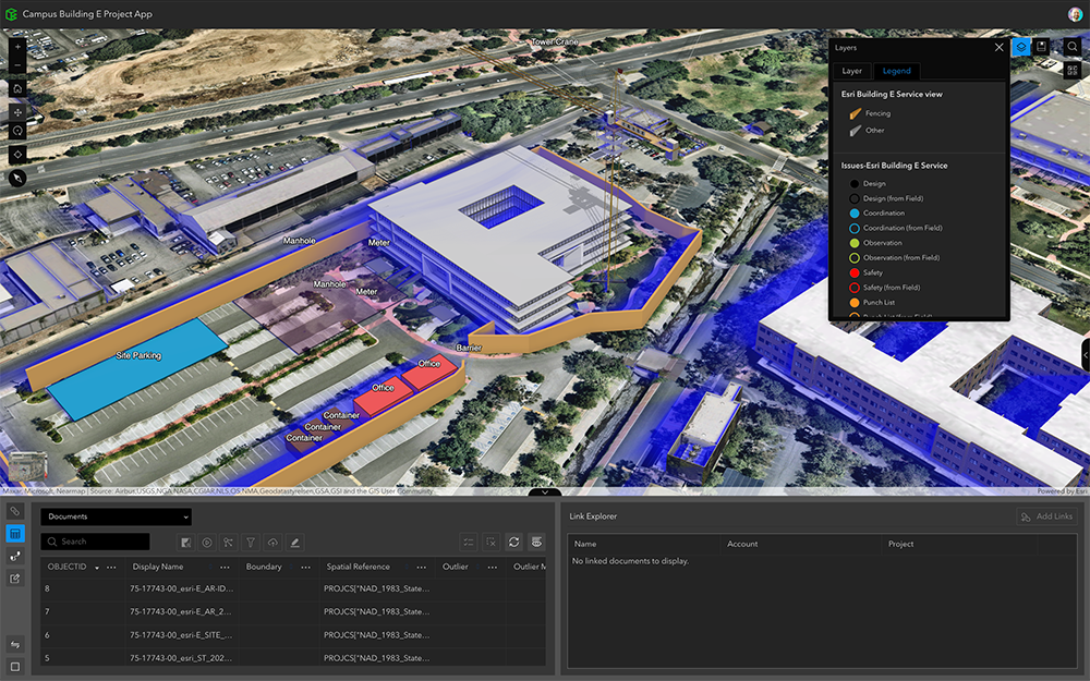
For teams that need to respond quickly to changes in BIM content, a new tool in ArcGIS GeoBIM offers a streamlined, high-performance solution. Introduced in the June 2025 update, the Add Document Models tool generates simplified 3D models directly from Revit and IFC documents in Autodesk Forma—automatically georeferenced and linked to the source.
The simplified 3D model method using ArcGIS GeoBIM focuses on agility and performance. It’s optimized for fast updates—making it ideal for teams that need to visualize spatially accurate BIM content without the overhead of full model complexity.

This method is optimized for AEC project teams who need to visualize spatially accurate BIM content without the overhead of full model complexity. It’s especially well-suited for construction monitoring, stakeholder engagement, and mobile workflows in the field. Using ArcGIS GeoBIM projects, teams can collect and track project issues from both the office or on-site, and upload them to Autodesk Forma—keeping everyone aligned.
By simplifying updates and ensuring spatial precision, teams save time, access critical design data faster, and improve decision-making with responsive, geolocated BIM content.

While simplified models are optimized for performance and collaboration, they do not preserve the amount of detail that building layers do. They are treated as single 3D objects in web scenes and do not support filtering by discipline, category, or level. However, they maintain direct links to the original Revit or IFC documents in Autodesk, ensuring access to the latest full model detail when needed.
Try the new Add Document Models tool in ArcGIS GeoBIM. With a Creator user type and above, you can create ArcGIS GeoBIM projects connected to Autodesk Forma.
Choosing the right method for your project
Both methods empower you to bring BIM data into geospatial context and for use in GIS workflows—each tailored to different project needs.
- Use building layers when you need comprehensive, element-level detail for design reviews, asset management, or spatial analysis.
- Choose simplified 3D models when speed, agility, and frequent updates are key for construction monitoring, stakeholder engagement, and mobile workflows.
Whether you’re building a detailed asset management dashboard or a lightweight project viewer, the ArcGIS platform gives you the flexibility to integrate BIM content from Autodesk in the way that works best for your team’s needs.
The Add Document Models tool is currently in beta for ArcGIS GeoBIM on ArcGIS Online. Coming to ArcGIS Enterprise. Learn more here.


Article Discussion: