Join us both in-person and virtually for the 2022 Esri User Conference, taking place July 11-15 in San Diego, California. Be a part of the world’s largest conference for GIS professionals and connect with other like-minded individuals solving the world’s biggest challenges.
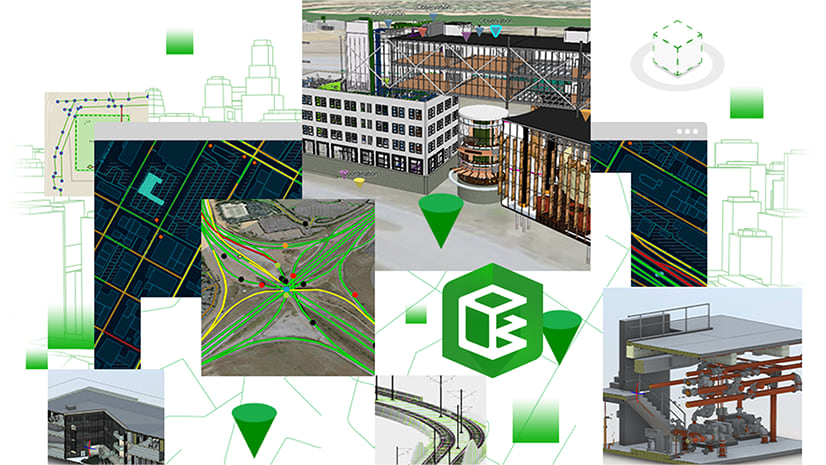
Let’s cover the ways you can learn more about the possibilities of bringing building information modeling (BIM) data into your GIS workflows and projects. In this blog post, you will find a curated list of sessions about GIS and BIM integration and ArcGIS GeoBIM, opportunities to connect with Esri experts, and more.
Agenda Highlights
- Esri Showcase
- Sessions on GIS and BIM Integration
- Special Interest Group Meetings
- Esri Service Appointments
- Registering to Attend
Esri Showcase
If you will be joining us at the San Diego Convention Center, you can find our kiosks for GIS and BIM integration and ArcGIS GeoBIM located within the AEC Showcase (Ground Level, Exhibit Halls ABC). Visit us to speak with our GIS-BIM experts, see a demo of ArcGIS GeoBIM, and learn more about connecting your projects in context.
AEC Showcase Hours
Tuesday, July 12: 9:00 a.m. — 6:00 p.m.
Wednesday, July 13: 9:00 a.m. — 6:00 p.m.
Thursday, July 14: 9:00 a.m. — 4:00 p.m.

Sessions on GIS and BIM Integration

ArcGIS GeoBIM: An Introduction
Tuesday, July 12, 2:30 p.m. — 3:30 p.m.
SDCC – Room 05 B
TECHNICAL WORKSHOP
ArcGIS GeoBIM delivers an easy-to-use web-based experience for project teams to explore and collaborate on BIM projects using data from multiple systems in a geospatial context. AEC and Operations teams can work with their linked data from multiple systems in configurable web apps that simplify communication and collaboration with stakeholders. Come learn how to create apps in ArcGIS GeoBIM that reduce file conversion, increase access to evolving data, and share project information securely for better decision making. Find out about recent product updates and what’s coming next on the ArcGIS GeoBIM roadmap.
Anthony Renteria, Stephen Brockwell, Ozgur Ertac

ArcGIS Pro: Integrating BIM Designs
Tuesday, July 12, 1:00 p.m. — 2:00 p.m.
SDCC – Room 30 B
TECHNICAL WORKSHOP
Building Information Models (BIM) are attribute-rich digital models of buildings and infrastructure. ArcGIS Pro can now help you not only visualize this information, but also access the rich attributes and 3D content in your GIS by directly reading IFC and Revit files. This session will show how you can use your Building Information Models (BIM), used for architectural designs, as part of a broader geospatial environment earlier in the design process.
David Alvarez, Karen Hodge, Jeff Reinhart

ArcGIS Indoors: An Introduction
Wednesday, July 13, 8:30 a.m. — 9:30 a.m.
SDCC – Room 02
TECHNICAL WORKSHOP
In this session, learn how to transform CAD and BIM floor plans into an information model in the geodatabase for authoring and sharing floor aware maps of your building interiors. Also learn how to leverage these indoor maps to power Indoors apps for space planning and offering employees, building occupants, and visitors a web and mobile experience for way-finding, workspace reservation, location sharing, building incident reporting, and more.
Marco Viola, Mohd Faraz Siddiqui, William Isley

ArcGIS Indoors: Creating and Maintaining an Indoor GIS
Wednesday, July 13, 1:00 p.m. — 2:00 p.m.
SDCC – Room 15 B
TECHNICAL WORKSHOP
Take building floor plans from CAD and BIM and transform them into a geodatabase information model of your buildings interior to create and share 2D and 3D indoor maps. Leverage indoor maps within Indoors for providing occupants and visitors solutions for way-finding, workspace reservation, space planning, and more. Learn how to leverage your indoor maps with ArcGIS for field data collection, dash-boarding, and more. Also learn best practices for the update data lifecycle between CAD/BIM and your Indoor GIS modeled in the geodatabase.
Sophie Frank, Jinho Kang

Diving Into the Autodesk® Integration with the Esri Platforms Using CAD and Civil 3D®
Wednesday, July 13, 2:30 p.m. — 3:30 p.m.
SDCC – Ballroom 06 F
TECHNICAL WORKSHOP
GIS workflows rely on CAD and Civil 3D data generated by outside survey, engineering, and architectural sources. In this session, we show how to leverage your AutoCAD® and Civil 3D data using proper techniques along with exploring workflows to easily position these files to be used in your work. You will learn how to insert and append them into a Geodatabase to subsequently publish it in ArcGIS Online and make them available to the whole organization.
Richard Horrocks, Jeff Reinhart, Prasanta Bhattarai

Integrating GIS and BIM for Project Operations
Thursday, July 14, 10:00 a.m. — 11:00 a.m.
SDCC – Ballroom 15 B
TECHNICAL WORKSHOP
Improvements to 3D capabilities in ArcGIS, direct integrations of BIM files, and cloud-to-cloud integration with ArcGIS GeoBIM enable AEC consultants and owner/operators to visualize, monitor, and gain value from a wide assortment of project datasets. Get an overview of how ArcGIS connects with design, construction, and operations workflows, discuss Esri’s BIM connectivity in ArcGIS Pro, learn about GeoBIM workflows, and hear about other roadmap advancements.
Anthony Renteria, Erika Bocian

ArcGIS: Using BIM to Support Infrastructure GIS
Thursday, July 14, 12:15 p.m. — 1:00 p.m.
SDCC – Expo Demo Theater 06
DEMO THEATER PRESENTATION
Building Information Modeling (BIM) is a known process to develop attribute-rich digital models of buildings that can be brought into ArcGIS. However, did you know infrastructure is also modeled through this process and can be directly brought into your GIS? Learn how ArcGIS Pro reads various infrastructure BIM into features, including IFC, and how sharing these as hosted services can help your teams visualize assets with robust attribution that are useful in web applications.
Anthony Renteria, David Alvarez
Special Interest Group (SIG) Meetings

Design & Engineering SIG
Tuesday, July 12, 7:00 a.m. — 8:00 a.m.
SDCC – Room 24 B
Join your infrastructure peers and colleagues at the AEC Design & Engineering Special Interest Group meeting. This is a unique opportunity to hear from industry leaders who will share their insights on Permit & Preliminary Design, As-built workflows, Collaborative Design Reviews, and Jobsite & Field workflows.

Construction Management SIG
Wednesday, July 13, 7:00 a.m. — 8:00 a.m.
SDCC – Room 25 C
Join your infrastructure peers and colleagues at the AEC Construction Management Special Interest Group meeting. This is a unique opportunity to hear from industry leaders, who will share their insights on Scheduling & Planning, Supply Chain Logistics, Jobsite Workflows, and Project Handover.

GIS in the Digital Twin SIG
Wednesday, July 13, 11:30 a.m. — 12:30 p.m.
SDCC – Room 24 C
Are you interested in Digital Twins? Attend this SIG to meet and engage with other users who are focused on deploying Digital Twins in their industry. Esri will have experts on-site to help facilitate conversations and connect you with like-minded peers.
Matt Piper, Kathleen Kewley, Micah Callough
Esri Service Appointments
Looking for guidance and feedback on how best to design, implement, and strengthen your organization’s geospatial solutions? From July 12-14, we are offering in-person attendees the opportunity to connect one-on-one with Esri experts through service appointments.
Sign up for an appointment by choosing your appointment type and completing the form. An Esri staff member will follow up with you to schedule your appointment. Please note that while appointments are complimentary, availability is limited and we are currently offering one appointment per in-person attendee.
Geospatial Strategy
A key element to maximizing the impact of GIS for your organization is developing and executing a geospatial strategy. Do you understand your organization’s business challenges? Do you know how GIS, mapping, and location intelligence can support those challenges? Meet with Esri experts to review where you are today and how GIS can help your organization meet its goals by developing and executing a geospatial strategy.
Experts will review your current geospatial strategy in the context of people, processes, and technology by:
- Discussing business challenges, criteria for success, and future goals.
- Discussing the as-is state of your GIS program.
- Performing a high-level review of the as-is state of GIS technology and inventory (business, data, applications, infrastructure, and people).
Change Management
If your organization is introducing new workflows or planning a key GIS initiative, Esri’s people-focused change management can help you achieve the adoption needed for maximum impact. Meet with a change management consultant to discuss options to deploy an adoption strategy that builds a strong foundation for sustained organizational change and innovation with ArcGIS.
Join us at the 2022 Esri User Conference
Register today to attend in-person, virtually with digital access, or for the plenary only.


Article Discussion: