As civil aviation authorities and air navigation service providers move to the next generation of air traffic management (ATM) technology, a greater number of regulatory requirements for airports are becoming an integral part of the transformation. Airports are tasked with providing high-quality intelligence to their air navigation service provider (ANSP) to support ATM, capacity planning, and other critical functions. Esri has solutions designed to help airports meet regulatory requirements regardless of where in the world they are located.
Solutions for airport regulatory compliance
Obstacle analysis & permitting
Noise mitigation
Wildlife management
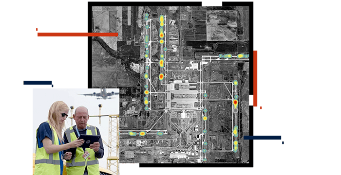
Obstacle analysis and land-use permitting
Ensuring an unobstructed airspace is critical to aviation safety. With the ArcGIS for Aviation: Airports solution, you can perform all required obstruction analyses to meet all aviation regulations. The solution will generate validated electronic airport layout plans, all designed to help you prepare compliance data for submission to your civil aviation authority.
Noise mitigation
As air traffic volume increases and as population encroachment around most airports continues, the impacts of noise will grow. This condition requires tools to help visualize, analyze, and mitigate noise's environmental impact on communities and on natural environments. ArcGIS allows you to understand affected populations, and it can be integrated with parcel information to support land-acquisition and sound-mitigation plans.
Wildlife management
Airport and aviation leaders have become increasingly aware of aviation dangers posed by wildlife populations near airports. ArcGIS sets the standard among airport wildlife managers for documenting bird strikes and wildlife movements and inventories, and for designing mitigations based on habitat management. The increasing use of ground-based radar supports real-time threat mitigation efforts with GIS.
CASE STUDY
A new approach at Reno-Tahoe International Airport
Discover how GIS fueled Reno-Tahoe efforts toward success.
Read the case study
0:00
Video
Wildlife management at Schiphol International
Schiphol is working to prevent bird and aircraft collisions with an app that shows radar data of bird movements.
Case study
Dublin Airport
Discover how Dublin Airport transforms data management with ArcGIS Enterprise.