
Security Operations
Protect critical assets and unify your security missions with GIS
Incident and risk management for the security enterprise
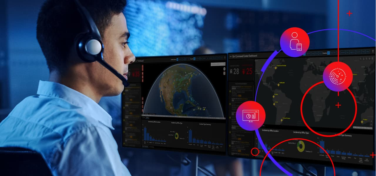
Esri's solutions for security operations provide business leaders, security managers, and security teams with real-time situational awareness, command and control capabilities, and advanced analytics.
GIS supports the following focus areas:
- Security operations centers
- Intelligence and analysis
- Event security
- Crisis management
- Financial crime and loss prevention
- Field teams
Site Security and Event Management ebook
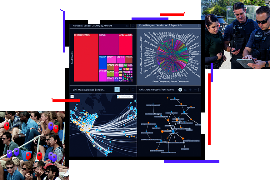
Esri's location-based GIS technology provides the tools and resources that staff in a global security operations center need to integrate and assess data from disparate sources and existing physical security information management (PSIM) systems. This real-time data integration gives security and risk management personnel a complete view of any incident or event and the intelligence required for investigative analysis before, during, and after a crisis.

Security operations strategies
Previous
Next
A real-time security operations software solution
ArcGIS is designed to integrate into large, heterogenous, and constantly evolving systems. Esri partners and customers integrate ArcGIS into the systems used for security operations.
Open and interoperable
ArcGIS is an open, flexible, and interoperable system that supports innovation. Esri supports open standards for data, services, and metadata.
Explore Esri's open systemSecurity and identity
ArcGIS uses best practices for security across cloud, enterprise, desktop, and mobile technologies.
Explore the security modelCloud ready
ArcGIS is a cloud-ready system. Secure and private clouds allow intelligence organizations to modernize and consolidate IT infrastructure. ArcGIS Enterprise is ready for deployment in Amazon Web Services or Microsoft Azure clouds.
Explore cloud deploymentDisconnected operations
ArcGIS supports multiple deployment patterns. Information can be provisioned and replicated between these patterns to support disconnected, intermittent, and limited bandwidth (DIL) environments.
Explore deployment optionsUpcoming events
Stay up-to-date on trends, technology, and best practices related to GIS in public safety.

Security Operations Community
View the latest GIS news, user stories, and resources for security operations professionals.