Skip to Content

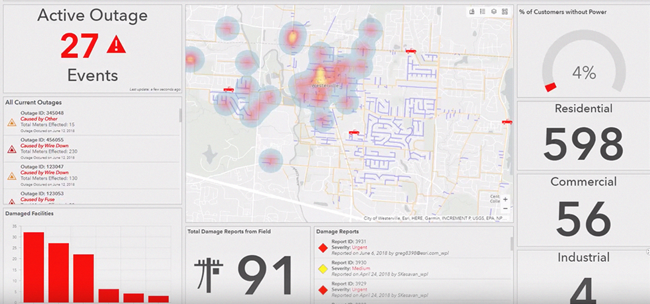
Business Intelligence

Turn location data into business intelligence

Electric utility data is by nature location intensive. Assets, employees, and customers are all located somewhere. They all must relate to each other's location. Examining raw data through the lens of location opens the door to greater insights and more meaningful visualization. The ArcGIS platform delivers a complete solution. It provides electric utility business intelligence with instant access to many forms of critical data, electric utility data analytics, and outstanding presentation capabilities. The platform fosters excellent communication and collaboration between all users. Move forward seeing data in new ways with deeper insights and understanding of location for better data-driven business decisions.

Visualization and exploration

Esri's ArcGIS models show real-time operation and interpret big data. It processes weather and traffic data and creates performance indicators.
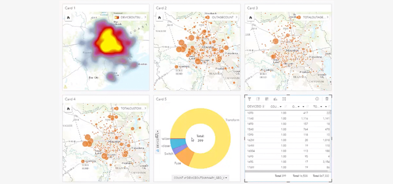
Pattern recognition

ArcGIS determines suitability, finding the best location and paths. It determines how places are related spatially.
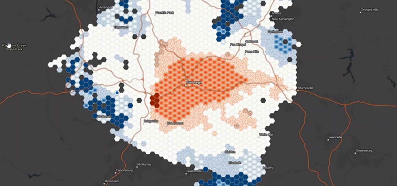
Decision-making

ArcGIS shares results directly, connecting data to crews. Visualize information easily and see relationships to determine prescriptive actions.

User Story

Diminishing tree-related outages by 60 percent

Mid-South Synergy used ArcGIS data analysis to consolidate tree trimming work and increase operational efficiency.

Read the story

Electric utilities business areas

Previous
Next
See all utilities

Contact sales

Connect with the Esri electric utilities team