Skip to Content

Grid Modernization

ArcGIS is smart grid technology

GIS—The foundation of grid modernization

Storms, fires, earthquakes, and landslides hammer your grid. Grid modernization is about making your grid resilient, reliable, and affordable. Smart grids begin with sensors providing essential location-based data that fosters insights on how to build a tougher, more sustainable electric grid. ArcGIS smart grid technology uses that data and bridges the gap between your information and operational technologies (IT/OT) to sharpen insights on grid behavior—and grid vulnerability. Uncover hidden hazards and opportunities with spatial analytics. 

Unify IT/OT

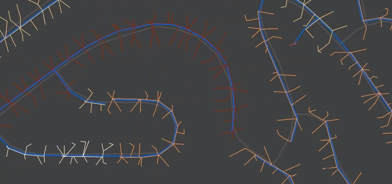
Esri's new ArcGIS Utility Network gives you a full model of the grid. This smart grid technology has the tools to model networks as they are on the ground. Easily create terminals, complex switches, structural elements, and neutral connections.

Spatial analysis

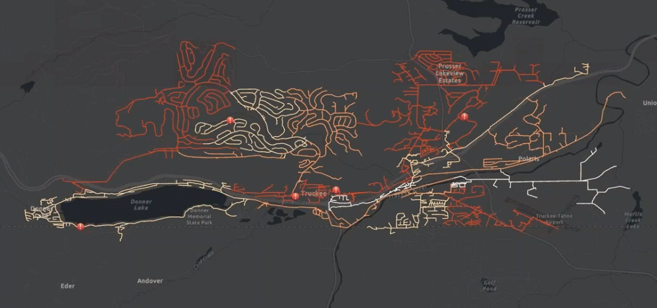
Leaders at a modern utility need greater insights into the behavior of their grid—both in relation to its surroundings and threats. Location plays a strong role in assessing vulnerabilities. ArcGIS spatial analysis tools sharpen your understanding of where the network is most at risk.

Operational awareness

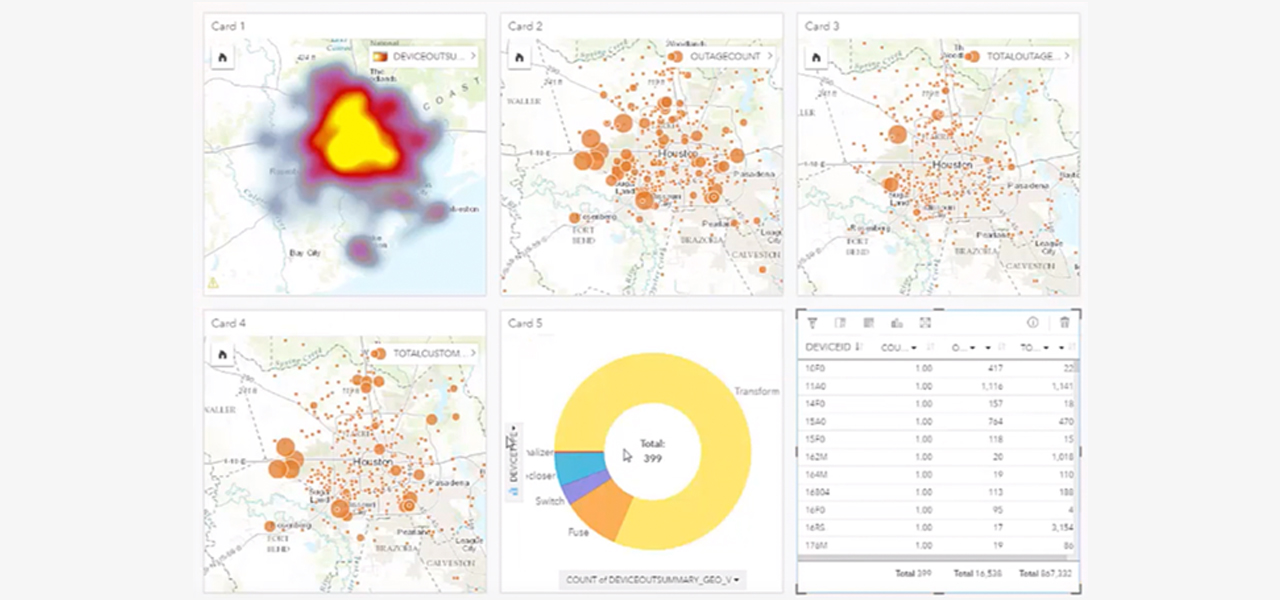
ArcGIS brings network functionality to any device—anytime, anywhere—for complete operational awareness. Know how microgrids and renewable resources impact your operations. Share the immediate state of the grid with corporate officers, customers, the media, and government officials.

Ebook

Empowering grid modernization

How are utilities dealing with shrinking revenues, rising costs, and skyrocketing customer demand? Download this free ebook to see how ArcGIS helps.

Download the ebook

Electric utilities business areas

Previous
Next
See all utilities

Contact sales

Connect with the Esri electric utilities team